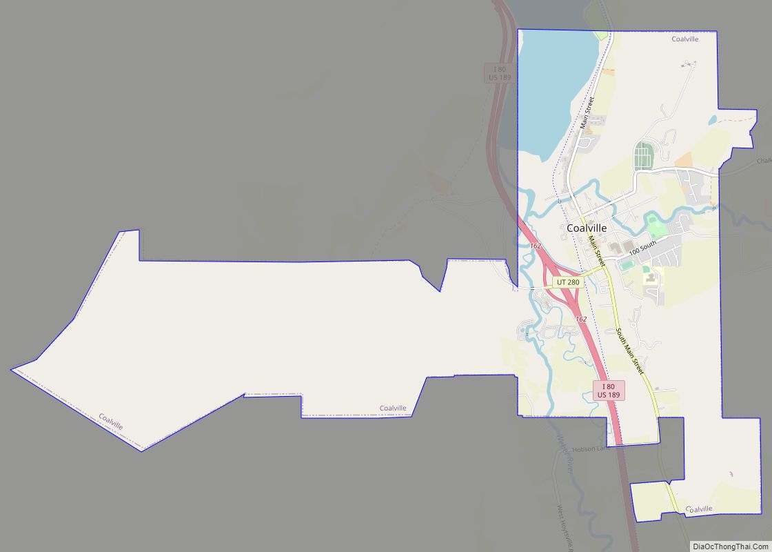
Coalville is a city in and the county seat of Summit County, Utah, United States. It is part of the Salt Lake City, Utah Metropolitan Statistical Area. The population was 1,363 as of the 2010 census. Interstate 80 passes through the town, as well as the Weber River, which flows into Echo Reservoir, just north of Coalville.
| Name: | Coalville city |
|---|---|
| LSAD Code: | 25 |
| LSAD Description: | city (suffix) |
| State: | Utah |
| County: | Summit County |
| Founded: | 1859 |
| Elevation: | 5,577 ft (1,700 m) |
| Total Area: | 6.67 sq mi (17.27 km²) |
| Land Area: | 6.22 sq mi (16.12 km²) |
| Water Area: | 0.45 sq mi (1.15 km²) |
| Total Population: | 1,363 |
| Population Density: | 256.39/sq mi (99.00/km²) |
| ZIP code: | 84017 |
| Area code: | 435 |
| FIPS code: | 4914840 |
| GNISfeature ID: | 1426770 |
| Website: | www.coalvillecity.org |
Online Interactive Map
Click on ![]() to view map in "full screen" mode.
to view map in "full screen" mode.
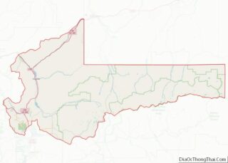
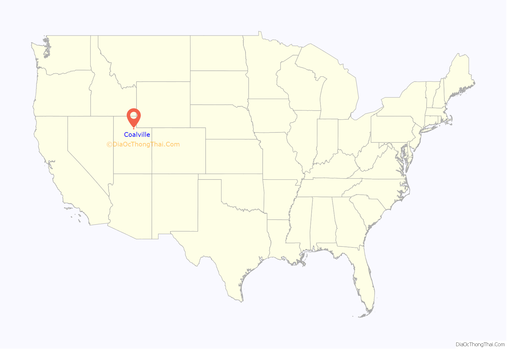
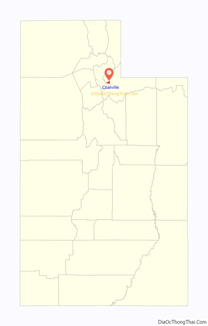
Coalville location map. Where is Coalville city?
History
Coalville originally began as a settlement known as Chalk Creek. In 1854, the territorial government in Utah offered a $1000 reward to anyone who could find coal within 40 miles of Salt Lake City. Four years later, Thomas Rhodes found a coal vein in the Chalk Creek area, and coal mining began in earnest. Hundreds of tons of coal were shipped to Salt Lake City, and soon a narrow gauge railroad was built. The settlement was then renamed Coalville, as a result of this early success.
Coalville was officially founded in 1859 by William Henderson Smith, an early Mormon freighter. He noticed that wheat, spilled by other wagons moving through the area, would grow to maturity without being tended. He subsequently convinced four families to settle in the area with him.
Early life in Coalville was difficult, and during winters, the settlers dealt with a constant scarcity of food. When food ran out, they would travel to Salt Lake City for supplies. The local Indian tribes were also hostile for a time, and the settlers built a fort on the advice of Brigham Young. In 1867, Coalville was incorporated.
By 1880, success in the coal industry led to the extension of the railroad into Park City. Then known as the Summit County Railway, the railroad continued to transport coal and was also used for Park City’s silver mines.
Unlike most Mormon settlements in Utah and the intermountain west, Coalville city streets are not aligned to the true north. Main Street in Coalville is offset such that it runs slightly north-northwest, and Center street runs slightly east-northeast.
Both the Thomas L. Allen House and the Summit Stake Tabernacle in Coalville are listed on the National Register of Historic Places.
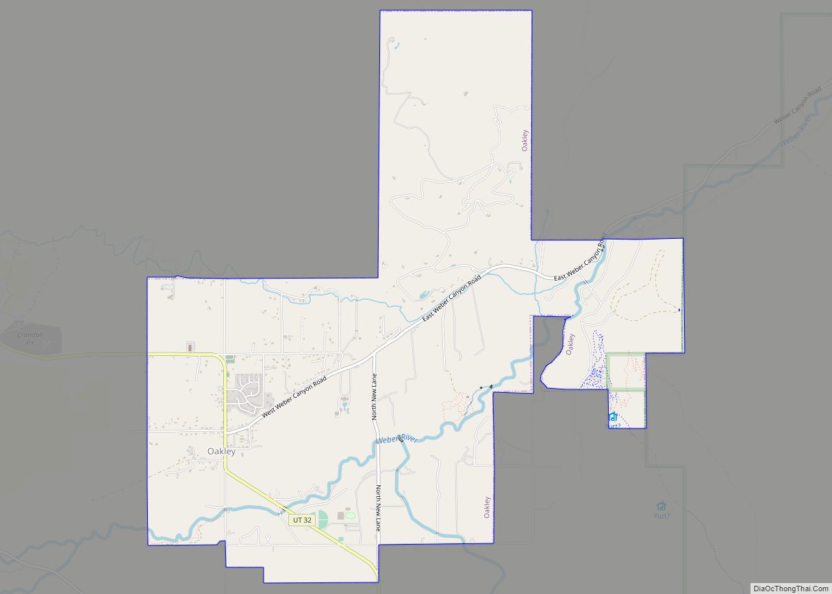
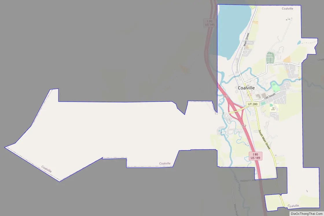
Coalville Road Map
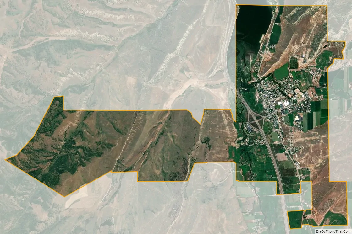
Coalville city Satellite Map
Geography
According to the United States Census Bureau, the city has a total area of 3.3 square miles (8.5 km), of which 2.9 square miles (7.5 km) is land and 0.4 square miles (1.0 km) (12.27%) is water.
Coalville has a high-altitude, warm-summer humid continental climate (Köppen Dfb), characterized by extreme diurnal temperature ranges that range from extremely cold winter nights to hot afternoons in the summer. However, the high altitude and low humidity mean that mornings in the summer remain very cool, and frosts have occasionally occurred—even in July. Precipitation is moderate throughout the year, though with a minimum in summer, and snow accumulation is generally heavy due to the very cold nights between November and March, with a median of 60.1 inches (1.53 m) for the year.
Coalville is located at the intersection of two narrow valleys—formed by Chalk Creek and the Weber River. Like other valley locations in northern Utah, Coalville experiences pronounced temperature inversions associated with high-pressure systems during winter months, with low temperatures below 0 °F relatively common. Owing to this localized phenomenon, observed low temperatures are often significantly lower than those forecasted by national agencies.
See also
Map of Utah State and its subdivision: Map of other states:- Alabama
- Alaska
- Arizona
- Arkansas
- California
- Colorado
- Connecticut
- Delaware
- District of Columbia
- Florida
- Georgia
- Hawaii
- Idaho
- Illinois
- Indiana
- Iowa
- Kansas
- Kentucky
- Louisiana
- Maine
- Maryland
- Massachusetts
- Michigan
- Minnesota
- Mississippi
- Missouri
- Montana
- Nebraska
- Nevada
- New Hampshire
- New Jersey
- New Mexico
- New York
- North Carolina
- North Dakota
- Ohio
- Oklahoma
- Oregon
- Pennsylvania
- Rhode Island
- South Carolina
- South Dakota
- Tennessee
- Texas
- Utah
- Vermont
- Virginia
- Washington
- West Virginia
- Wisconsin
- Wyoming