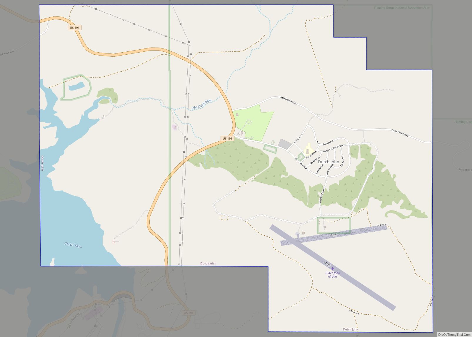
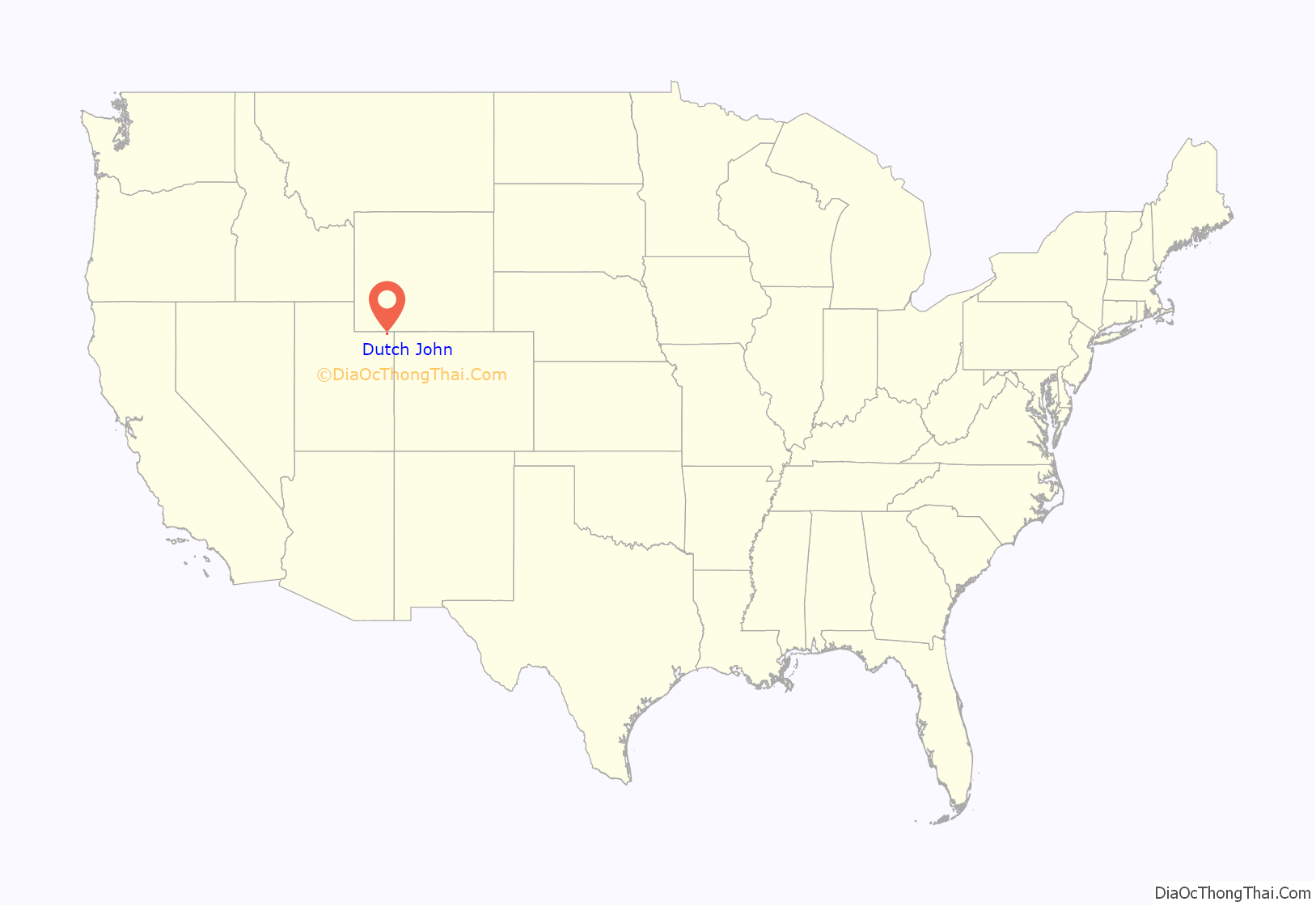
Dutch John is a town located in eastern Daggett County, Utah, United States, approximately 4 miles (6 km) northeast of the Flaming Gorge Dam on U.S. Route 191. The population was 145 at the 2010 census.
| Name: | Dutch John town |
|---|---|
| LSAD Code: | 43 |
| LSAD Description: | town (suffix) |
| State: | Utah |
| County: | Daggett County |
| Founded: | 1957 |
| Incorporated: | 2016 |
| Elevation: | 6,430 ft (1,960 m) |
| Total Area: | 6.29 sq mi (16.28 km²) |
| Land Area: | 5.90 sq mi (15.28 km²) |
| Water Area: | 0.39 sq mi (1.00 km²) |
| Total Population: | 1,690 |
| Population Density: | 23.90/sq mi (9.23/km²) |
| ZIP code: | 84023 |
| Area code: | 435 |
| FIPS code: | 4920780 |
| GNISfeature ID: | 2584762 |
| Website: | dutchjohn.org |
Online Interactive Map
Click on ![]() to view map in "full screen" mode.
to view map in "full screen" mode.
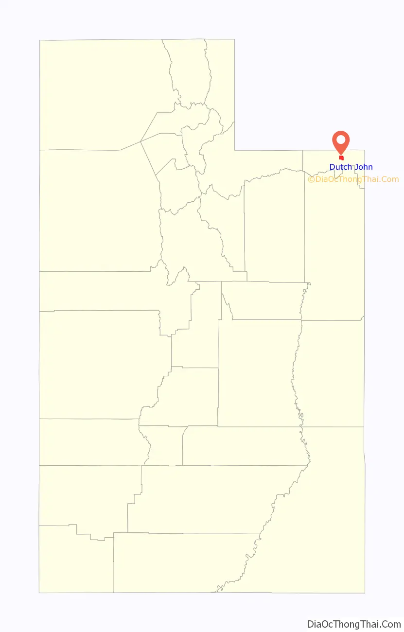
Dutch John location map. Where is Dutch John town?
History
The town (but a census-designated place before 2016) was platted and constructed beginning in 1957 by the United States Bureau of Reclamation to house workers working on the construction of Flaming Gorge Dam. After the dam’s completion in 1964, Dutch John became home to a smaller number of dam maintenance and operations personnel, as well as employees of the National Park Service and United States Forest Service.
The Dutch John townsite and its buildings continued to be owned by the Bureau of Reclamation until 1998 when the town was privatized. Buildings were sold to individual landowners, and undeveloped land in the town was transferred to Daggett County. The county later completed a master plan for the Dutch John townsite and has begun offering parcels of land for sale to developers.
In July 2002, the human-caused Mustang Ridge fire burned approximately 22,000 acres (89 km) of pinyon/juniper forest near Dutch John. The fire caused damage to power transmission lines which were supported by wooden poles.
During the peak years of construction activity at Flaming Gorge Dam, as many as 3,500 people lived in Dutch John.
In November 2014, the residents of Dutch John voted overwhelmingly to incorporate into a town. An election was held in June 2015, in which William Rogers was elected mayor; Ryan Kelly, Sandy Kunkel, Harriet Dickerson, and Dave MacDonald were elected as members of the Town Council. They took office, and the incorporation became official in January 2016. In the town’s 2021 election, Sandy Kunkel was elected as mayor.
A resort within the town is host to the world’s largest fishing fly. It is over three tons in weight and is over 32 feet long.
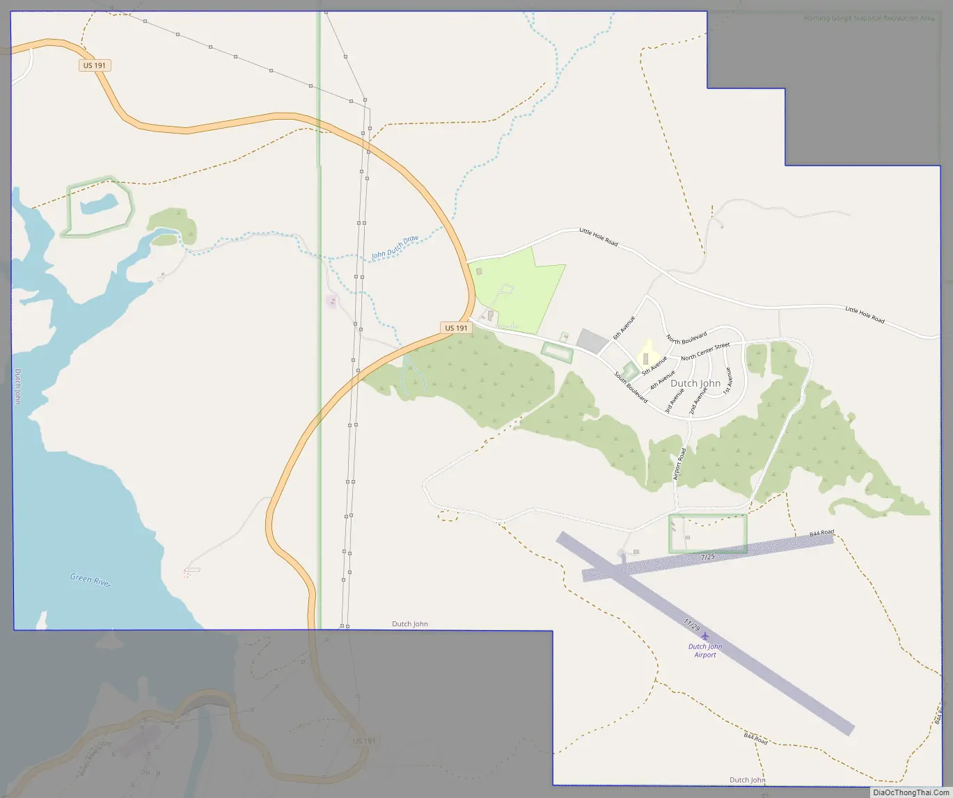
Dutch John Road Map
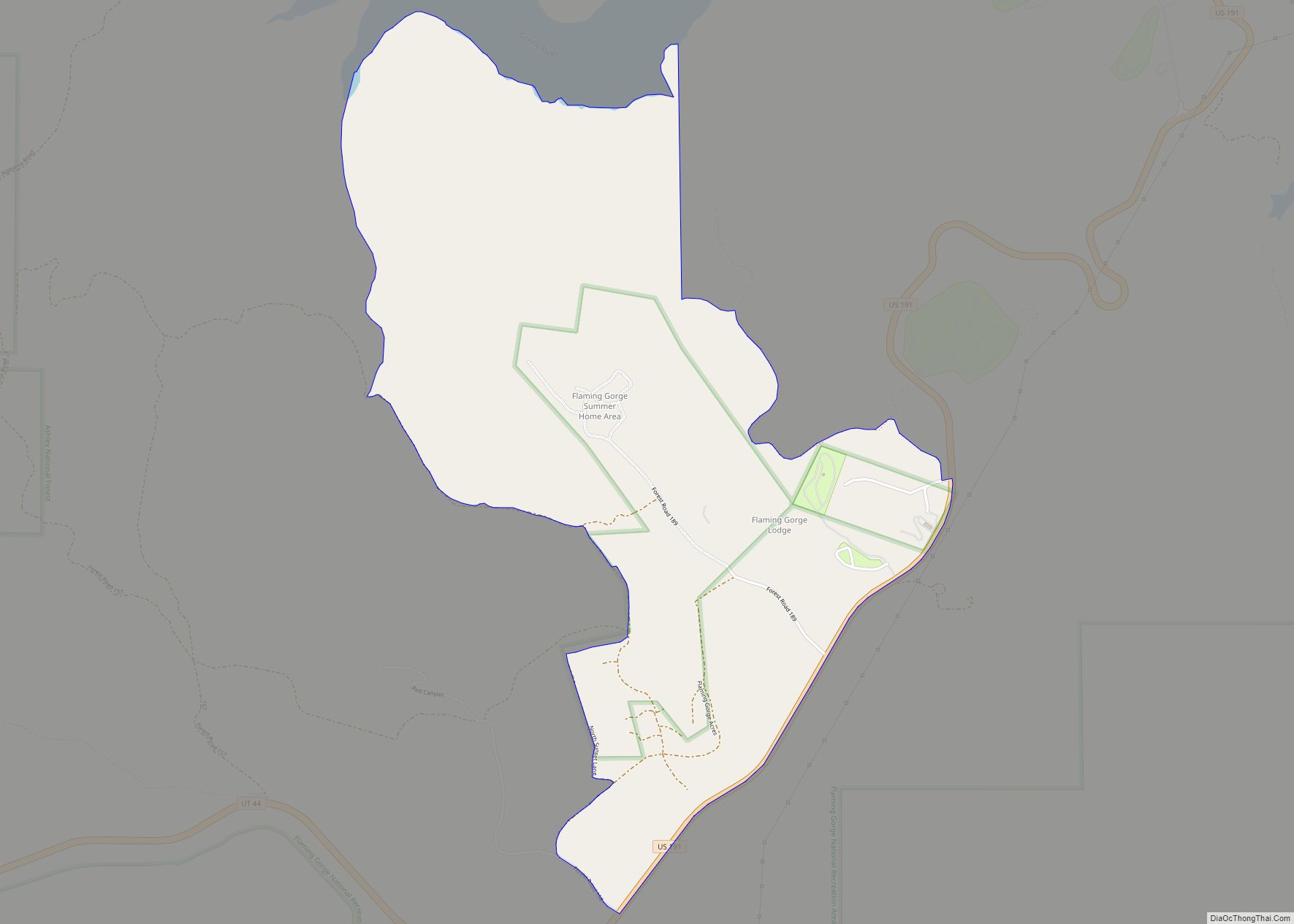
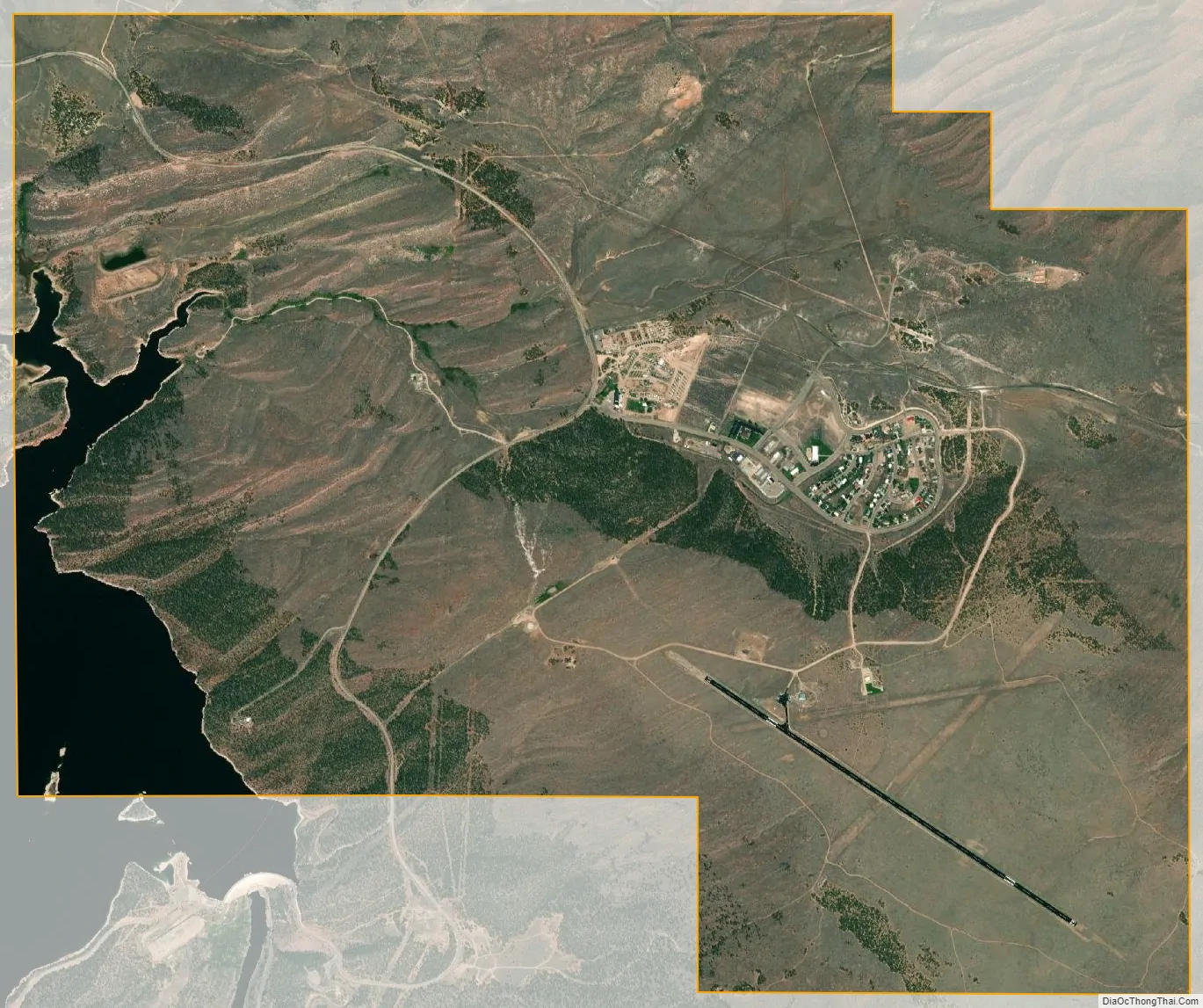
Dutch John city Satellite Map
See also
Map of Utah State and its subdivision: Map of other states:- Alabama
- Alaska
- Arizona
- Arkansas
- California
- Colorado
- Connecticut
- Delaware
- District of Columbia
- Florida
- Georgia
- Hawaii
- Idaho
- Illinois
- Indiana
- Iowa
- Kansas
- Kentucky
- Louisiana
- Maine
- Maryland
- Massachusetts
- Michigan
- Minnesota
- Mississippi
- Missouri
- Montana
- Nebraska
- Nevada
- New Hampshire
- New Jersey
- New Mexico
- New York
- North Carolina
- North Dakota
- Ohio
- Oklahoma
- Oregon
- Pennsylvania
- Rhode Island
- South Carolina
- South Dakota
- Tennessee
- Texas
- Utah
- Vermont
- Virginia
- Washington
- West Virginia
- Wisconsin
- Wyoming