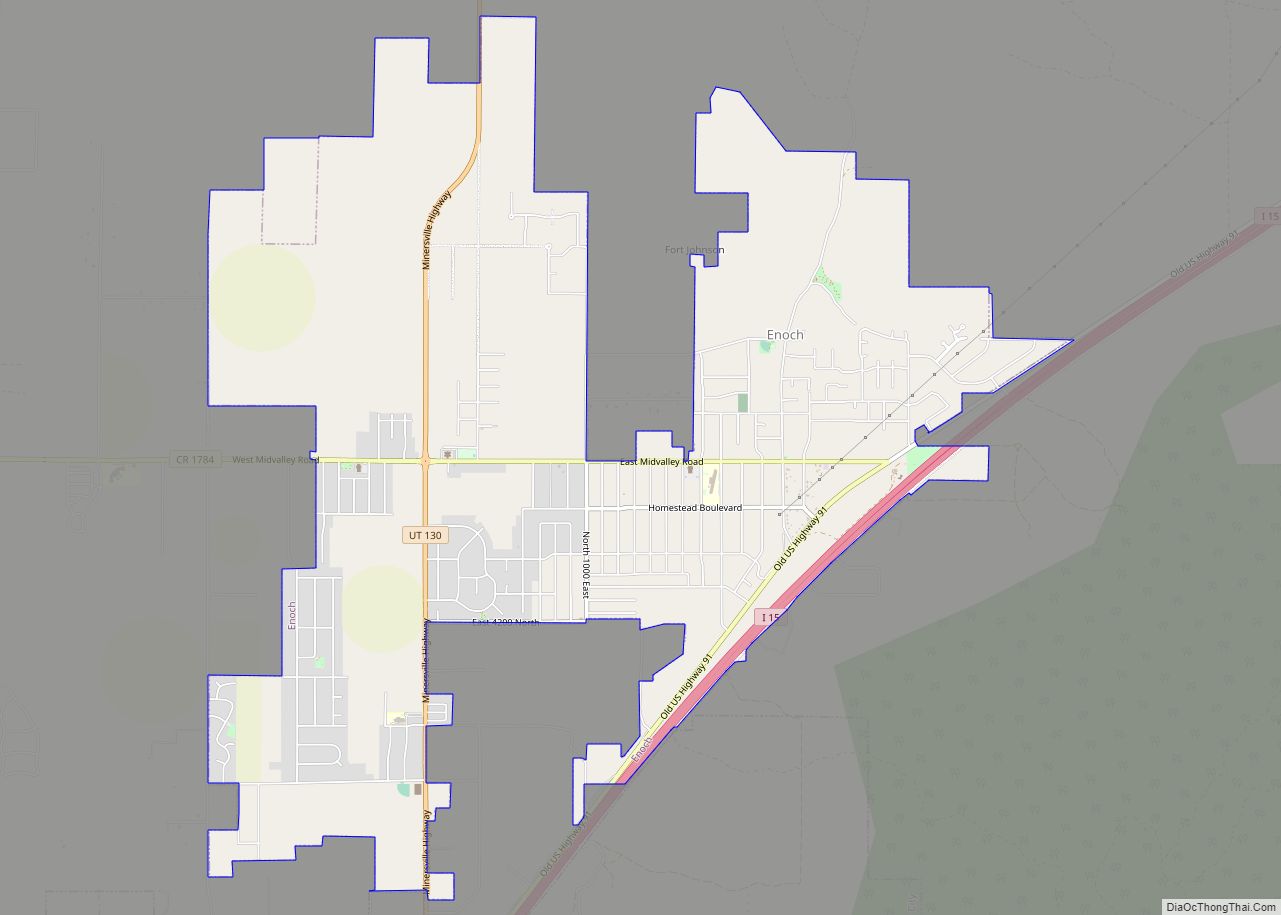
Enoch is a city in Iron County, Utah, United States, and is located approximately 7 miles (11 km) northeast of Cedar City in the northeast part of Cedar Valley. The population was 5,803 at the 2010 census, up from 3,467 at the 2000 census. As of 2018 the estimated population was 7,039.
| Name: | Enoch city |
|---|---|
| LSAD Code: | 25 |
| LSAD Description: | city (suffix) |
| State: | Utah |
| County: | Iron County |
| Founded: | May 1851 |
| Incorporated: | January 10, 1966 |
| Elevation: | 5,545 ft (1,690 m) |
| Total Area: | 7.84 sq mi (20.31 km²) |
| Land Area: | 7.84 sq mi (20.31 km²) |
| Water Area: | 0.00 sq mi (0.00 km²) |
| Total Population: | 5,803 |
| Population Density: | 740/sq mi (290/km²) |
| ZIP code: | 84721 |
| Area code: | 435 |
| FIPS code: | 4923200 |
| GNISfeature ID: | 1437554 |
| Website: | cityofenoch.org |
Online Interactive Map
Click on ![]() to view map in "full screen" mode.
to view map in "full screen" mode.
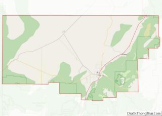
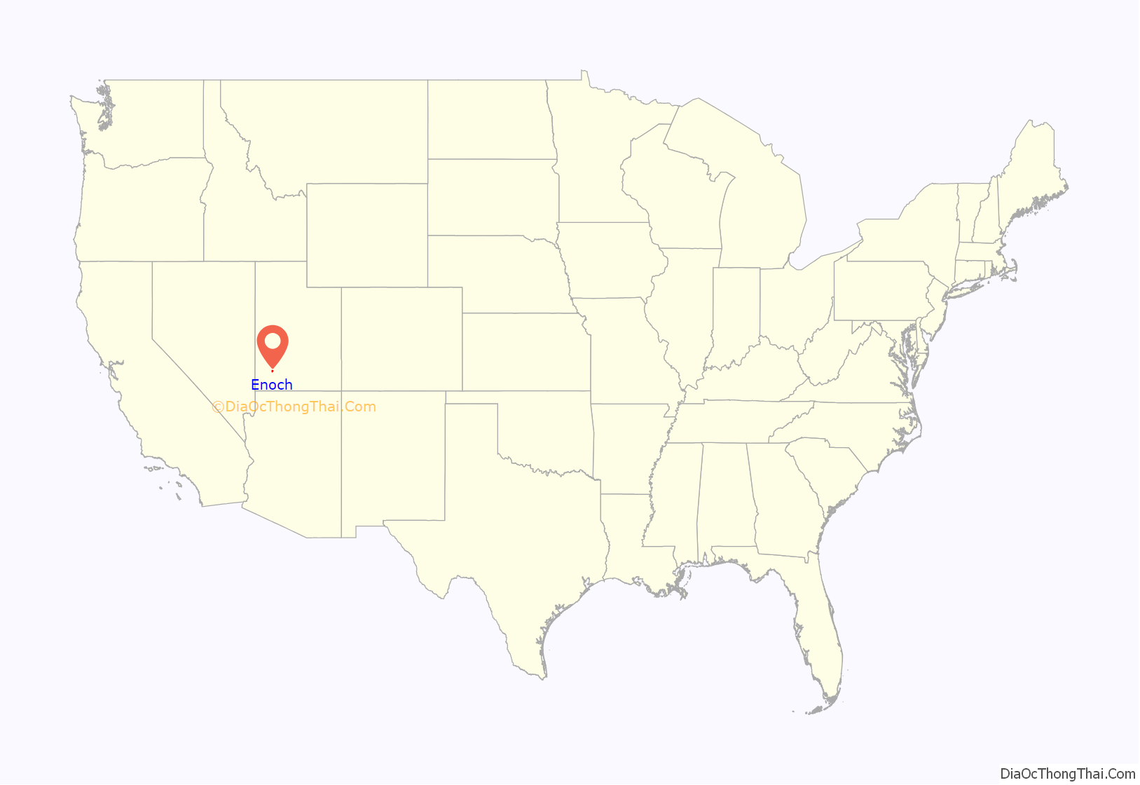
Enoch location map. Where is Enoch city?

History
Enoch was founded by Joel H. Johnson. It was originally known as Johnson’s Springs and Fort Johnson.
Enoch was originally settled as part of an iron mission along with Cedar City and Parowan. The area was originally known as “Fort Johnson” and “Johnson Springs”, after Joel H. Johnson, the earliest known white settler, who came to the area in 1851 with his family. In 1890, the area’s name was changed to “Enoch”, to avoid confusion with another settlement in Utah also named Johnson Springs. Enoch was officially incorporated on January 10, 1966, absorbing nearby Grimshawville, Stevensville, and Williamsville. The present name is after the Order of Enoch.
Enoch was incorporated on 10 January 1966 and at that time absorbed the neighboring communities of Grimshawville, Stevensville and Williamsville.
In June 2011, a new stake of the Church of Jesus Christ of Latter-day Saints was created. There are now the Enoch and Enoch West stakes. The dividing line is Minersville Highway.
In August 2021, the city sustained heavy flooding. The mayor of Enoch declared a state of emergency and the Red Cross set up a shelter to help citizens who were displaced by flooding in their homes. Iron County’s emergency management coordinator reported that about 200 homes were damaged.
On January 4, 2023, a man shot and killed his wife, five children and mother-in-law before killing himself. His wife had recently filed for divorce.
Enoch Road Map
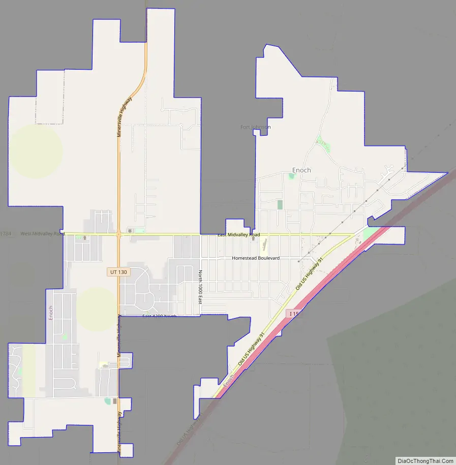
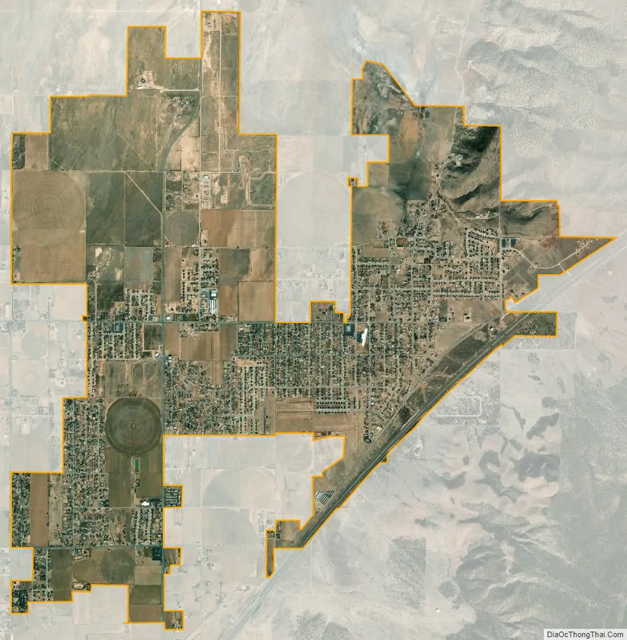
Enoch city Satellite Map
Geography
According to the United States Census Bureau, the city has a total area of 7.2 square miles (18.7 km), all land. Enoch is bordered to the south by Cedar City. Interstate 15 forms the southeastern border of Enoch, with access from Exit 62 to the south and Exit 71 to the northeast. I-15 leads north 245 miles (394 km) to Salt Lake City and southwest 175 miles (282 km) to Las Vegas.
Climate
The climate in this area has mild differences between highs and lows, and there is adequate rainfall year-round. According to the Köppen climate classification system, Enoch has a marine west coast climate, abbreviated “Cfb” on climate maps.
In 2021 Enoch experienced heavy flooding after a storm.
See also
Map of Utah State and its subdivision: Map of other states:- Alabama
- Alaska
- Arizona
- Arkansas
- California
- Colorado
- Connecticut
- Delaware
- District of Columbia
- Florida
- Georgia
- Hawaii
- Idaho
- Illinois
- Indiana
- Iowa
- Kansas
- Kentucky
- Louisiana
- Maine
- Maryland
- Massachusetts
- Michigan
- Minnesota
- Mississippi
- Missouri
- Montana
- Nebraska
- Nevada
- New Hampshire
- New Jersey
- New Mexico
- New York
- North Carolina
- North Dakota
- Ohio
- Oklahoma
- Oregon
- Pennsylvania
- Rhode Island
- South Carolina
- South Dakota
- Tennessee
- Texas
- Utah
- Vermont
- Virginia
- Washington
- West Virginia
- Wisconsin
- Wyoming