Woodruff is a town in Rich County, Utah, United States. The population was 180 at the 2010 census.
| Name: | Woodruff town |
|---|---|
| LSAD Code: | 43 |
| LSAD Description: | town (suffix) |
| State: | Utah |
| County: | Rich County |
| Incorporated: | 1933 |
| Elevation: | 6,339 ft (1,932 m) |
| Total Area: | 0.72 sq mi (1.87 km²) |
| Land Area: | 0.72 sq mi (1.87 km²) |
| Water Area: | 0.00 sq mi (0.00 km²) |
| Total Population: | 180 |
| Population Density: | 293.63/sq mi (113.37/km²) |
| ZIP code: | 84086 |
| Area code: | 435 |
| FIPS code: | 4985260 |
| GNISfeature ID: | 1434462 |
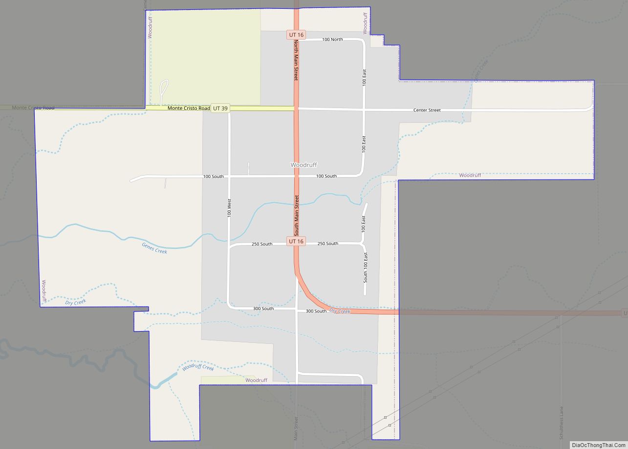
Online Interactive Map
Click on ![]() to view map in "full screen" mode.
to view map in "full screen" mode.
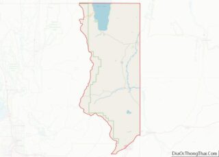
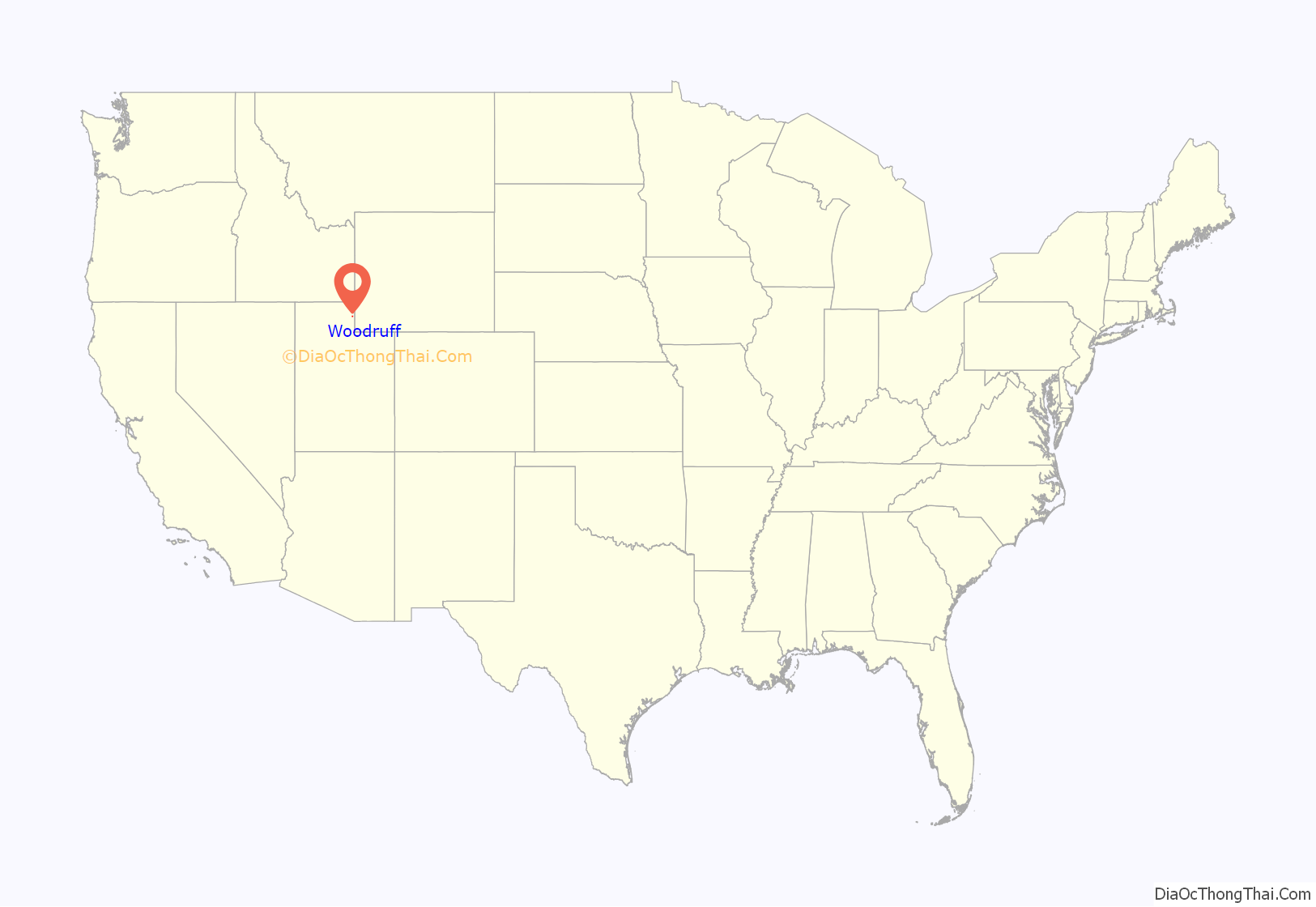
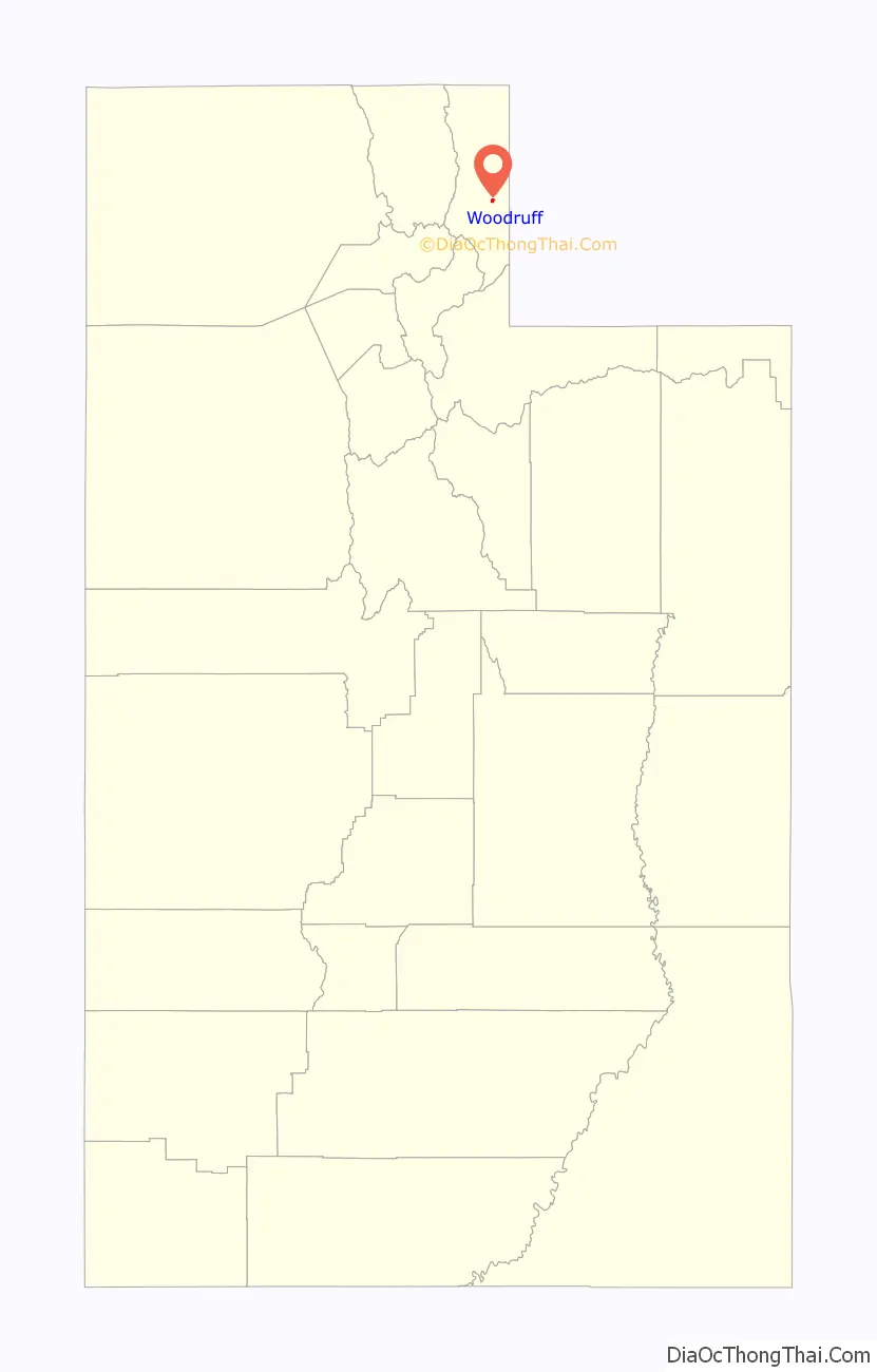
Woodruff location map. Where is Woodruff town?
History
The first settlement at Woodruff was made in 1870. A post office called Woodruff has been in operation since 1872. The town was named in honor of Wilford Woodruff, fourth President of The Church of Jesus Christ of Latter-day Saints.
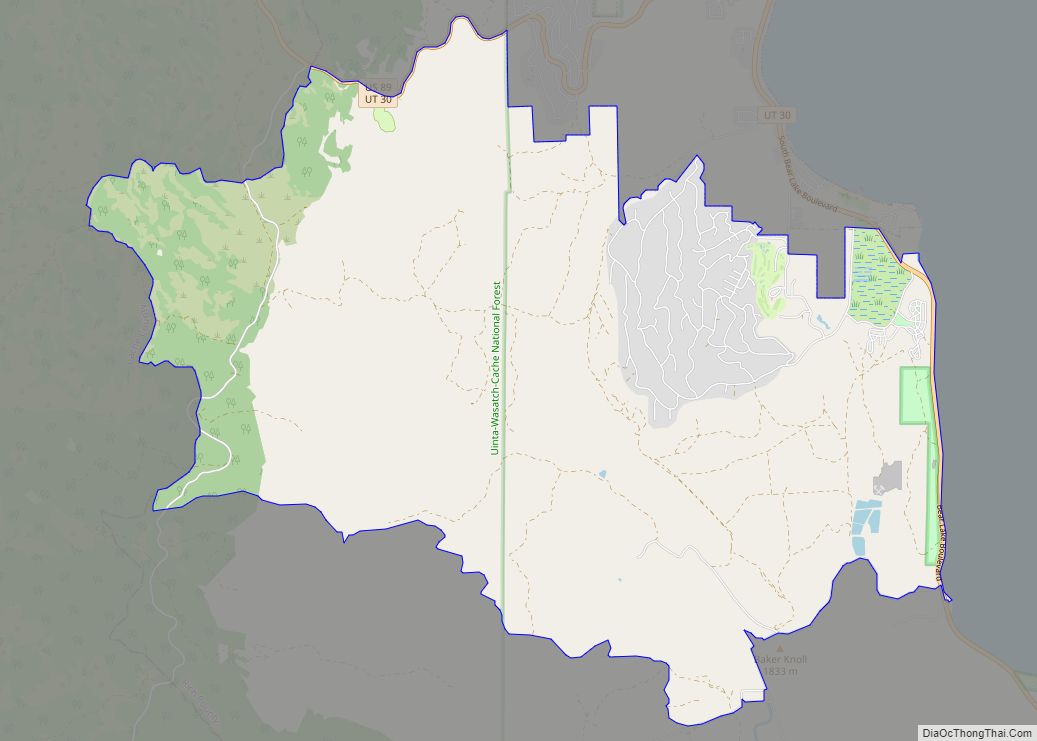
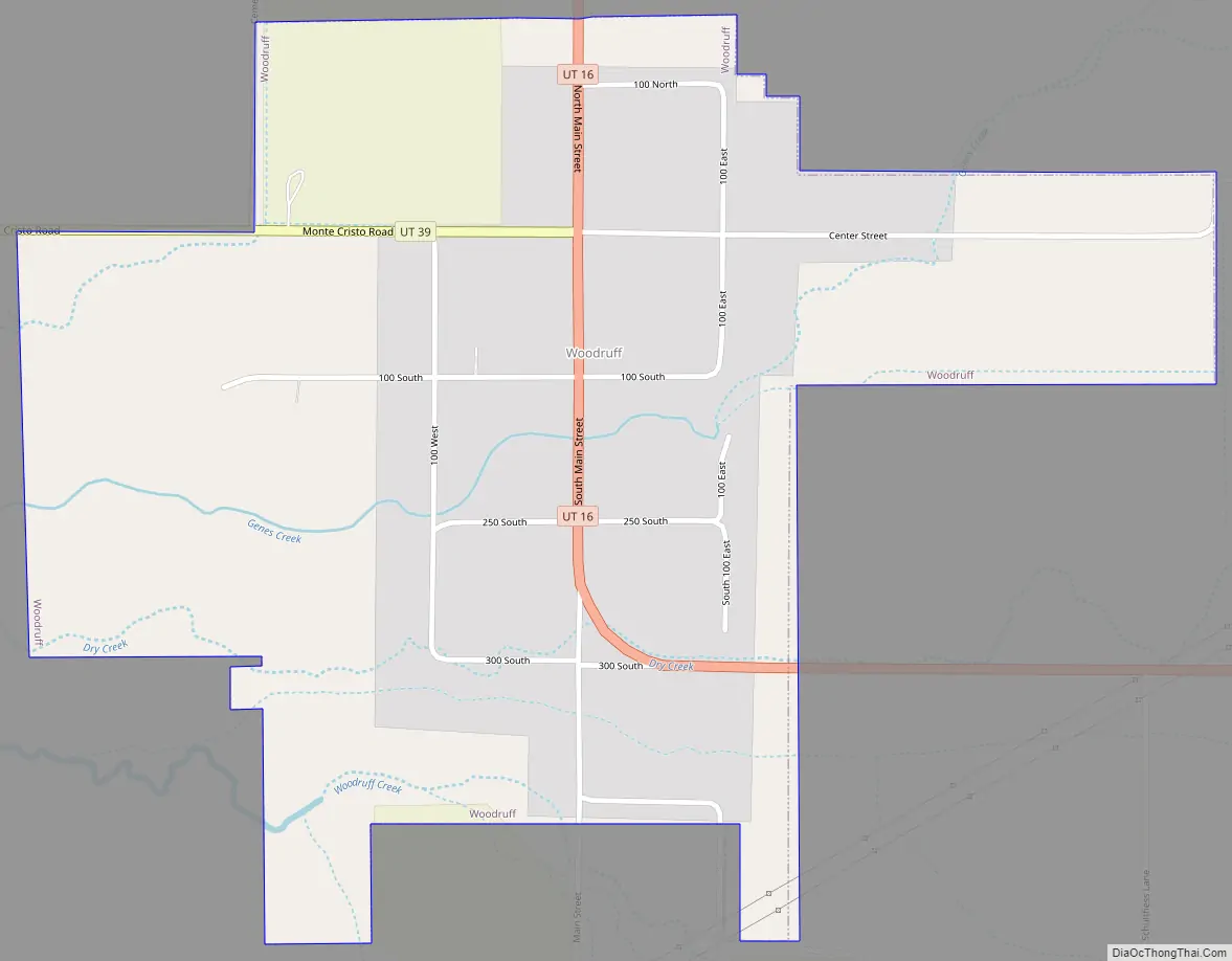
Woodruff Road Map
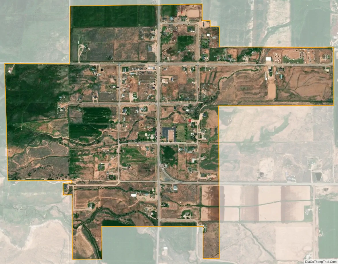
Woodruff city Satellite Map
Geography
According to the United States Census Bureau, the town has a total area of 0.5 square mile (1.4 km), all land.
Climate
This climatic region is typified by large seasonal temperature differences, with warm to summers and cold (sometimes severely cold) winters. According to the Köppen Climate Classification system, Woodruff has a humid continental climate, abbreviated “Dfb” on climate maps. Woodruff’s climate has high diurnal temperature variation, resulting in cold nights even during summer.
See also
Map of Utah State and its subdivision: Map of other states:- Alabama
- Alaska
- Arizona
- Arkansas
- California
- Colorado
- Connecticut
- Delaware
- District of Columbia
- Florida
- Georgia
- Hawaii
- Idaho
- Illinois
- Indiana
- Iowa
- Kansas
- Kentucky
- Louisiana
- Maine
- Maryland
- Massachusetts
- Michigan
- Minnesota
- Mississippi
- Missouri
- Montana
- Nebraska
- Nevada
- New Hampshire
- New Jersey
- New Mexico
- New York
- North Carolina
- North Dakota
- Ohio
- Oklahoma
- Oregon
- Pennsylvania
- Rhode Island
- South Carolina
- South Dakota
- Tennessee
- Texas
- Utah
- Vermont
- Virginia
- Washington
- West Virginia
- Wisconsin
- Wyoming