Kanarraville (/kəˈnærəvɪl/ kə-NARR-ə-vil) is a town in Iron County, Utah, United States. The population was 355 at the 2010 census.
| Name: | Kanarraville town |
|---|---|
| LSAD Code: | 43 |
| LSAD Description: | town (suffix) |
| State: | Utah |
| County: | Iron County |
| Incorporated: | 1933 |
| Elevation: | 5,541 ft (1,689 m) |
| Total Area: | 0.45 sq mi (1.15 km²) |
| Land Area: | 0.45 sq mi (1.15 km²) |
| Water Area: | 0.00 sq mi (0.00 km²) |
| Total Population: | 355 |
| Population Density: | 914.61/sq mi (352.99/km²) |
| ZIP code: | 84742 |
| Area code: | 435 |
| FIPS code: | 4940030 |
| GNISfeature ID: | 1429278 |
| Website: | www.kanarraville.org |
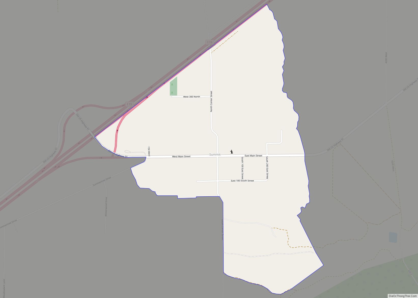
Online Interactive Map
Click on ![]() to view map in "full screen" mode.
to view map in "full screen" mode.
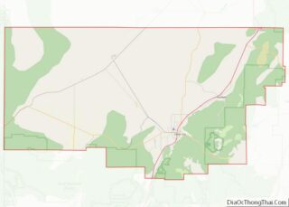
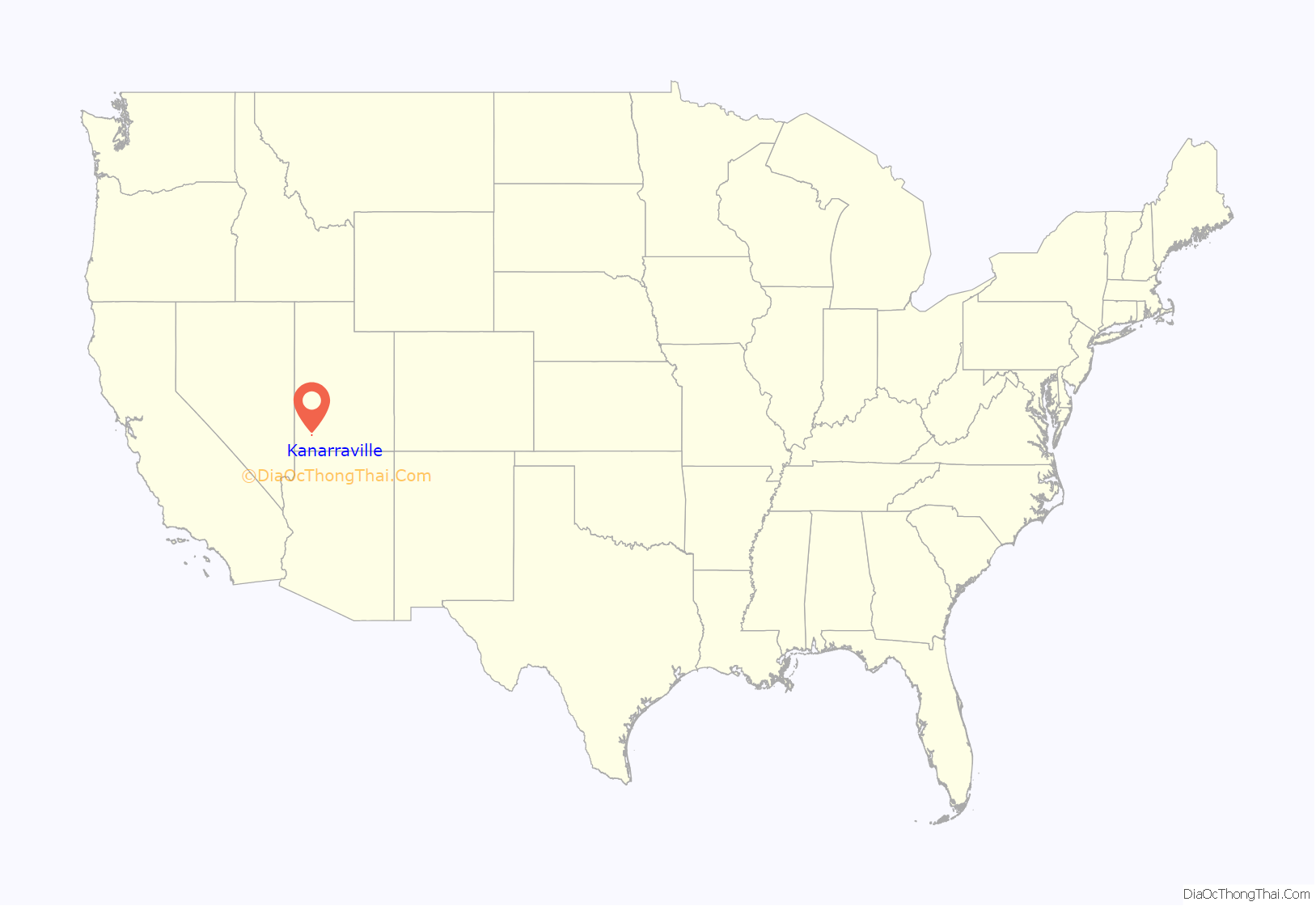
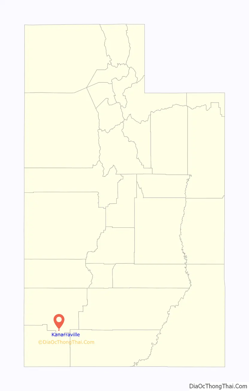
Kanarraville location map. Where is Kanarraville town?
History
Kanarra, later renamed Kanarraville, on Kanarra Creek, was first settled in 1861 and 1862. It was named for Piute Chief Canarrah or Quanarrah, but settlers spelled it Kanarrah or Kanarra. Its settlers were families driven from Fort Harmony when the fort had to be abandoned after most of its adobe walls were washed away during a month of heavy rains in January and February, during the Great Flood of 1862. New Harmony in Washington County was the other settlement created by refugees from this disaster.
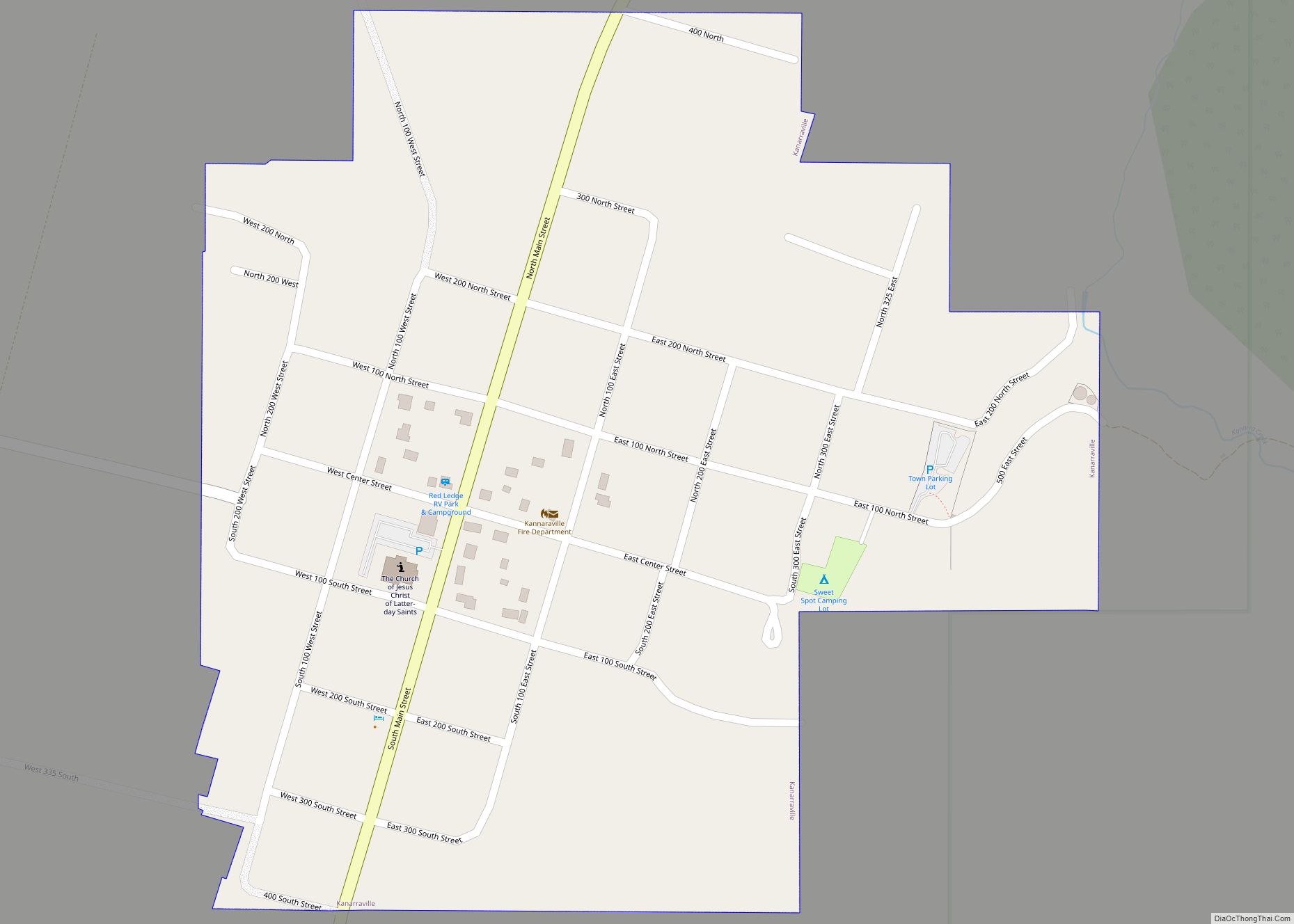
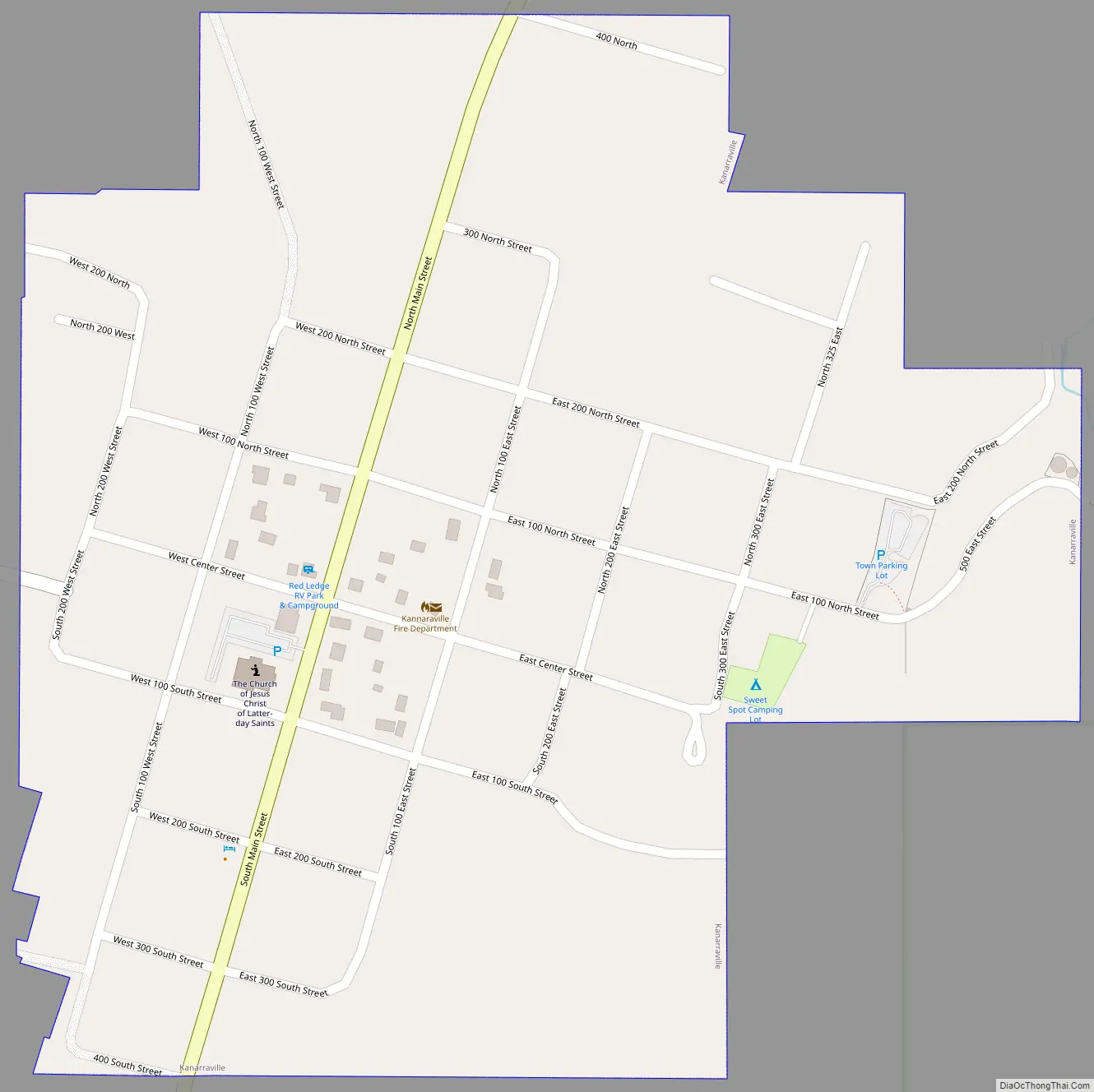
Kanarraville Road Map
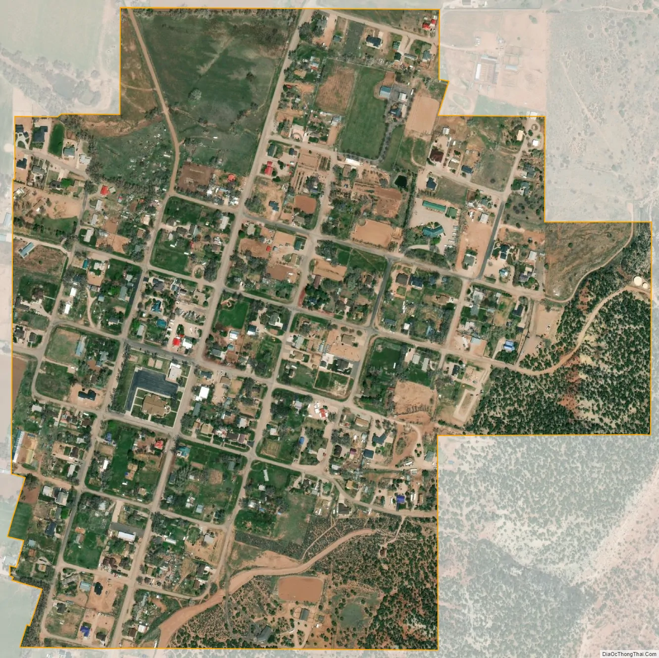
Kanarraville city Satellite Map
Geography
According to the United States Census Bureau, the town has a total area of 0.46 square miles (1.2 km), all land.
Kanarraville is located adjacent to the southwest end of Cedar Valley; it is also at the base of the Hurricane Cliffs, on the town’s east border.
Climate
This region experiences warm (but not hot) and dry summers, with no average monthly temperatures above 71.6 °F. According to the Köppen Climate Classification system, Kanarraville has a warm-summer Mediterranean climate, abbreviated “Csb” on climate maps.
See also
Map of Utah State and its subdivision: Map of other states:- Alabama
- Alaska
- Arizona
- Arkansas
- California
- Colorado
- Connecticut
- Delaware
- District of Columbia
- Florida
- Georgia
- Hawaii
- Idaho
- Illinois
- Indiana
- Iowa
- Kansas
- Kentucky
- Louisiana
- Maine
- Maryland
- Massachusetts
- Michigan
- Minnesota
- Mississippi
- Missouri
- Montana
- Nebraska
- Nevada
- New Hampshire
- New Jersey
- New Mexico
- New York
- North Carolina
- North Dakota
- Ohio
- Oklahoma
- Oregon
- Pennsylvania
- Rhode Island
- South Carolina
- South Dakota
- Tennessee
- Texas
- Utah
- Vermont
- Virginia
- Washington
- West Virginia
- Wisconsin
- Wyoming