Kingston is a town in Piute County, Utah, United States. The population was 135 at the 2020 census.
| Name: | Kingston town |
|---|---|
| LSAD Code: | 43 |
| LSAD Description: | town (suffix) |
| State: | Utah |
| County: | Piute County |
| Incorporated: | 1935 |
| Elevation: | 6,017 ft (1,834 m) |
| Total Area: | 5.40 sq mi (13.99 km²) |
| Land Area: | 5.40 sq mi (13.99 km²) |
| Water Area: | 0.00 sq mi (0.00 km²) |
| Total Population: | 135 |
| Population Density: | 28.70/sq mi (11.08/km²) |
| ZIP code: | 84743 |
| Area code: | 435 |
| FIPS code: | 4941350 |
| GNISfeature ID: | 1442334 |
Online Interactive Map
Click on ![]() to view map in "full screen" mode.
to view map in "full screen" mode.
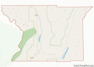
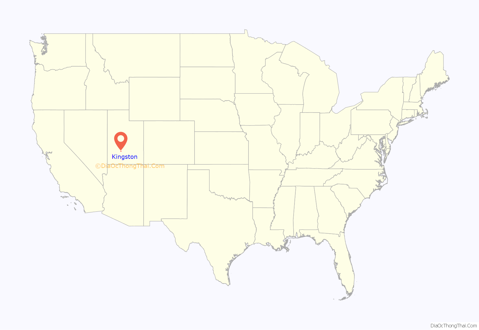
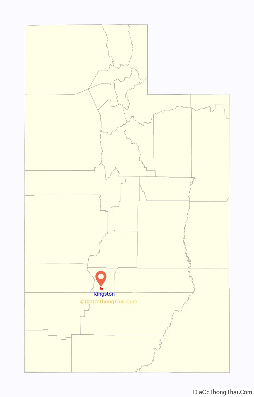
Kingston location map. Where is Kingston town?
History
Kingston is named for Thomas Rice King, who moved from Fillmore to Piute County with his five sons and their families specifically to find a place where they could establish a United Order. In the 1870s Brigham Young was encouraging communal living in United Order communities. The King families’ United Order functioned from 1876 to 1883. Kingston became an incorporated town in 1935.
The members of the United Order built the village of Kingston on ten acres of land east of Circleville.
“The town consisted of a central community building for school, dances, church and other meetings. A blacksmith shop, milk house, bakery, tailor shop, post office, carpenter shop and store surrounded the meetinghouse. Homes built in like style formed a fort around a ten-acre block. These first log houses had dirt floors and roofs. A communal kitchen and dining hall about seventy feet long stood in the center, with a large vegetable garden close by.”
Just east of Kingston the community had their industrial center in which buildings such as a flour mill, tannery, sawmill, and woolen mill were located. Isaac Riddle had previously built a burr mill in the area, however, it could not meet the needs of the people and so they built a gristmill at the mouth of Kingston Canyon. The community also operated a dairy about 20 miles from Kingston near present-day Antimony.
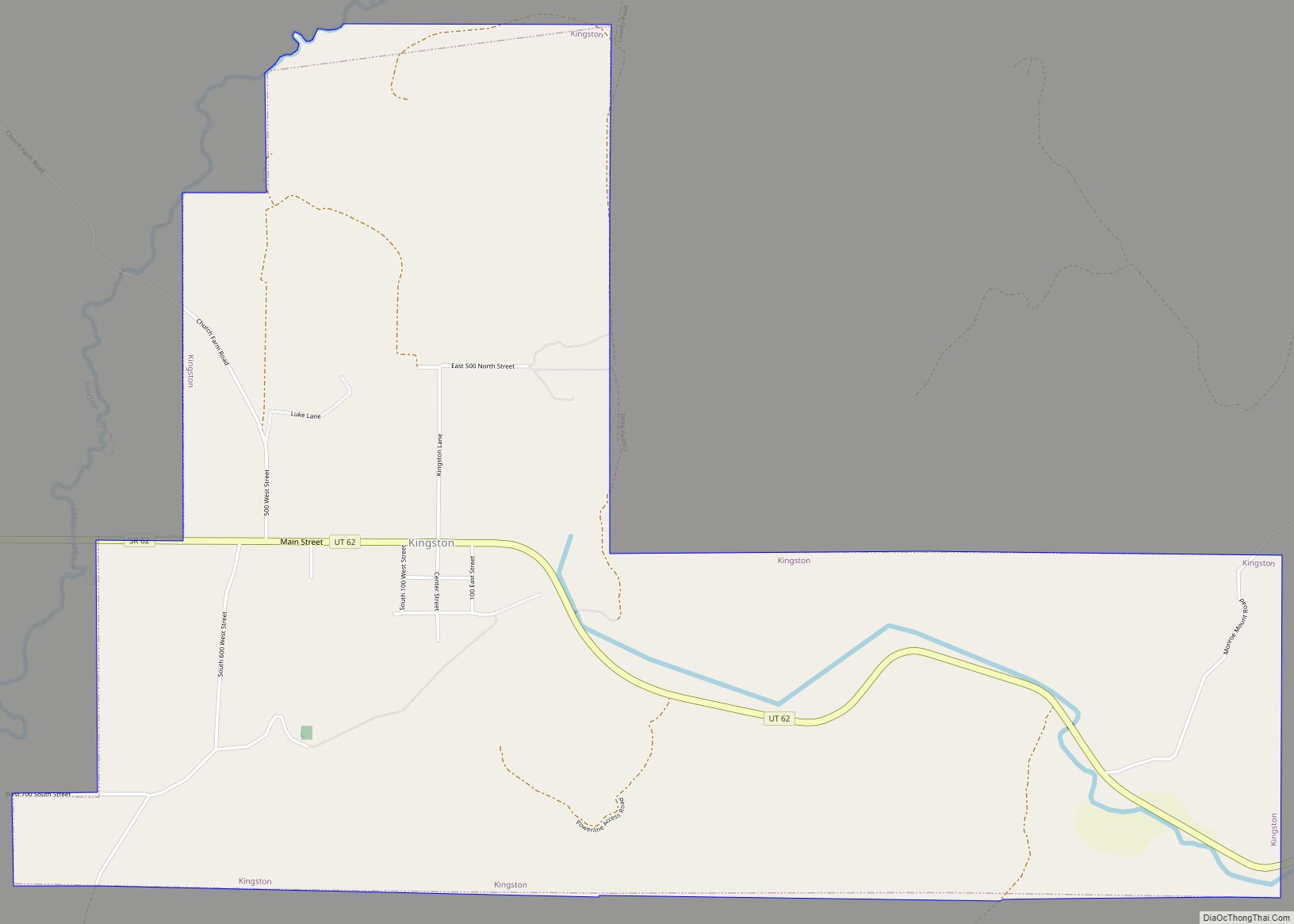
Kingston Road Map
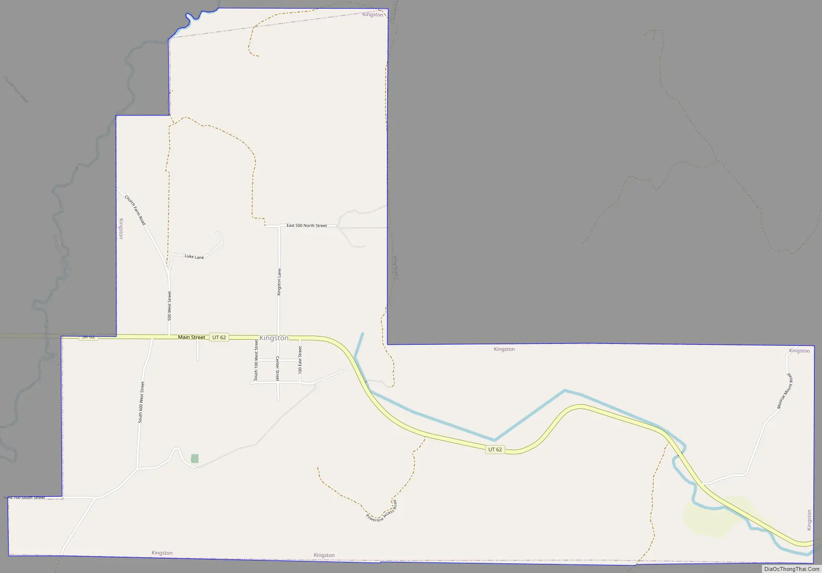
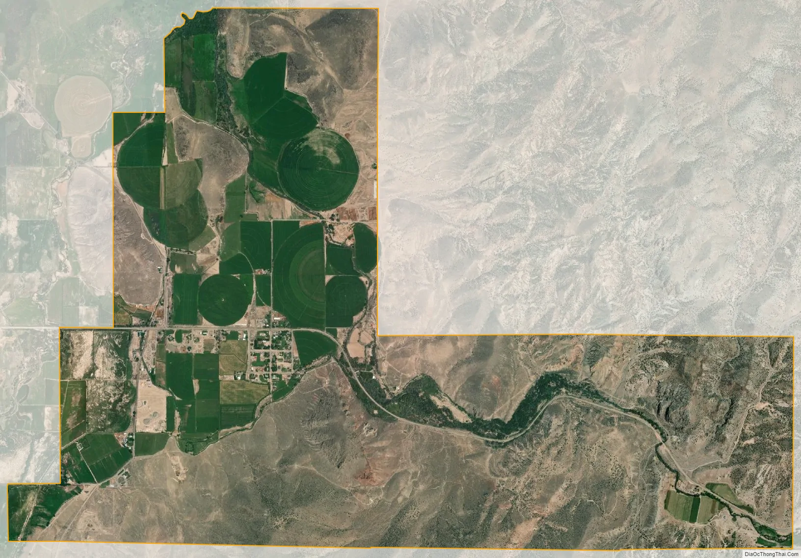
Kingston city Satellite Map
Geography
According to the United States Census Bureau, the town has a total area of 5.3 square miles (13.8 km), all land.
Climate
This climatic region is typified by large seasonal temperature differences, with warm to hot (and often humid) summers and cold (sometimes severely cold) winters. According to the Köppen Climate Classification system, Kingston has a humid continental climate, abbreviated “Dfb” on climate maps.
See also
Map of Utah State and its subdivision: Map of other states:- Alabama
- Alaska
- Arizona
- Arkansas
- California
- Colorado
- Connecticut
- Delaware
- District of Columbia
- Florida
- Georgia
- Hawaii
- Idaho
- Illinois
- Indiana
- Iowa
- Kansas
- Kentucky
- Louisiana
- Maine
- Maryland
- Massachusetts
- Michigan
- Minnesota
- Mississippi
- Missouri
- Montana
- Nebraska
- Nevada
- New Hampshire
- New Jersey
- New Mexico
- New York
- North Carolina
- North Dakota
- Ohio
- Oklahoma
- Oregon
- Pennsylvania
- Rhode Island
- South Carolina
- South Dakota
- Tennessee
- Texas
- Utah
- Vermont
- Virginia
- Washington
- West Virginia
- Wisconsin
- Wyoming