Lehi (/ˈliːhaɪ/ LEE-hy) is a city in Utah County, Utah, United States. It is named after Lehi, a prophet in the Book of Mormon. The population was 75,907 at the 2020 census, up from 47,407 in 2010. The rapid growth in Lehi is due, in part, to the rapid development of the tech industry region known as Silicon Slopes. The center of population of Utah is located in Lehi.
| Name: | Lehi city |
|---|---|
| LSAD Code: | 25 |
| LSAD Description: | city (suffix) |
| State: | Utah |
| County: | Utah County |
| Incorporated: | February 5, 1852 |
| Elevation: | 4,564 ft (1,391 m) |
| Total Area: | 28.45 sq mi (73.69 km²) |
| Land Area: | 28.09 sq mi (72.74 km²) |
| Water Area: | 0.36 sq mi (0.94 km²) |
| Total Population: | 75,907 |
| ZIP code: | 84043 |
| Area code: | 385, 801 |
| FIPS code: | 4944320 |
| GNISfeature ID: | 1442553 |
| Website: | www.lehi-ut.gov |
Online Interactive Map
Click on ![]() to view map in "full screen" mode.
to view map in "full screen" mode.
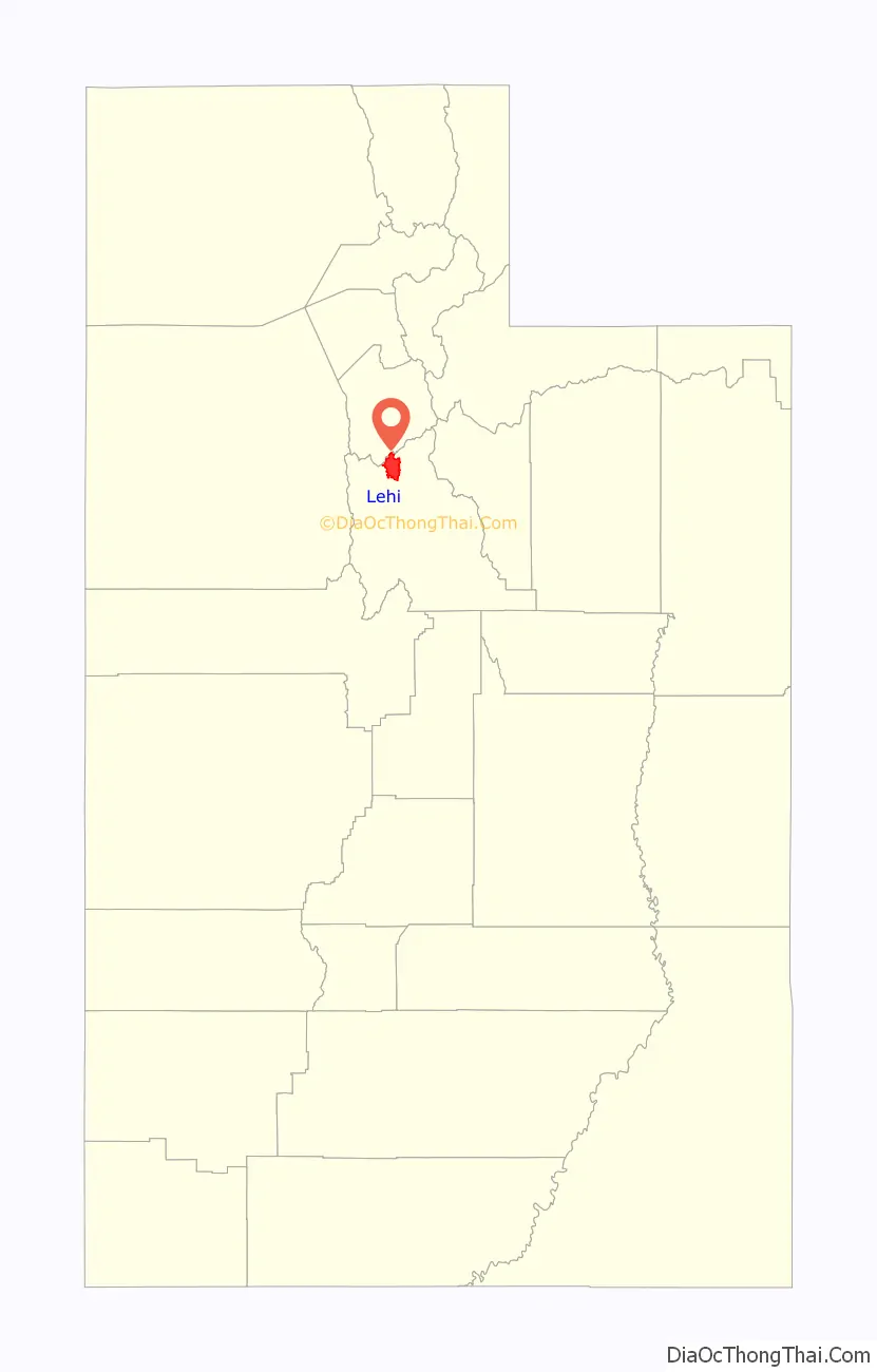
Lehi location map. Where is Lehi city?

History
A group of Mormon pioneers settled the area now known as Lehi in the fall of 1850 at a place called Dry Creek in the northernmost part of Utah Valley. It was renamed Evansville in 1851 after David Evans, a local bishop in the Church of Jesus Christ of Latter-day Saints. Other historical names include Sulphur Springs and Snow’s Springs.
The land was organized into parcels of 40 acres (160,000 m) and new settlers received a plot of this size until the entire tract was exhausted. There was little water to irrigate the rich soil, so it became necessary to divert a portion of American Fork Creek. Evansville consumed up to one-third of the creek’s water, as authorized by the Utah Territorial Legislature.
The settlement grew so rapidly that, in early 1852, Bishop Evans petitioned the Utah Territorial Legislature to incorporate the settlement. Lehi City was incorporated by legislative act on February 5, 1852. It was the sixth city incorporated in Utah. The legislature also approved a request to call the new city Lehi, after a Book of Mormon prophet of the same name. The first mayor of Lehi was Silas P. Barnes, from 1853-1854.
The downtown area has been designated the Lehi Main Street Historic District by the National Park Service and is on the National Register of Historic Places.
Lehi Road Map

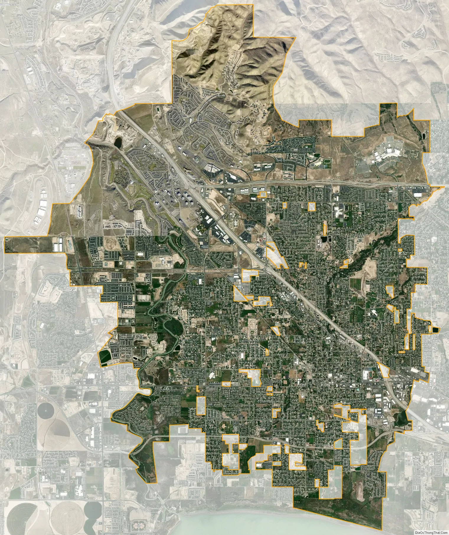
Lehi city Satellite Map
Geography
According to the United States Census Bureau, the city has a total area of 26.7 square miles (69.1 km) of which 26.3 square miles (68.2 km) is land and 0.35 square miles (0.9 km), or 1.28%, is water.
Climate
See also
Map of Utah State and its subdivision: Map of other states:- Alabama
- Alaska
- Arizona
- Arkansas
- California
- Colorado
- Connecticut
- Delaware
- District of Columbia
- Florida
- Georgia
- Hawaii
- Idaho
- Illinois
- Indiana
- Iowa
- Kansas
- Kentucky
- Louisiana
- Maine
- Maryland
- Massachusetts
- Michigan
- Minnesota
- Mississippi
- Missouri
- Montana
- Nebraska
- Nevada
- New Hampshire
- New Jersey
- New Mexico
- New York
- North Carolina
- North Dakota
- Ohio
- Oklahoma
- Oregon
- Pennsylvania
- Rhode Island
- South Carolina
- South Dakota
- Tennessee
- Texas
- Utah
- Vermont
- Virginia
- Washington
- West Virginia
- Wisconsin
- Wyoming


