Bothell West is a census-designated place (CDP) in Snohomish County, Washington, United States. The population was 16,607 at the 2010 census. Bothell West is one of several CDPs that were created out of the former North Creek CDP in 2010.
Bothell West, along with Bothell East, are recognized as part of unincorporated Bothell.
| Name: | Bothell West CDP |
|---|---|
| LSAD Code: | 57 |
| LSAD Description: | CDP (suffix) |
| State: | Washington |
| County: | Snohomish County |
| Elevation: | 482 ft (147 m) |
| Total Area: | 4.217 sq mi (10.92 km²) |
| Land Area: | 4.217 sq mi (10.92 km²) |
| Water Area: | 0.000 sq mi (0.00 km²) |
| Total Population: | 16,607 |
| Population Density: | 3,938.1/sq mi (1,520.5/km²) |
| FIPS code: | 5307395 |
| GNISfeature ID: | 2584948 |
Online Interactive Map
Click on ![]() to view map in "full screen" mode.
to view map in "full screen" mode.
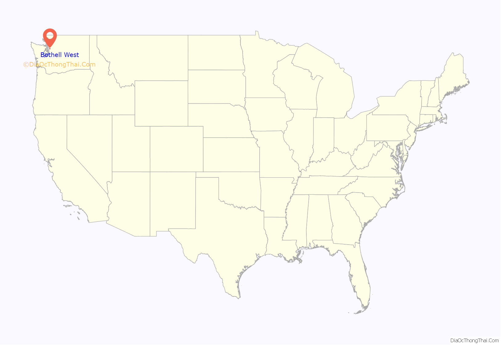
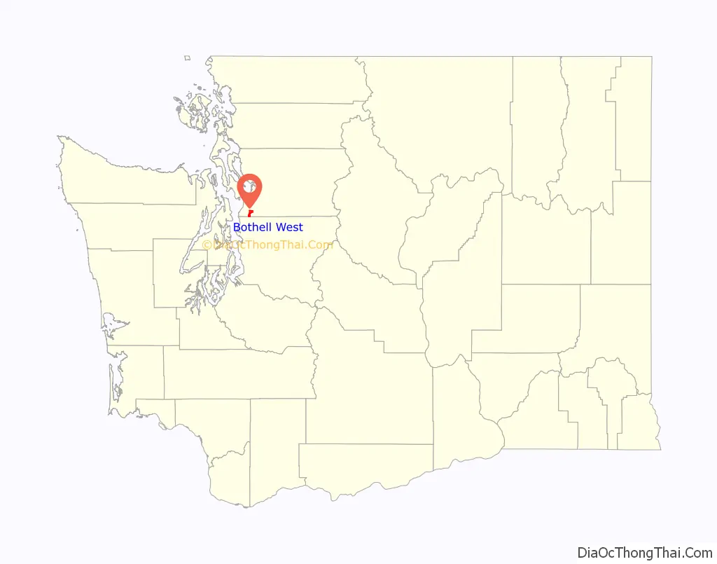
Bothell West location map. Where is Bothell West CDP?
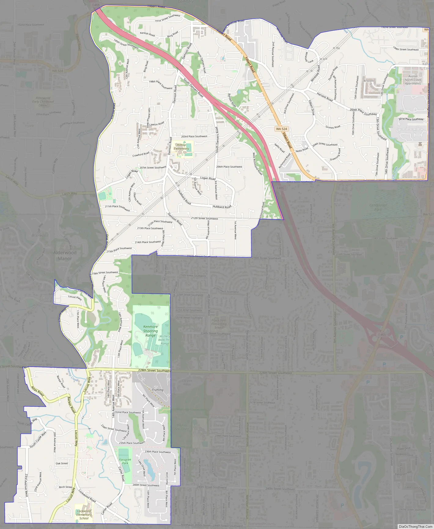
Bothell West Road Map
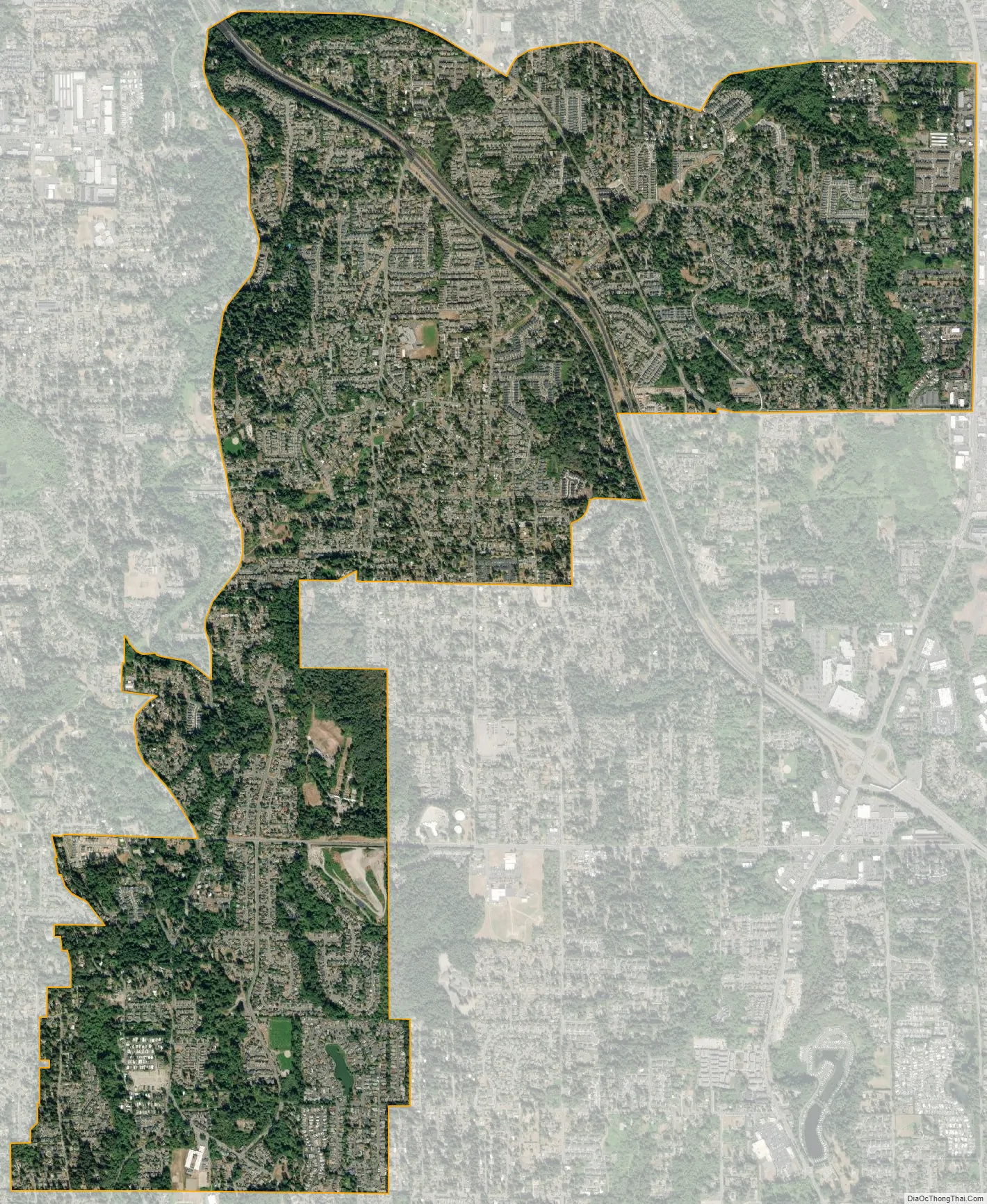
Bothell West city Satellite Map
Geography
Bothell West is located at 47°48′19″N 122°14′27″W / 47.80528°N 122.24083°W / 47.80528; -122.24083 (47.805218, -122.240703).
According to the United States Census Bureau, the CDP has a total area of 4.217 square miles (10.92 km), all of it land.
See also
Map of Washington State and its subdivision:- Adams
- Asotin
- Benton
- Chelan
- Clallam
- Clark
- Columbia
- Cowlitz
- Douglas
- Ferry
- Franklin
- Garfield
- Grant
- Grays Harbor
- Island
- Jefferson
- King
- Kitsap
- Kittitas
- Klickitat
- Lewis
- Lincoln
- Mason
- Okanogan
- Pacific
- Pend Oreille
- Pierce
- San Juan
- Skagit
- Skamania
- Snohomish
- Spokane
- Stevens
- Thurston
- Wahkiakum
- Walla Walla
- Whatcom
- Whitman
- Yakima
- Alabama
- Alaska
- Arizona
- Arkansas
- California
- Colorado
- Connecticut
- Delaware
- District of Columbia
- Florida
- Georgia
- Hawaii
- Idaho
- Illinois
- Indiana
- Iowa
- Kansas
- Kentucky
- Louisiana
- Maine
- Maryland
- Massachusetts
- Michigan
- Minnesota
- Mississippi
- Missouri
- Montana
- Nebraska
- Nevada
- New Hampshire
- New Jersey
- New Mexico
- New York
- North Carolina
- North Dakota
- Ohio
- Oklahoma
- Oregon
- Pennsylvania
- Rhode Island
- South Carolina
- South Dakota
- Tennessee
- Texas
- Utah
- Vermont
- Virginia
- Washington
- West Virginia
- Wisconsin
- Wyoming


