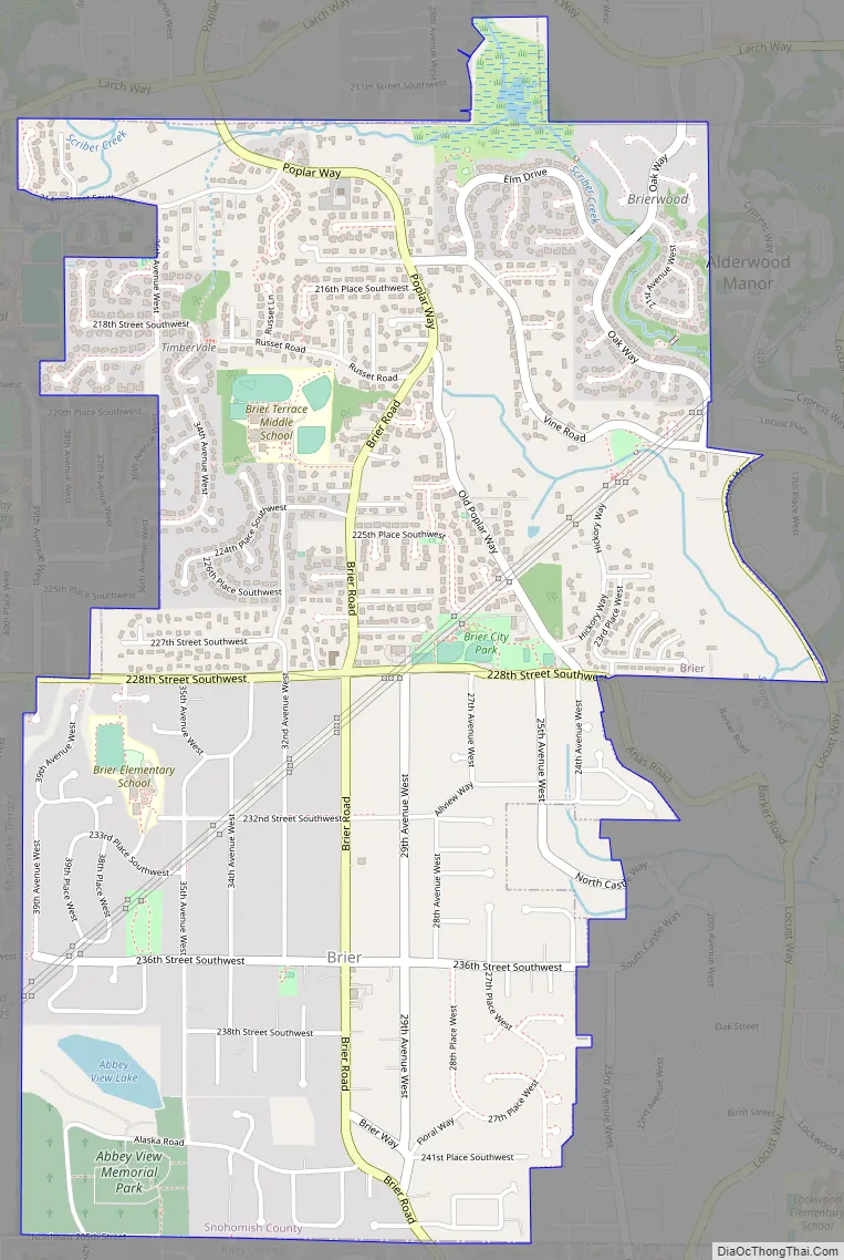
Brier is a city in Snohomish County, Washington, United States. It is bordered by Mountlake Terrace to the west, Lynnwood to the north, Bothell to the east, and Lake Forest Park to the south. The population was 6,087 at the 2010 census.
| Name: | Brier city |
|---|---|
| LSAD Code: | 25 |
| LSAD Description: | city (suffix) |
| State: | Washington |
| County: | Snohomish County |
| Founded: | 1883 |
| Incorporated: | February 11, 1965 |
| Elevation: | 420 ft (128 m) |
| Total Area: | 2.20 sq mi (5.69 km²) |
| Land Area: | 2.20 sq mi (5.69 km²) |
| Water Area: | 0.00 sq mi (0.00 km²) |
| Total Population: | 6,087 |
| Population Density: | 3,173.95/sq mi (1,225.24/km²) |
| ZIP code: | 98036 |
| Area code: | 425 |
| FIPS code: | 5307940 |
| GNISfeature ID: | 1512029 |
| Website: | ci.brier.wa.us |
Online Interactive Map
Click on ![]() to view map in "full screen" mode.
to view map in "full screen" mode.
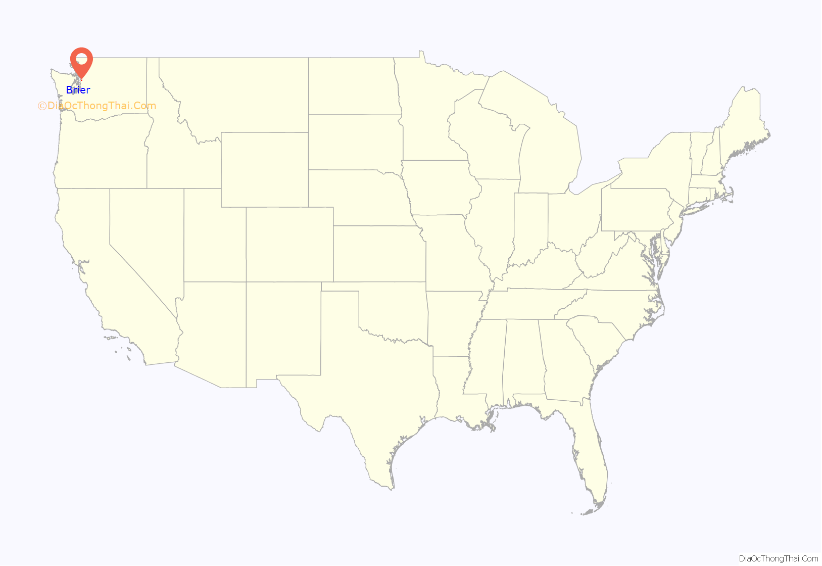
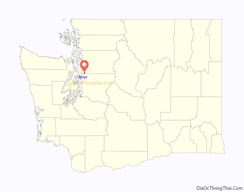
Brier location map. Where is Brier city?
History
Brier is located in the traditional territory of the Sammamish people, Snohomish people, and Suquamish people. The coastal Salish peoples of the region named the area dxʷɬ(ə)q̓ ab, meaning “other side of something” and “a wide place.”
The first European-descendant homestead settlers in the Brier area arrived in 1883 and were followed by loggers who had cleared most of the forestland by 1915. The area was known for its mink farms and later gave way to suburban ranch houses in the 1950s and 1960s.
Brier was named for an existing road that bisected the subdivision where the community was developed in the 1950s. It was officially incorporated as a city on February 11, 1965, after an emergency vote following a proposal from a developer to annex the area into neighboring Mountlake Terrace. The area was gradually developed into a suburban community, growing to over 6,000 people by 1999. Since its incorporation, several elected officials in Brier have been recalled or forced to resign over various misconduct allegations and convictions. A permanent city hall opened in April 2005, replacing a leased office.
Brier Road Map
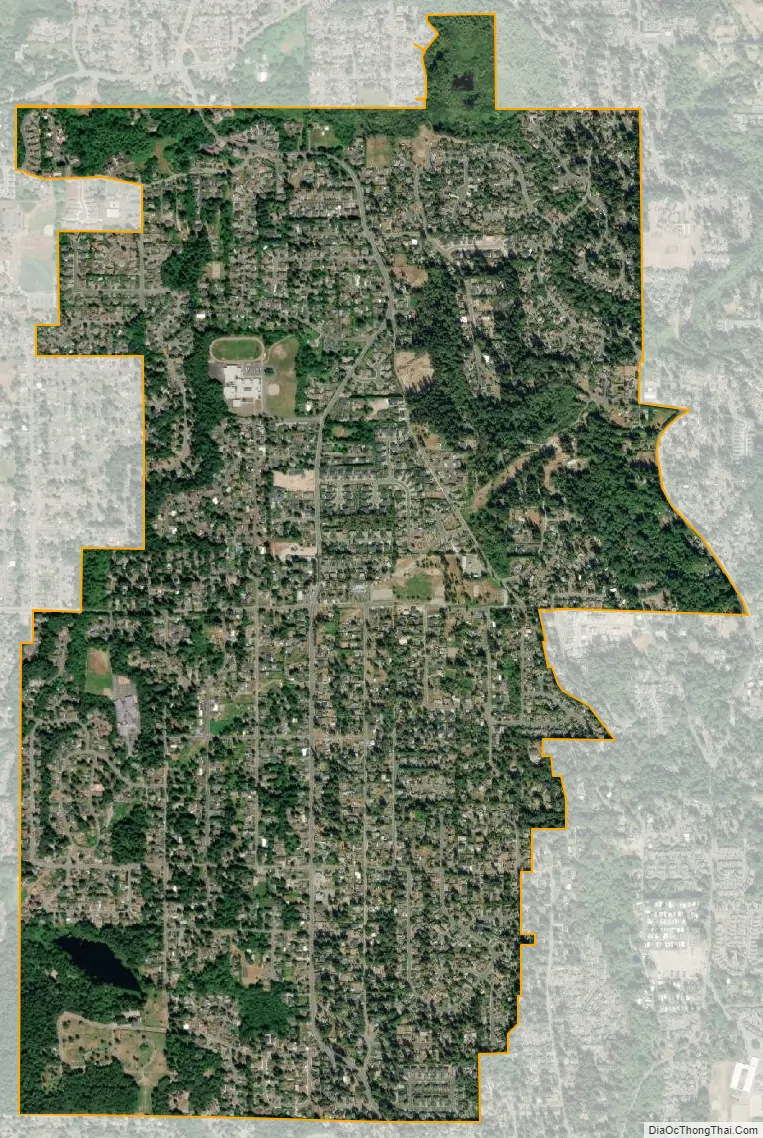
Brier city Satellite Map
Geography
Brier is located 15 miles (24 km) north of Seattle in southern Snohomish County, bordered to the south by Lake Forest Park in King County. The cities of Mountlake Terrace and Bothell lie to the west and east, respectively. The unincorporated area to the north is connected by Brier Road, which continues towards Lynnwood.
According to the United States Census Bureau, the city has a total area of 2.13 square miles (5.52 km), all of it land. The city has large lot sizes for residential homes, at a minimum of 12,500 square feet (1,160 m) and is exclusively zoned for single-family homes.
See also
Map of Washington State and its subdivision:- Adams
- Asotin
- Benton
- Chelan
- Clallam
- Clark
- Columbia
- Cowlitz
- Douglas
- Ferry
- Franklin
- Garfield
- Grant
- Grays Harbor
- Island
- Jefferson
- King
- Kitsap
- Kittitas
- Klickitat
- Lewis
- Lincoln
- Mason
- Okanogan
- Pacific
- Pend Oreille
- Pierce
- San Juan
- Skagit
- Skamania
- Snohomish
- Spokane
- Stevens
- Thurston
- Wahkiakum
- Walla Walla
- Whatcom
- Whitman
- Yakima
- Alabama
- Alaska
- Arizona
- Arkansas
- California
- Colorado
- Connecticut
- Delaware
- District of Columbia
- Florida
- Georgia
- Hawaii
- Idaho
- Illinois
- Indiana
- Iowa
- Kansas
- Kentucky
- Louisiana
- Maine
- Maryland
- Massachusetts
- Michigan
- Minnesota
- Mississippi
- Missouri
- Montana
- Nebraska
- Nevada
- New Hampshire
- New Jersey
- New Mexico
- New York
- North Carolina
- North Dakota
- Ohio
- Oklahoma
- Oregon
- Pennsylvania
- Rhode Island
- South Carolina
- South Dakota
- Tennessee
- Texas
- Utah
- Vermont
- Virginia
- Washington
- West Virginia
- Wisconsin
- Wyoming


