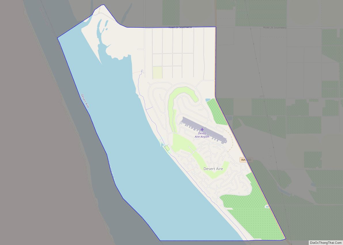
Desert Aire is a census-designated place (CDP) in Grant County, Washington, United States. Desert Aire’s elevation is 560 ft (170 m). The population was 1,626 at the 2010 census, up from 1,124 at the 2000 census.
| Name: | Desert Aire CDP |
|---|---|
| LSAD Code: | 57 |
| LSAD Description: | CDP (suffix) |
| State: | Washington |
| County: | Grant County |
| Elevation: | 568 ft (173 m) |
| Total Area: | 6.1 sq mi (15.8 km²) |
| Land Area: | 3.4 sq mi (8.8 km²) |
| Water Area: | 2.7 sq mi (7.0 km²) |
| Total Population: | 1,626 |
| Population Density: | 479/sq mi (184.9/km²) |
| ZIP code: | 99349 |
| Area code: | 509 |
| FIPS code: | 5317617 |
| GNISfeature ID: | 1511877 |
Online Interactive Map
Click on ![]() to view map in "full screen" mode.
to view map in "full screen" mode.
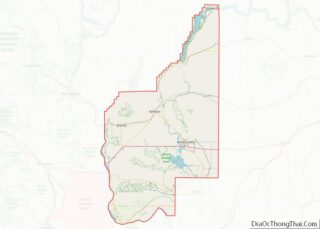
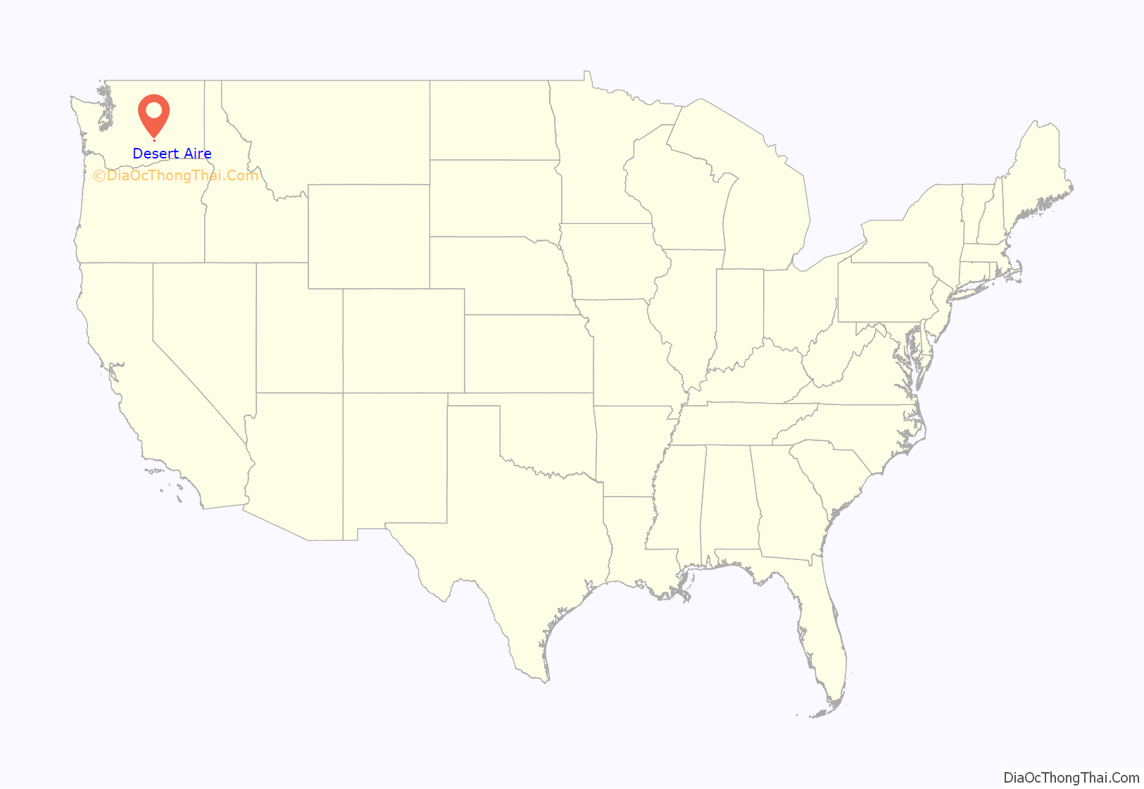
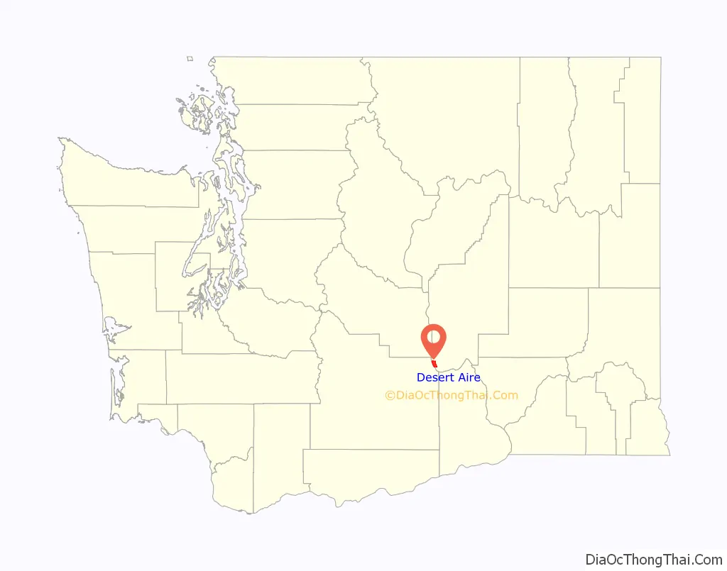
Desert Aire location map. Where is Desert Aire CDP?
History
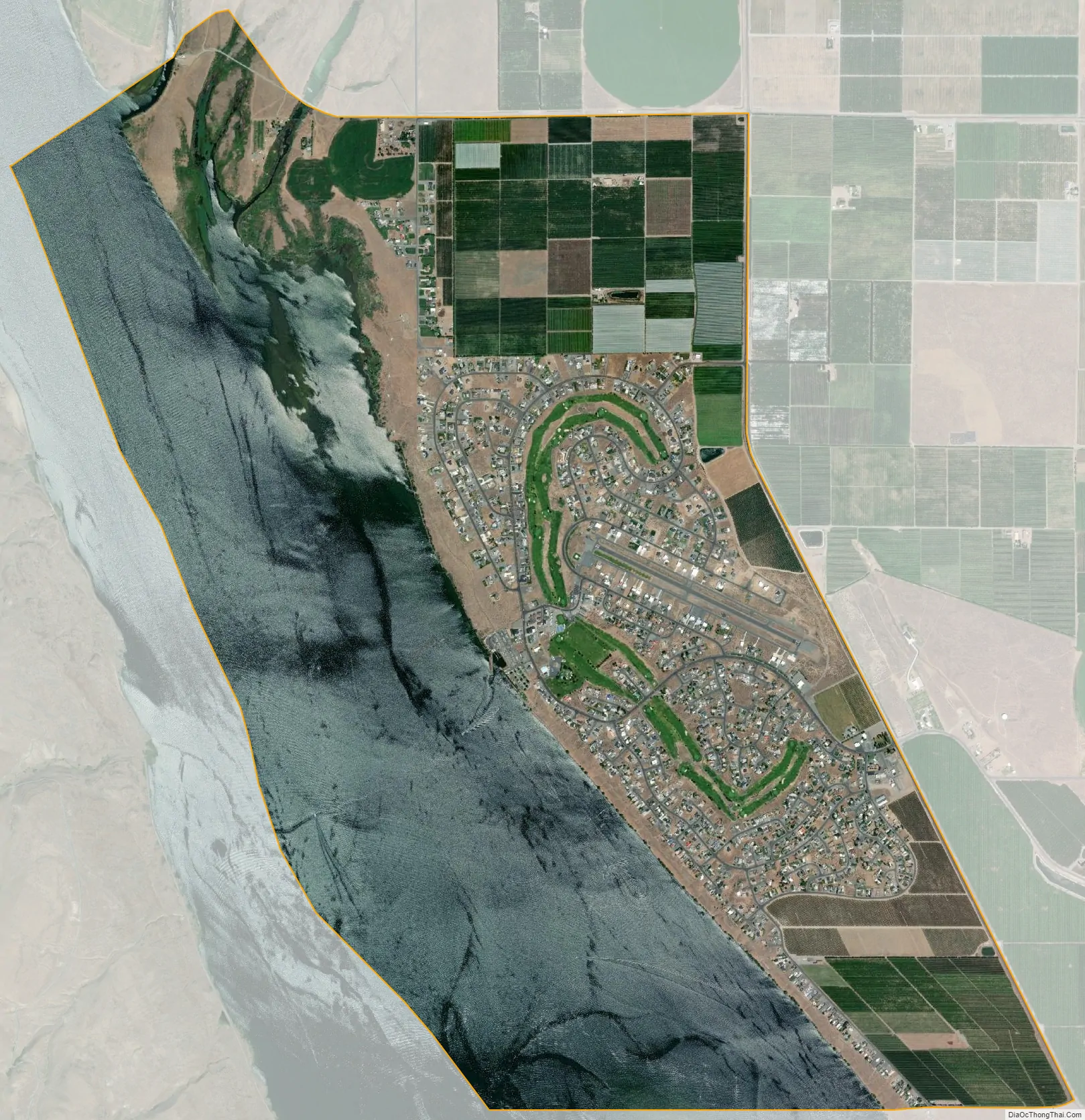
In the late 1960s, a group of investors led by Harry Davidson, of Harry Davidson, Inc., bought 3,200 acres (13 km) of land along the Columbia River near the Priest Rapids Dam for some $1,000,000. Davidson cut in a runway and flew investors into his airport community in a Douglas DC-3. They developed a planned community of some 1,600 homes centered on the airport, a golf course and marina, which opened beginning in 1970. In 1994 the Grant County Airport District #1 was formed and now maintains the regional public-use airport in the community.
Desert Aire Road Map
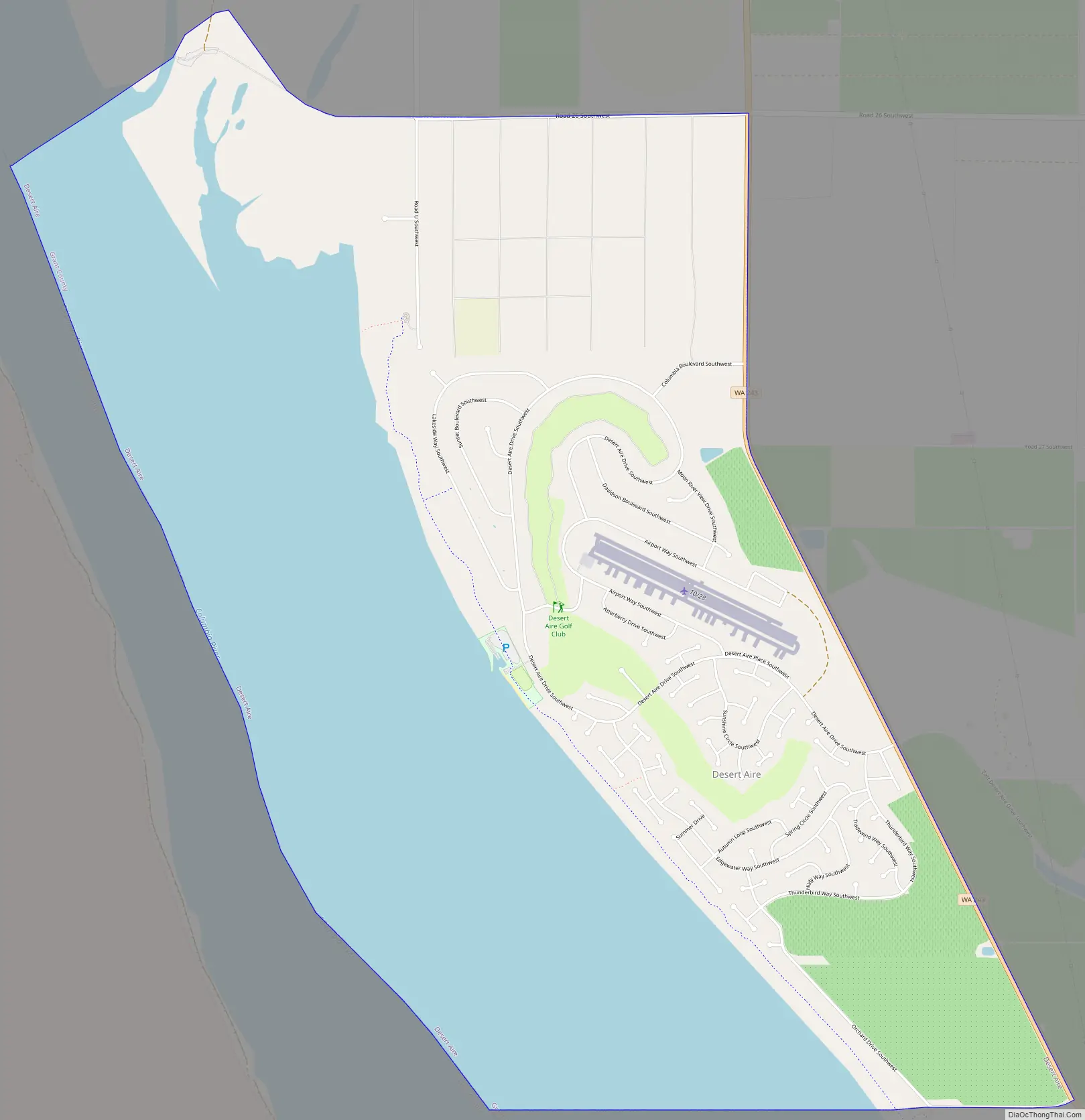
Desert Aire city Satellite Map
Geography
Desert Aire is located near the southwest corner of Grant County at 46°41′6″N 119°55′29″W / 46.68500°N 119.92472°W / 46.68500; -119.92472 (46.685121, -119.924811), on the east bank of the Columbia River where it is part of Priest Rapids Lake. Washington State Route 243 forms the eastern edge of the CDP; the highway leads north 5 miles (8 km) to Mattawa and 20 miles (32 km) to Interstate 90 across the Columbia River from Vantage. To the southeast SR 243 leads 11 miles (18 km) to SR 24 at the Vernita Bridge over the Columbia.
According to the United States Census Bureau, the Desert Aire CDP has a total area of 6.1 square miles (15.8 km), of which 3.4 square miles (8.8 km) are land and 2.7 square miles (7.0 km), or 44.32%, are water. The CDP extends out to the middle of the Columbia River, where it is bordered by Yakima County to the west.
See also
Map of Washington State and its subdivision:- Adams
- Asotin
- Benton
- Chelan
- Clallam
- Clark
- Columbia
- Cowlitz
- Douglas
- Ferry
- Franklin
- Garfield
- Grant
- Grays Harbor
- Island
- Jefferson
- King
- Kitsap
- Kittitas
- Klickitat
- Lewis
- Lincoln
- Mason
- Okanogan
- Pacific
- Pend Oreille
- Pierce
- San Juan
- Skagit
- Skamania
- Snohomish
- Spokane
- Stevens
- Thurston
- Wahkiakum
- Walla Walla
- Whatcom
- Whitman
- Yakima
- Alabama
- Alaska
- Arizona
- Arkansas
- California
- Colorado
- Connecticut
- Delaware
- District of Columbia
- Florida
- Georgia
- Hawaii
- Idaho
- Illinois
- Indiana
- Iowa
- Kansas
- Kentucky
- Louisiana
- Maine
- Maryland
- Massachusetts
- Michigan
- Minnesota
- Mississippi
- Missouri
- Montana
- Nebraska
- Nevada
- New Hampshire
- New Jersey
- New Mexico
- New York
- North Carolina
- North Dakota
- Ohio
- Oklahoma
- Oregon
- Pennsylvania
- Rhode Island
- South Carolina
- South Dakota
- Tennessee
- Texas
- Utah
- Vermont
- Virginia
- Washington
- West Virginia
- Wisconsin
- Wyoming