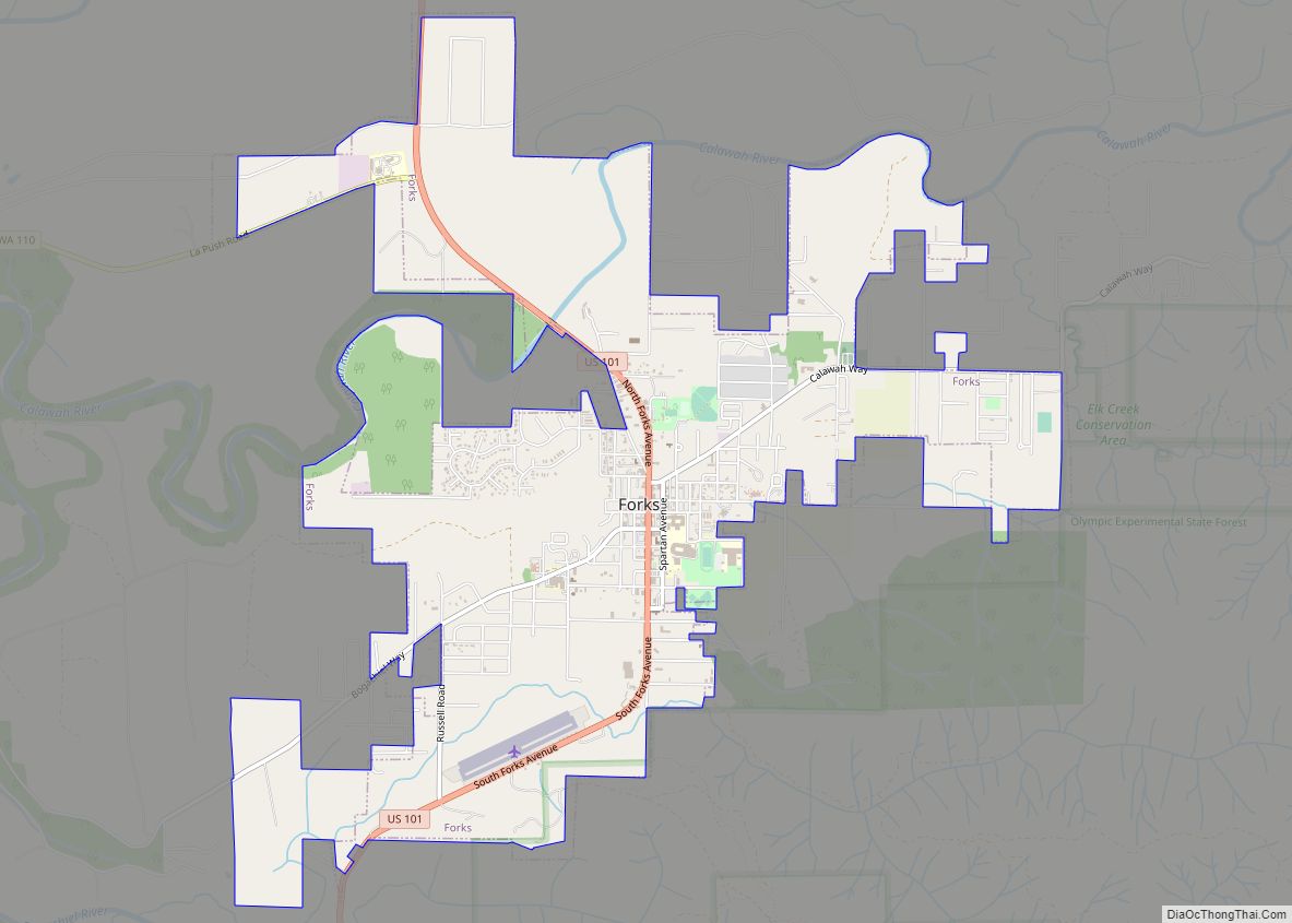
Forks, also previously known as the unincorporated town of Quillayute, is a city in southwest Clallam County, Washington, United States. The population was 3,335 at the 2020 census. It is named after the forks in the nearby Quillayute, Bogachiel, Calawah, and Sol Duc rivers.
For many years, the city’s economy was fueled by the local timber industry. More recently it has drawn tourism related to the novel series Twilight and films of the same name, set in Forks. With recent declines in the timber industry, Forks has relied on the nearby Clallam Bay Corrections Center and Olympic Corrections Center as sources of jobs. Forks is a popular destination for sport fishers who fish for salmon and rainbow trout in nearby rivers. It is also supported by visitors to Olympic National Park.
| Name: | Forks city |
|---|---|
| LSAD Code: | 25 |
| LSAD Description: | city (suffix) |
| State: | Washington |
| County: | Clallam County |
| Incorporated: | August 7, 1945 |
| Elevation: | 305 ft (93 m) |
| Total Area: | 4.12 sq mi (10.67 km²) |
| Land Area: | 4.12 sq mi (10.67 km²) |
| Water Area: | 0.00 sq mi (0.00 km²) |
| Total Population: | 3,335 |
| Population Density: | 810/sq mi (312.6/km²) |
| ZIP code: | 98331 |
| Area code: | 360 |
| FIPS code: | 5324810 |
| GNISfeature ID: | 1519696 |
| Website: | forkswashington.org |
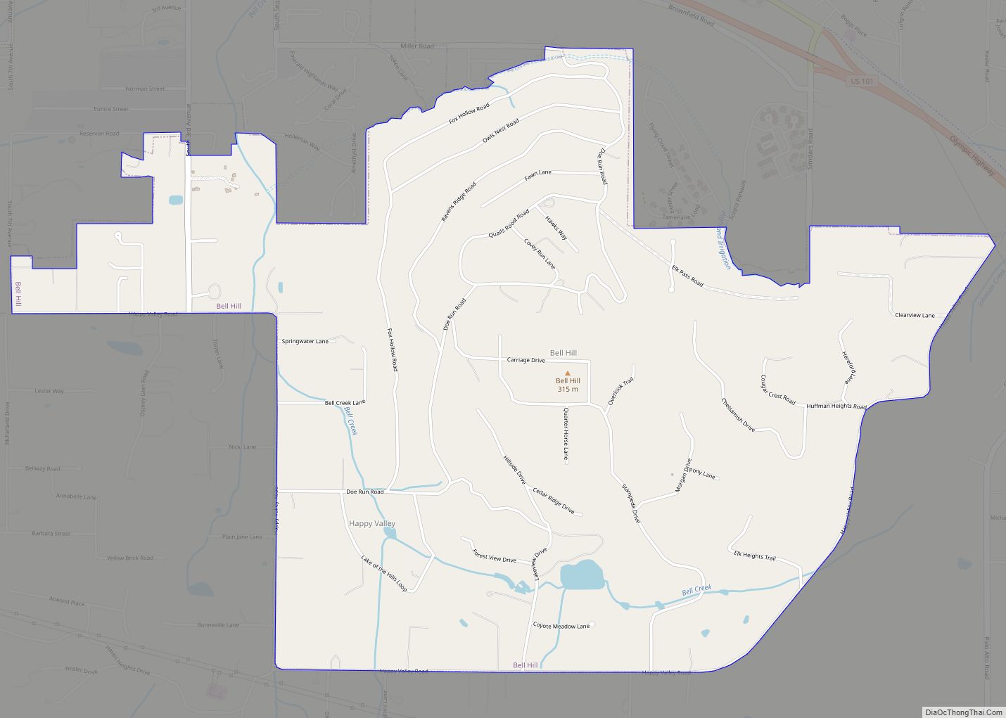
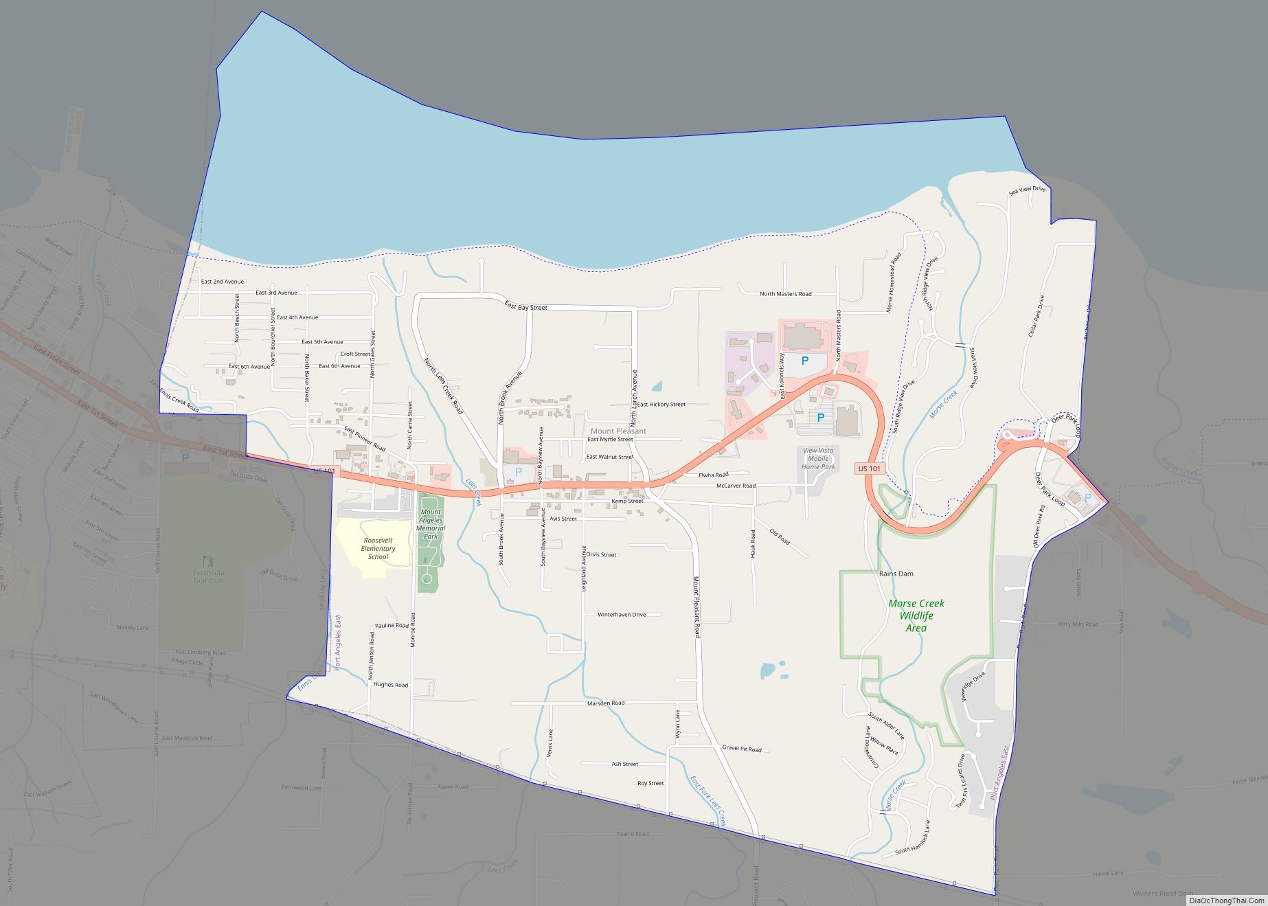
Online Interactive Map
Click on ![]() to view map in "full screen" mode.
to view map in "full screen" mode.
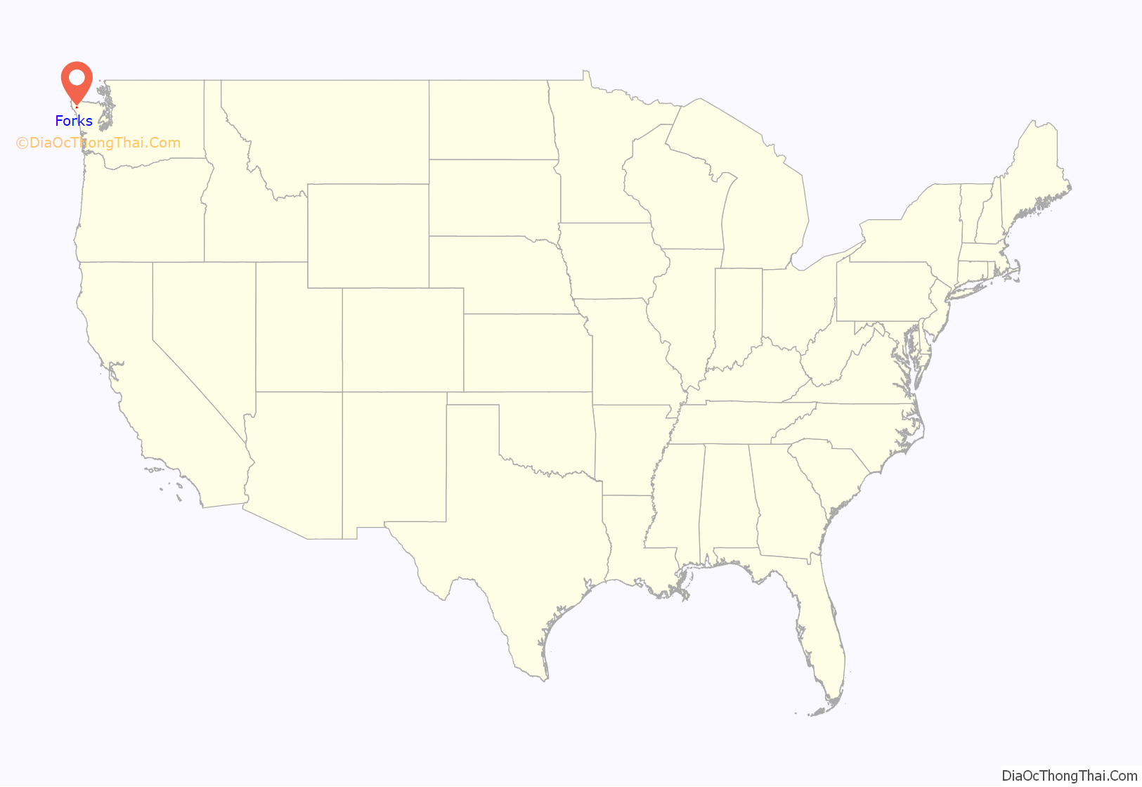
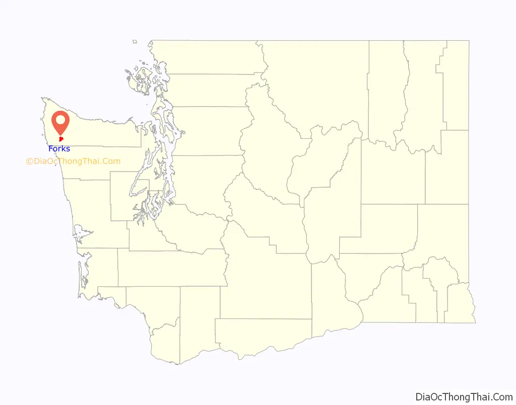
Forks location map. Where is Forks city?
History
Territory of the Quileute Native Americans
Forks was once inhabited by the Quileute Native American tribe, before they ceded their territory. In 1889 a reservation was created near Forks the same year that Washington became a state. That same year the village was burnt down by settler Daniel Pullen. Forks is 12 miles from tribal burning areas that area tribes used to regenerate young ferns. The phrase “prairie upstream” from Quileute language was translated and became the name Forks Prairie.
Early settlement
Early settlers to Forks came via the rivers and trails from the Pacific and the Strait of Juan de Fuca due to the lack of overland options. In the 1860s, men from Dungeness unsuccessfully attempted to convince the territorial legislature to create Quillehuyte County out of Clallam and Jefferson counties’s western ends.
In January 1878, a mile east of Forks, Luther and Esther Ford arrived and laid claim to the 160-acre homestead (at the time there was already a few trappers living in the area). Ford set up the first dairy herd in the settlement in 1879. In 1884 a post office opened in Nelson’s cabin. Since another Washington settlement already was named ‘Ford’s Prairie’ the name ‘Forks’ was chosen as the name. The name ‘Forks’ was due to the prairie’s location as a fork in the vicinity of three rivers.
It was difficult to receive and sell products in Forks in its early days since the nearest market was in Port Townsend (over 55 miles away). The small supply boat that was provided in the summers was not large enough for cargo either. Due to these problems, hops would regularly rot awaiting transport. It was not until narrow roads were built in the 1880s and 1890s that the situation improved slightly. Eventually canoes and ferries were used to help alleviate these issues. In 1927 a single car-sized road opened from Lake Crescent to Forks and the Olympic Loop Highway (U.S. 101) was built through Forks in 1931. The Mora post moved to Forks in the early 1890s which consisted of a general store, hardware store, and a hotel. In the early 1900s, hop growing declined and the Forks Cooperative Creamery was established which operated for 70 years.
Timber was cleared by settlers and small-time loggers in the late 1800s. Booming logging camps were set up by timber baron Michael Earles in the early 1900s which attracted many workers to the area. In 1916, Merrill & Ring began to log in the Pysht River drainage northwest of the area. President Grover Cleveland placed individual claiming of timber volume off-limits in the Olympic Peninsula around this time which proved monumental for the area’s future. The Olympic Forest Reserve was trimmed by 623,000 acres but it contained three-fourths of all timber by volume. The Olympic National Park took up the remaining parts of the reserve (it first became a monument in 1909). Isolation soon creeped into the area due to the 1907 national recession. Sitka spruce in the West End was provided during the First World War due to urgent demand. The U.S. Army’s Spruce Production Division used this spruce to build 36 miles of railroad track from Port Angeles to Lake Pleasant in six months. But before it could be completed, World War I ended and no spruce was hauled down the line.
Settlers from the Hoh came gradually to Forks in its earlier days. In 1912 the town was laid out where the Whittier homestead stood and as late as the 1920s the town was just a block of buildings and prairie homesteads amongst looming forests. In 1930 the current newspaper, Forks Forum, started publication 40 years after the original Forks newspaper was established. Throughout the 1920s and 1930s, Forks gained many amenities of modern towns at the time as new inhabitants increased its population. Nearly 20 percent of the forest around Forks was flattened as what locals described as a “hurricane roaring overhead” swept through the West End. Five years later a fire occurred on Main Street before another fire hit the town in 1951.
Modern history
Forks was officially incorporated on August 7, 1945, following an election of the constituents who would become its first town members.
The city gained popularity for being a key setting in Stephenie Meyer’s Twilight series (2005 to 2008) and related film adaptations.
Forks Road Map
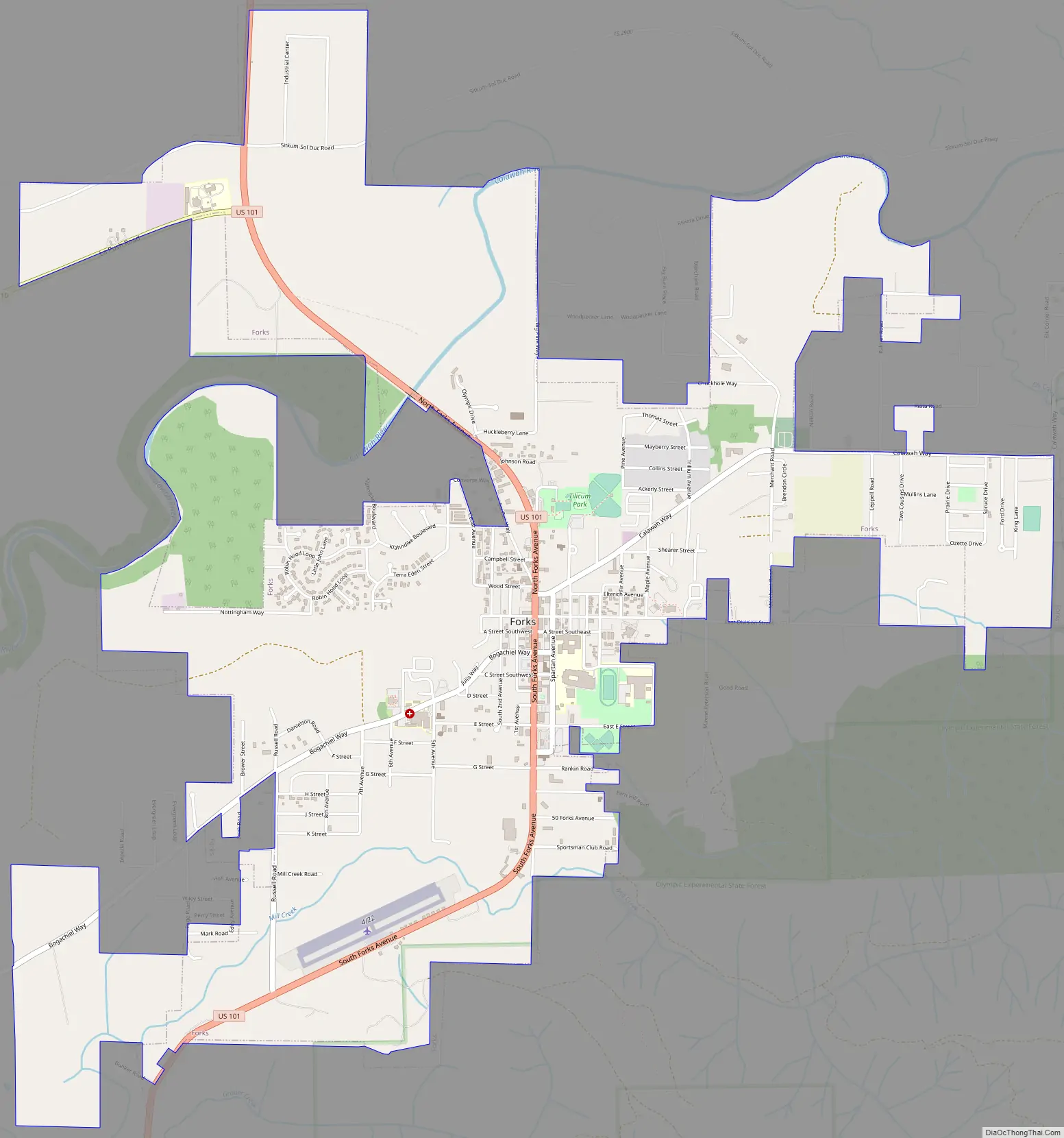
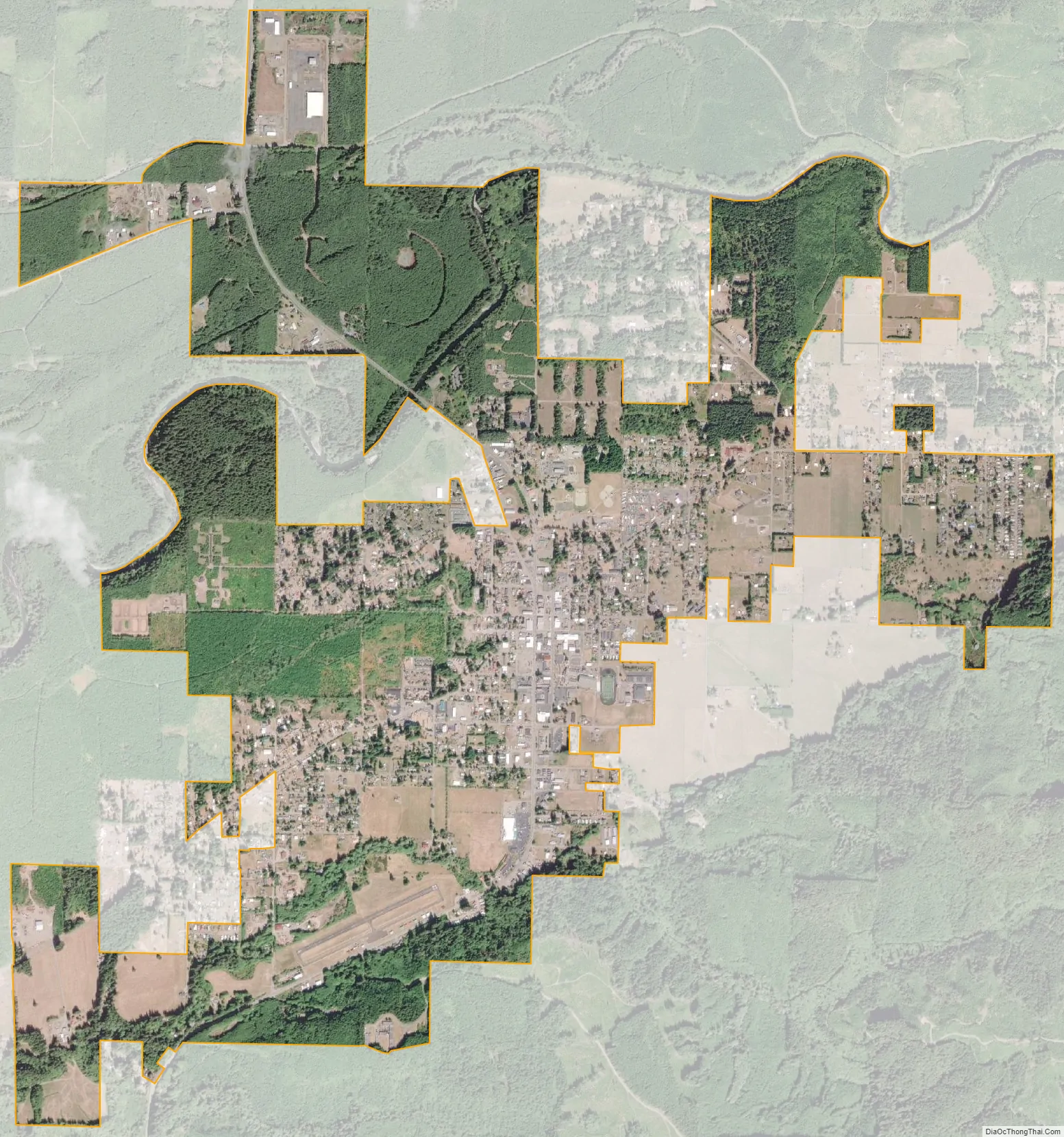
Forks city Satellite Map
Geography
The city lies on Forks Prairie just east of the confluence of the Calawah River with the Bogachiel River. U.S. Route 101 passes through the town. The Olympic rainforest surrounds the town.
Forks has an oceanic climate (Cfb) in a temperate rainforest with very high rainfall, above 100 inches (2,500 mm) per year. Although there is a drying trend in summer, rain is still abundant, just not as wet as the rest of the year. Forks averages 212 days per year with measurable precipitation.
According to the United States Census Bureau, the city has a total area of 3.65 square miles (9.45 km), all of it land.
- ^ Mean monthly maxima and minima (i.e. the highest and lowest temperature readings during an entire month or year) calculated based on data at said location from 1991 to 2020.
See also
Map of Washington State and its subdivision:- Adams
- Asotin
- Benton
- Chelan
- Clallam
- Clark
- Columbia
- Cowlitz
- Douglas
- Ferry
- Franklin
- Garfield
- Grant
- Grays Harbor
- Island
- Jefferson
- King
- Kitsap
- Kittitas
- Klickitat
- Lewis
- Lincoln
- Mason
- Okanogan
- Pacific
- Pend Oreille
- Pierce
- San Juan
- Skagit
- Skamania
- Snohomish
- Spokane
- Stevens
- Thurston
- Wahkiakum
- Walla Walla
- Whatcom
- Whitman
- Yakima
- Alabama
- Alaska
- Arizona
- Arkansas
- California
- Colorado
- Connecticut
- Delaware
- District of Columbia
- Florida
- Georgia
- Hawaii
- Idaho
- Illinois
- Indiana
- Iowa
- Kansas
- Kentucky
- Louisiana
- Maine
- Maryland
- Massachusetts
- Michigan
- Minnesota
- Mississippi
- Missouri
- Montana
- Nebraska
- Nevada
- New Hampshire
- New Jersey
- New Mexico
- New York
- North Carolina
- North Dakota
- Ohio
- Oklahoma
- Oregon
- Pennsylvania
- Rhode Island
- South Carolina
- South Dakota
- Tennessee
- Texas
- Utah
- Vermont
- Virginia
- Washington
- West Virginia
- Wisconsin
- Wyoming