Gold Bar is a city in Snohomish County, Washington, United States. It is located on the Skykomish River between Sultan and Index, connected by U.S. Route 2. The population was 2,403 at the 2020 census.
| Name: | Gold Bar city |
|---|---|
| LSAD Code: | 25 |
| LSAD Description: | city (suffix) |
| State: | Washington |
| County: | Snohomish County |
| Incorporated: | September 16, 1910 |
| Elevation: | 207 ft (63 m) |
| Total Area: | 1.06 sq mi (2.74 km²) |
| Land Area: | 1.06 sq mi (2.74 km²) |
| Water Area: | 0.00 sq mi (0.00 km²) |
| Total Population: | 2,403 |
| Population Density: | 2,220.96/sq mi (857.19/km²) |
| ZIP code: | 98251 |
| Area code: | 360 |
| FIPS code: | 5327365 |
| GNISfeature ID: | 1520077 |
| Website: | cityofgoldbar.us |
Online Interactive Map
Click on ![]() to view map in "full screen" mode.
to view map in "full screen" mode.
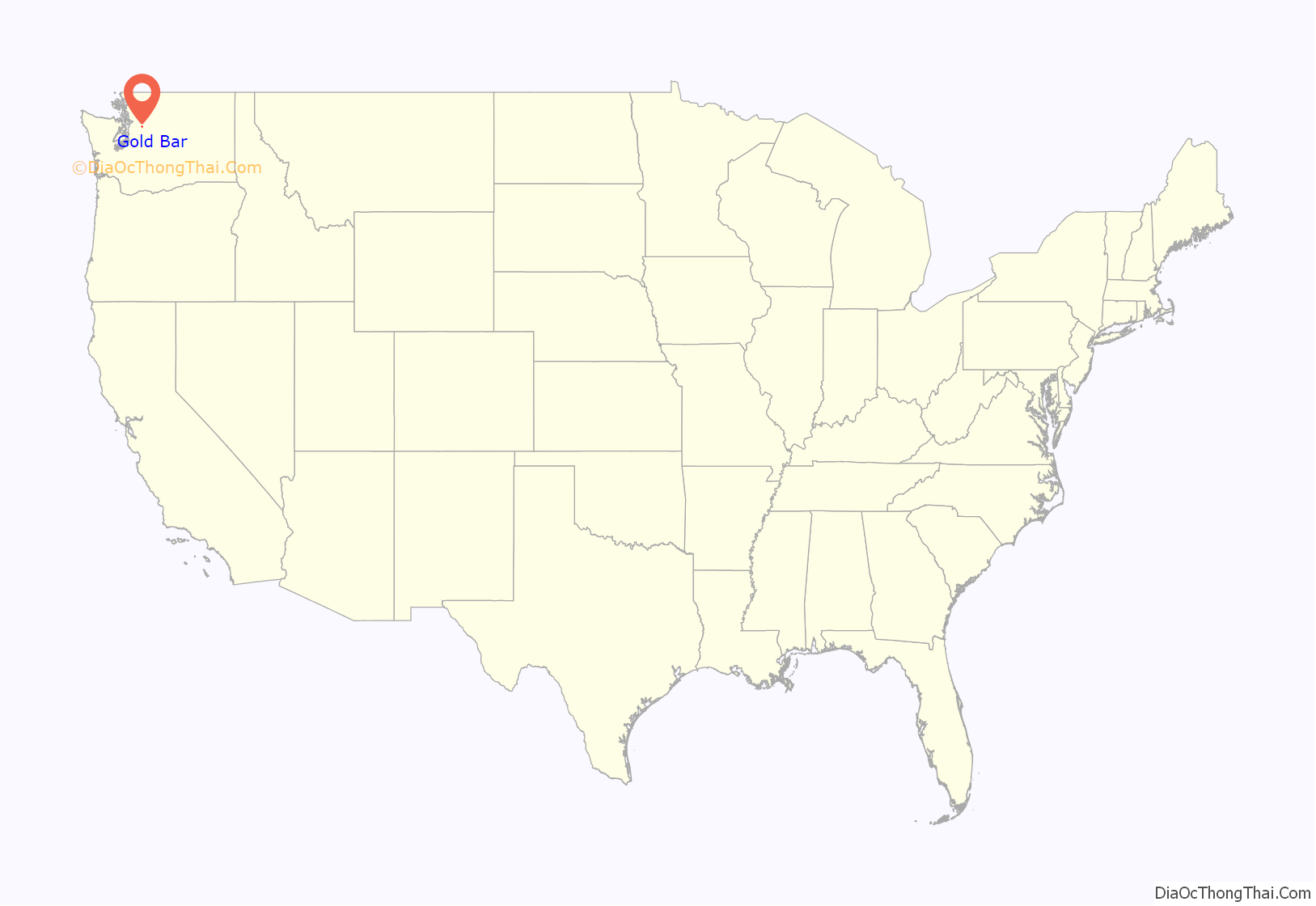
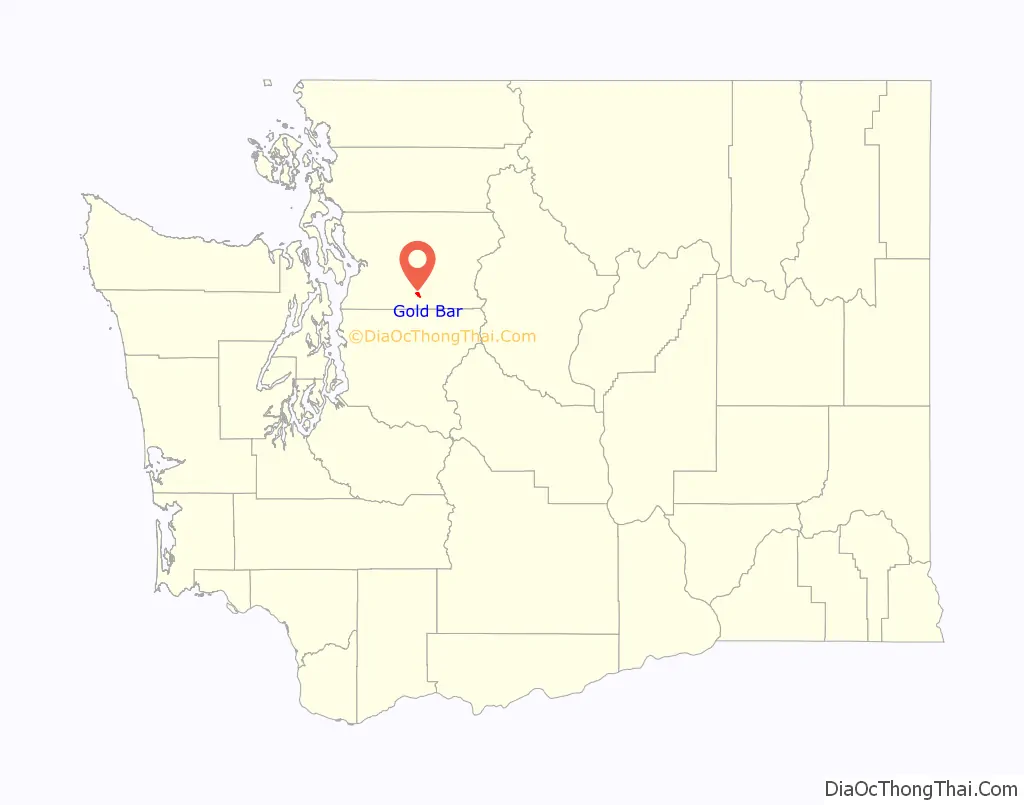
Gold Bar location map. Where is Gold Bar city?
History
The area around modern-day Gold Bar was occupied by the Skykomish, a branch of the Snohomish people, prior to the arrival of American settlers. The Skykomish had a permanent village near Gold Bar that was named ‘xaitɬd. Gold Bar started as a prospectors camp in 1869, named by a miner who found traces of gold on a river gravel bar. After Gold Bar became a construction camp for the Great Northern Railway, anti-Chinese sentiment was inflamed by a shooting fray started by disreputable camp followers. To save the lives of the threatened Chinese, construction engineer Eduard Bauer slipped them out of camp in hastily constructed coffins. Gold Bar was officially incorporated on September 16, 1910. The 1940 population was 307.
In 2012, the city government considered disincorporation to avoid bankruptcy due to low sales tax revenue and high expenses attributed to filling public records requests and fighting lawsuits from an activist. The city council voted against disincorporation and placed a property tax levy on the ballot, which was rejected by voters in November 2012.
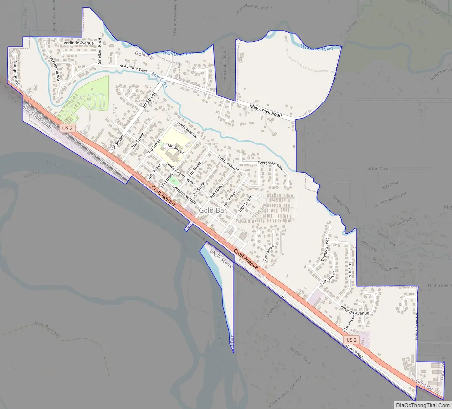
Gold Bar Road Map
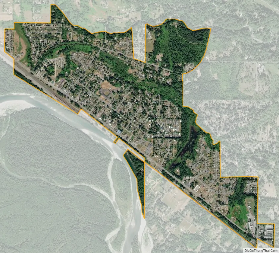
Gold Bar city Satellite Map
Geography
According to the United States Census Bureau, the city has a total area of 1.03 square miles (2.67 km), all of it land. The city center is bordered to the south by the Skykomish River and to the north by the Wallace River.
Gold Bar is adjacent to Wallace Falls State Park, located 2 miles (3.2 km) northeast.
Climate
The climate in this area has mild differences between highs and lows, and there is adequate rainfall year-round. According to the Köppen Climate Classification system, Gold Bar has a marine west coast climate, abbreviated “Cfb” on climate maps.
See also
Map of Washington State and its subdivision:- Adams
- Asotin
- Benton
- Chelan
- Clallam
- Clark
- Columbia
- Cowlitz
- Douglas
- Ferry
- Franklin
- Garfield
- Grant
- Grays Harbor
- Island
- Jefferson
- King
- Kitsap
- Kittitas
- Klickitat
- Lewis
- Lincoln
- Mason
- Okanogan
- Pacific
- Pend Oreille
- Pierce
- San Juan
- Skagit
- Skamania
- Snohomish
- Spokane
- Stevens
- Thurston
- Wahkiakum
- Walla Walla
- Whatcom
- Whitman
- Yakima
- Alabama
- Alaska
- Arizona
- Arkansas
- California
- Colorado
- Connecticut
- Delaware
- District of Columbia
- Florida
- Georgia
- Hawaii
- Idaho
- Illinois
- Indiana
- Iowa
- Kansas
- Kentucky
- Louisiana
- Maine
- Maryland
- Massachusetts
- Michigan
- Minnesota
- Mississippi
- Missouri
- Montana
- Nebraska
- Nevada
- New Hampshire
- New Jersey
- New Mexico
- New York
- North Carolina
- North Dakota
- Ohio
- Oklahoma
- Oregon
- Pennsylvania
- Rhode Island
- South Carolina
- South Dakota
- Tennessee
- Texas
- Utah
- Vermont
- Virginia
- Washington
- West Virginia
- Wisconsin
- Wyoming


