Snoqualmie Pass is a census-designated place (CDP) in Kittitas County, Washington, United States. It includes the unincorporated community of Hyak. The population was 311 at the 2010 census.
The CDP is named for the mountain pass that carries Interstate 90 across the Cascade Range, which itself is named for the Snoqualmie tribe, a Native American tribe indigenous to the Snoqualmie Valley located west of the pass. The portion of the mountain pass west of the height of land, in King County, is not part of the Snoqualmie Pass CDP.
Based on per capita income, Snoqualmie Pass ranks 8th of 522 areas in the state of Washington to be ranked. It is also the highest rank achieved in Kittitas County.
| Name: | Snoqualmie Pass CDP |
|---|---|
| LSAD Code: | 57 |
| LSAD Description: | CDP (suffix) |
| State: | Washington |
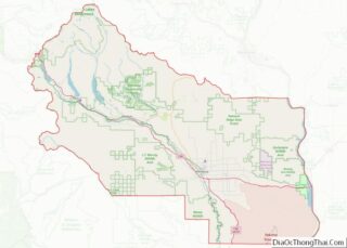
| County: | Kittitas County |
| Elevation: | 2,726 ft (831 m) |
| Total Area: | 2.93 sq mi (7.58 km²) |
| Land Area: | 2.93 sq mi (7.58 km²) |
| Water Area: | 0.0 sq mi (0.0 km²) |
| Total Population: | 311 |
| Population Density: | 106/sq mi (41.1/km²) |
| ZIP code: | 98068 |
| Area code: | 425 |
| FIPS code: | 5365275 |
| GNISfeature ID: | 1852958 |
Online Interactive Map
Click on ![]() to view map in "full screen" mode.
to view map in "full screen" mode.
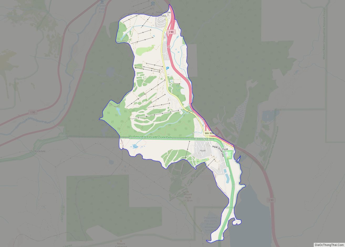
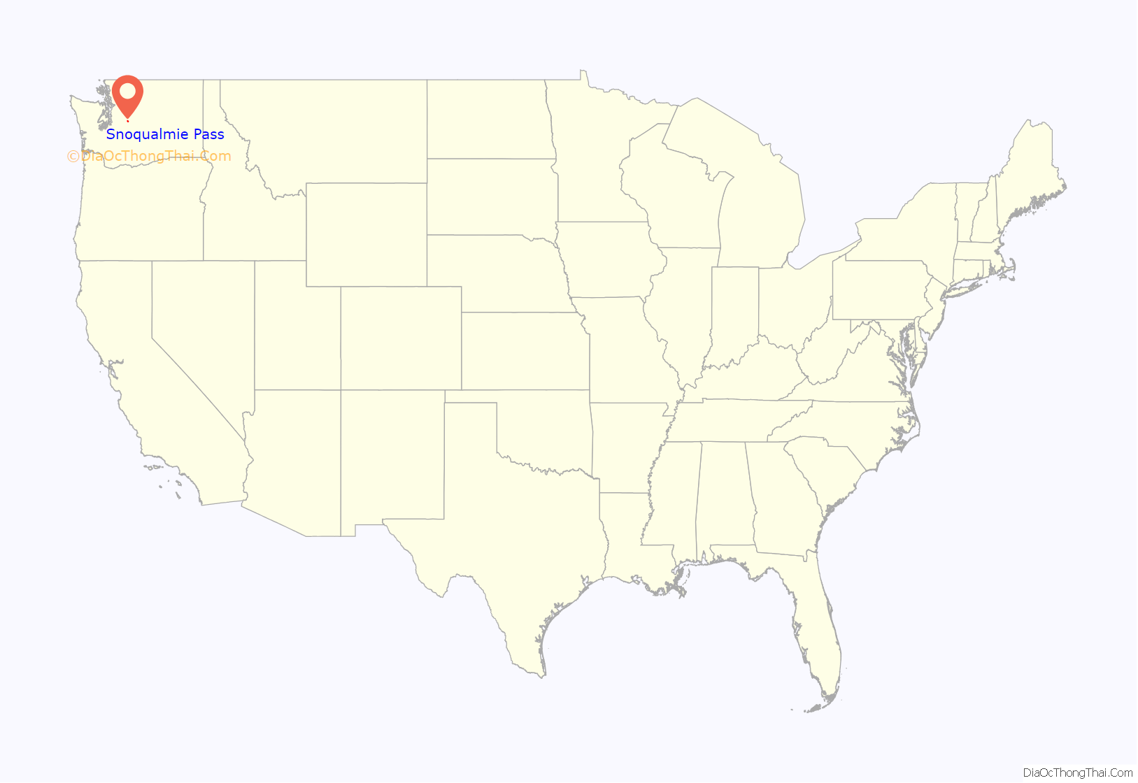
Snoqualmie Pass location map. Where is Snoqualmie Pass CDP?
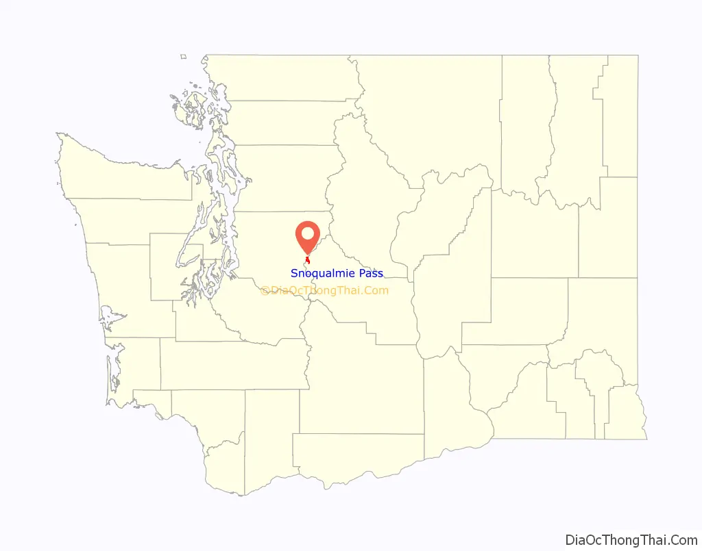
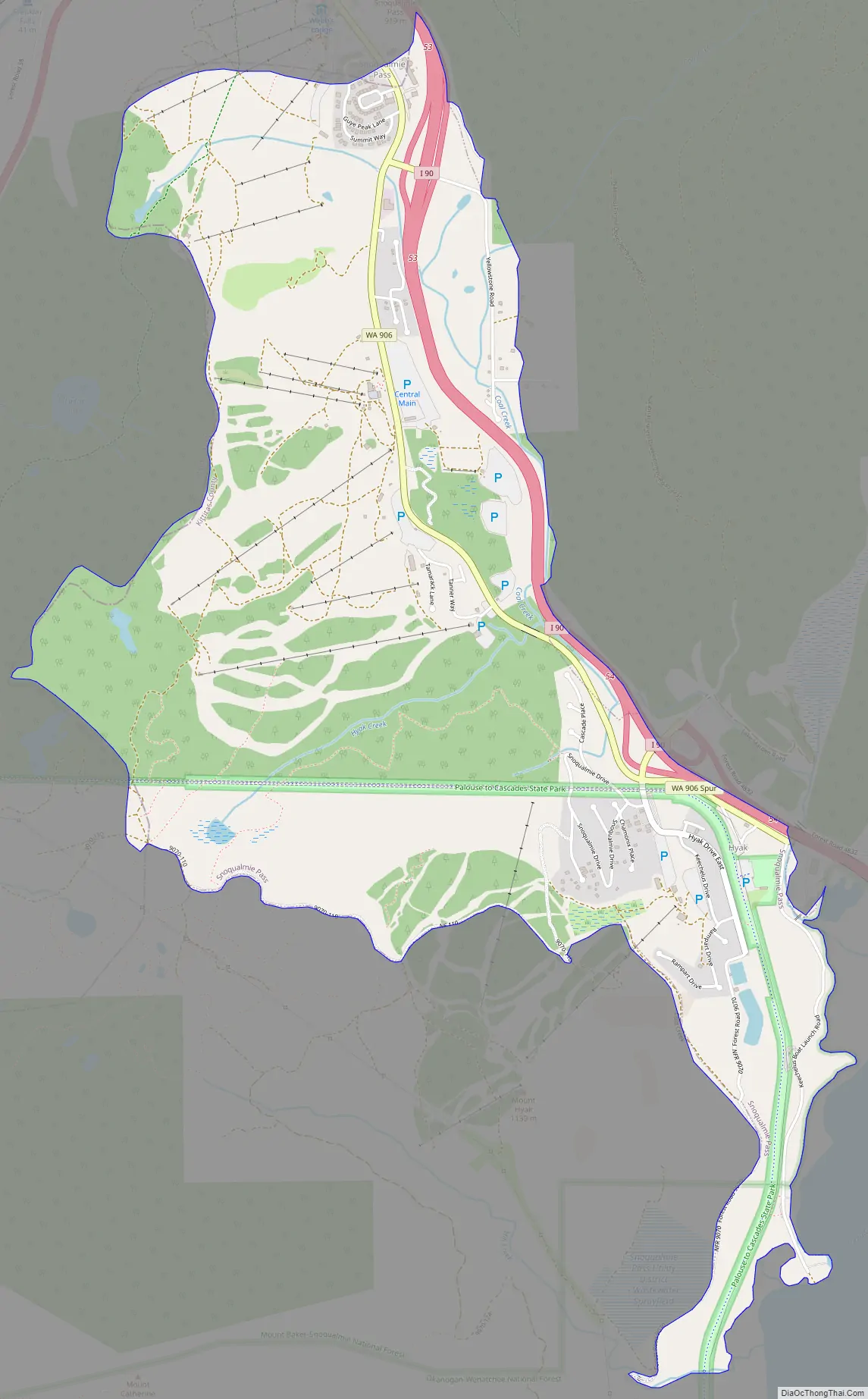
Snoqualmie Pass Road Map
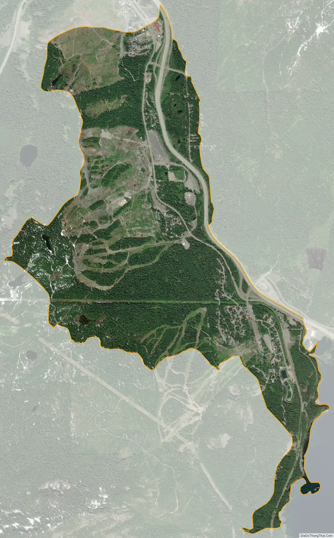
Snoqualmie Pass city Satellite Map
Geography
The community is in westernmost Kittitas County, on the east side of Snoqualmie Pass. Its western border follows the King County border, which is also the height of land of the Cascade Range. The CDP extends southeast as far as Keechelus Lake, the source of the Yakima River. The unincorporated community of Hyak is in the southeast part of the CDP.
Interstate 90 passes through the community, with access from Exits 53 and 54. I-90 leads west 53 miles (85 km) to Seattle and southeast the same distance to Ellensburg, the Kittitas county seat. Washington State Route 906 serves as a local main road through the Snoqualmie Pass community, connecting with I-90 at both of its exits.
According to the United States Census Bureau, the Snoqualmie Pass CDP has a total area of 2.9 square miles (7.6 km), all of it land. Situated at a main crossing point of the Cascade Range, Snoqualmie Pass is located along the Mountains to Sound Greenway, which spans parts of King and Kittitas counties. The eastern portal of the 2.2-mile-long (3.5 km) Snoqualmie Tunnel is in the CDP at Hyak.
Climate
Due to its elevation, Snoqualmie Pass experiences significantly lower temperatures than Seattle, and receives much more precipitation, much of it being snow. Snoqualmie Pass has a humid continental climate (Koppen: Dsb bordering Csb) with cold, very wet and snowy winters, and mild to warm, relatively dry summers.
See also
Map of Washington State and its subdivision:- Adams
- Asotin
- Benton
- Chelan
- Clallam
- Clark
- Columbia
- Cowlitz
- Douglas
- Ferry
- Franklin
- Garfield
- Grant
- Grays Harbor
- Island
- Jefferson
- King
- Kitsap
- Kittitas
- Klickitat
- Lewis
- Lincoln
- Mason
- Okanogan
- Pacific
- Pend Oreille
- Pierce
- San Juan
- Skagit
- Skamania
- Snohomish
- Spokane
- Stevens
- Thurston
- Wahkiakum
- Walla Walla
- Whatcom
- Whitman
- Yakima
- Alabama
- Alaska
- Arizona
- Arkansas
- California
- Colorado
- Connecticut
- Delaware
- District of Columbia
- Florida
- Georgia
- Hawaii
- Idaho
- Illinois
- Indiana
- Iowa
- Kansas
- Kentucky
- Louisiana
- Maine
- Maryland
- Massachusetts
- Michigan
- Minnesota
- Mississippi
- Missouri
- Montana
- Nebraska
- Nevada
- New Hampshire
- New Jersey
- New Mexico
- New York
- North Carolina
- North Dakota
- Ohio
- Oklahoma
- Oregon
- Pennsylvania
- Rhode Island
- South Carolina
- South Dakota
- Tennessee
- Texas
- Utah
- Vermont
- Virginia
- Washington
- West Virginia
- Wisconsin
- Wyoming