Thorp (/θɔːrp/ THORP) is an unincorporated community and census-designated place (CDP) in Kittitas County, Washington, United States. In 2015, the population was 317 according to statistics compiled by Data USA.
The town of Thorp is 100 miles (160 km) east of Seattle, 8 miles (13 km) northwest of Ellensburg, and 17 miles (27 km) southeast of Cle Elum. It is located at the narrow west end of the Kittitas Valley, where high elevation forests of the Cascade Range give way to cattle ranches surrounded by farmlands noted for timothy hay, alfalfa, vegetables, and fruit production.
Thorp is named for Fielden Mortimer Thorp, recognized as the first permanent white settler in the Kittitas Valley. He established a homestead at the approach to Taneum Canyon (/ˈteɪn.əm/, TAYN-əm) near the present-day town in 1868. Klála, an ancient Native American village and the largest indigenous settlement in the Kittitas Valley at the arrival of the first white settlers, was located about one mile above the current town site.
| Name: | Thorp CDP |
|---|---|
| LSAD Code: | 57 |
| LSAD Description: | CDP (suffix) |
| State: | Washington |
| County: | Kittitas County |
| Elevation: | 1,637 ft (499 m) |
| Total Area: | 1.2 sq mi (3.2 km²) |
| Land Area: | 1.2 sq mi (3.2 km²) |
| Water Area: | 0.0 sq mi (0.0 km²) |
| Total Population: | 317 |
| ZIP code: | 98946 |
| Area code: | 509 |
| FIPS code: | 5371225 |
| GNISfeature ID: | 1527125 |
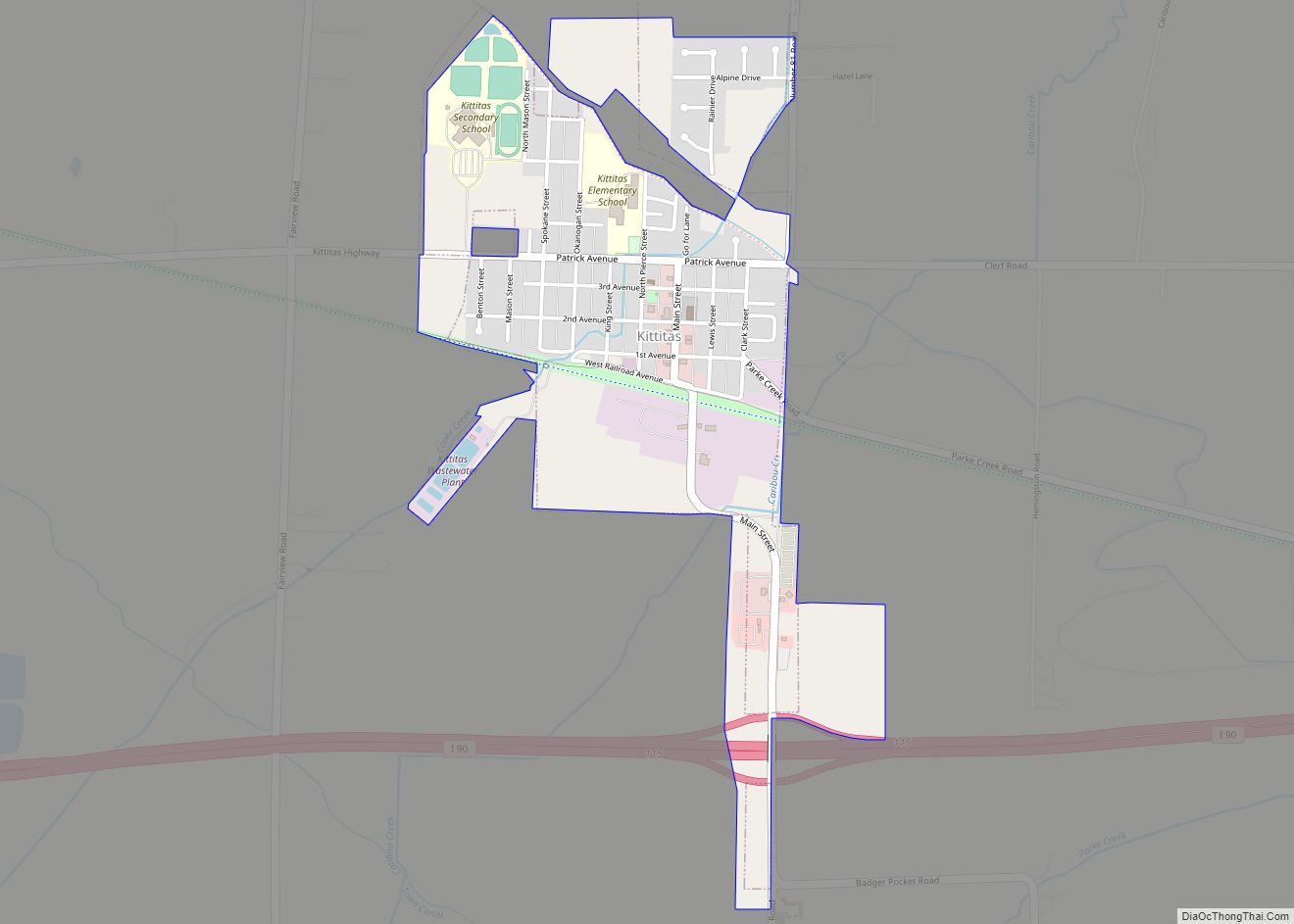
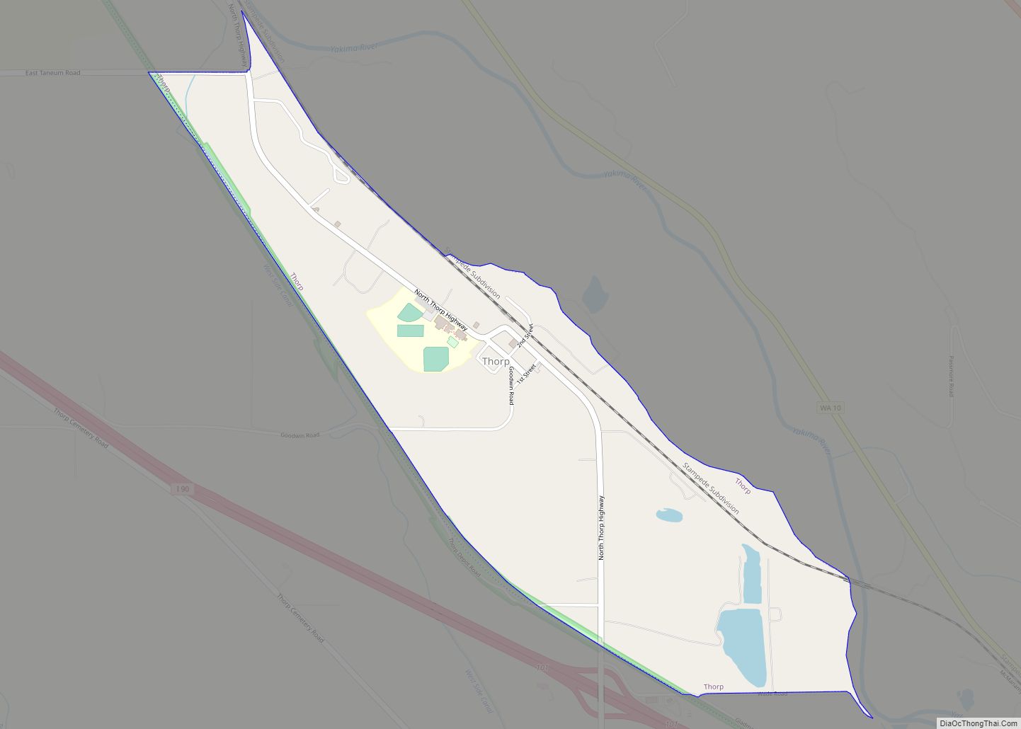
Online Interactive Map
Click on ![]() to view map in "full screen" mode.
to view map in "full screen" mode.
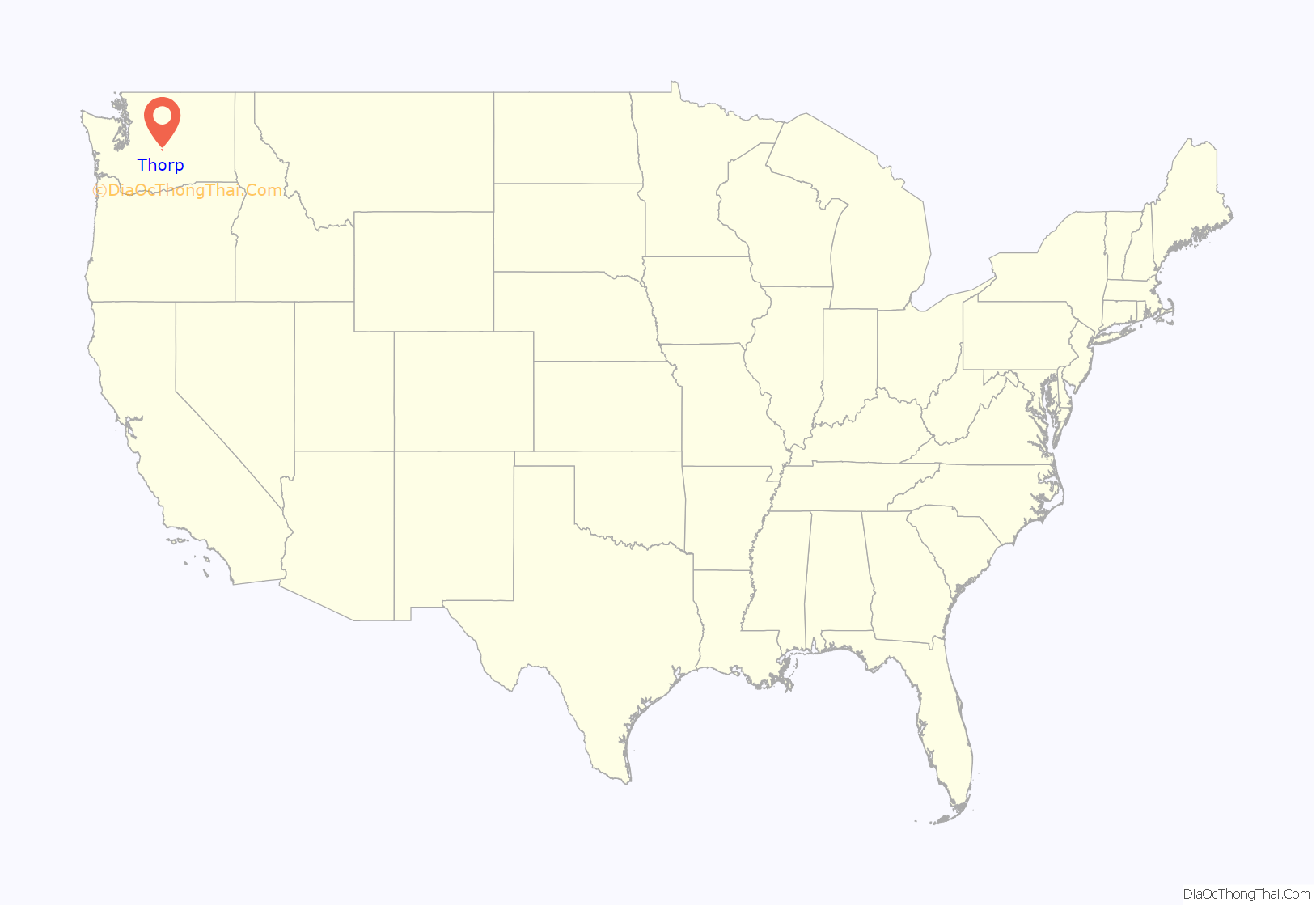
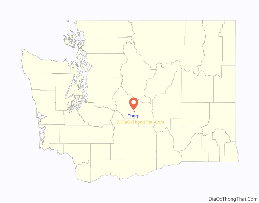
Thorp location map. Where is Thorp CDP?
Thorp Road Map
Thorp city Satellite Map
Geography
Thorp is located in central Kittitas County at 47°4′5″N 120°40′22″W / 47.06806°N 120.67278°W / 47.06806; -120.67278 (47.068006, -120.672687). According to the United States Census Bureau, the CDP has a total area of 1.2 square miles (3.2 km), all of it land.
The town site of Thorp is above the flood plain of the upper Yakima River at an elevation of 1,637 feet (499 m). It is situated near the river’s west bank directly opposite the Hayward Hill slide area and Clark Flats, near the southeastern approach to the Yakima River canyon at the foot of Thorp Prairie. To the west of the town is Taneum Canyon, and to the northwest are Elk Heights, Morrison Canyon and the Sunlight Waters private residential subdivision. Ellensburg, the county seat, is southeast of Thorp.
Northwest of Thorp at the junction of SR 10 and Thorp Highway, the Yakima River emerges from a canyon parallel to a basalt flow, the uppermost layers of which have been dated to 10.5 million years. The Thorp Prairie sits atop the basalt flows and ends at a deep canyon of Miocene columnar basalt structures carved by Swauk Creek whose headwaters are at Blewett Pass along US 97 to the north. The Thorp Prairie deposits were also delivered by the Thorp Glacial episode.
Topography
North and northeast of the town of Thorp along the Yakima River channel is the gradual upward lift of the Thorp Drift, marked by an elevation change due to the incline onto the terminal moraine that marks the furthest advance of the Thorp Glacial stage. Here the Thorp Gravels, which are named for the town of Thorp and the Thorp Glacial episode, are exposed along the ancient river channel in what is known as the “Slide Area”. The gravels were formed at the terminus of the Thorp Glacial advance approximately 600,000 years ago.
The Thorp Gravels themselves are believed to be between 3 and 4 million years old. The whole structure is composed of individually layered belts of gravel and sand which are not well consolidated, continually weather, and are prone to continuing erosion and landslides averaging 30 degrees. The area is rich with wildlife, including bald eagles and osprey who hunt for prey along the river. It is also a crossing point for deer and elk who often can be seen at dawn and dusk heading to the river for water.
About 7 miles (11 km) west of Thorp, the first glimpses of the Columbia River Plateau are seen where the Yakima River has cut into the westernmost edge of the basalt plateau. The Columbia Plateau basalt formed when lava poured out of fissures in the ground across eastern Washington during the Miocene era, 17 to 20 million years ago, erupting intermittently for over 10 million years. Many layers of basalt successively flowed over one another, back when the area was still flat. Subsequent to the Miocene lava flows, the volcanoes of the Cascade Mountains actively erupted, depositing ash, cinders, pumice and mudflows that eventually inter-fingered with the alternating basalt layers throughout the region.
Interstate 90 drops through the Thorp Drift, which marks the oldest and furthest reaching known glacial moraine in the Kittitas Valley. Changes in the types of vegetation become more evident in this area. The changes are the result of a drop in elevation of about 1,400 feet from the summit of Snoqualmie Pass to Thorp, and a significant drop in precipitation of about 107 inches average a year at the summit of Snoqualmie Pass, to 42.94 inches average a year at Thorp.
At the bottom of the Thorp Drift moraine the view opens up into the Kittitas Valley which is deeply buried in river gravel deposited by the ancient Yakima River. This valley is a syncline that creates the Ellensburg Basin located between Mission Ridge to the north and Manastash Ridge to the south. The Ellensburg Basin, more formally called the Ellensburg Formation, holds nearly 4,000 feet of rock, sand, and gravel that accumulated over a period of 2 to 10 million years during the Miocene and lower Pliocene age.
Climate
The climate at Thorp is hot during summer when temperatures tend to be in the 80s, and very cold during winter when temperatures tend to be in the 20s.
The warmest month of the year at Thorp is July, with an average high of 77.2 °F and an average low of 51.8 °F. The coldest month of the year is January, with an average low of 16.5 °F and an average high of 34.3 °F. Temperature variations between night and day tend to be relatively large during summer with a difference that can reach 30 °F, and fairly limited during winter with temperatures hovering at or below freezing for most of the day, and often dipping below zero at night.
Temperatures generally drop significantly in October, while rainfall rises from less than half an inch to nearly 5 inches average per month. This trend continues through late autumn and winter, with a marked drop in precipitation beginning in April which coincides with a gradual rise in temperature into late spring and summer.
There is significant variation in rainfall throughout the year, with December and January receiving a mix of rainfall and snow, averaging 9.06 and 7.94 inches respectively. Rainfall during summer is, on average, less than half an inch each month with July receiving the lowest monthly average precipitation of the year at .07 inches.
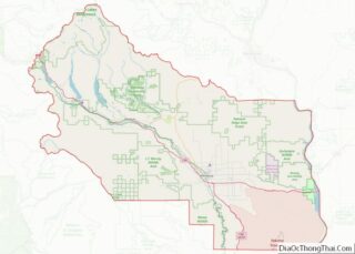
Surrounding area
See also
Map of Washington State and its subdivision:- Adams
- Asotin
- Benton
- Chelan
- Clallam
- Clark
- Columbia
- Cowlitz
- Douglas
- Ferry
- Franklin
- Garfield
- Grant
- Grays Harbor
- Island
- Jefferson
- King
- Kitsap
- Kittitas
- Klickitat
- Lewis
- Lincoln
- Mason
- Okanogan
- Pacific
- Pend Oreille
- Pierce
- San Juan
- Skagit
- Skamania
- Snohomish
- Spokane
- Stevens
- Thurston
- Wahkiakum
- Walla Walla
- Whatcom
- Whitman
- Yakima
- Alabama
- Alaska
- Arizona
- Arkansas
- California
- Colorado
- Connecticut
- Delaware
- District of Columbia
- Florida
- Georgia
- Hawaii
- Idaho
- Illinois
- Indiana
- Iowa
- Kansas
- Kentucky
- Louisiana
- Maine
- Maryland
- Massachusetts
- Michigan
- Minnesota
- Mississippi
- Missouri
- Montana
- Nebraska
- Nevada
- New Hampshire
- New Jersey
- New Mexico
- New York
- North Carolina
- North Dakota
- Ohio
- Oklahoma
- Oregon
- Pennsylvania
- Rhode Island
- South Carolina
- South Dakota
- Tennessee
- Texas
- Utah
- Vermont
- Virginia
- Washington
- West Virginia
- Wisconsin
- Wyoming