Tonasket /təˈnæskət/ is a city in Okanogan County, Washington, United States. The population was 1,032 at the 2010 census.
| Name: | Tonasket city |
|---|---|
| LSAD Code: | 25 |
| LSAD Description: | city (suffix) |
| State: | Washington |
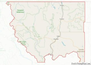
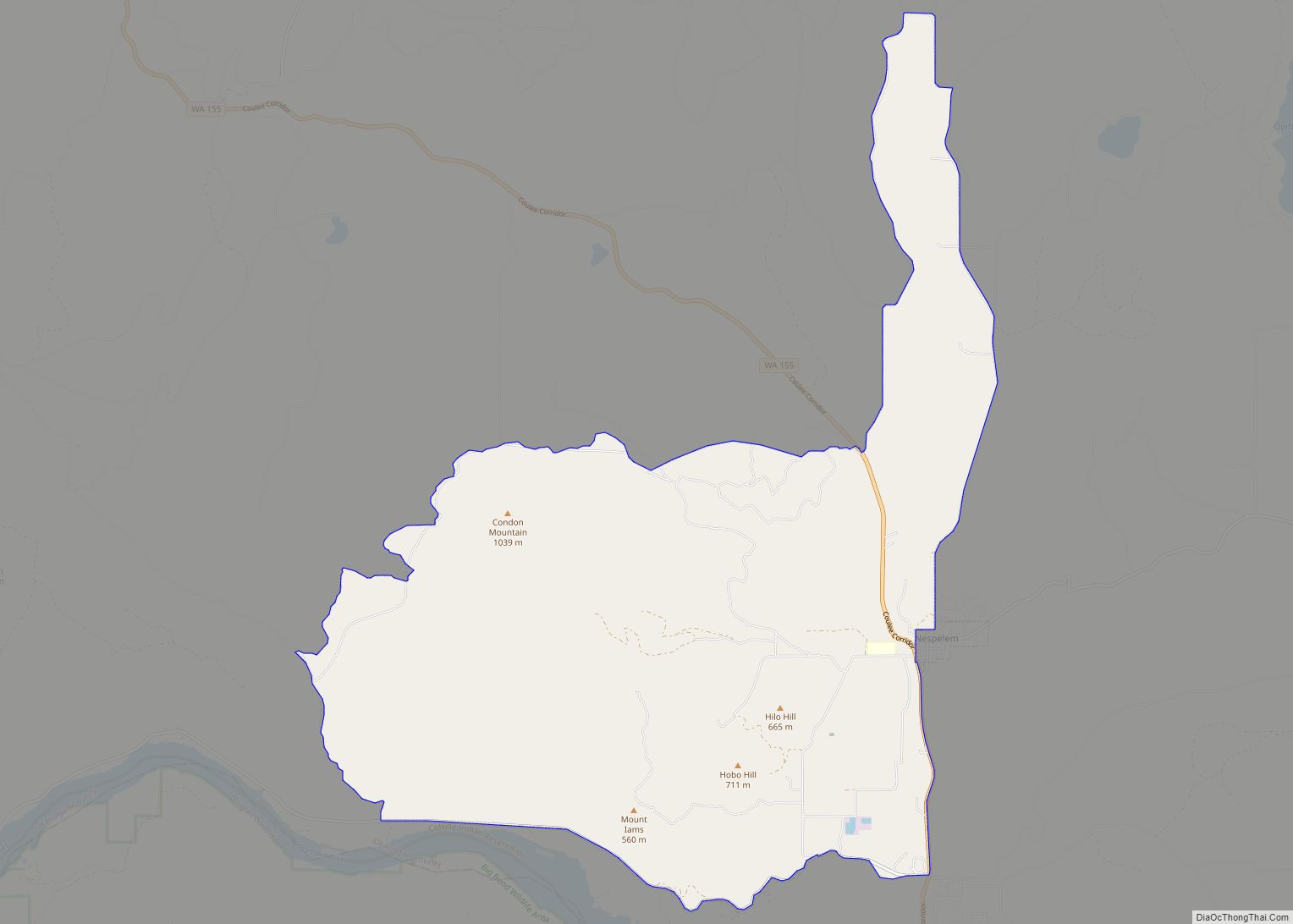
| County: | Okanogan County |
| Elevation: | 919 ft (280 m) |
| Total Area: | 0.96 sq mi (2.49 km²) |
| Land Area: | 0.94 sq mi (2.44 km²) |
| Water Area: | 0.02 sq mi (0.05 km²) |
| Total Population: | 1,032 |
| Population Density: | 1,187.50/sq mi (458.52/km²) |
| ZIP code: | 98855 |
| Area code: | 509 |
| FIPS code: | 5371890 |
| GNISfeature ID: | 1527301 |
Online Interactive Map
Click on ![]() to view map in "full screen" mode.
to view map in "full screen" mode.
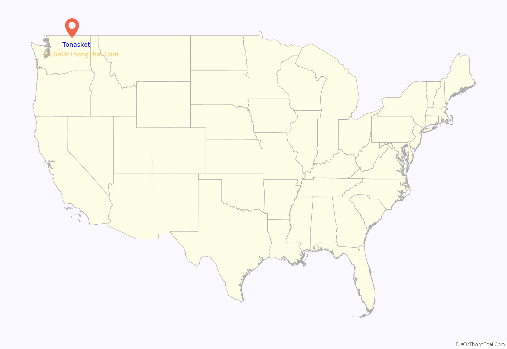
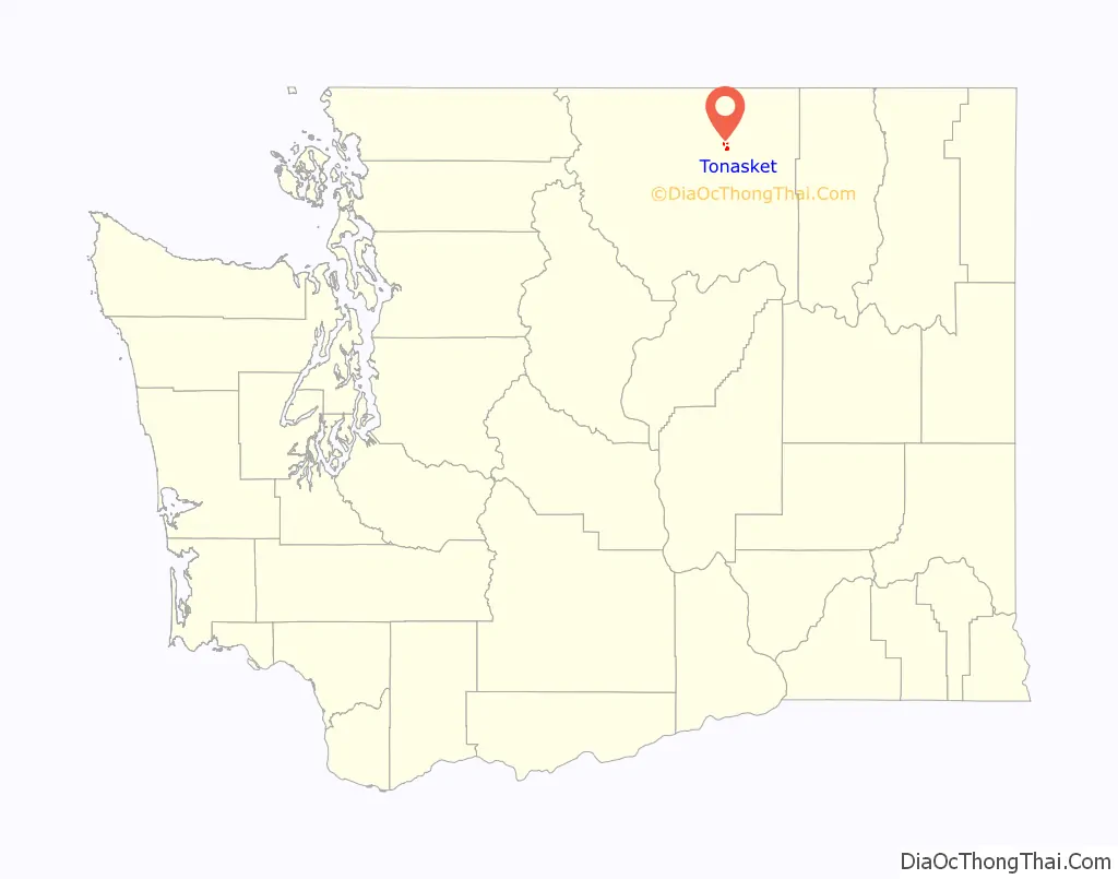
Tonasket location map. Where is Tonasket city?
History
Tonasket was officially incorporated on December 16, 1927. It is named after Chief Tonasket of the Okanogan people, a local leader from this area who assumed the status of grand chief of the American Okanogan after the drawing of the Canada–United States border by the Oregon Treaty of 1846, assuming a leadership role in Okanogan territory formerly held by Chief Nicola who lived north of the border.
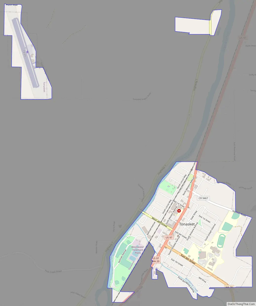
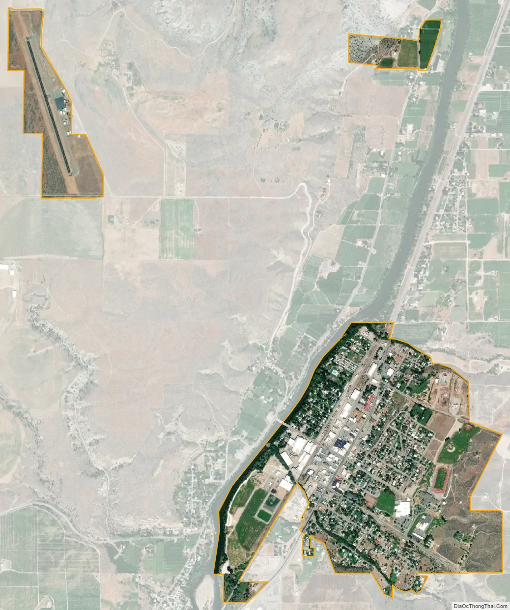
Tonasket is a city located along the eastern bank of the Okanogan River in north-central Okanogan County, Washington. U.S. Highway 97, the main north–south highway through central Washington, bisects the city on its way north to the Canada–US border approximately twenty miles away. Washington State Route 20 turns east of 97 at 6th St, and continues running across the state. The city is bordered on the north by Siwash Creek, on the south by Bonaparte Creek, and on the west by the Okanogan River.
Tonasket, which has been the site of a U.S. post office since 1901, was platted in 1910 and incorporated in 1927. It serves as a hub for agricultural and forestry industries in north central Okanogan County. It is the location of three major fruit storage and processing facilities and the offices of the Tonasket Ranger District of the Colville National Forest.
Many descendants of pioneer families still reside in Tonasket and the surrounding areas and are interested in preserving and sharing the history of their heritage. A son of one of those pioneer families, Walter H. Brattain, grew up on a cattle ranch near Tonasket, attended Tonasket schools and shared the 1956 Nobel Prize for Physics (with William Shockley and John Bardeen) for the invention of the transistor.
Tonasket Road Map
Tonasket city Satellite Map
Geography
Tonasket is located along the Okanogan River at an altitude of 1,311 ft (400 m).
According to the United States Census Bureau, the city has a total area of 0.80 square miles (2.07 km), all of it land.
Tonasket Municipal Airport (W01) opened to the public in July 1990 with one paved runway of 3,053 ft (931 m) in length, situated 2 miles (3 km) northwest of town on 100 acres (40 ha) of land.
See also
Map of Washington State and its subdivision:- Adams
- Asotin
- Benton
- Chelan
- Clallam
- Clark
- Columbia
- Cowlitz
- Douglas
- Ferry
- Franklin
- Garfield
- Grant
- Grays Harbor
- Island
- Jefferson
- King
- Kitsap
- Kittitas
- Klickitat
- Lewis
- Lincoln
- Mason
- Okanogan
- Pacific
- Pend Oreille
- Pierce
- San Juan
- Skagit
- Skamania
- Snohomish
- Spokane
- Stevens
- Thurston
- Wahkiakum
- Walla Walla
- Whatcom
- Whitman
- Yakima
- Alabama
- Alaska
- Arizona
- Arkansas
- California
- Colorado
- Connecticut
- Delaware
- District of Columbia
- Florida
- Georgia
- Hawaii
- Idaho
- Illinois
- Indiana
- Iowa
- Kansas
- Kentucky
- Louisiana
- Maine
- Maryland
- Massachusetts
- Michigan
- Minnesota
- Mississippi
- Missouri
- Montana
- Nebraska
- Nevada
- New Hampshire
- New Jersey
- New Mexico
- New York
- North Carolina
- North Dakota
- Ohio
- Oklahoma
- Oregon
- Pennsylvania
- Rhode Island
- South Carolina
- South Dakota
- Tennessee
- Texas
- Utah
- Vermont
- Virginia
- Washington
- West Virginia
- Wisconsin
- Wyoming