Anderson is a city in the Denali Borough, Alaska, United States, and the borough’s only incorporated community. At the 2010 census the population was 246, down from 367 at the 2000 census. At the 2020 census, the population dropped to 177 residents. The city is named after one of the original homesteaders.
| Name: | Anderson city |
|---|---|
| LSAD Code: | 25 |
| LSAD Description: | city (suffix) |
| State: | Alaska |
| County: | Denali Borough |
| Incorporated: | June 2, 1962 |
| Elevation: | 515 ft (157 m) |
| Total Area: | 44.99 sq mi (116.51 km²) |
| Land Area: | 42.20 sq mi (109.30 km²) |
| Water Area: | 2.79 sq mi (7.22 km²) |
| Total Population: | 177 |
| Population Density: | 4.19/sq mi (1.62/km²) |
| ZIP code: | 99744 |
| Area code: | 907 |
| FIPS code: | 0203220 |
| GNISfeature ID: | 1398245 |
| Website: | www.anderson.govoffice.com |
Online Interactive Map
Click on ![]() to view map in "full screen" mode.
to view map in "full screen" mode.
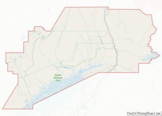
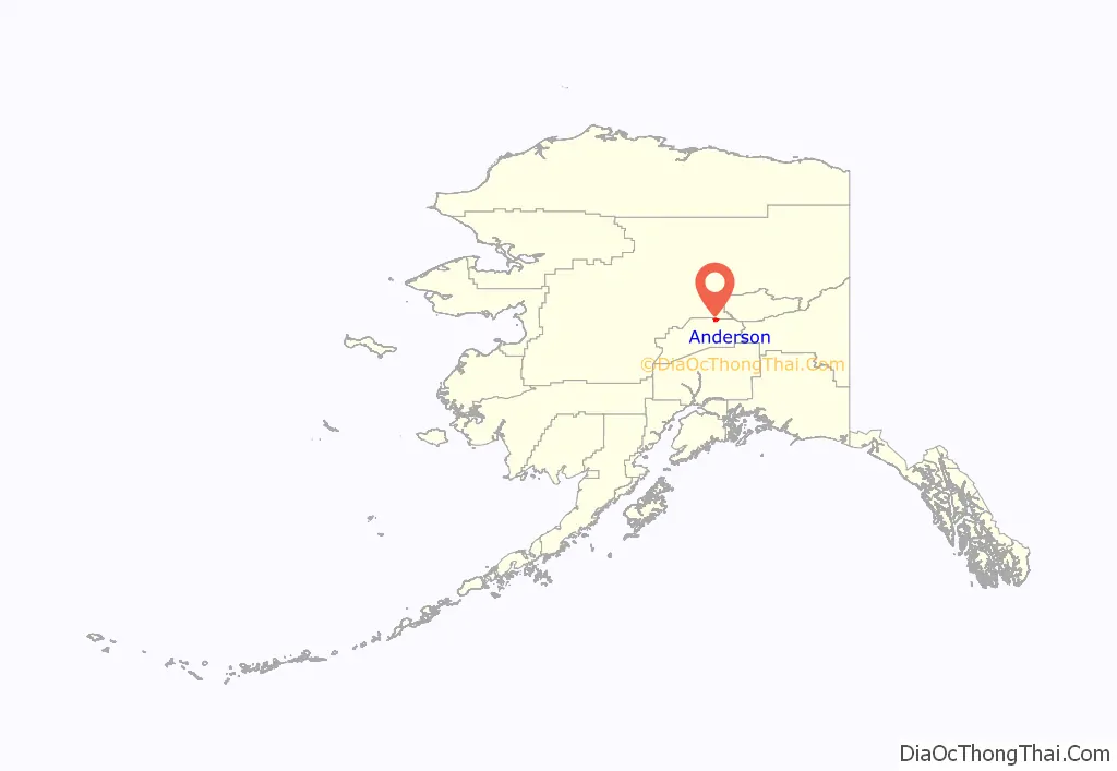
Anderson location map. Where is Anderson city?
History
Early years
Anderson is named after Arthur Anderson, one of several homesteaders who settled in the area in the late 1950s. In 1959, Anderson subdivided his homestead into house lots and sold most of the lots to civilian workers from Clear Air Force Station, a Ballistic Missile Early Warning System station completed in 1961. An elementary school was built in the community in 1961, and Anderson incorporated as a city on June 2, 1962.
In the 1960s, a road was completed between Anderson and Nenana. A ferry across the Tanana River at Nenana provided access to the Fairbanks–Nenana Highway, and hence to Fairbanks and the contiguous North American highway system via the Richardson and Alaska Highways. The ferry was replaced with a bridge in 1968. In 1972, the George Parks Highway was completed, which provided direct road access to points south, including Anchorage.
21st century
In March 2007, the city announced a plan to attract more residents: the awarding of free land to interested applicants. This concept has been compared to that of the Homestead Act.
The Anderson/Clear Lions Club, in conjunction with commercial sponsors and Two Rivers-based concert promoters Acoustic Adventures, hosted the annual Anderson Bluegrass Festival. Held on the last weekend of every July from Friday through Sunday at Riverside Park, the festival was the city’s significant visitor attraction. The festival was discontinued in 2012. It was replaced with a similar, privately run family music festival held in the same location starting in 2015.
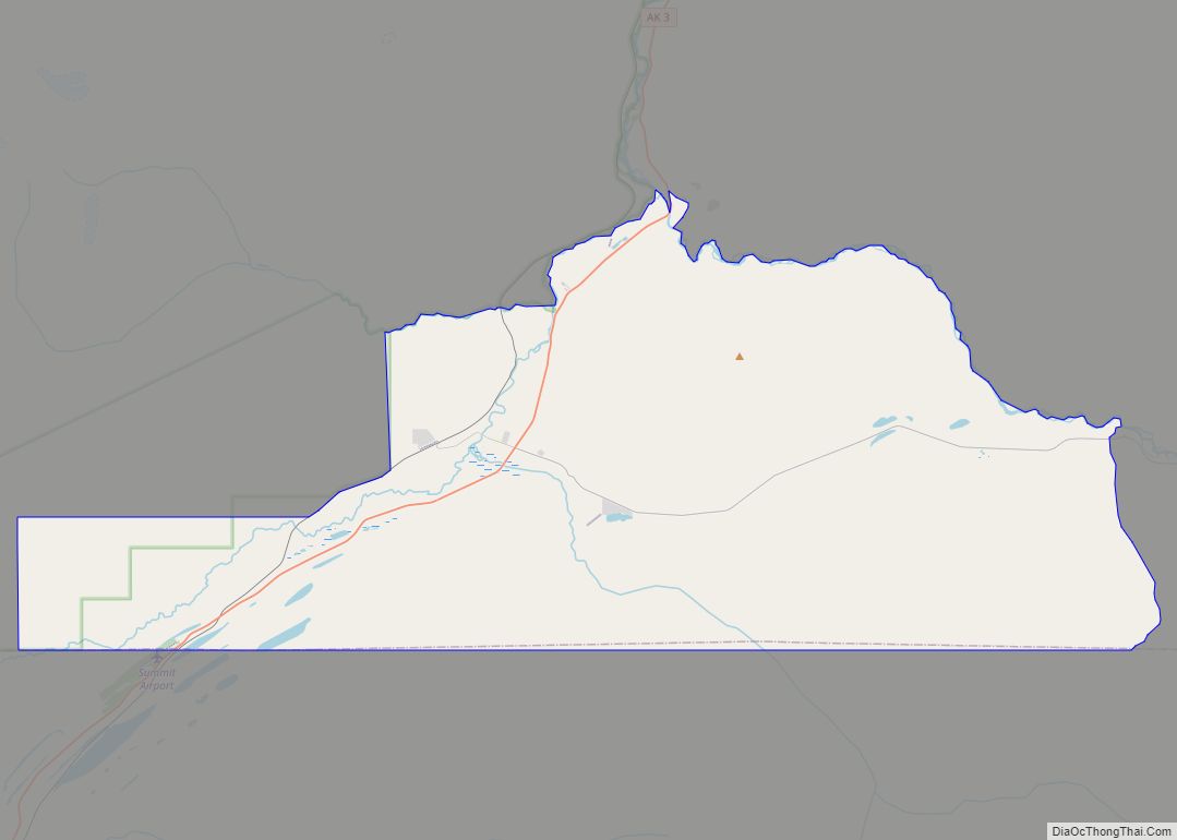
Anderson Road Map
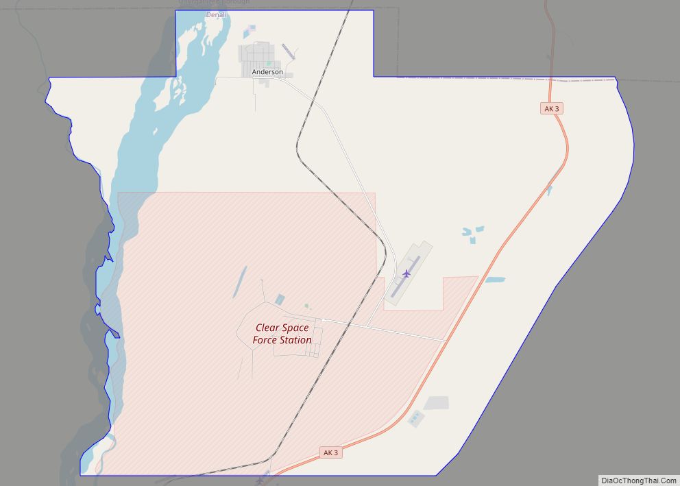
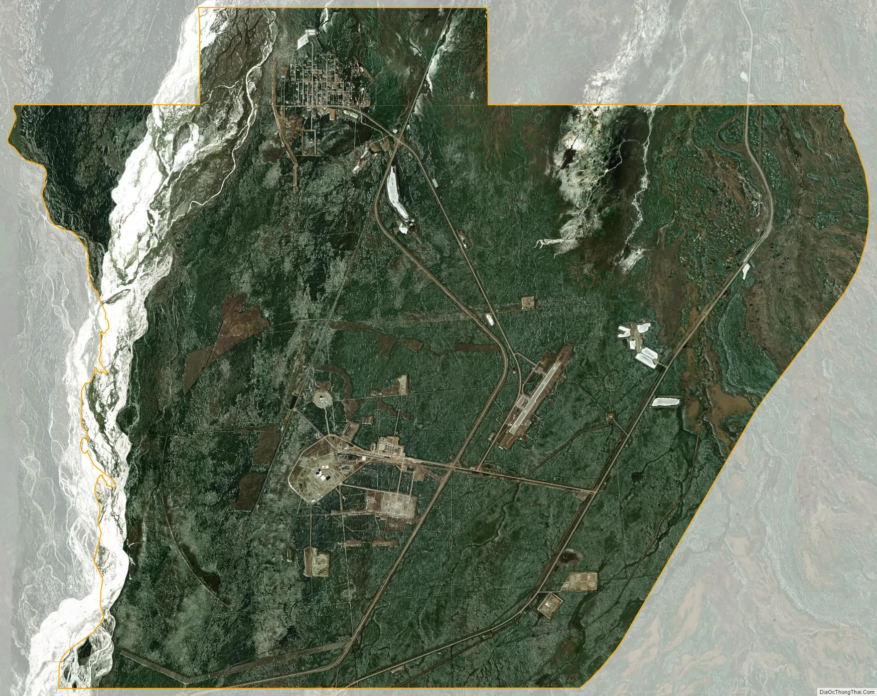
Anderson city Satellite Map
Geography
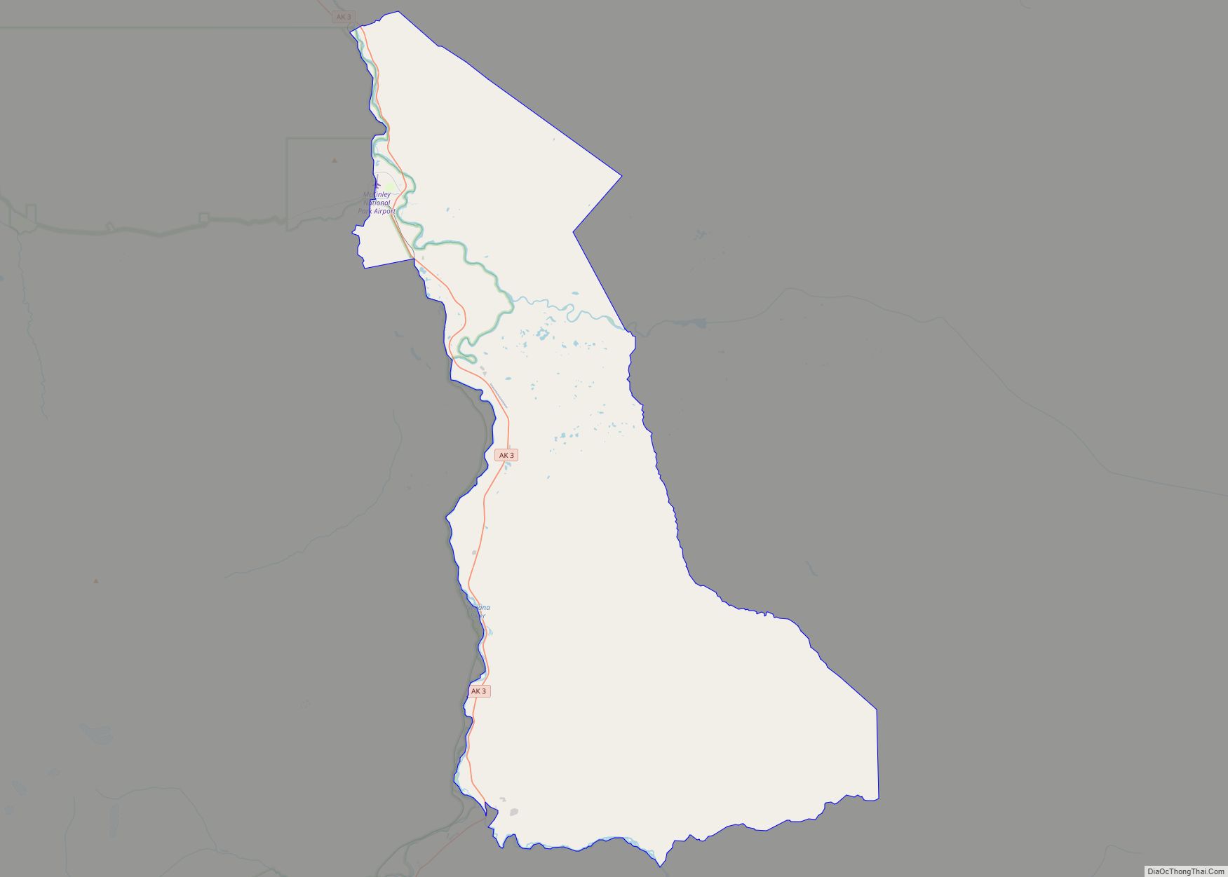
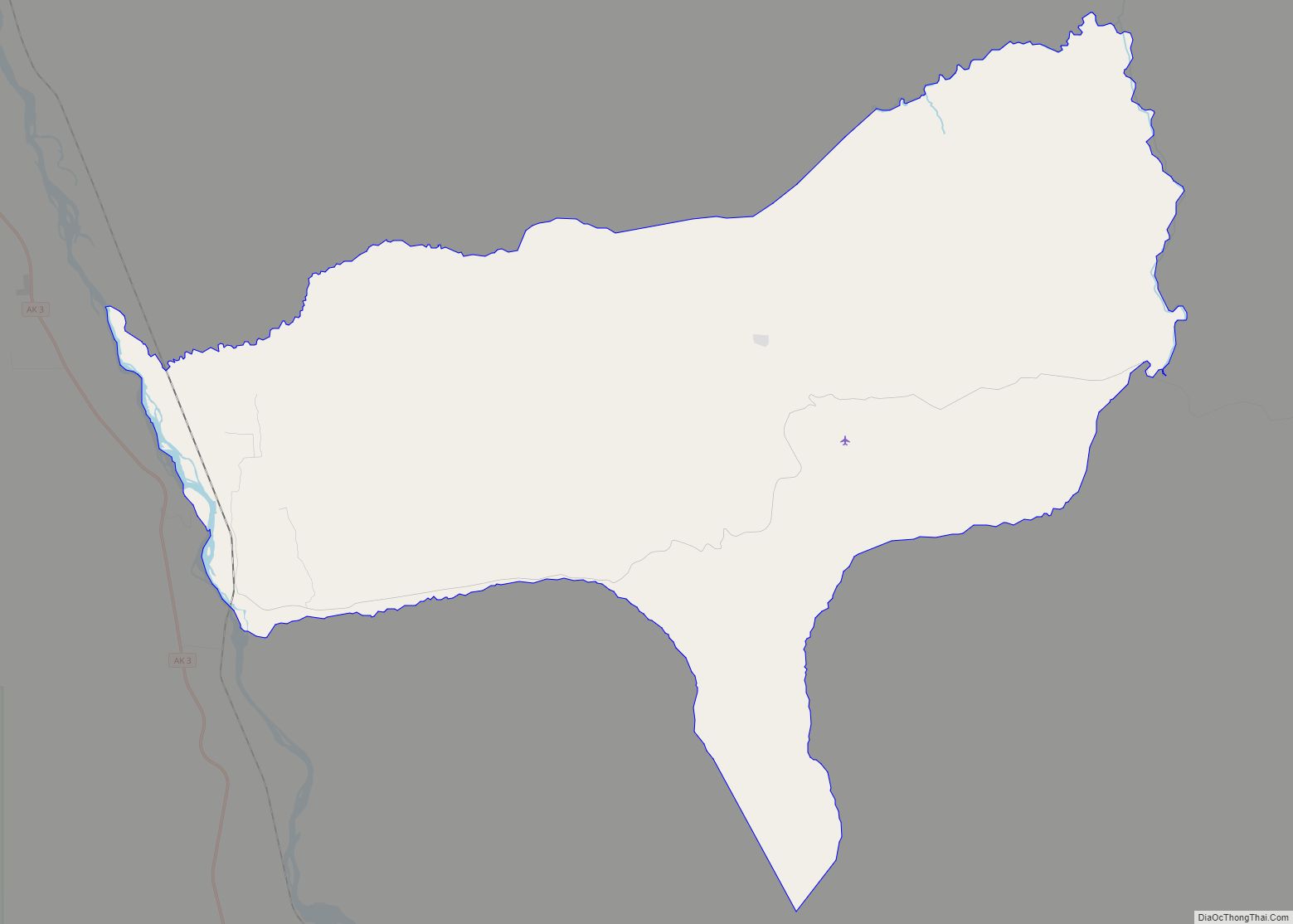
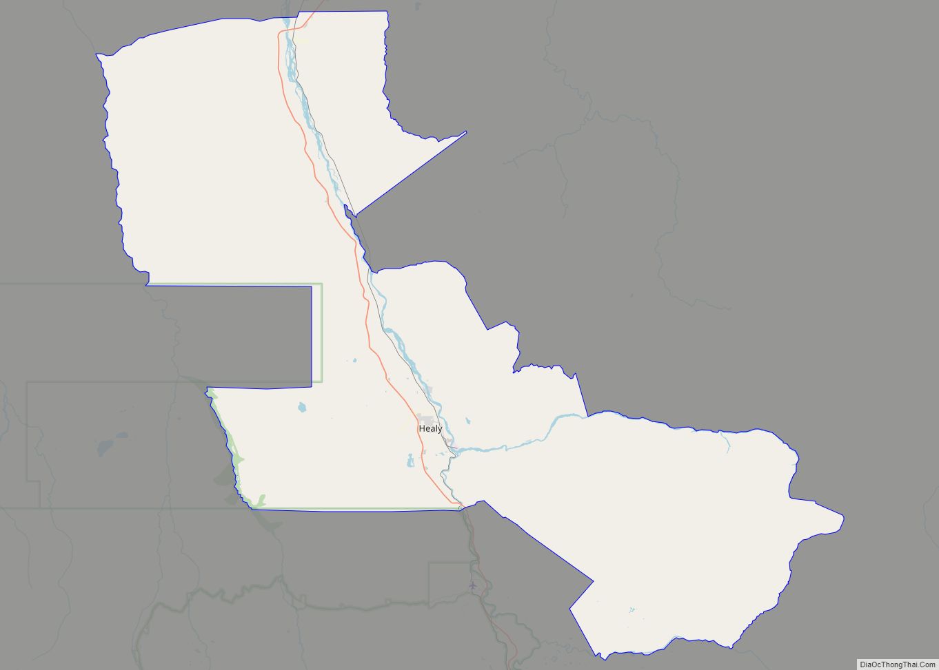
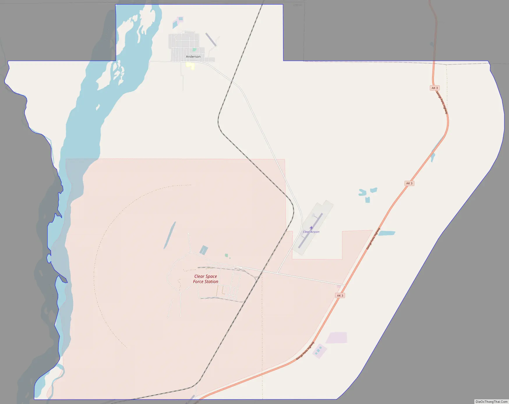
Anderson is located at 64°20′43″N 149°11′43″W / 64.34528°N 149.19528°W / 64.34528; -149.19528 (64.345372, -149.195352), abutting the northern border of the Denali Borough. Anderson is north of Healy, south of Nenana and 75 miles (121 km) southwest of Fairbanks. The Anderson townsite lies in between the Alaska Railroad mainline and the Nenana River, along the northern edge of city limits. The George Parks Highway (5.5 miles (8.9 km) east of the townsite) and Clear Air Force Station (5.5 miles (8.9 km) south of the townsite) are also within city limits. Clear Air Force Station is home to the 213th Space Warning Squadron. Anderson lies 289 miles (465 km) north of Anchorage, the most populous city of Alaska, and 81 miles (130 km) southwest of Fairbanks.
According to the United States Census Bureau, the city has a total area of 47.3 square miles (122.5 km), of which 43.7 square miles (113.3 km) is land and 3.6 square miles (9.2 km), or 7.49%, is water.
Anderson attracts mostly curious visitors, owing to its “out of the way” location at the end of a side road, plus those stopping to camp or access the Nenana River at Riverside Park.
See also
Map of Alaska State and its subdivision:- Aleutians East
- Aleutians West
- Anchorage
- Bethel
- Bristol Bay
- Denali
- Dillingham
- Fairbanks North Star
- Haines
- Juneau
- Kenai Peninsula
- Ketchikan Gateway
- Kodiak Island
- Lake and Peninsula
- Matanuska-Susitna
- Nome
- North Slope
- Northwest Arctic
- Prince of Wales-Outer Ketchi
- Sitka
- Skagway-Yakutat-Angoon
- Southeast Fairbanks
- Valdez-Cordova
- Wade Hampton
- Wrangell-Petersburg
- Yukon-Koyukuk
- Alabama
- Alaska
- Arizona
- Arkansas
- California
- Colorado
- Connecticut
- Delaware
- District of Columbia
- Florida
- Georgia
- Hawaii
- Idaho
- Illinois
- Indiana
- Iowa
- Kansas
- Kentucky
- Louisiana
- Maine
- Maryland
- Massachusetts
- Michigan
- Minnesota
- Mississippi
- Missouri
- Montana
- Nebraska
- Nevada
- New Hampshire
- New Jersey
- New Mexico
- New York
- North Carolina
- North Dakota
- Ohio
- Oklahoma
- Oregon
- Pennsylvania
- Rhode Island
- South Carolina
- South Dakota
- Tennessee
- Texas
- Utah
- Vermont
- Virginia
- Washington
- West Virginia
- Wisconsin
- Wyoming