Diamond Ridge (Dena’ina: Ch’aqiniggech’) is a census-designated place (CDP) just outside Homer in Kenai Peninsula Borough, Alaska, United States. At the 2010 census the population was 1,156, down from 1,802 in 2000.
| Name: | Diamond Ridge CDP |
|---|---|
| LSAD Code: | 57 |
| LSAD Description: | CDP (suffix) |
| State: | Alaska |
| County: | Kenai Peninsula Borough |
| Elevation: | 1,060 ft (323 m) |
| Total Area: | 42.40 sq mi (109.81 km²) |
| Land Area: | 42.40 sq mi (109.81 km²) |
| Water Area: | 0.00 sq mi (0.00 km²) |
| Total Population: | 1,330 |
| Population Density: | 31.37/sq mi (12.11/km²) |
| Area code: | 907 |
| FIPS code: | 0218925 |
| GNISfeature ID: | 1865549 |
Online Interactive Map
Click on ![]() to view map in "full screen" mode.
to view map in "full screen" mode.
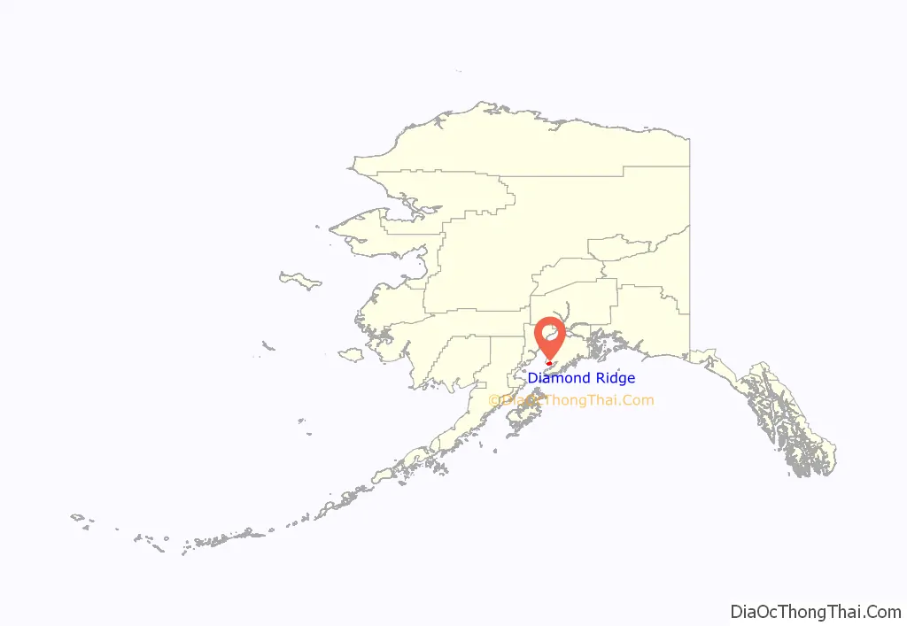
Diamond Ridge location map. Where is Diamond Ridge CDP?
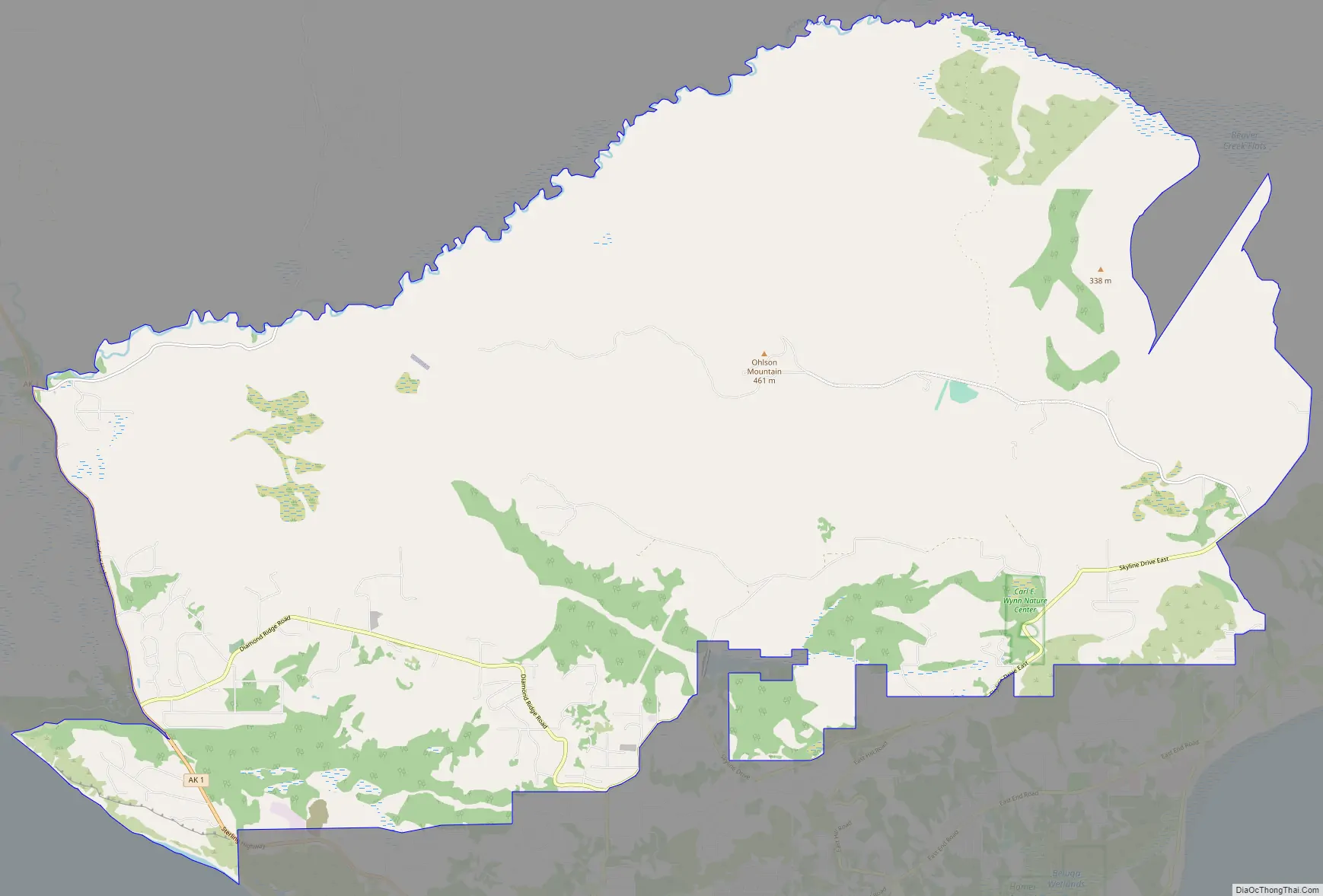
Diamond Ridge Road Map
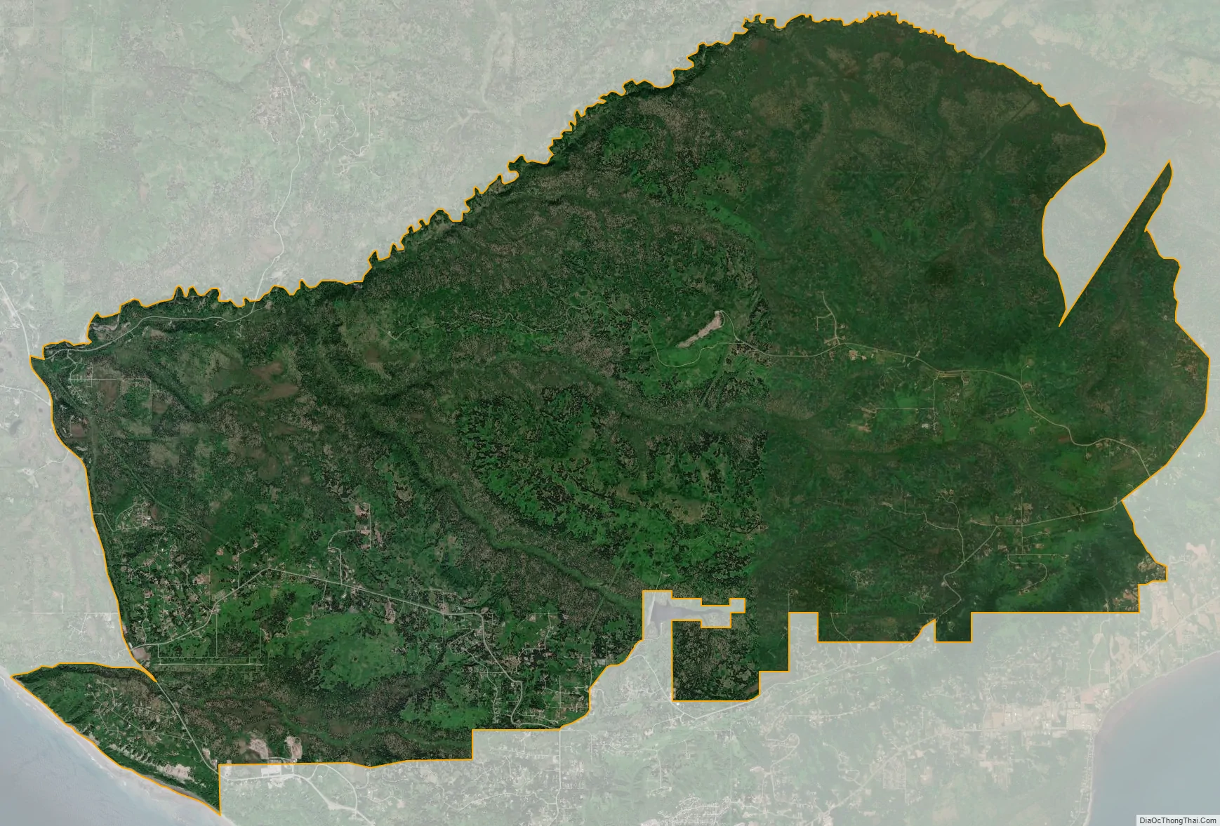
Diamond Ridge city Satellite Map
Geography
Diamond Ridge is located at 59°39′55″N 151°34′15″W / 59.66528°N 151.57083°W / 59.66528; -151.57083 (59.665391, -151.570826) and is bordered to the south by the city of Homer and to the southeast by the city of Kachemak. To the east is the Fritz Creek CDP, while to the north and west is the Anchor Point CDP. The farthest west part of the Diamond Ridge CDP borders Cook Inlet at the mouth of Kachemak Bay.
The community is named for the high ground, Diamond Ridge, on which it sits. The ridge reaches an elevation of 1,202 feet (366 m) above sea level and is in the southern part of the CDP. Parallel landforms to the north are Crossman Ridge in the center of the CDP and a ridge connecting 1,513-foot (461 m) Ohlson Mountain and 1,622-foot (494 m) Lookout Mountain in the north. The terrain slopes north from the ridges to the Anchor River, which forms the northern boundary of the CDP.
According to the United States Census Bureau, the Diamond Ridge CDP has a total area of 42.4 square miles (109.8 km), of which 0.004 square miles (0.01 km), or 0.01%, are water. The main access is via Diamond Ridge Road, which runs across the top of the 5-mile-long (8.0 km) ridge and connects to feeder roads on either side.
See also
Map of Alaska State and its subdivision:- Aleutians East
- Aleutians West
- Anchorage
- Bethel
- Bristol Bay
- Denali
- Dillingham
- Fairbanks North Star
- Haines
- Juneau
- Kenai Peninsula
- Ketchikan Gateway
- Kodiak Island
- Lake and Peninsula
- Matanuska-Susitna
- Nome
- North Slope
- Northwest Arctic
- Prince of Wales-Outer Ketchi
- Sitka
- Skagway-Yakutat-Angoon
- Southeast Fairbanks
- Valdez-Cordova
- Wade Hampton
- Wrangell-Petersburg
- Yukon-Koyukuk
- Alabama
- Alaska
- Arizona
- Arkansas
- California
- Colorado
- Connecticut
- Delaware
- District of Columbia
- Florida
- Georgia
- Hawaii
- Idaho
- Illinois
- Indiana
- Iowa
- Kansas
- Kentucky
- Louisiana
- Maine
- Maryland
- Massachusetts
- Michigan
- Minnesota
- Mississippi
- Missouri
- Montana
- Nebraska
- Nevada
- New Hampshire
- New Jersey
- New Mexico
- New York
- North Carolina
- North Dakota
- Ohio
- Oklahoma
- Oregon
- Pennsylvania
- Rhode Island
- South Carolina
- South Dakota
- Tennessee
- Texas
- Utah
- Vermont
- Virginia
- Washington
- West Virginia
- Wisconsin
- Wyoming


