Fritz Creek is a census-designated place (CDP) in the Kenai Peninsula Borough, Alaska, United States, northeast of Homer. At the 2020 census the population was 2,248, up from 1,932 in 2010.
| Name: | Fritz Creek CDP |
|---|---|
| LSAD Code: | 57 |
| LSAD Description: | CDP (suffix) |
| State: | Alaska |
| County: | Kenai Peninsula Borough |
| Elevation: | 1,198 ft (365 m) |
| Total Area: | 53.95 sq mi (139.74 km²) |
| Land Area: | 53.95 sq mi (139.74 km²) |
| Water Area: | 0.00 sq mi (0.00 km²) |
| Total Population: | 2,248 |
| Population Density: | 41.66/sq mi (16.09/km²) |
| ZIP code: | 99603 |
| Area code: | 907 |
| FIPS code: | 0227090 |
| GNISfeature ID: | 1866947 |
Online Interactive Map
Click on ![]() to view map in "full screen" mode.
to view map in "full screen" mode.
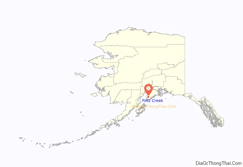
Fritz Creek location map. Where is Fritz Creek CDP?
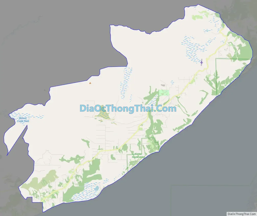
Fritz Creek Road Map
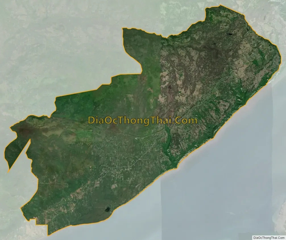
Fritz Creek city Satellite Map
Geography
Fritz Creek is located at 59°43′54″N 151°15′02″W / 59.731632°N 151.250527°W / 59.731632; -151.250527, covering an area 6 to 20 miles (10 to 32 km) northeast of Homer. It sits on the north side of Kachemak Bay and is bordered to the southwest by the city of Kachemak, to the west by the Diamond Ridge CDP, and to the northeast by the Fox River CDP.
According to the United States Census Bureau, the CDP has a total area of 54.0 square miles (139.9 km), all of it recorded as land.
Climbing from sea level to over 1,500 feet (460 m), the community offers fantastic views of the Kenai Mountains and Kachemak Bay.
See also
Map of Alaska State and its subdivision:- Aleutians East
- Aleutians West
- Anchorage
- Bethel
- Bristol Bay
- Denali
- Dillingham
- Fairbanks North Star
- Haines
- Juneau
- Kenai Peninsula
- Ketchikan Gateway
- Kodiak Island
- Lake and Peninsula
- Matanuska-Susitna
- Nome
- North Slope
- Northwest Arctic
- Prince of Wales-Outer Ketchi
- Sitka
- Skagway-Yakutat-Angoon
- Southeast Fairbanks
- Valdez-Cordova
- Wade Hampton
- Wrangell-Petersburg
- Yukon-Koyukuk
- Alabama
- Alaska
- Arizona
- Arkansas
- California
- Colorado
- Connecticut
- Delaware
- District of Columbia
- Florida
- Georgia
- Hawaii
- Idaho
- Illinois
- Indiana
- Iowa
- Kansas
- Kentucky
- Louisiana
- Maine
- Maryland
- Massachusetts
- Michigan
- Minnesota
- Mississippi
- Missouri
- Montana
- Nebraska
- Nevada
- New Hampshire
- New Jersey
- New Mexico
- New York
- North Carolina
- North Dakota
- Ohio
- Oklahoma
- Oregon
- Pennsylvania
- Rhode Island
- South Carolina
- South Dakota
- Tennessee
- Texas
- Utah
- Vermont
- Virginia
- Washington
- West Virginia
- Wisconsin
- Wyoming


