Klawock (Tlingit: Lawáak) is a city in Prince of Wales–Hyder Census Area, in the U.S. state of Alaska, on the west coast of Prince of Wales Island, on Klawock Inlet, across from Klawock Island. The population was 755 at the 2010 census, down from 854 in 2000. It is located 90 kilometres (56 mi) from Ketchikan, 11 kilometres (6.8 mi) from Craig, and 39 kilometres (24 mi) from Hollis.
| Name: | Klawock city |
|---|---|
| LSAD Code: | 25 |
| LSAD Description: | city (suffix) |
| State: | Alaska |
| County: | Prince of Wales-Hyder Census Area |
| Founded: | 1868 |
| Incorporated: | October 29, 1929 |
| Elevation: | 79 ft (24 m) |
| Total Area: | 0.97 sq mi (2.52 km²) |
| Land Area: | 0.68 sq mi (1.76 km²) |
| Water Area: | 0.29 sq mi (0.75 km²) 34.83% |
| Total Population: | 720 |
| Population Density: | 1,057.27/sq mi (408.32/km²) |
| Area code: | 907 |
| FIPS code: | 0240400 |
| GNISfeature ID: | 1423100 |
| Website: | www.cityofklawock.com |
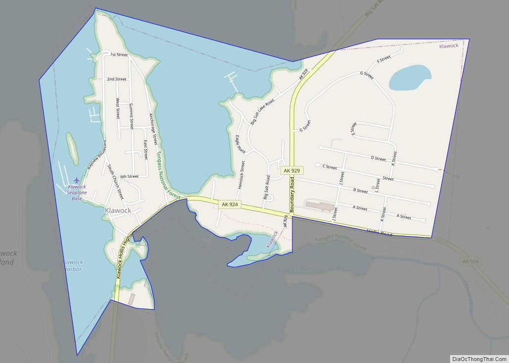
Online Interactive Map
Click on ![]() to view map in "full screen" mode.
to view map in "full screen" mode.
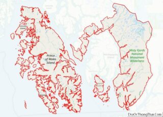
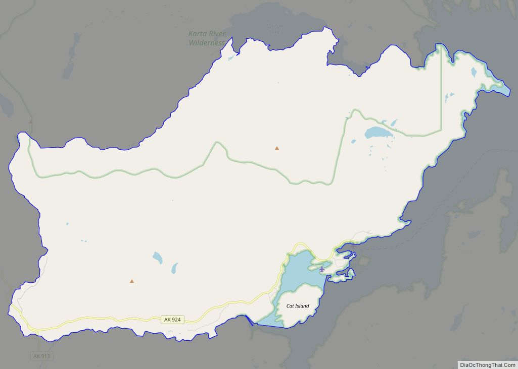
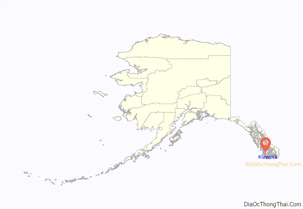
Klawock location map. Where is Klawock city?
History
Klawock’s first settlers were Tlingit who came from the northern winter village of Tuxekan. They used it as a fishing camp for the summer period, and called it by several different names: Klawerak, Tlevak, Clevak, and Klawak. The name “Klawock” is derived from the Tlingit name Lawá, the man who founded the community. In 1853 a Russian navigator referred to the village as “Klyakkhan”, and in 1855 as “Thlewakh”.
In 1868, European Americans opened a trading post and a salmon saltery; some years later, in 1878, a San Francisco firm opened the first cannery in Alaska. In the following decades, several others were established. A United States post office was established in 1882. The 1890 census recorded the town’s population as 260.
The Alaska Native Brotherhood (ANB) and Alaska Native Sisterhood (ANS), nonprofit organizations working for civil rights of Alaska Natives, were established by residents in 1912. Its founders and many volunteers built the Town Hall and a community center in 1939, during the Great Depression.
In 1929 the town was incorporated as a city, and in 1934 Congress awarded federal funding for the expansion of the cannery, on the condition that the community remains liquor-free. At the same time, the Klawock Cooperative Association (a nonprofit organization) was formed to manage the cannery.
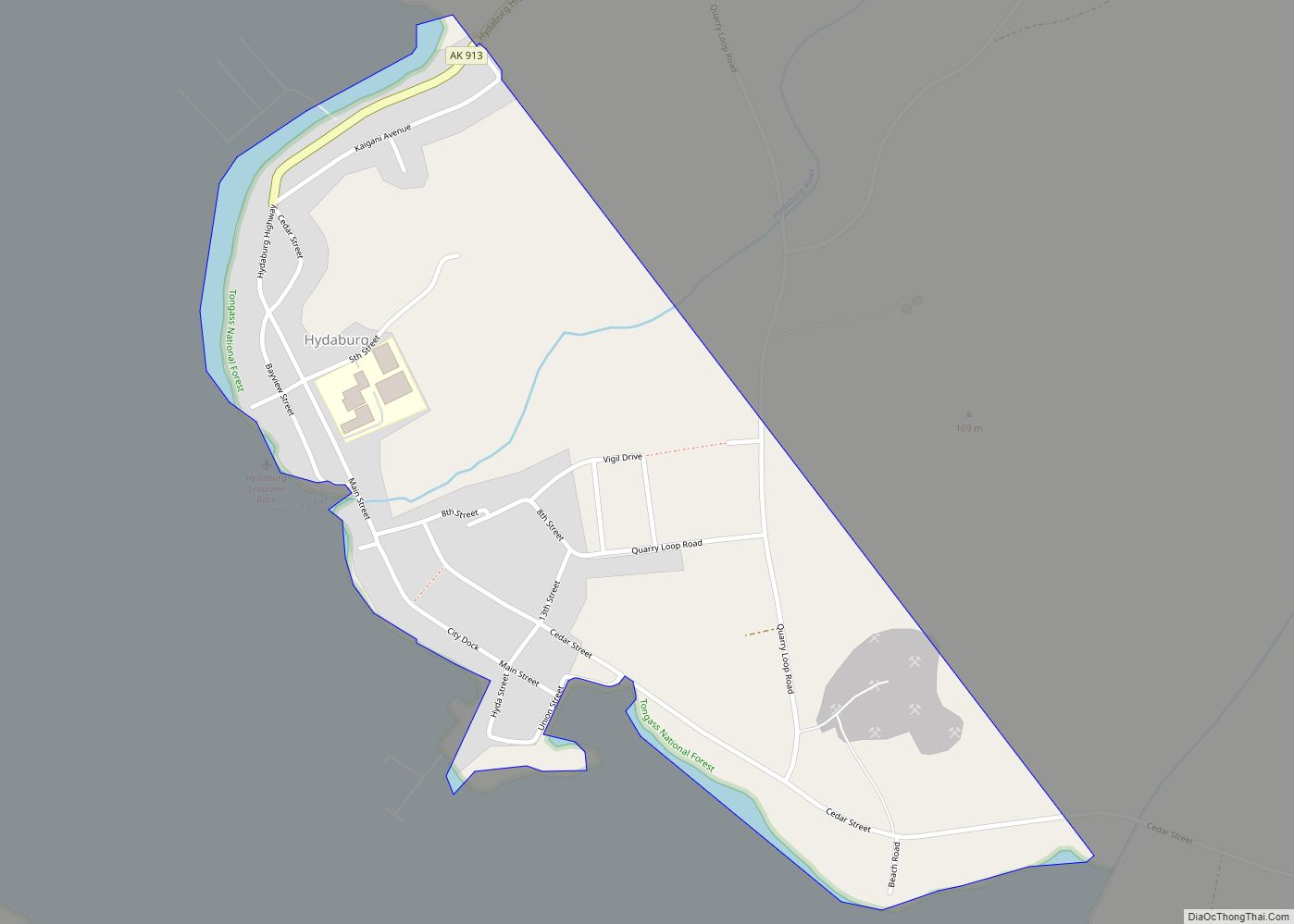
Klawock Road Map
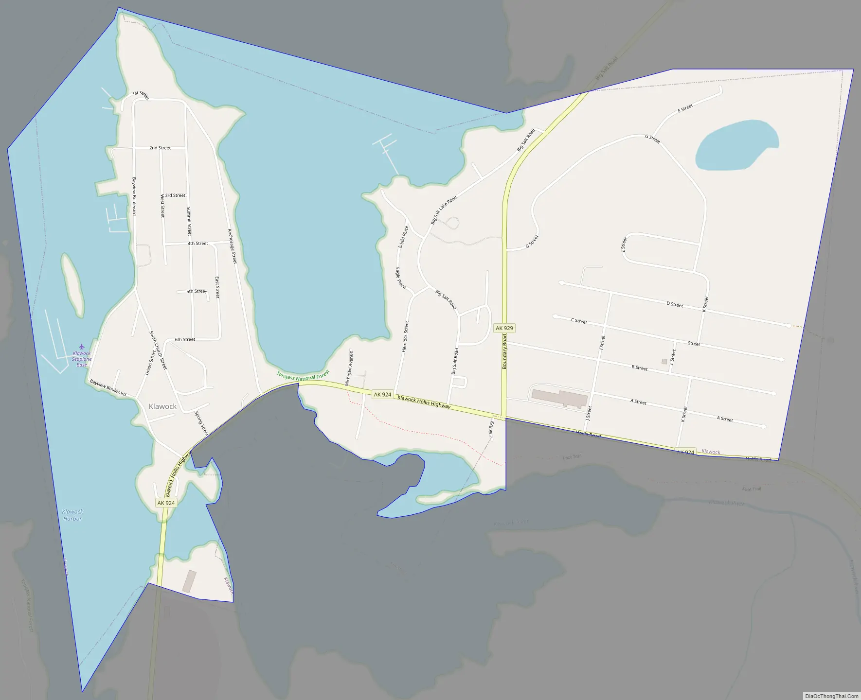
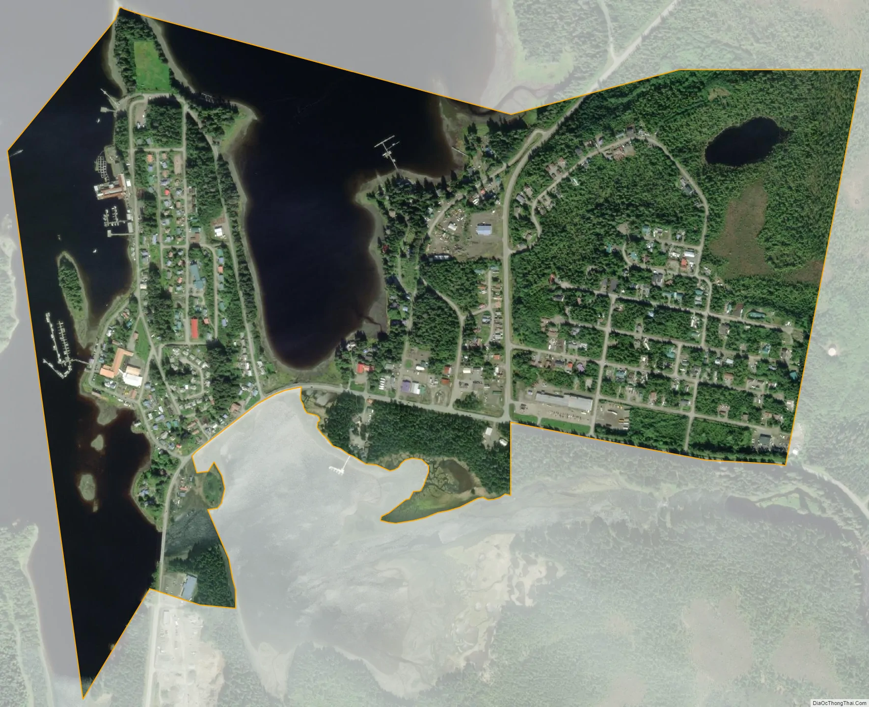
Klawock city Satellite Map
Geography
Klawock is located at 55°33′18″N 133°05′07″W / 55.55500°N 133.08528°W / 55.55500; -133.08528. According to the United States Census Bureau, the city has a total area of 0.9 square miles (2.3 km), of which, 0.6 square miles (1.6 km) of it is land and 0.3 square miles (0.78 km) of it (34.83%) is water.
Climate
Klawock has a warm summer oceanic climate.
See also
Map of Alaska State and its subdivision:- Aleutians East
- Aleutians West
- Anchorage
- Bethel
- Bristol Bay
- Denali
- Dillingham
- Fairbanks North Star
- Haines
- Juneau
- Kenai Peninsula
- Ketchikan Gateway
- Kodiak Island
- Lake and Peninsula
- Matanuska-Susitna
- Nome
- North Slope
- Northwest Arctic
- Prince of Wales-Outer Ketchi
- Sitka
- Skagway-Yakutat-Angoon
- Southeast Fairbanks
- Valdez-Cordova
- Wade Hampton
- Wrangell-Petersburg
- Yukon-Koyukuk
- Alabama
- Alaska
- Arizona
- Arkansas
- California
- Colorado
- Connecticut
- Delaware
- District of Columbia
- Florida
- Georgia
- Hawaii
- Idaho
- Illinois
- Indiana
- Iowa
- Kansas
- Kentucky
- Louisiana
- Maine
- Maryland
- Massachusetts
- Michigan
- Minnesota
- Mississippi
- Missouri
- Montana
- Nebraska
- Nevada
- New Hampshire
- New Jersey
- New Mexico
- New York
- North Carolina
- North Dakota
- Ohio
- Oklahoma
- Oregon
- Pennsylvania
- Rhode Island
- South Carolina
- South Dakota
- Tennessee
- Texas
- Utah
- Vermont
- Virginia
- Washington
- West Virginia
- Wisconsin
- Wyoming