Lowell Point is a census-designated place (CDP) in Kenai Peninsula Borough, Alaska, United States, just outside Seward. At the 2010 census the population was 80, down from 92 in 2000.
| Name: | Lowell Point CDP |
|---|---|
| LSAD Code: | 57 |
| LSAD Description: | CDP (suffix) |
| State: | Alaska |
| County: | Kenai Peninsula Borough |
| Elevation: | 36 ft (11 m) |
| Total Area: | 11.75 sq mi (30.43 km²) |
| Land Area: | 11.73 sq mi (30.37 km²) |
| Water Area: | 0.02 sq mi (0.06 km²) |
| Total Population: | 79 |
| Population Density: | 6.74/sq mi (2.60/km²) |
| Area code: | 907 |
| FIPS code: | 0245295 |
| GNISfeature ID: | 1865557 |
Online Interactive Map
Click on ![]() to view map in "full screen" mode.
to view map in "full screen" mode.
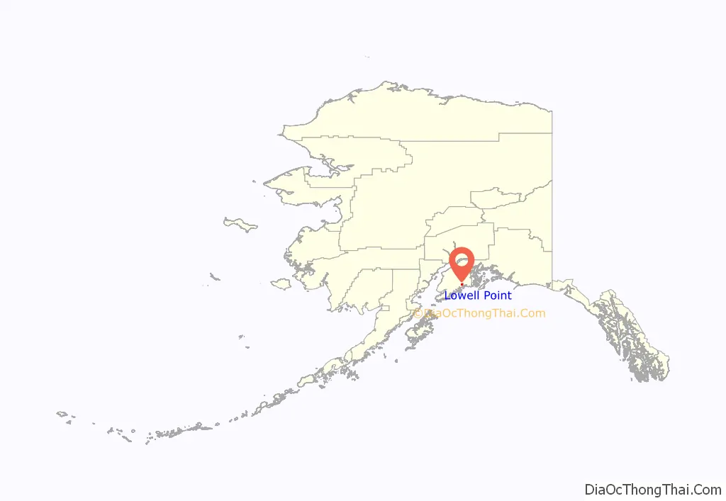
Lowell Point location map. Where is Lowell Point CDP?
Lowell Point Road Map

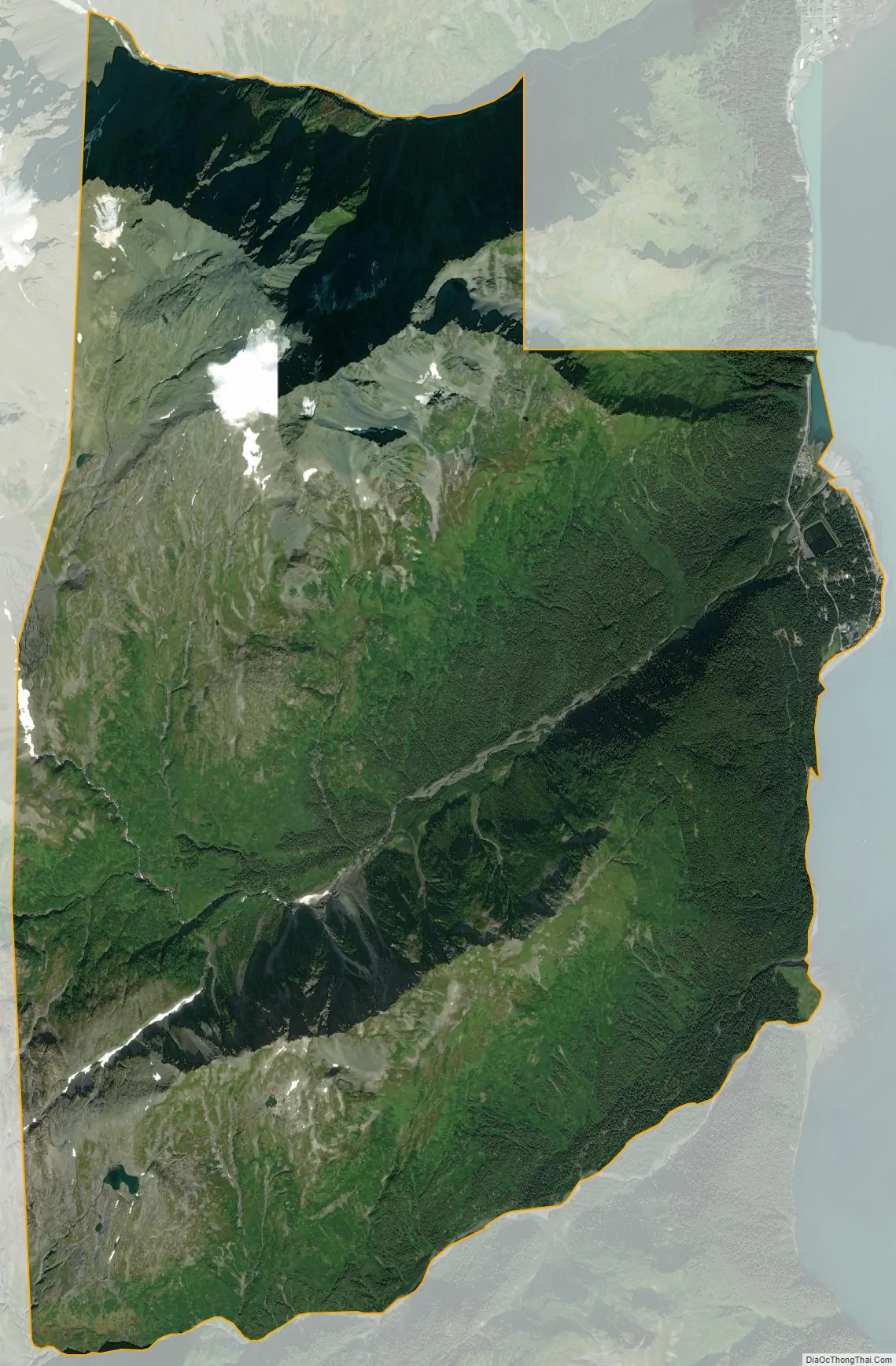
Lowell Point city Satellite Map
Geography
Lowell Point is located on the east side of the Kenai Peninsula at 60°4′18″N 149°26′37″W / 60.07167°N 149.44361°W / 60.07167; -149.44361 (60.071557, -149.443715). It sits on the western shore of Resurrection Bay and is bordered to the northeast by the city of Seward. According to the United States Census Bureau, the CDP has a total area of 11.9 square miles (30.9 km), of which 0.02 square miles (0.06 km), or 0.18%, are water.
The only road access is Lowell Point Road, an extension of Seward’s Railway Avenue which begins beyond the Seward townsite boundaries, a short distance southwest of the Alaska SeaLife Center and the southern terminus of the Seward Highway. The road is a rough gravel road running along a thin strip of flat land between the mountains and Resurrection Bay, and provides access to the CDP, and beyond to Caines Head State Recreation Area and Fort McGilvray.
Lowell Point does not have a formal harbor, as the well-developed Seward Harbor is a short distance away, but small boats can make beach landings.
See also
Map of Alaska State and its subdivision:- Aleutians East
- Aleutians West
- Anchorage
- Bethel
- Bristol Bay
- Denali
- Dillingham
- Fairbanks North Star
- Haines
- Juneau
- Kenai Peninsula
- Ketchikan Gateway
- Kodiak Island
- Lake and Peninsula
- Matanuska-Susitna
- Nome
- North Slope
- Northwest Arctic
- Prince of Wales-Outer Ketchi
- Sitka
- Skagway-Yakutat-Angoon
- Southeast Fairbanks
- Valdez-Cordova
- Wade Hampton
- Wrangell-Petersburg
- Yukon-Koyukuk
- Alabama
- Alaska
- Arizona
- Arkansas
- California
- Colorado
- Connecticut
- Delaware
- District of Columbia
- Florida
- Georgia
- Hawaii
- Idaho
- Illinois
- Indiana
- Iowa
- Kansas
- Kentucky
- Louisiana
- Maine
- Maryland
- Massachusetts
- Michigan
- Minnesota
- Mississippi
- Missouri
- Montana
- Nebraska
- Nevada
- New Hampshire
- New Jersey
- New Mexico
- New York
- North Carolina
- North Dakota
- Ohio
- Oklahoma
- Oregon
- Pennsylvania
- Rhode Island
- South Carolina
- South Dakota
- Tennessee
- Texas
- Utah
- Vermont
- Virginia
- Washington
- West Virginia
- Wisconsin
- Wyoming


