Nanwalek (‘place by lagoon’; Russian: Нануалек), formerly Alexandrovsk (Russian: Александровск) and later English Bay, is a census-designated place (CDP) in the Kenai Peninsula Borough, Alaska, United States, that contains a traditional Alutiiq village. The population was 254 at the 2010 census, up from 177 in 2000. There is one school located in the community, attended by 76 students.
Subsistence activities are a large part of the culture for indigenous people, and Nanwalek is no exception, especially when it comes to salmon and seal harvesting. The sale of alcohol is banned in the village, although importing and possession are allowed.
| Name: | Nanwalek CDP |
|---|---|
| LSAD Code: | 57 |
| LSAD Description: | CDP (suffix) |
| State: | Alaska |
| County: | Kenai Peninsula Borough |
| Elevation: | 50 ft (20 m) |
| Total Area: | 8.40 sq mi (21.75 km²) |
| Land Area: | 8.38 sq mi (21.72 km²) |
| Water Area: | 0.01 sq mi (0.04 km²) |
| Total Population: | 247 |
| Population Density: | 29.46/sq mi (11.37/km²) |
| ZIP code: | 99603 |
| Area code: | 907 |
| FIPS code: | 0252210 |
Online Interactive Map
Click on ![]() to view map in "full screen" mode.
to view map in "full screen" mode.
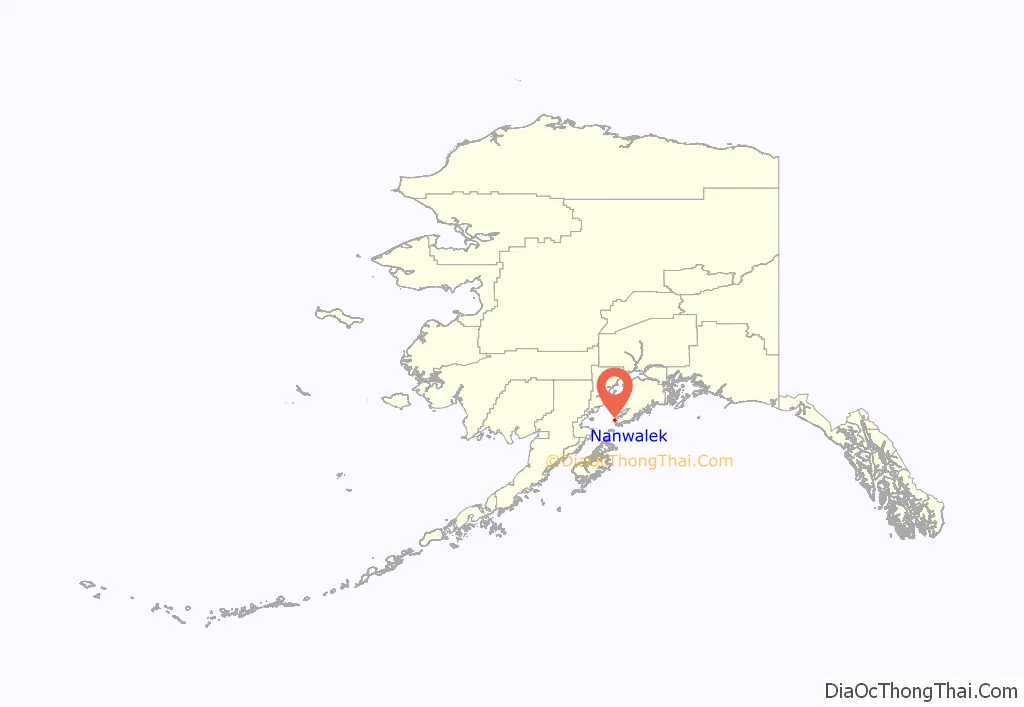
Nanwalek location map. Where is Nanwalek CDP?
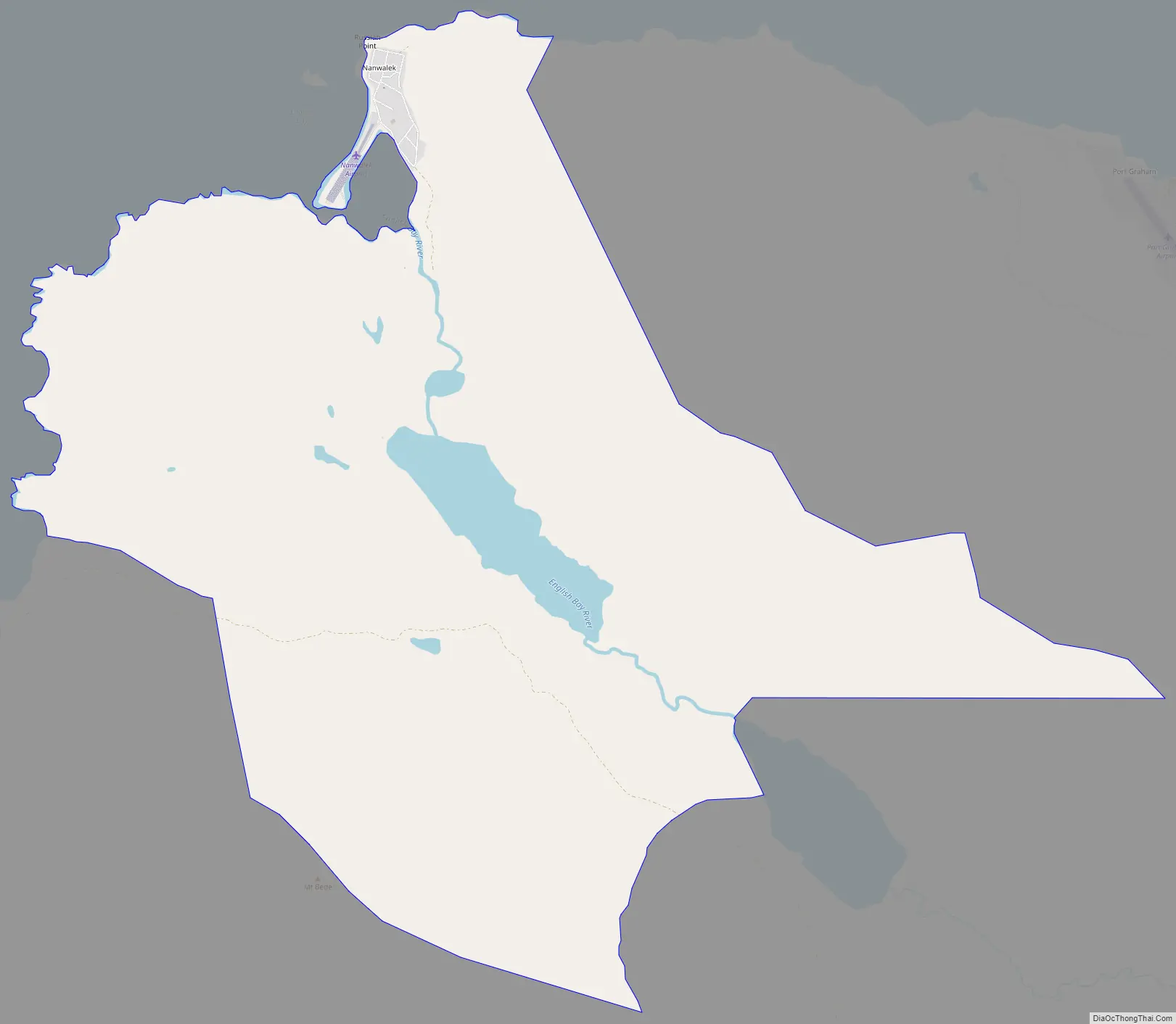
Nanwalek Road Map
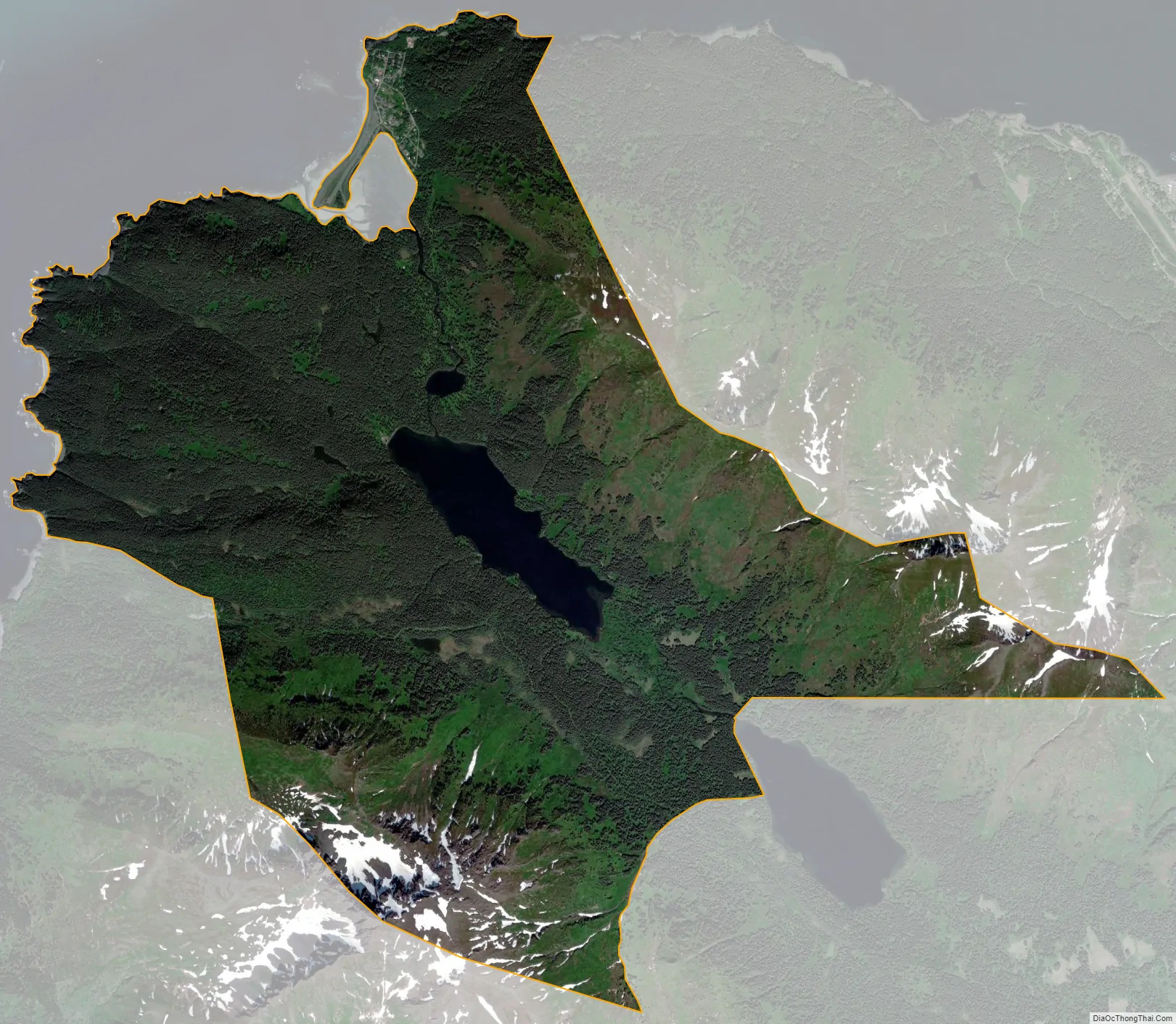
Nanwalek city Satellite Map
Geography
Nanwalek and Port Graham are located near the southern tip of the Kenai Peninsula and are separated by less than 5 miles (8 km). Both villages are accessible only by air or water (they lie 23 miles (37 km) southwest of Homer). The Alaska Marine Highway System provides service to nearby Seldovia (located only 10 miles (16 km) up the coast line). A state-owned 1,850-by-50-foot (564 by 15 m) gravel airstrip sits atop a natural spit which divides the small lagoon from the southern mouth of Cook Inlet. Looking northwest across Cook Inlet, one can see Mount Iliamna 60 miles (97 km) away and further to the north Mount Redoubt, 80 miles (130 km) away. Although they are in the vicinity of the village, they do not cause trouble to the villagers, since Iliamna is erupting continuously, emitting only smoke, and Redoubt is so far in the north that the ashes from its eruptions bother mostly Kenai and Anchorage. It is Augustine (the most active volcano of the eastern Aleutian arc), 50 miles (80 km) due west across Cook Inlet, which makes life nasty in Nanwalek, Port Graham, Seldovia and Homer when it erupts, as it most recently has done in 1986 and 2006.
Nanwalek is located at 59°21′13″N 151°54′45″W / 59.353483°N 151.912482°W / 59.353483; -151.912482.
According to the United States Census Bureau, the CDP has a total area of 8.4 square miles (21.8 km), of which 0.02 square miles (0.04 km), or 0.16%, are water.
See also
Map of Alaska State and its subdivision:- Aleutians East
- Aleutians West
- Anchorage
- Bethel
- Bristol Bay
- Denali
- Dillingham
- Fairbanks North Star
- Haines
- Juneau
- Kenai Peninsula
- Ketchikan Gateway
- Kodiak Island
- Lake and Peninsula
- Matanuska-Susitna
- Nome
- North Slope
- Northwest Arctic
- Prince of Wales-Outer Ketchi
- Sitka
- Skagway-Yakutat-Angoon
- Southeast Fairbanks
- Valdez-Cordova
- Wade Hampton
- Wrangell-Petersburg
- Yukon-Koyukuk
- Alabama
- Alaska
- Arizona
- Arkansas
- California
- Colorado
- Connecticut
- Delaware
- District of Columbia
- Florida
- Georgia
- Hawaii
- Idaho
- Illinois
- Indiana
- Iowa
- Kansas
- Kentucky
- Louisiana
- Maine
- Maryland
- Massachusetts
- Michigan
- Minnesota
- Mississippi
- Missouri
- Montana
- Nebraska
- Nevada
- New Hampshire
- New Jersey
- New Mexico
- New York
- North Carolina
- North Dakota
- Ohio
- Oklahoma
- Oregon
- Pennsylvania
- Rhode Island
- South Carolina
- South Dakota
- Tennessee
- Texas
- Utah
- Vermont
- Virginia
- Washington
- West Virginia
- Wisconsin
- Wyoming


