Nikiski is a census-designated place (CDP) in Kenai Peninsula Borough, Alaska, United States. The population was 4,456 at the 2020 census, down from 4,493 in 2010.
| Name: | Nikiski CDP |
|---|---|
| LSAD Code: | 57 |
| LSAD Description: | CDP (suffix) |
| State: | Alaska |
| County: | Kenai Peninsula Borough |
| Elevation: | 128 ft (39 m) |
| Total Area: | 75.93 sq mi (196.65 km²) |
| Land Area: | 69.48 sq mi (179.94 km²) |
| Water Area: | 6.45 sq mi (16.71 km²) |
| Total Population: | 4,456 |
| Population Density: | 64.14/sq mi (24.76/km²) |
| ZIP code: | 99635 |
| Area code: | 907 |
| FIPS code: | 0254050 |
| GNISfeature ID: | 1416651 |
Online Interactive Map
Click on ![]() to view map in "full screen" mode.
to view map in "full screen" mode.
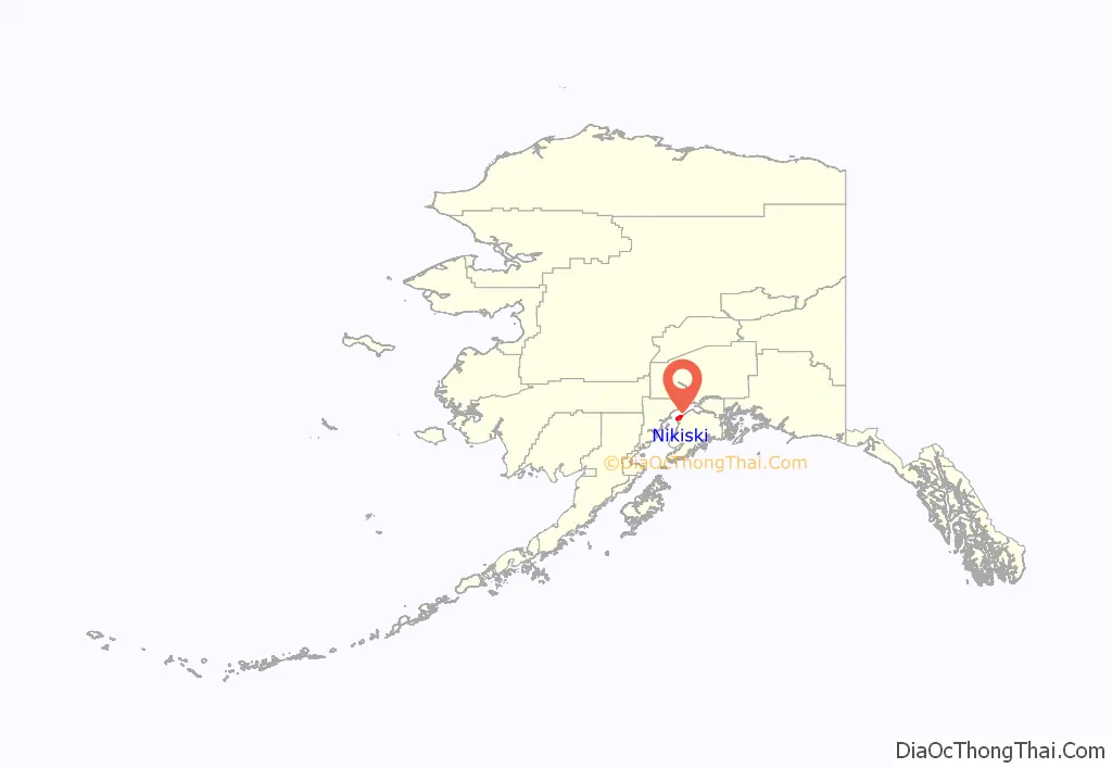
Nikiski location map. Where is Nikiski CDP?
History
Nikiski was once home to an Agrium fertilizer plant, which was once the Kenai Peninsula Borough’s largest employer. The facility closed in 2008 due to natural gas shortages, but the company continues to explore reopening it.
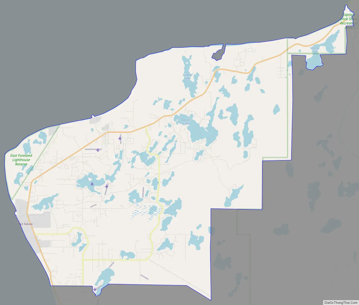
Nikiski Road Map
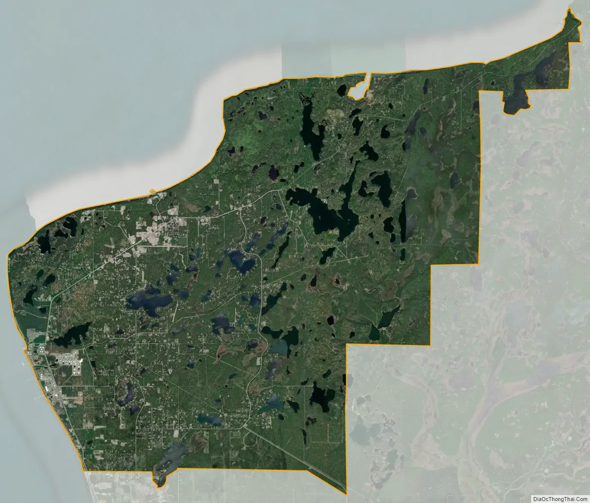
Nikiski city Satellite Map
Geography
Nikiski is located at 60°42′28″N 151°15′46″W / 60.70778°N 151.26278°W / 60.70778; -151.26278 (60.707891, -151.262646) on the west side of the Kenai Peninsula. It lies along the shore of Cook Inlet between Salamatof to the south and the Swanson River to the northeast. It is bordered across the Swanson River by the Point Possession CDP.
According to the United States Census Bureau, the Nikiski CDP has a total area of 75.9 square miles (196.7 km), of which 69.4 square miles (179.8 km) are land and 6.5 square miles (16.8 km), or 8.57%, are water. The CDP is in a low-lying region covered by several lakes, including Stormy Lake, Suneva Lake, Daniels Lake, Timberlost Lake, Island Lake, Foreland Lake, Bernice Lake, and Cabin Lake.
The main road access is via the Kenai Spur Highway, which leads south 11 miles (18 km) to the city of Kenai and north to Captain Cook State Recreation Area. A second road, the Nikiski Emergency Escape Route, also leads south to the City of Kenai.
See also
Map of Alaska State and its subdivision:- Aleutians East
- Aleutians West
- Anchorage
- Bethel
- Bristol Bay
- Denali
- Dillingham
- Fairbanks North Star
- Haines
- Juneau
- Kenai Peninsula
- Ketchikan Gateway
- Kodiak Island
- Lake and Peninsula
- Matanuska-Susitna
- Nome
- North Slope
- Northwest Arctic
- Prince of Wales-Outer Ketchi
- Sitka
- Skagway-Yakutat-Angoon
- Southeast Fairbanks
- Valdez-Cordova
- Wade Hampton
- Wrangell-Petersburg
- Yukon-Koyukuk
- Alabama
- Alaska
- Arizona
- Arkansas
- California
- Colorado
- Connecticut
- Delaware
- District of Columbia
- Florida
- Georgia
- Hawaii
- Idaho
- Illinois
- Indiana
- Iowa
- Kansas
- Kentucky
- Louisiana
- Maine
- Maryland
- Massachusetts
- Michigan
- Minnesota
- Mississippi
- Missouri
- Montana
- Nebraska
- Nevada
- New Hampshire
- New Jersey
- New Mexico
- New York
- North Carolina
- North Dakota
- Ohio
- Oklahoma
- Oregon
- Pennsylvania
- Rhode Island
- South Carolina
- South Dakota
- Tennessee
- Texas
- Utah
- Vermont
- Virginia
- Washington
- West Virginia
- Wisconsin
- Wyoming


