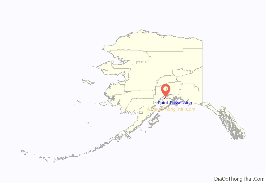
Point Possession (Dena’ina: Tuyqun or Ch’aghałnikt) is a census-designated place (CDP) on the Kenai Peninsula in Alaska. According to the 2020 census, the CDP population was 9. Since 2009, Point Possession has been owned by the federal government and has been made a part of the Kenai National Wildlife Refuge.
| Name: | Point Possession CDP |
|---|---|
| LSAD Code: | 57 |
| LSAD Description: | CDP (suffix) |
| State: | Alaska |
| County: | Kenai Peninsula Borough |
| Elevation: | 100 ft (30 m) |
| Total Area: | 41.98 sq mi (108.71 km²) |
| Land Area: | 41.98 sq mi (108.71 km²) |
| Water Area: | 0.00 sq mi (0.00 km²) |
| Total Population: | 9 |
| Population Density: | 0.21/sq mi (0.08/km²) |
| FIPS code: | 0261825 |
Online Interactive Map
Click on ![]() to view map in "full screen" mode.
to view map in "full screen" mode.
Point Possession location map. Where is Point Possession CDP?
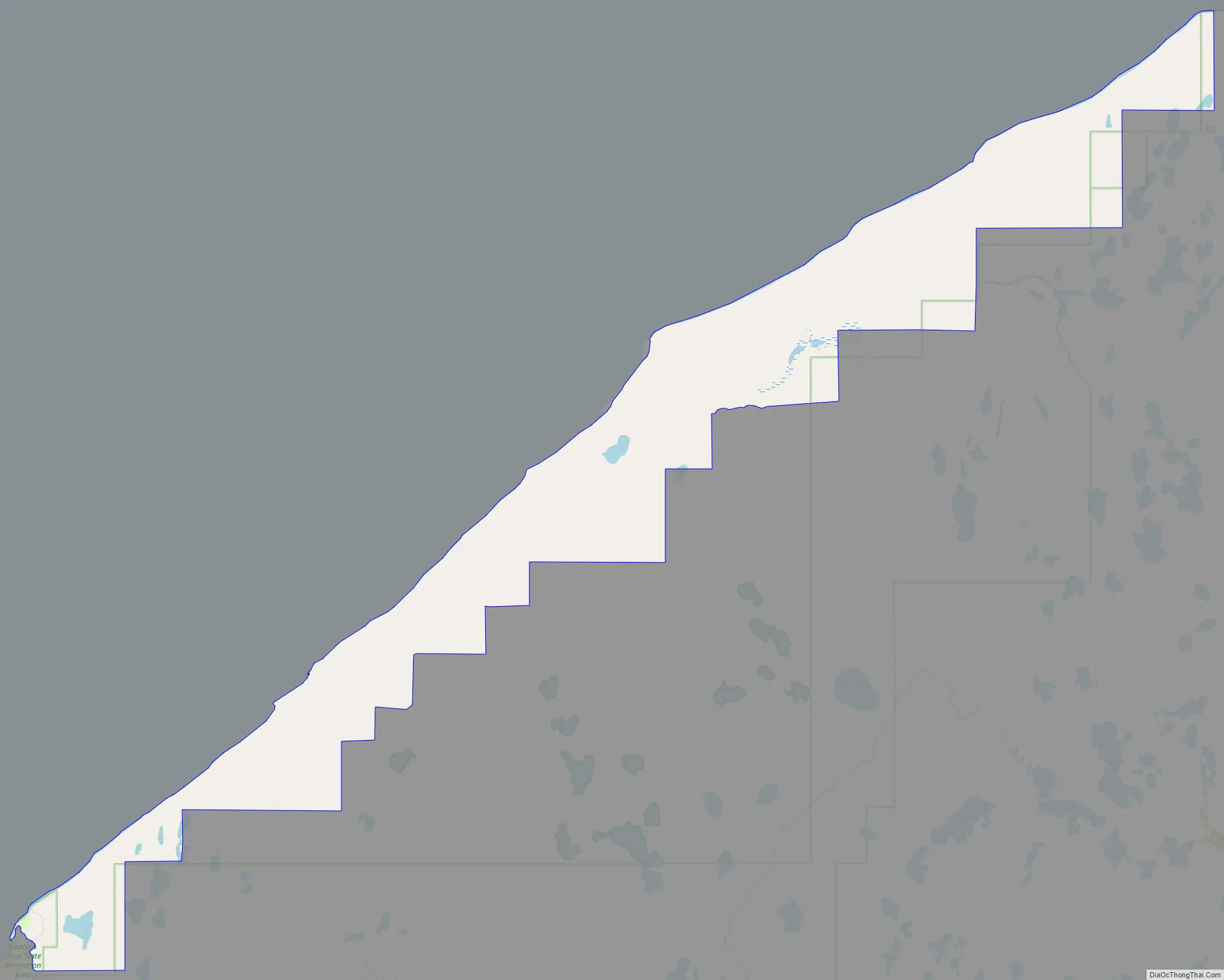
Point Possession Road Map
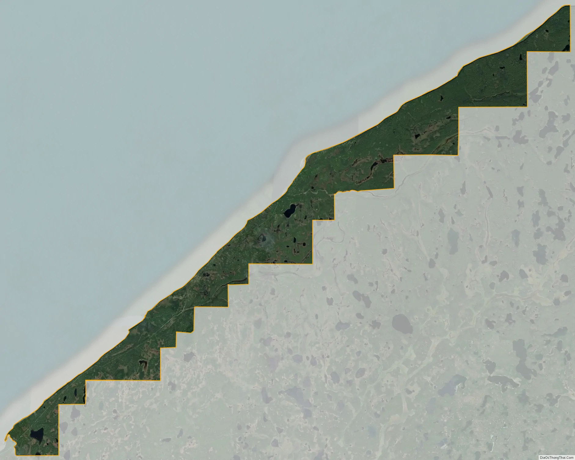
Point Possession city Satellite Map
Geography
The CDP is named for Point Possession, a landform on the northwest side of the Kenai Peninsula that marks the southern side of the mouth of Turnagain Arm into Cook Inlet. The CDP extends from the point 27 miles (43 km) southwest along the shore of Cook Inlet to the mouth of the Swanson River, across which is the CDP of Nikiski. The Kenai Spur Highway enters the Point Possession CDP at the Swanson River and shortly dead-ends while still within the Captain Cook State Recreation Area; it leads southwest 27 miles (43 km) to the city of Kenai. The rest of the CDP is accessible only via four-wheel-drive roads.
According to the U.S. Census Bureau, the Point Possession CDP has an area of 42.0 square miles (108.7 km), all of which is recorded as land. While the permanent population is three, the 2010 census counted 214 housing units.
See also
Map of Alaska State and its subdivision:- Aleutians East
- Aleutians West
- Anchorage
- Bethel
- Bristol Bay
- Denali
- Dillingham
- Fairbanks North Star
- Haines
- Juneau
- Kenai Peninsula
- Ketchikan Gateway
- Kodiak Island
- Lake and Peninsula
- Matanuska-Susitna
- Nome
- North Slope
- Northwest Arctic
- Prince of Wales-Outer Ketchi
- Sitka
- Skagway-Yakutat-Angoon
- Southeast Fairbanks
- Valdez-Cordova
- Wade Hampton
- Wrangell-Petersburg
- Yukon-Koyukuk
- Alabama
- Alaska
- Arizona
- Arkansas
- California
- Colorado
- Connecticut
- Delaware
- District of Columbia
- Florida
- Georgia
- Hawaii
- Idaho
- Illinois
- Indiana
- Iowa
- Kansas
- Kentucky
- Louisiana
- Maine
- Maryland
- Massachusetts
- Michigan
- Minnesota
- Mississippi
- Missouri
- Montana
- Nebraska
- Nevada
- New Hampshire
- New Jersey
- New Mexico
- New York
- North Carolina
- North Dakota
- Ohio
- Oklahoma
- Oregon
- Pennsylvania
- Rhode Island
- South Carolina
- South Dakota
- Tennessee
- Texas
- Utah
- Vermont
- Virginia
- Washington
- West Virginia
- Wisconsin
- Wyoming


