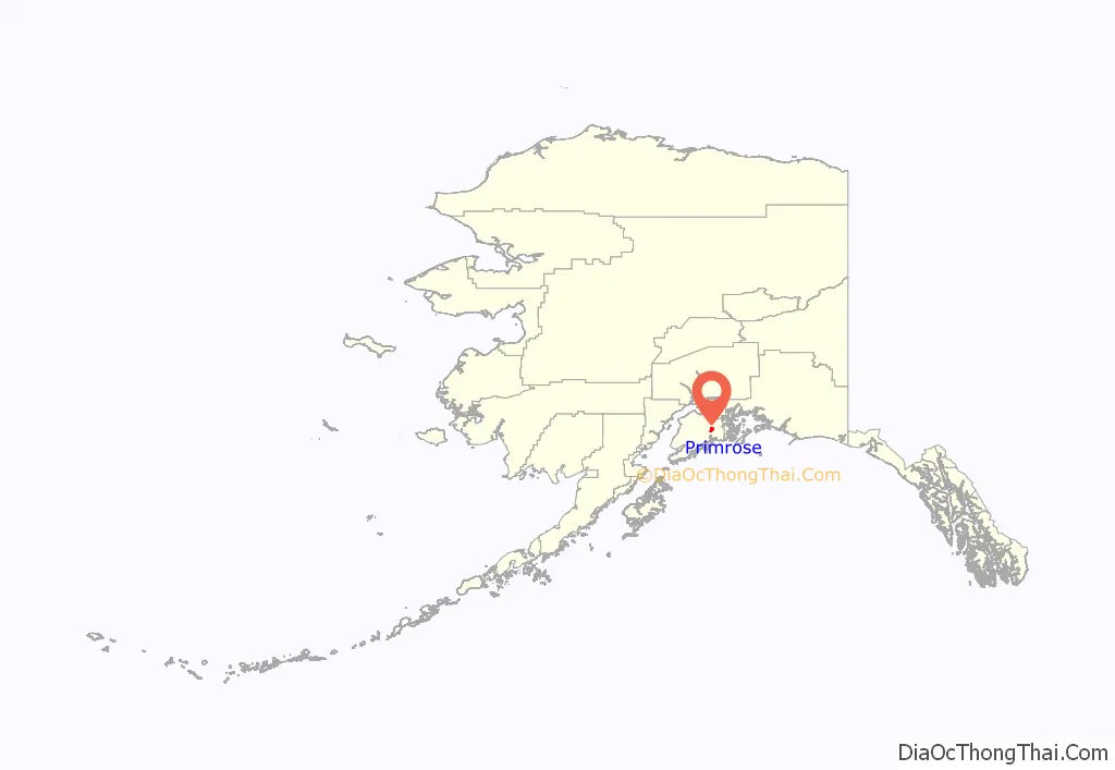
Primrose is a census-designated place (CDP) in Kenai Peninsula Borough, Alaska, United States. The population was 78 at the 2010 census, down from 93 at the 2000 census. Primrose is one of a number of small communities located north of Seward along the Seward Highway.
| Name: | Primrose CDP |
|---|---|
| LSAD Code: | 57 |
| LSAD Description: | CDP (suffix) |
| State: | Alaska |
| County: | Kenai Peninsula Borough |
| Elevation: | 3,212 ft (979 m) |
| Total Area: | 35.50 sq mi (91.96 km²) |
| Land Area: | 34.47 sq mi (89.27 km²) |
| Water Area: | 1.03 sq mi (2.68 km²) |
| Total Population: | 96 |
| Population Density: | 2.79/sq mi (1.08/km²) |
| Area code: | 907 |
| FIPS code: | 0264240 |
| GNISfeature ID: | 2419191 |
Online Interactive Map
Click on ![]() to view map in "full screen" mode.
to view map in "full screen" mode.
Primrose location map. Where is Primrose CDP?
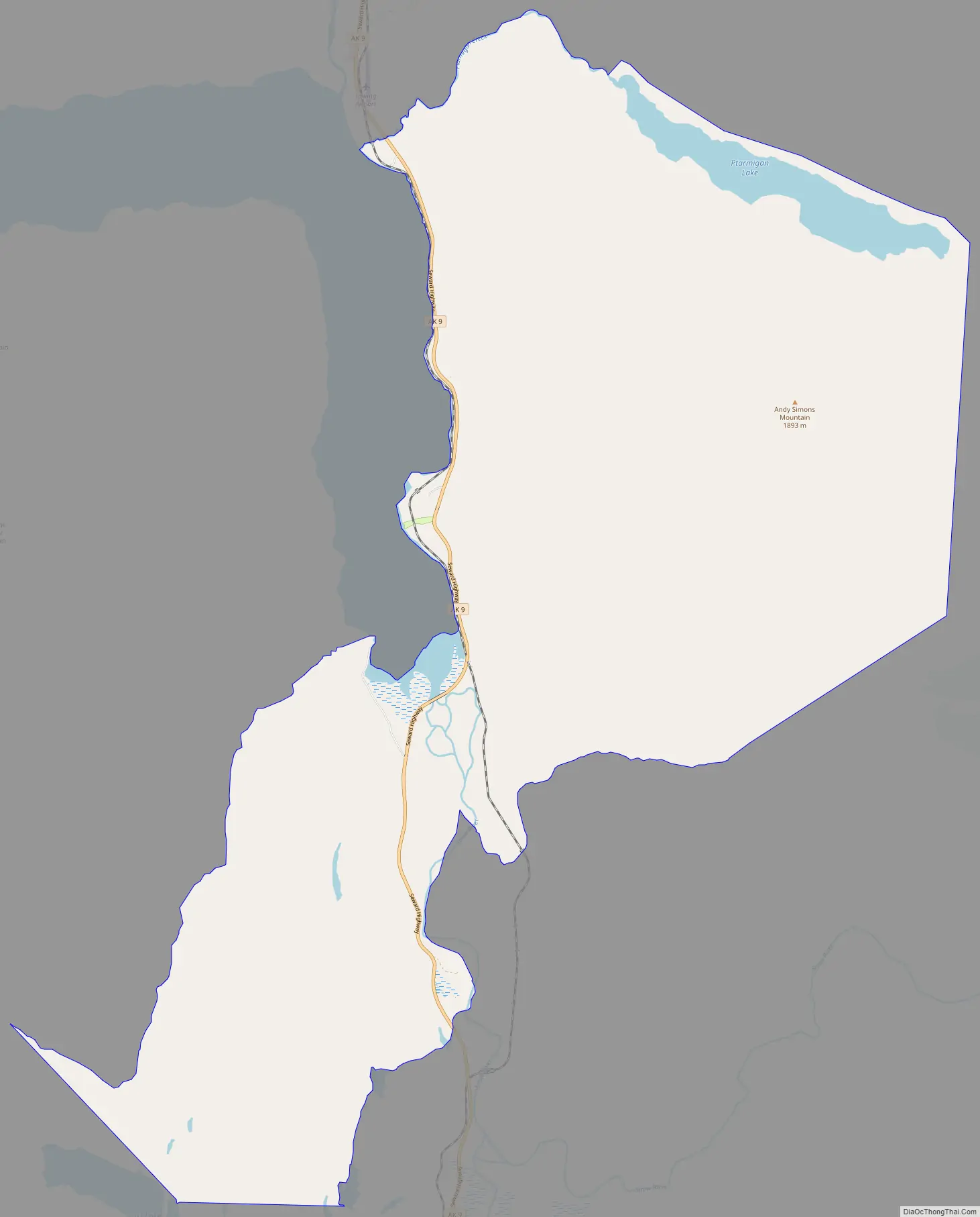
Primrose Road Map
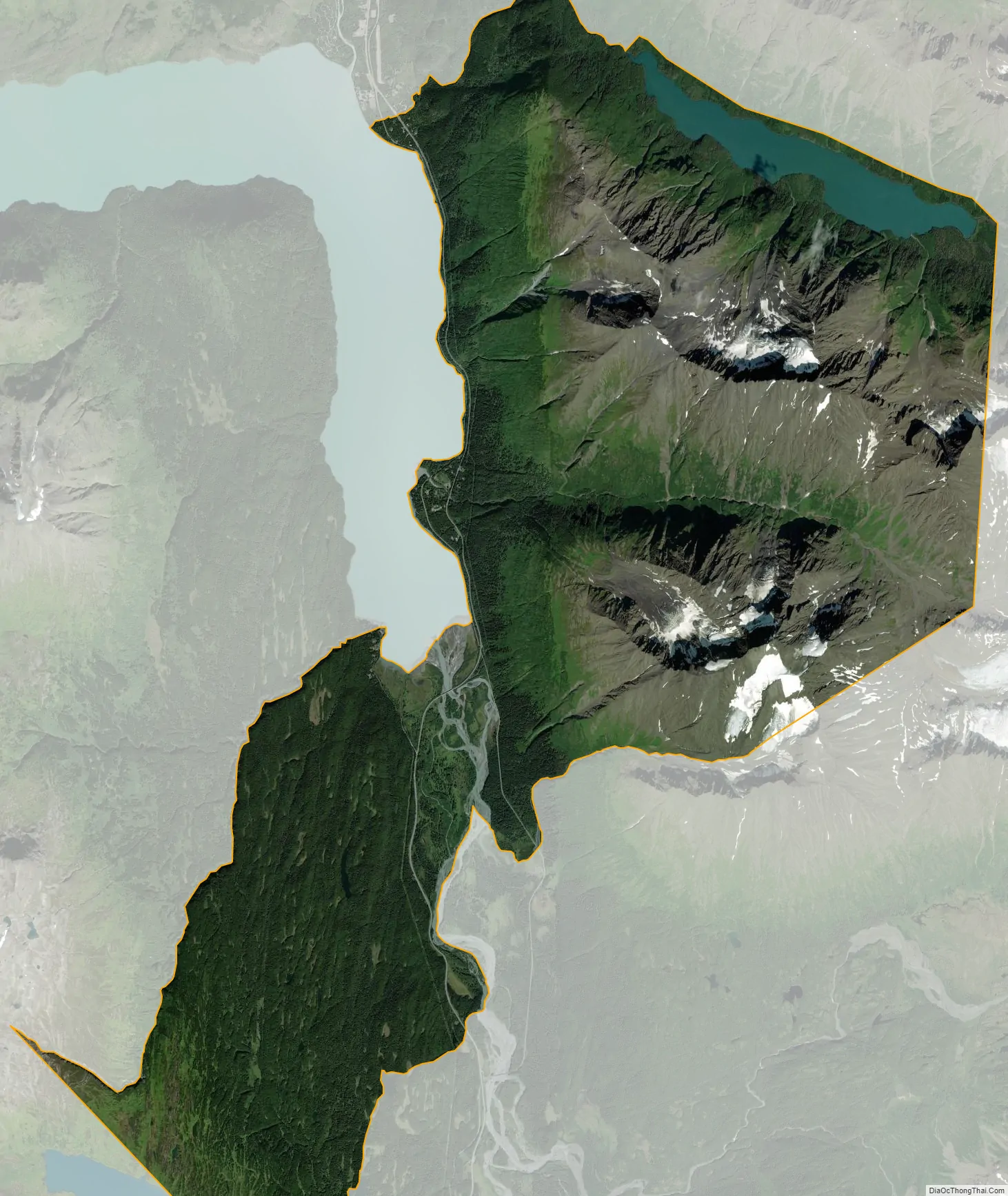
Primrose city Satellite Map
Geography
Primrose is located on the eastern part of the Kenai Peninsula at 60°20′36″N 149°20′39″W / 60.34333°N 149.34417°W / 60.34333; -149.34417 (60.343405, -149.344250), at the mouth of the Snow River in Kenai Lake. It is bordered to the north by Crown Point and to the south by Bear Creek. Alaska Route 9, the Seward Highway, runs through the community, leading south 18 miles (29 km) to Seward and north the same distance to Alaska Route 1 at Tern Lake.
According to the United States Census Bureau, the Primrose CDP has a total area of 38.2 square miles (99.0 km), of which 34.5 square miles (89.3 km) are land and 1.0 square mile (2.7 km), or 2.92%, are water.
See also
Map of Alaska State and its subdivision:- Aleutians East
- Aleutians West
- Anchorage
- Bethel
- Bristol Bay
- Denali
- Dillingham
- Fairbanks North Star
- Haines
- Juneau
- Kenai Peninsula
- Ketchikan Gateway
- Kodiak Island
- Lake and Peninsula
- Matanuska-Susitna
- Nome
- North Slope
- Northwest Arctic
- Prince of Wales-Outer Ketchi
- Sitka
- Skagway-Yakutat-Angoon
- Southeast Fairbanks
- Valdez-Cordova
- Wade Hampton
- Wrangell-Petersburg
- Yukon-Koyukuk
- Alabama
- Alaska
- Arizona
- Arkansas
- California
- Colorado
- Connecticut
- Delaware
- District of Columbia
- Florida
- Georgia
- Hawaii
- Idaho
- Illinois
- Indiana
- Iowa
- Kansas
- Kentucky
- Louisiana
- Maine
- Maryland
- Massachusetts
- Michigan
- Minnesota
- Mississippi
- Missouri
- Montana
- Nebraska
- Nevada
- New Hampshire
- New Jersey
- New Mexico
- New York
- North Carolina
- North Dakota
- Ohio
- Oklahoma
- Oregon
- Pennsylvania
- Rhode Island
- South Carolina
- South Dakota
- Tennessee
- Texas
- Utah
- Vermont
- Virginia
- Washington
- West Virginia
- Wisconsin
- Wyoming


