Salamatof (Dena’ina: Ken Dech’etl’t) is a census-designated place (CDP) in Kenai Peninsula Borough, Alaska, United States. The population was 1,078 at the 2020 census, up from 980 in 2010. Salamatof is the location for the former Wildwood Air Force Station, which operated from 1965 to 1972 (from 1951 to 1965, it was an Army Station). Today, it is the Wildwood Correctional Complex.
| Name: | Salamatof CDP |
|---|---|
| LSAD Code: | 57 |
| LSAD Description: | CDP (suffix) |
| State: | Alaska |
| County: | Kenai Peninsula Borough |
| Total Area: | 8.20 sq mi (21.24 km²) |
| Land Area: | 8.03 sq mi (20.80 km²) |
| Water Area: | 0.17 sq mi (0.44 km²) |
| Total Population: | 1,078 |
| Population Density: | 134.23/sq mi (51.83/km²) |
| ZIP code: | 99611 |
| Area code: | 907 |
| FIPS code: | 0266510 |
Online Interactive Map
Click on ![]() to view map in "full screen" mode.
to view map in "full screen" mode.
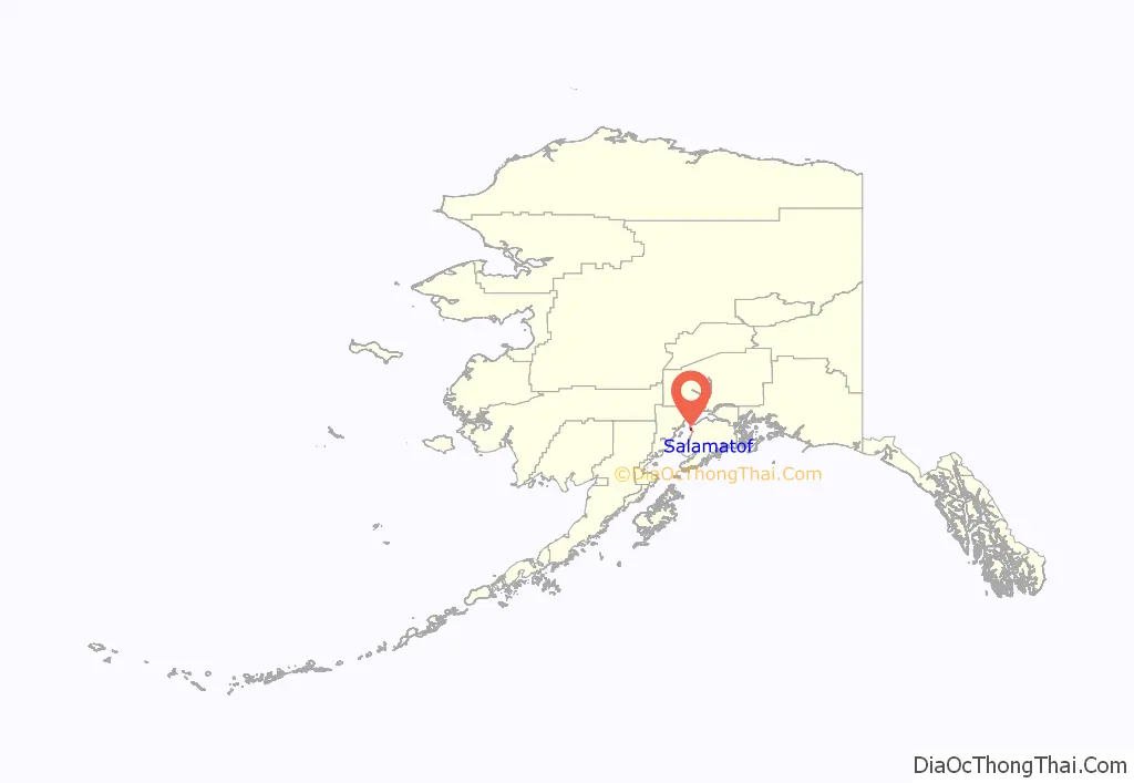
Salamatof location map. Where is Salamatof CDP?
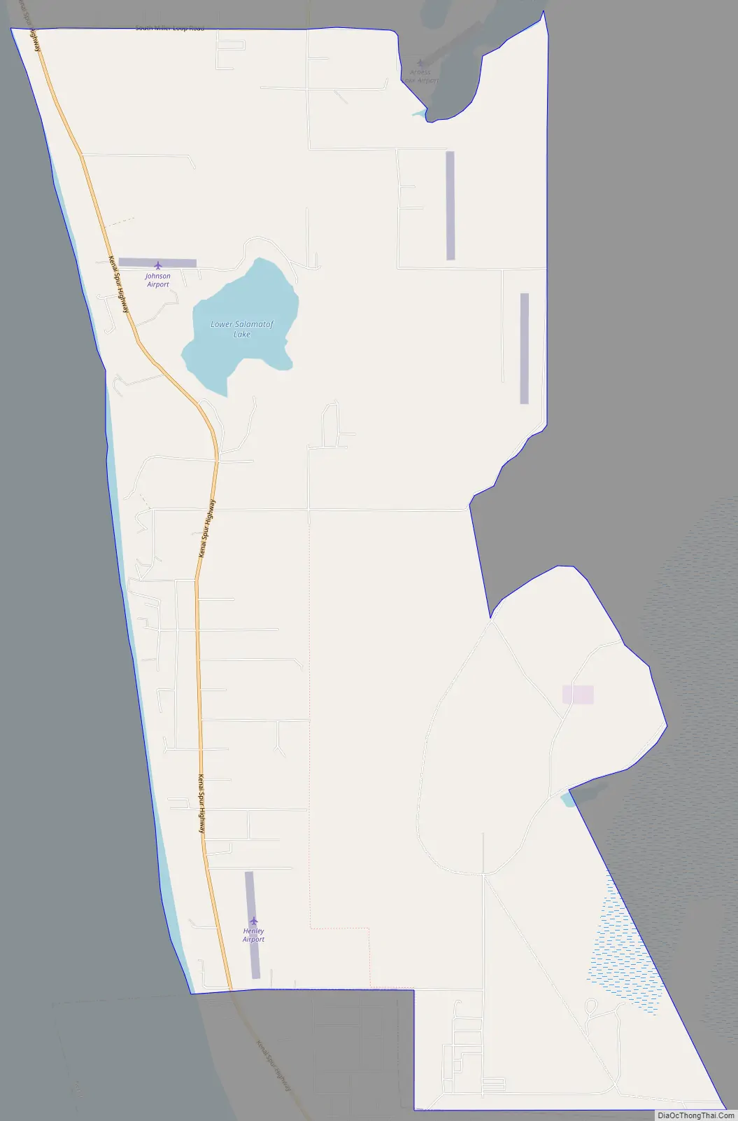
Salamatof Road Map
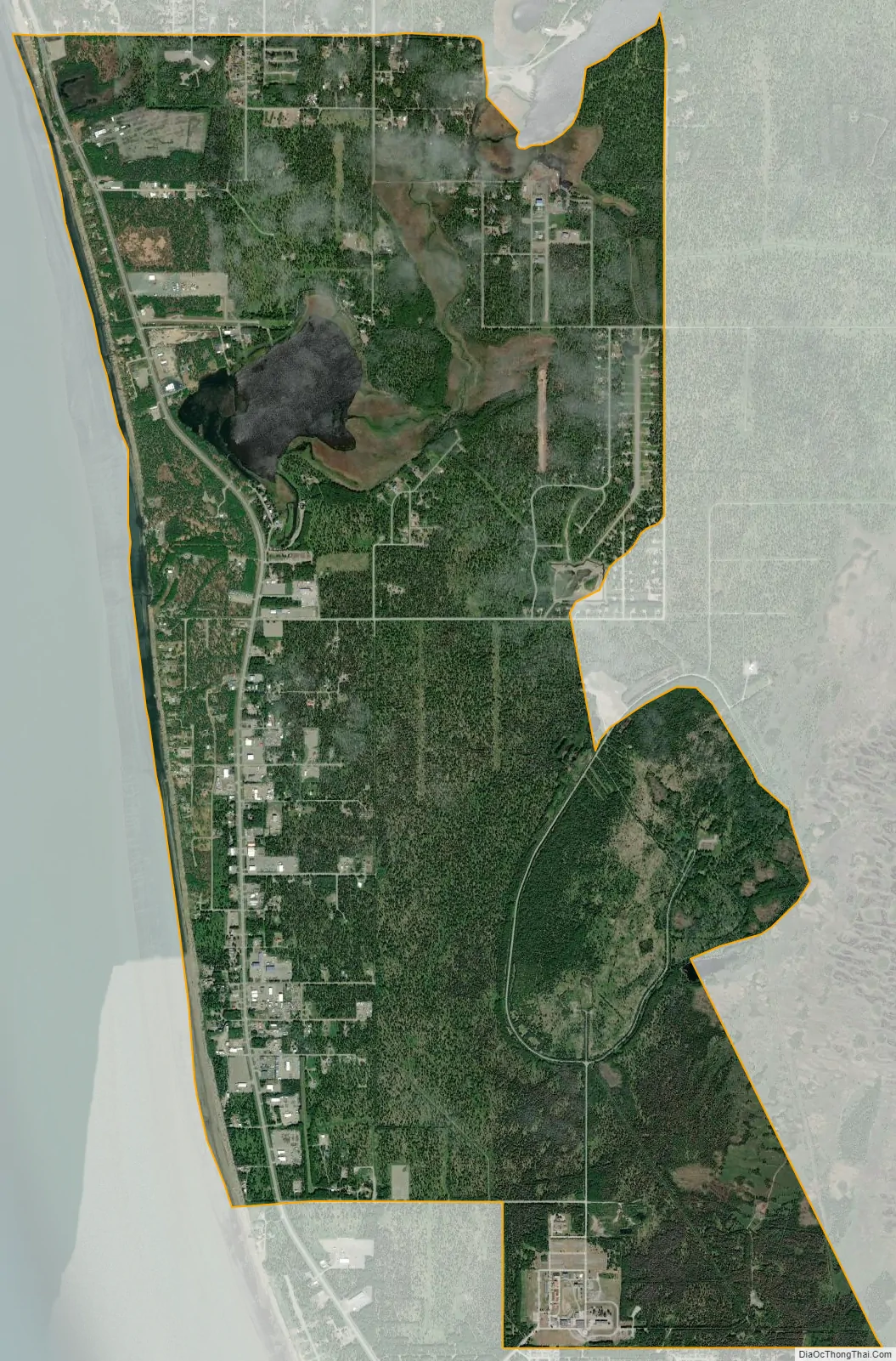
Salamatof city Satellite Map
Geography
Salamatof is located on the western side of the Kenai Peninsula at 60°35′36″N 151°18′38″W / 60.59333°N 151.31056°W / 60.59333; -151.31056 (60.593250, -151.310547), and comprises populated areas between the city of Kenai to the south and unincorporated Nikiski to the north. It is bordered to the west by Cook Inlet.
According to the United States Census Bureau, the Salamatof CDP has a total area of 8.3 square miles (21.4 km), of which 8.1 square miles (21.0 km) are land and 0.2 square miles (0.4 km), or 2.05%, are water.
See also
Map of Alaska State and its subdivision:- Aleutians East
- Aleutians West
- Anchorage
- Bethel
- Bristol Bay
- Denali
- Dillingham
- Fairbanks North Star
- Haines
- Juneau
- Kenai Peninsula
- Ketchikan Gateway
- Kodiak Island
- Lake and Peninsula
- Matanuska-Susitna
- Nome
- North Slope
- Northwest Arctic
- Prince of Wales-Outer Ketchi
- Sitka
- Skagway-Yakutat-Angoon
- Southeast Fairbanks
- Valdez-Cordova
- Wade Hampton
- Wrangell-Petersburg
- Yukon-Koyukuk
- Alabama
- Alaska
- Arizona
- Arkansas
- California
- Colorado
- Connecticut
- Delaware
- District of Columbia
- Florida
- Georgia
- Hawaii
- Idaho
- Illinois
- Indiana
- Iowa
- Kansas
- Kentucky
- Louisiana
- Maine
- Maryland
- Massachusetts
- Michigan
- Minnesota
- Mississippi
- Missouri
- Montana
- Nebraska
- Nevada
- New Hampshire
- New Jersey
- New Mexico
- New York
- North Carolina
- North Dakota
- Ohio
- Oklahoma
- Oregon
- Pennsylvania
- Rhode Island
- South Carolina
- South Dakota
- Tennessee
- Texas
- Utah
- Vermont
- Virginia
- Washington
- West Virginia
- Wisconsin
- Wyoming


