Seldovia (Alutiiq: Angagkitaqnuuq; Dena’ina: Angidahtnu; Russian: Селдовия) is a city in Kenai Peninsula Borough, Alaska, United States. Its population was 255 at the 2010 census, down from 286 in 2000. It is located along Kachemak Bay southwest of Homer. There is no road system connecting the town to other communities, so all travel to Seldovia is by airplane or boat.
The Alaska Native people of Seldovia make up approximately one quarter of the population and have ancestors of Aleut and Alutiiq (Sugpiaq) descent, as well as some Dena’ina.
| Name: | Seldovia city |
|---|---|
| LSAD Code: | 25 |
| LSAD Description: | city (suffix) |
| State: | Alaska |
| County: | Kenai Peninsula Borough |
| Incorporated: | May 7, 1945 |
| Elevation: | 52 ft (16 m) |
| Total Area: | 0.55 sq mi (1.42 km²) |
| Land Area: | 0.39 sq mi (1.00 km²) |
| Water Area: | 0.16 sq mi (0.42 km²) |
| Total Population: | 235 |
| Population Density: | 607.24/sq mi (234.54/km²) |
| ZIP code: | 99663 |
| Area code: | 907 |
| FIPS code: | 0268340 |
| GNISfeature ID: | 1413937 |
| Website: | cityofseldovia.com |
Online Interactive Map
Click on ![]() to view map in "full screen" mode.
to view map in "full screen" mode.
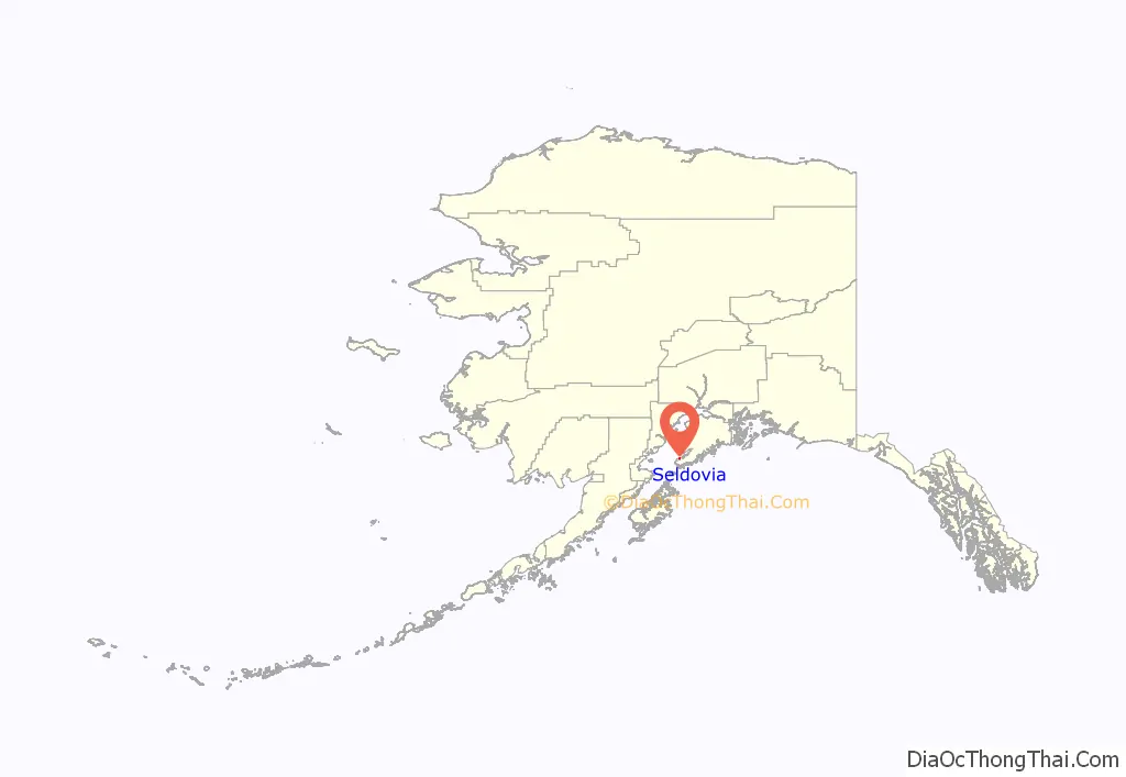
Seldovia location map. Where is Seldovia city?
History
The native residents are mixed Dena’ina Athabaskan Indian and Alutiiq (Sugpiaq) Eskimo. In 1787 or 1788 a Russian fur trade post named Aleksandrovskaia was established at today’s Seldovia by hunting parties under Evstratii Ivanovich Delarov, of the Shelikhov-Golikov company, precursor of the Russian-American Company. Although there has been little definitive archeological evidence of human habitation at Seldovia prior to the 1800s, it is said the early Russian St. Nicholas Orthodox Church, started in 1820, was built on top of an older aboriginal Inuit village site. The town’s original Russian name, Seldevoy, translates to “Herring Bay”, as there was a significant herring population prior to rampant overfishing early in the 20th century.
Until the development of a more complete road system in Alaska, Seldovia was an important “first stop” for ships sailing from Seward, Kodiak and other points outside Cook Inlet. At one time Seldovia was home to over 2,000 residents, but today fewer than 300 persons reside year round.
The town was one of many communities along the shores of Cook Inlet, noted for having one of the most severe tidal movements in North America. Similar to the dramatic tides of Bay of Fundy, the Cook Inlet’s waters prior to 1964 would rise or fall 26 feet every six hours during the peak tides.
After the Good Friday earthquake on March 27, 1964, which registered 9.2 on the moment magnitude scale, the surrounding land mass dropped six feet. Seldovia’s “boardwalk” before the earthquake was thick wooden plank and piling, and the town’s main street was built almost entirely along the waterfront. Most of the community’s businesses, and many homes were similarly constructed upon pilings on either side of this “street”. The sudden sinking of the land caused higher tides, peaking at 32 feet, to completely submerge the boardwalk and flood the homes and businesses along the waterfront.
The waterfront was rebuilt (known at the time as “urban renewal”) using fill from Cap’s Hill, which was demolished to rebuild the town on higher ground. There is only one small portion of the boardwalk left; this section of the boardwalk was built decades after the original boardwalk and it is known to the townfolk as “the new boardwalk”, even though it is now the only boardwalk. The original boardwalk is completely gone, destroyed during the urban renewal process, along with many homes and businesses.
Seldovia has been home to many industries, including fox farming, berry picking and commercial fishing, including King Crab fishing. Logging and mining have also featured in local history. Today charter boats keep busy bringing the visiting sport fishermen to the fishing grounds of Kachemak Bay and other nearby waters.
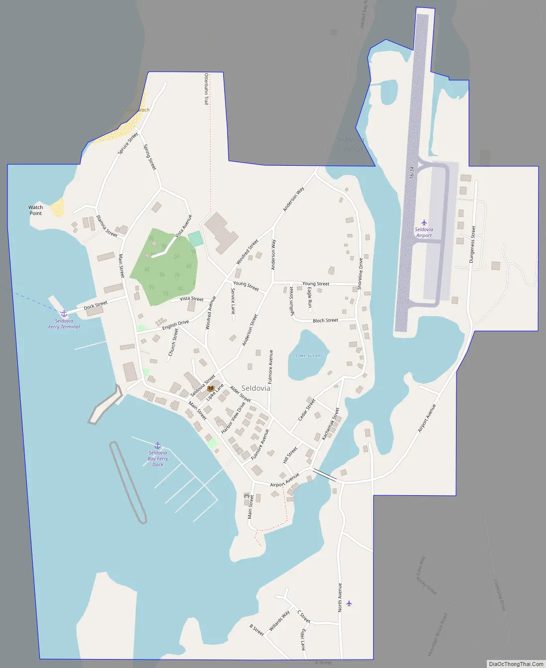
Seldovia Road Map
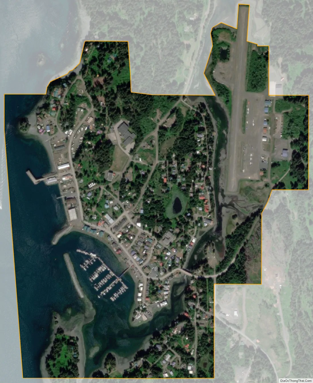
Seldovia city Satellite Map
Geography
Seldovia is on the Kenai Peninsula on the south shore of Kachemak Bay opposite Homer. The community is located in the Seldovia Recording District.
Seldovia sea level change is -9.96 mm/yr, over the last 50 years it is about -19.6 inches or -1.6 ft.
According to the United States Census Bureau, the city of Seldovia has a total area of 0.6 square miles (1.6 km), of which, 0.4 square miles (1.0 km) of it is land and 0.2 square miles (0.52 km) of it (33.33%) is water.
Climate
Seldovia has snowy winters and brief dry summers (Koppen Dsc).
See also
Map of Alaska State and its subdivision:- Aleutians East
- Aleutians West
- Anchorage
- Bethel
- Bristol Bay
- Denali
- Dillingham
- Fairbanks North Star
- Haines
- Juneau
- Kenai Peninsula
- Ketchikan Gateway
- Kodiak Island
- Lake and Peninsula
- Matanuska-Susitna
- Nome
- North Slope
- Northwest Arctic
- Prince of Wales-Outer Ketchi
- Sitka
- Skagway-Yakutat-Angoon
- Southeast Fairbanks
- Valdez-Cordova
- Wade Hampton
- Wrangell-Petersburg
- Yukon-Koyukuk
- Alabama
- Alaska
- Arizona
- Arkansas
- California
- Colorado
- Connecticut
- Delaware
- District of Columbia
- Florida
- Georgia
- Hawaii
- Idaho
- Illinois
- Indiana
- Iowa
- Kansas
- Kentucky
- Louisiana
- Maine
- Maryland
- Massachusetts
- Michigan
- Minnesota
- Mississippi
- Missouri
- Montana
- Nebraska
- Nevada
- New Hampshire
- New Jersey
- New Mexico
- New York
- North Carolina
- North Dakota
- Ohio
- Oklahoma
- Oregon
- Pennsylvania
- Rhode Island
- South Carolina
- South Dakota
- Tennessee
- Texas
- Utah
- Vermont
- Virginia
- Washington
- West Virginia
- Wisconsin
- Wyoming


