Anthem is a master-planned community partially located within Phoenix and partially located within a census-designated place (CDP), New River. The community is entirely located in Maricopa County, Arizona, United States, within the Phoenix Metropolitan Area. As of the 2020 census, the population of the Anthem CDP was 23,190.
| Name: | Anthem CDP |
|---|---|
| LSAD Code: | 57 |
| LSAD Description: | CDP (suffix) |
| State: | Arizona |
| County: | Maricopa County |
| Elevation: | 1,864 ft (568 m) |
| Total Area: | 7.92 sq mi (20.51 km²) |
| Land Area: | 7.92 sq mi (20.50 km²) |
| Water Area: | 0.00 sq mi (0.01 km²) |
| Total Population: | 23,190 |
| Population Density: | 2,929.51/sq mi (1,131.12/km²) |
| ZIP code: | 85086, 85087 |
| Area code: | 623 |
| FIPS code: | 0402430 |
| GNISfeature ID: | 2054803 |
Online Interactive Map
Click on ![]() to view map in "full screen" mode.
to view map in "full screen" mode.
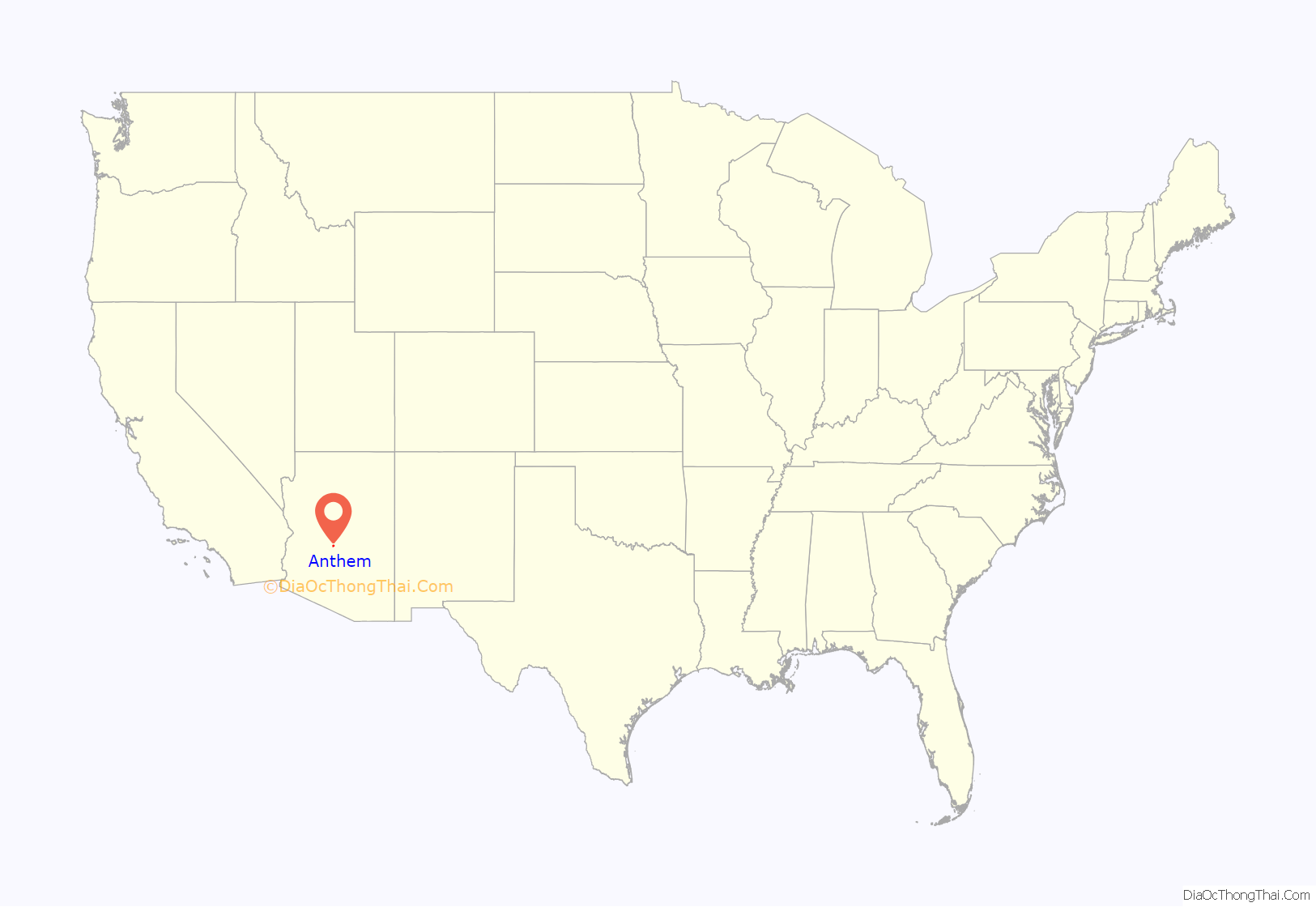
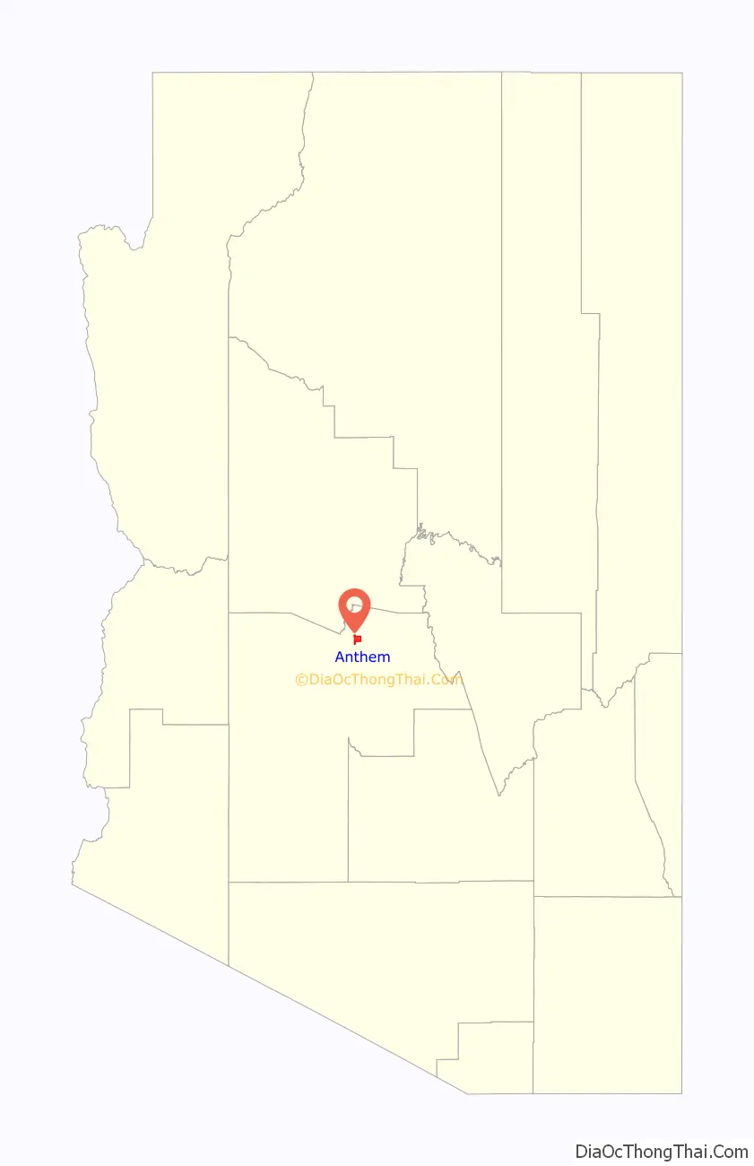
Anthem location map. Where is Anthem CDP?
History
Anthem was developed by Del Webb in 1999 as a master-planned community in the foothills approximately 30 miles (48 km) north of downtown Phoenix. Anthem has been described as one of the best places to raise a family by Parenting magazine and one of the best family friendly neighborhoods in the Phoenix area by Phoenix Magazine.
Anthem is well known for its year-round activities, primarily geared towards families. The community center offers youth soccer, baseball, basketball, tennis, various forms of martial arts, and swimming amongst other activities for ages as early as toddler years. Homeowner’s association dues cover a pool larger than Olympic size, a community water park with slides and various depths for all swimming levels, paths that crisscross the town, bike paths that circle all major streets, and pocket parks scattered throughout the town. In addition, there is a 63-acre community park complete with an amphitheater, many grassy areas, volleyball, soccer, football, baseball and little league fields along with a train, pavilion, lakes and pagodas.
On July 31, 2012, a storm dropped 5.01 inches (127 mm) of rain on Anthem in the span of 90 minutes, causing widespread flooding that damaged homes and required the rescue of nine people. A subsequent investigation into the flood concluded that the storm was a “one-in-1,000 year rain catastrophe”.
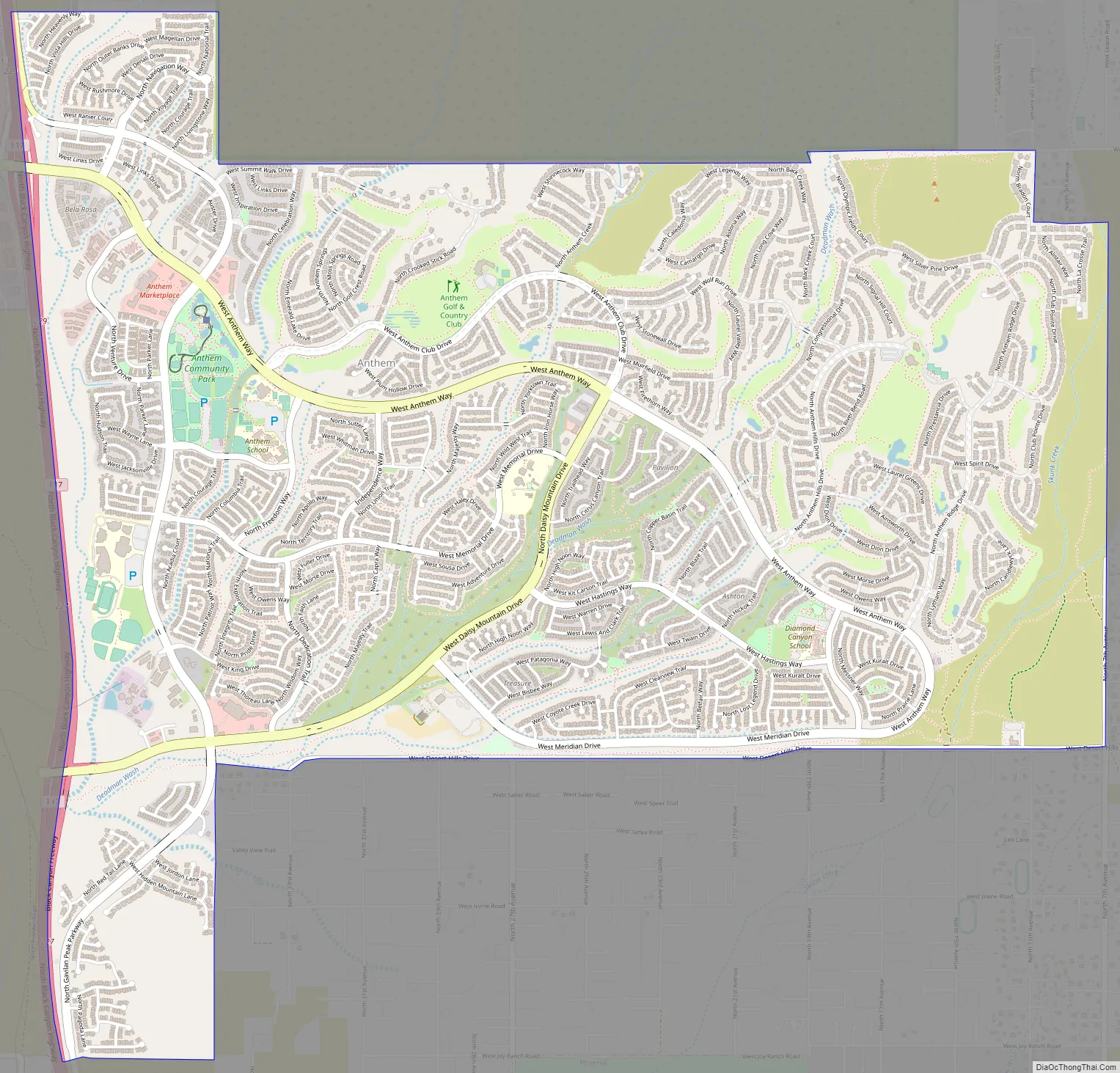
Anthem Road Map
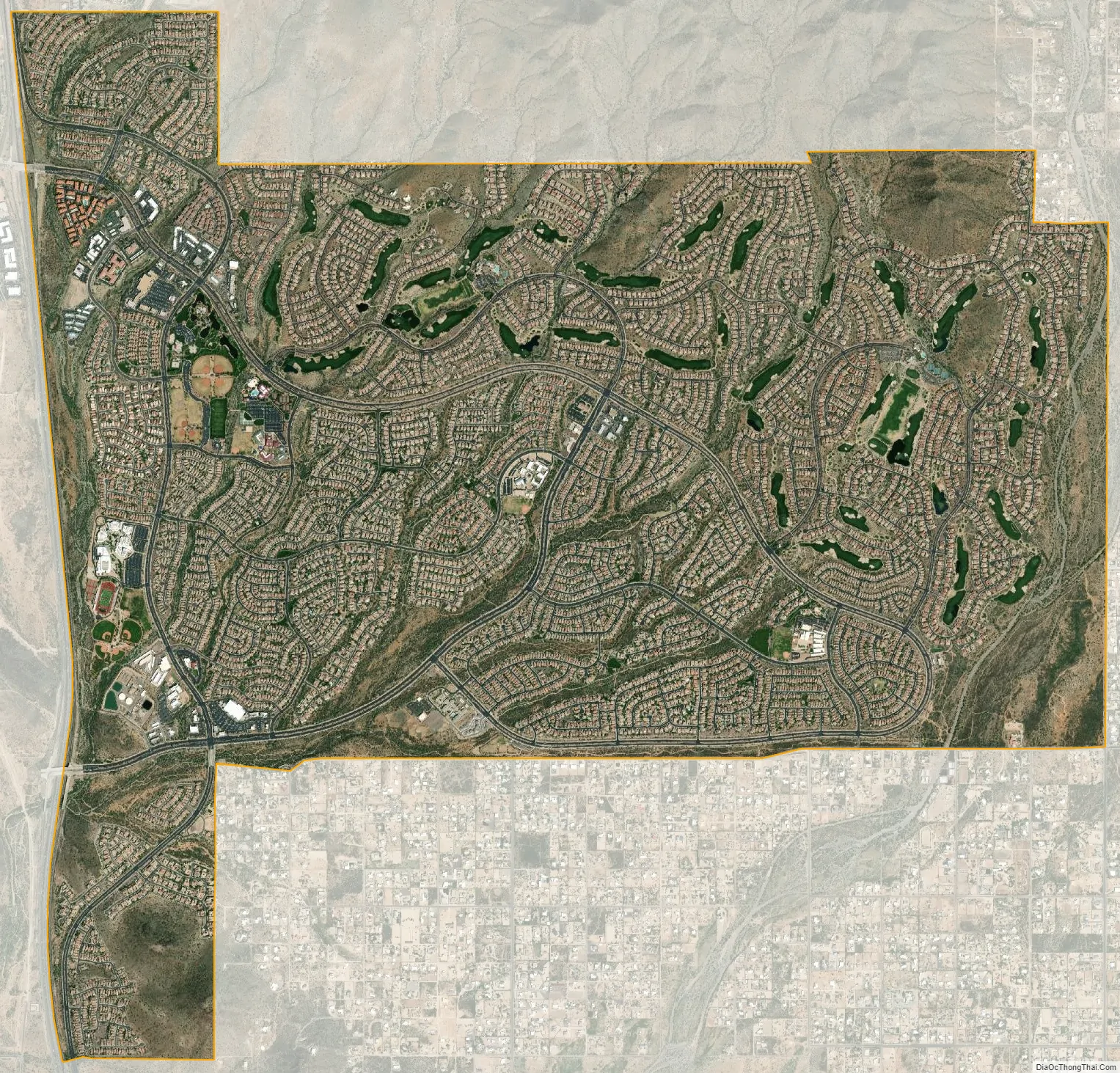
Anthem city Satellite Map
Geography
Anthem is built on 5,856 acres (9.2 sq mi) at the base of Daisy Mountain and Gavilan Peak in northern Maricopa County. The CDP portion of Anthem has an area of 7.9 square miles (20 km). The community’s elevation ranges from 1,760 to 2,428 feet (536 to 740 m), with an average elevation of 1,863 feet (568 m). Approximately 36 percent of the community is preserved as open space, including 291 acres (118 ha) of open hillside.
The community is bordered on the north, east and south by the New River CDP, while the western portion of the community is located within Phoenix city limits.
Climate
Due to its higher elevation in the upper Sonoran Desert, Anthem is slightly cooler and receives a higher level of rainfall than areas of Phoenix to the south.
See also
Map of Arizona State and its subdivision: Map of other states:- Alabama
- Alaska
- Arizona
- Arkansas
- California
- Colorado
- Connecticut
- Delaware
- District of Columbia
- Florida
- Georgia
- Hawaii
- Idaho
- Illinois
- Indiana
- Iowa
- Kansas
- Kentucky
- Louisiana
- Maine
- Maryland
- Massachusetts
- Michigan
- Minnesota
- Mississippi
- Missouri
- Montana
- Nebraska
- Nevada
- New Hampshire
- New Jersey
- New Mexico
- New York
- North Carolina
- North Dakota
- Ohio
- Oklahoma
- Oregon
- Pennsylvania
- Rhode Island
- South Carolina
- South Dakota
- Tennessee
- Texas
- Utah
- Vermont
- Virginia
- Washington
- West Virginia
- Wisconsin
- Wyoming


