Buckeye is a city in Maricopa County, Arizona, United States. It is Arizona’s largest city by area, and it is the westernmost suburb in the Phoenix Metropolitan Area. As of the 2020 census, the population was 91,502, up from 50,876 in 2010, and 6,537 in 2000. It was the fastest-growing city in the United States for 2017, 2018, and 2021.
| Name: | Buckeye city |
|---|---|
| LSAD Code: | 25 |
| LSAD Description: | city (suffix) |
| State: | Arizona |
| County: | Maricopa County |
| Elevation: | 1,076 ft (328 m) |
| Total Area: | 393.16 sq mi (1,018.29 km²) |
| Land Area: | 392.99 sq mi (1,017.83 km²) |
| Water Area: | 0.18 sq mi (0.45 km²) |
| Total Population: | 91,502 |
| Population Density: | 232.84/sq mi (89.90/km²) |
| ZIP code: | 85326, 85396 |
| Area code: | 623, 602, 480, 928 |
| FIPS code: | 0407940 |
| GNISfeature ID: | 2411736 |
| Website: | www.buckeyeaz.gov |
Online Interactive Map
Click on ![]() to view map in "full screen" mode.
to view map in "full screen" mode.
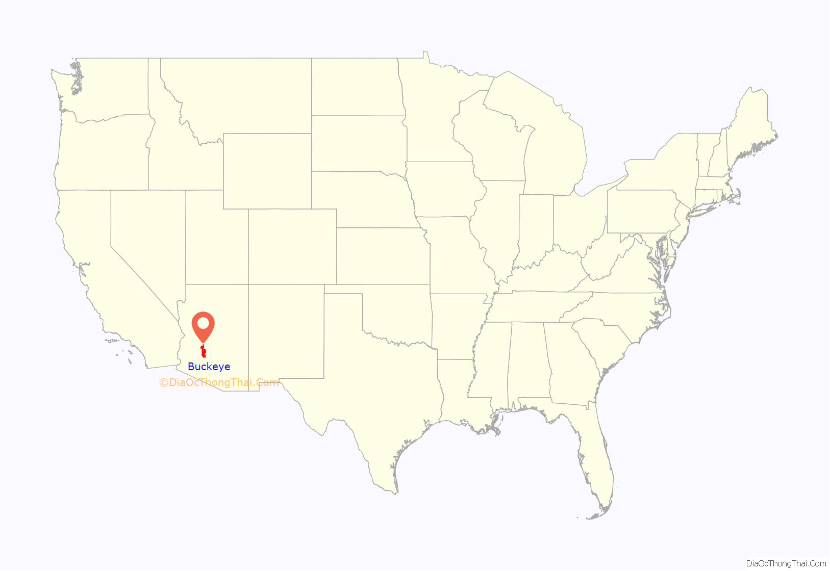
Buckeye location map. Where is Buckeye city?

History
In 1877, Thomas Newt Clanton led a group of six men, three women, and ten children from Creston, Iowa, to Arizona, where they settled in the Buckeye area.
Early settler Malie M. Jackson developed 10 miles (16 km) of the Buckeye Canal from 1884 to 1886, which he named after his home state of Ohio’s moniker, “The Buckeye State”. The town was founded in 1888 and originally named “Sidney“, after Jackson’s hometown in Ohio. However, because of the significance of the canal, the town became known as Buckeye. The name was legally changed to Buckeye in 1910. The town was incorporated in 1929, at which time it included 440 acres (180 ha). The town’s first mayor was Hugh M. Watson (1956–1958), who founded the Buckeye Valley Bank. Today, Watson Road is the site of the city’s commercial center.
In 2008, Buckeye was featured on The NewsHour with Jim Lehrer as part of a week-long series entitled “Blueprint America”.
A vote to designate the town as the City of Buckeye became effective in 2014.
In May 2019, population estimates released by the U.S. Census Bureau placed Buckeye as the fastest growing city in the United States by percentage from 2017–2018, growing by 8.5%.
Buckeye Road Map

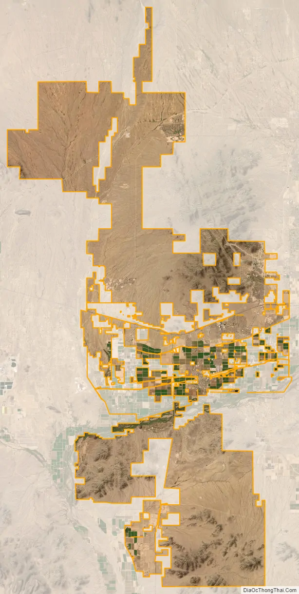
Buckeye city Satellite Map
Geography
Buckeye is located approximately 30 miles (48 km) west of downtown Phoenix in the Buckeye Valley. Interstate 10 passes through the central part of the city, north of the original town center. U.S. Route 80 once passed through the city, while Arizona State Route 85 skirts what was the city’s west edge. The city limits now extend 30 miles (48 km) to the north and 16 miles (26 km) to the south of the original town center.
According to the United States Census Bureau, the city has a total area of 393.2 square miles (1,018.4 km), of which 0.2 square miles (0.52 km), or 0.04%, were listed as water. The Gila River flows westward through the Buckeye Valley south of the center of the city. The Buckeye Hills and Little Rainbow Valley are to the south, beyond which the city limits extend as far as Margies Peak. To the north the city limits include the southern part of the White Tank Mountains and continue north nearly as far as Circle City. The Hassayampa River, a tributary of the Gila, flows southward through the northern part of the Buckeye city limits.
Soils in Buckeye are alkaline and mostly well drained loam or clay loam except in northern neighborhoods such as Verrado, where gravelly sand or sandy loam with varying degrees of excessive drainage are common.
Neighborhoods
The original Buckeye was built around downtown’s main street, Monroe Avenue. There are currently nearly 30 master planned communities planned for Buckeye. Those communities under development in which homes are occupied include Riata West, Sundance, Verrado, Westpark, Tartesso and Festival Ranch.
Other unbuilt planned communities within Buckeye include Douglas Ranch (planned for nearly 300,000 inhabitants), Sun Valley Villages, Spurlock Ranch, Trillium, Elianto, Westwind, Silver Rock, Sienna Hills, Henry Park, Southwest Ranch and Montierre.
Sundance Towne Center, a shopping center developed by Vestar Development in the Sundance community, opened in 2007.
Climate
Buckeye has a hot desert climate (Köppen BWh), with abundant sunshine due to the stable descending air of the eastern side of the subtropical anticyclone aloft and at sea level over the southwestern United States. Summers, as with most of the Sonoran Desert, are extremely hot, with 121.0 afternoons reaching 100 °F or 37.8 °C and 181.6 afternoons reaching 90 °F or 32.2 °C. The record high temperature of 128 °F (53.3 °C) occurred on July 28, 1995, and temperatures above 86 °F or 30 °C may occur in any month. Cooler weather may occasionally occur during summer, but such periods are no less unpleasant as they result from monsoonal weather, with its attendant higher cloudiness and humidity; however, actual rainfall from the monsoon is much more infrequent than in Flagstaff, Nogales or even Tucson. The heaviest daily rainfall has been 4.90 inches (124.5 mm) on September 2, 1894, but between 1971 and 2000 no month had more rainfall than 4.52 inches or 114.8 millimetres in December 1984.
The winter season from November to March is warm to very warm during the day, not much cooler than 68 °F or 20 °C during a typical afternoon, but 20.2 mornings typically fall to or below 32 °F or 0 °C, though no snowfall was recorded during the 1971 to 2000 period, and only twelve afternoons did not reach 50 °F or 10 °C. The coldest temperature recorded in Buckeye was 11 °F or −11.7 °C on January 8, 1913.
See also
Map of Arizona State and its subdivision: Map of other states:- Alabama
- Alaska
- Arizona
- Arkansas
- California
- Colorado
- Connecticut
- Delaware
- District of Columbia
- Florida
- Georgia
- Hawaii
- Idaho
- Illinois
- Indiana
- Iowa
- Kansas
- Kentucky
- Louisiana
- Maine
- Maryland
- Massachusetts
- Michigan
- Minnesota
- Mississippi
- Missouri
- Montana
- Nebraska
- Nevada
- New Hampshire
- New Jersey
- New Mexico
- New York
- North Carolina
- North Dakota
- Ohio
- Oklahoma
- Oregon
- Pennsylvania
- Rhode Island
- South Carolina
- South Dakota
- Tennessee
- Texas
- Utah
- Vermont
- Virginia
- Washington
- West Virginia
- Wisconsin
- Wyoming


