Avondale is a city in Maricopa County, Arizona, United States, adjacent to Phoenix. As of the 2020 census, the population of the city was 89,334, up from 76,238 in 2010 and 35,883 in 2000.
Avondale, incorporated in 1946, has experienced rapid residential and commercial growth in the years since 1980. Once primarily a sparsely populated farming community with many acres of alfalfa and cotton fields, Avondale has transformed into a major bedroom suburb for Phoenix.
Phoenix Children’s Hospital has a satellite facility (the Southwest Valley Urgent Care Center), at the corner of Avondale Boulevard and McDowell Road.
| Name: | Avondale city |
|---|---|
| LSAD Code: | 25 |
| LSAD Description: | city (suffix) |
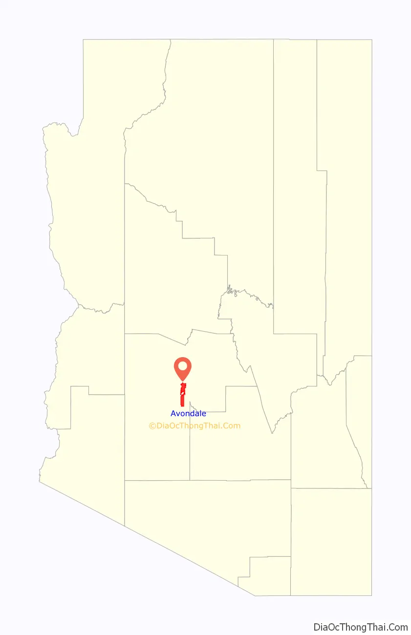
| State: | Arizona |
| County: | Maricopa County |
| Elevation: | 974 ft (297 m) |
| Total Area: | 47.87 sq mi (123.99 km²) |
| Land Area: | 47.62 sq mi (123.33 km²) |
| Water Area: | 0.26 sq mi (0.67 km²) |
| Total Population: | 89,334 |
| Population Density: | 1,876.13/sq mi (724.38/km²) |
| ZIP code: | 85323, 85392 |
| Area code: | 623 |
| FIPS code: | 0404720 |
| GNISfeature ID: | 2409765 |
| Website: | www.ci.avondale.az.us |
Online Interactive Map
Click on ![]() to view map in "full screen" mode.
to view map in "full screen" mode.
Avondale location map. Where is Avondale city?

History
William “Billy” G. Moore, arrived in Arizona in the late 1860s, settling near the Agua Fria River in 1880. Moore called bought land and named his settlement “Coldwater, Arizona” – apparently for both the river, and the water that flowed from a local spring. He served a brief stint as Justice of the Peace for the Agua Fria area. He eventually established a stage stop near Agua Fria crossing, the Coldwater Stage Station in the 1880’s. The state station was one of the very earliest stage stations in the region, supplying travelers with provisions on their way from Tucson to northern Arizona and California. A saloon and a general store was also built, bringing in more commerce for the settlement.
The post office was established in 1896 at a site near Avondale Ranch. From 1901 until 1905, William Moore served as Postmaster of the Coldwater post office. The post office eventually became known as Avondale, taking the name of the nearby ranch, and the name Coldwater was discontinued. In December 1946, the City of Avondale was incorporated.
Subsequent development resulted in a conglomeration of styles and architecture along Western Avenue typical of small western towns, with ranching, the railroad,and cotton farming as main industries. Recently, the city has seen tremendous growth in new development, both residential and commercial, while the Old Town area along Western Avenue preserves the historic business district and safeguards opportunities for small, independent businesses.
Avondale is a modern city, near the heart of the Phoenix-metropolitan area. Over the last decade, population growth took place at a rate of over 114%, making the city one of the fastest-growing in Maricopa County.
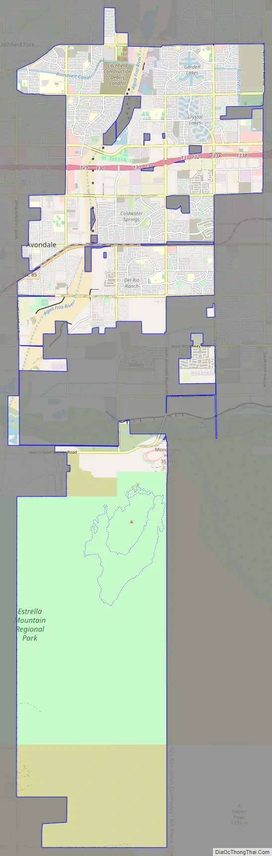
Avondale Road Map
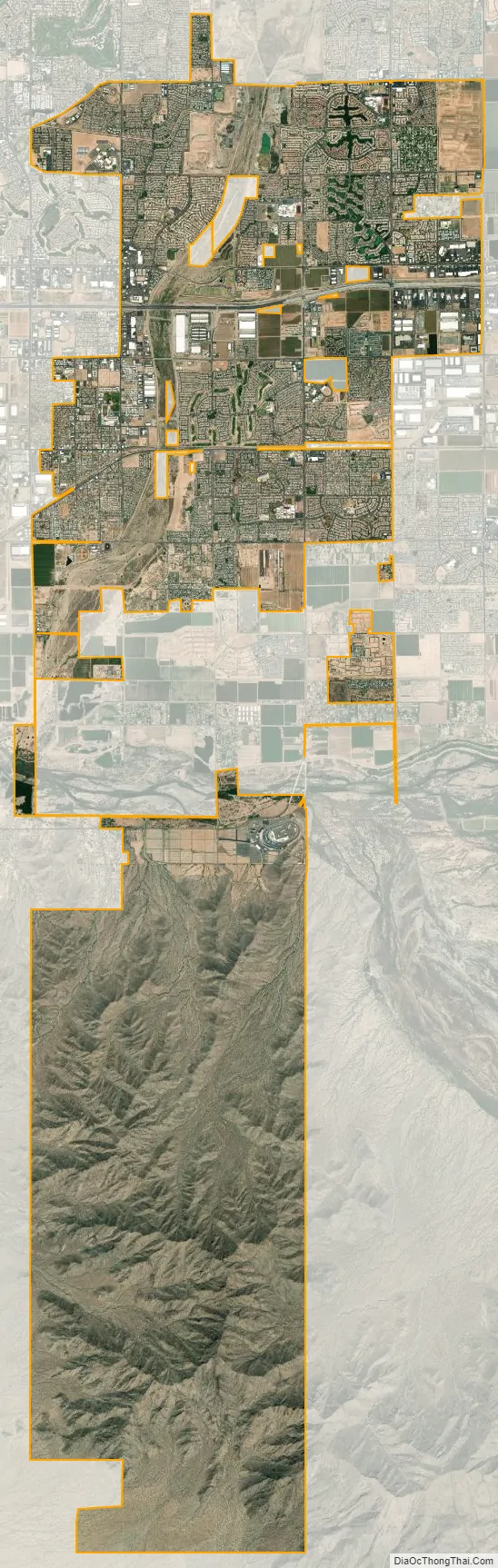
Avondale city Satellite Map
Geography
Avondale is located at 33°26′01″N 112°20′59″W / 33.43361°N 112.34972°W / 33.43361; -112.34972 (33.435322, −112.349758). It is bordered to the west by Goodyear, to the north by Litchfield Park, and to the east by Phoenix and Tolleson.
According to the United States Census Bureau, the city has a total area of 47.9 square miles (124 km), of which 0.3 square miles (0.78 km), or 0.54%, are water. The Gila River crosses the southern part of the city, joined from the north by the Agua Fria River.
Interstate 10 crosses the northern part of Avondale, with access from exits 129 through 133A. The freeway leads east 15 miles (24 km) to Downtown Phoenix and west 134 miles (216 km) to Blythe, California.
See also
Map of Arizona State and its subdivision: Map of other states:- Alabama
- Alaska
- Arizona
- Arkansas
- California
- Colorado
- Connecticut
- Delaware
- District of Columbia
- Florida
- Georgia
- Hawaii
- Idaho
- Illinois
- Indiana
- Iowa
- Kansas
- Kentucky
- Louisiana
- Maine
- Maryland
- Massachusetts
- Michigan
- Minnesota
- Mississippi
- Missouri
- Montana
- Nebraska
- Nevada
- New Hampshire
- New Jersey
- New Mexico
- New York
- North Carolina
- North Dakota
- Ohio
- Oklahoma
- Oregon
- Pennsylvania
- Rhode Island
- South Carolina
- South Dakota
- Tennessee
- Texas
- Utah
- Vermont
- Virginia
- Washington
- West Virginia
- Wisconsin
- Wyoming


