Golden Valley is an unincorporated area and census-designated place (CDP) in Mohave County, Arizona, United States. The population was 8,801 at the 2020 census.
| Name: | Golden Valley CDP |
|---|---|
| LSAD Code: | 57 |
| LSAD Description: | CDP (suffix) |
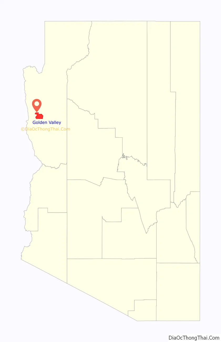
| State: | Arizona |
| County: | Mohave County |
| Elevation: | 2,805 ft (855 m) |
| Total Area: | 78.75 sq mi (203.95 km²) |
| Land Area: | 78.75 sq mi (203.95 km²) |
| Water Area: | 0.00 sq mi (0.00 km²) |
| Total Population: | 8,801 |
| Population Density: | 111.77/sq mi (43.15/km²) |
| ZIP code: | 86413 |
| Area code: | 928 |
| FIPS code: | 0428195 |
| GNISfeature ID: | 1866985 |
Online Interactive Map
Click on ![]() to view map in "full screen" mode.
to view map in "full screen" mode.
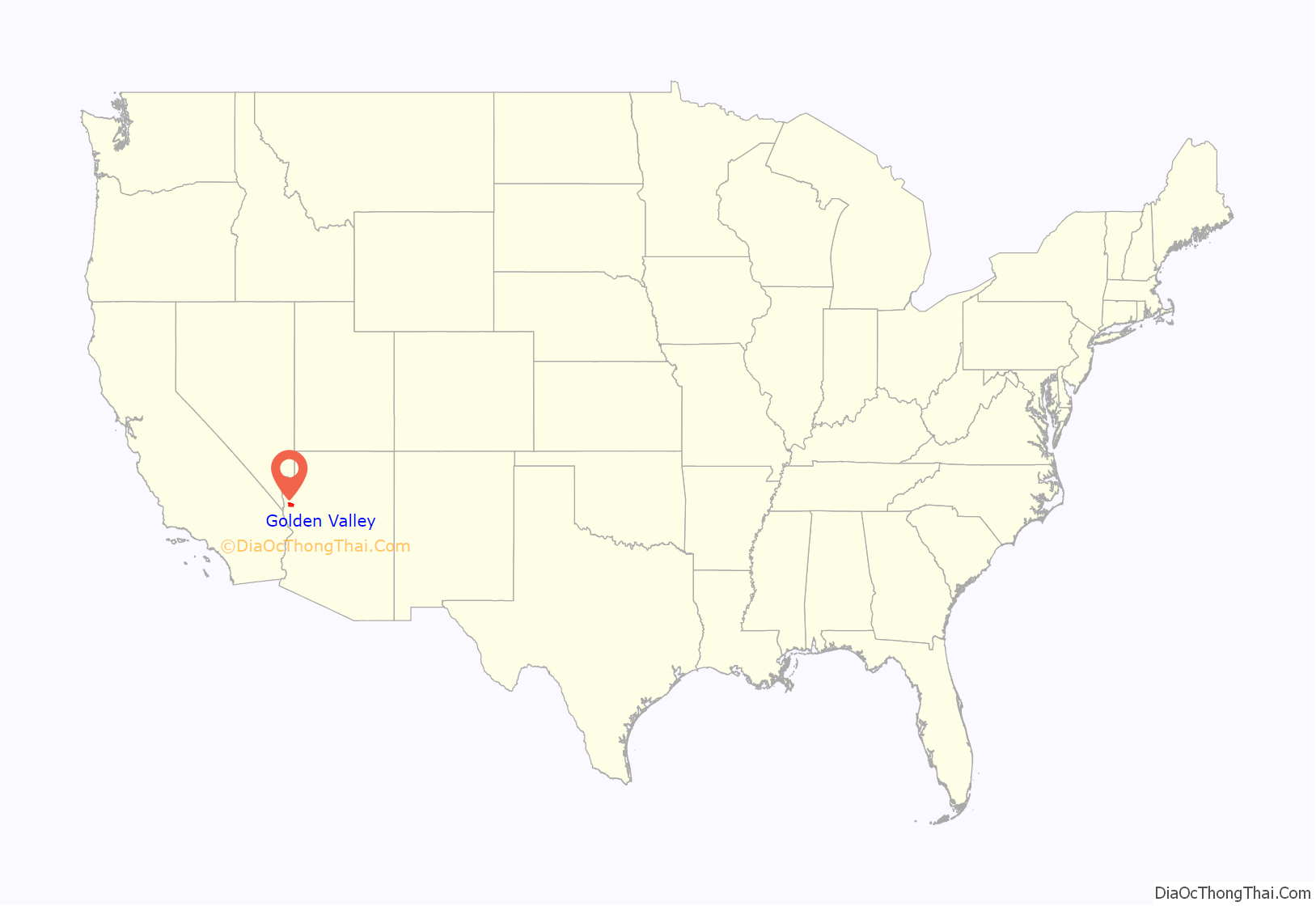
Golden Valley location map. Where is Golden Valley CDP?
History
Golden Valley was named after a company from Hollywood, California, that went into partnership with Crystal Collins to develop most of the land south of Arizona State Route 68 into 2.5-acre (1.0 ha) parcels. The company’s name was Golden Valley Development Company. The land was split into 2.5 acre parcels and sold for $695 each: $10 down and $10 per month.
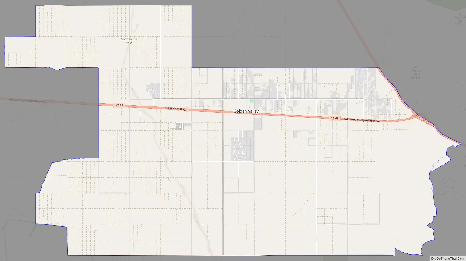
Golden Valley Road Map
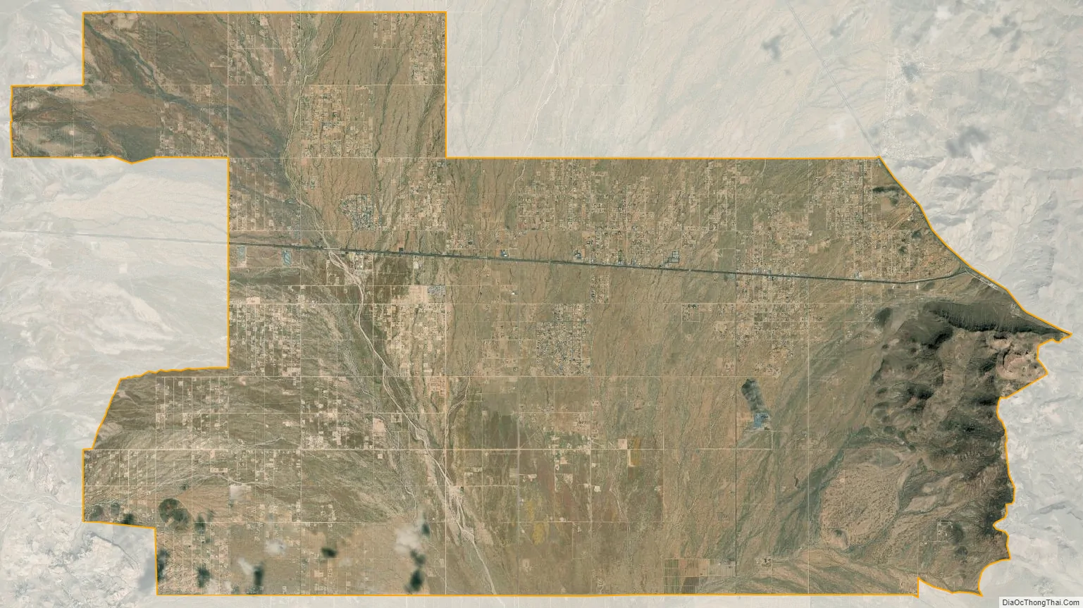
Golden Valley city Satellite Map
Geography
The community of Golden Valley lies in the Sacramento Valley, separated from the larger neighboring cities of Kingman and Bullhead City by the surrounding mountain ranges. State Route 68 runs through the heart of Golden Valley, leading east 10 miles (16 km) to Kingman and west over the Black Mountains 23 miles (37 km) to Bullhead City. At the eastern end of Golden Valley, Arizona 68 terminates at U.S. Route 93, which leads to Kingman to the south, or Las Vegas, Nevada, to the north. The center of the community is at 35°13′23″N 114°12′54″W / 35.22306°N 114.21500°W / 35.22306; -114.21500 (35.223016, -114.214988).
According to the United States Census Bureau, the Golden Valley CDP has a total area 78.7 square miles (204 km), all of it land. The Golden Valley ZIP Code (86413) extends 10 miles (16 km) north and 15 miles (24 km) south of the CDP proper, but all population statistics refer to the CDP area only.
Residents work in Golden Valley, Kingman, Bullhead, Laughlin, Lake Havasu and even as far as Las Vegas.
See also
Map of Arizona State and its subdivision: Map of other states:- Alabama
- Alaska
- Arizona
- Arkansas
- California
- Colorado
- Connecticut
- Delaware
- District of Columbia
- Florida
- Georgia
- Hawaii
- Idaho
- Illinois
- Indiana
- Iowa
- Kansas
- Kentucky
- Louisiana
- Maine
- Maryland
- Massachusetts
- Michigan
- Minnesota
- Mississippi
- Missouri
- Montana
- Nebraska
- Nevada
- New Hampshire
- New Jersey
- New Mexico
- New York
- North Carolina
- North Dakota
- Ohio
- Oklahoma
- Oregon
- Pennsylvania
- Rhode Island
- South Carolina
- South Dakota
- Tennessee
- Texas
- Utah
- Vermont
- Virginia
- Washington
- West Virginia
- Wisconsin
- Wyoming


