Queen Creek is a town in Maricopa and Pinal counties in the state of Arizona. The population was 59,519 as of the 2020 census, up from 26,361 at the 2010 census. It is a suburb of Phoenix, Arizona located in the far southeast area of the Phoenix metropolitan area. In 2023, a large battery factory was scheduled for 2025.
| Name: | Queen Creek town |
|---|---|
| LSAD Code: | 43 |
| LSAD Description: | town (suffix) |
| State: | Arizona |
| County: | Maricopa County, Pinal County |
| Incorporated: | 1989 |
| Elevation: | 1,421 ft (433 m) |
| Total Area: | 40.81 sq mi (105.70 km²) |
| Land Area: | 40.79 sq mi (105.64 km²) |
| Water Area: | 0.02 sq mi (0.06 km²) |
| Total Population: | 59,519 |
| Population Density: | 1,459.26/sq mi (563.43/km²) |
| ZIP code: | 85142 (Queen Creek) 85140 (San Tan Valley) 85212 (Mesa) |
| Area code: | 480 |
| FIPS code: | 0458150 |
| GNISfeature ID: | 2412518 |
| Website: | www.queencreekaz.gov |
Online Interactive Map
Click on ![]() to view map in "full screen" mode.
to view map in "full screen" mode.
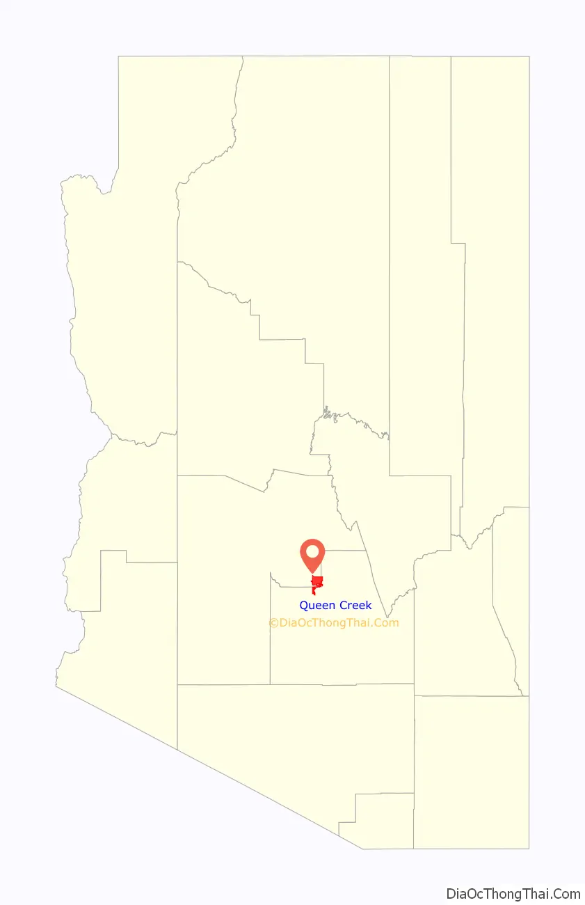
Queen Creek location map. Where is Queen Creek town?

History
From the post office form on file at the National Archives, Queen Creek was originally known as “Rittenhouse”, the community growing up out of a railroad stop. In 1919 the Queen Creek Farms Company was formed by C. H. Rittenhouse, constructing that railroad stop to ship the goods from the farm. Its eponymous creek (now a usually dry arroyo), Queen Creek, flowed through Queen Canyon and was named for the Silver Queen Mine, but it was originally called “Picket Post Creek”.
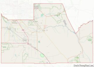
Queen Creek Road Map
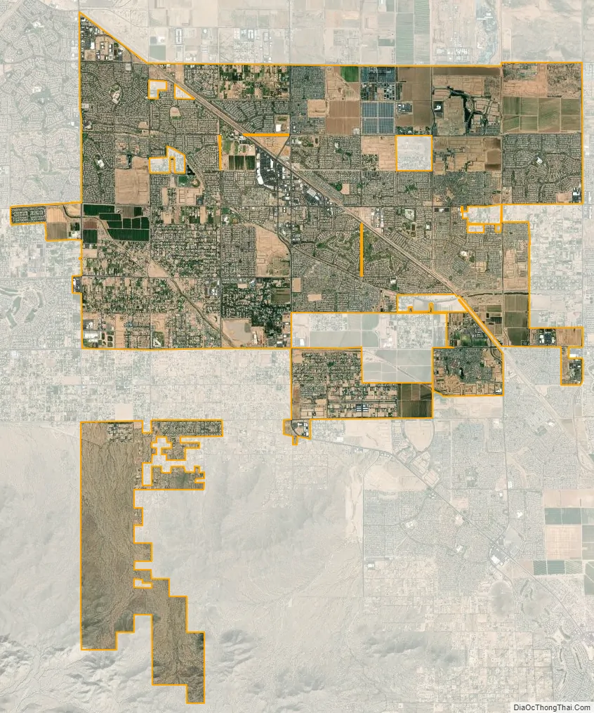
Queen Creek city Satellite Map
Geography
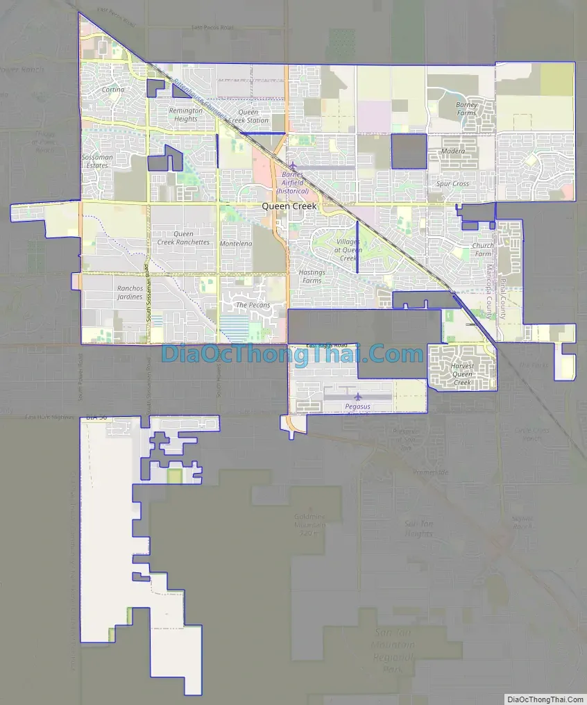
The town of Queen Creek is primarily within Maricopa County, but the town limits extend into Pinal County on the eastern and southern borders. The town is bordered to the south and east in Pinal County by the unincorporated community of San Tan Valley (population 96,692).
According to the United States Census Bureau, the town of Queen Creek has a total area of 40.8 square miles (106 km), of which 0.02 square miles (0.05 km), or 0.06%, are water.
See also
Map of Arizona State and its subdivision: Map of other states:- Alabama
- Alaska
- Arizona
- Arkansas
- California
- Colorado
- Connecticut
- Delaware
- District of Columbia
- Florida
- Georgia
- Hawaii
- Idaho
- Illinois
- Indiana
- Iowa
- Kansas
- Kentucky
- Louisiana
- Maine
- Maryland
- Massachusetts
- Michigan
- Minnesota
- Mississippi
- Missouri
- Montana
- Nebraska
- Nevada
- New Hampshire
- New Jersey
- New Mexico
- New York
- North Carolina
- North Dakota
- Ohio
- Oklahoma
- Oregon
- Pennsylvania
- Rhode Island
- South Carolina
- South Dakota
- Tennessee
- Texas
- Utah
- Vermont
- Virginia
- Washington
- West Virginia
- Wisconsin
- Wyoming