Rio Verde is a master-planned community and census-designated place (CDP) in Maricopa County, Arizona, United States. The population was 2,210 as of the 2020 census, up from 1,811 at the 2010 census.
| Name: | Rio Verde CDP |
|---|---|
| LSAD Code: | 57 |
| LSAD Description: | CDP (suffix) |
| State: | Arizona |
| County: | Maricopa County |
| Elevation: | 1,617 ft (493 m) |
| Total Area: | 4.33 sq mi (11.23 km²) |
| Land Area: | 4.33 sq mi (11.21 km²) |
| Water Area: | 0.01 sq mi (0.01 km²) |
| Total Population: | 2,210 |
| Population Density: | 510.51/sq mi (197.11/km²) |
| ZIP code: | 85263 |
| Area code: | 480 |
| FIPS code: | 0460250 |
| GNISfeature ID: | 37065 |
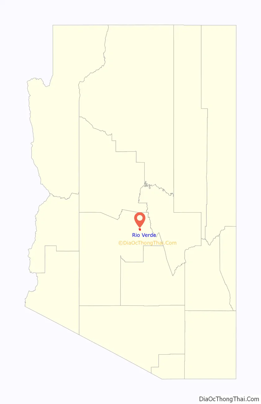
Online Interactive Map
Click on ![]() to view map in "full screen" mode.
to view map in "full screen" mode.
Rio Verde location map. Where is Rio Verde CDP?

History
The area surrounding the Rio Verde community, northeast of Scottsdale, was settled by small farmers in the 1880s, who grew hay and alfalfa to provide for the nearby Fort McDowell US Army camp (1865–1890) (now the Fort McDowell Yavapai Nation). In the late 1890s, Frank Asher and William W. Moore acquired several of the small farm plots on the Verde River, combining them into what became the Box Bar Ranch; Moore later bought out Asher’s interest. After his death in 1929, Moore’s sons, Glen and Lin Moore, operated the Box Bar as a partnership, under the name “Moore Bros Cattle Co.”, with grazing leases both east and west of the Verde River. Lin Moore also ran the X2 Ranch, known as “Moore’s Well”, 12 miles (19 km) to the west, where he and his wife, Ada Lucille, had homesteaded in the 1920s. William Moore’s father, Ransom B. Moore, had emigrated to Arizona from California in 1883 and ranched for many years on the Reno Ranch, just west of the community of Punkin Center in Gila County. Ransom Moore, founder of what is now Banning, California, also served as Gila County’s delegate to the 16th Arizona Territorial Legislative Assembly in 1891.
The “Asher Hills”, overlooking the community to the west, were named for Frank Asher, who had been Glen Moore’s brother-in-law and William Moore’s partner for a time. The granddaughter of Asher’s wife Ella, Jacque Mercer, was selected as Miss Arizona and then Miss America in 1949.
In 1954 the Moore brothers retired from the active cattle business and sold the ranch and their holdings to the Page Land & Cattle Co. (Lin Moore retained the X2 Ranch; after his death in 1960, his widow continued to operate the X2 until selling it in 1970.) The Moores’ descendants, including historian Wyatt James, still reside in Maricopa County. A portion of Lin & Lucille Moore’s homestead property on the foothills to the south, known as “The Ochoa Place”, has recently been incorporated into the expanding McDowell Mountains McDowell Sonoran Preserve.
In 1970, Page Land & Cattle sold ranch land to Rio Verde Development, Inc., which in 1973 began to develop the tract as the master-planned community of Rio Verde. An 18-hole golf course was completed in 1973, and a second in 1981. Both were extensively renovated in 2007.
The unincorporated community’s water is provided through 3 designated aquifers. EPCOR operates the private utility infrastructure they purchased from Rio Verde Utilities in 2018. Rio Verde has nothing to do with Rio Verde Foothills which was provided with water by the City of Scottsdale at cost until January 1, 2023, when the municipal supply was cut due to drought conditions. A planned water district for Rio Verde Foothills was rejected by the Maricopa County Board of Supervisors in August 2022; several residents filed a lawsuit against the City of Scottsdale to resume service.
Rio Verde Road Map
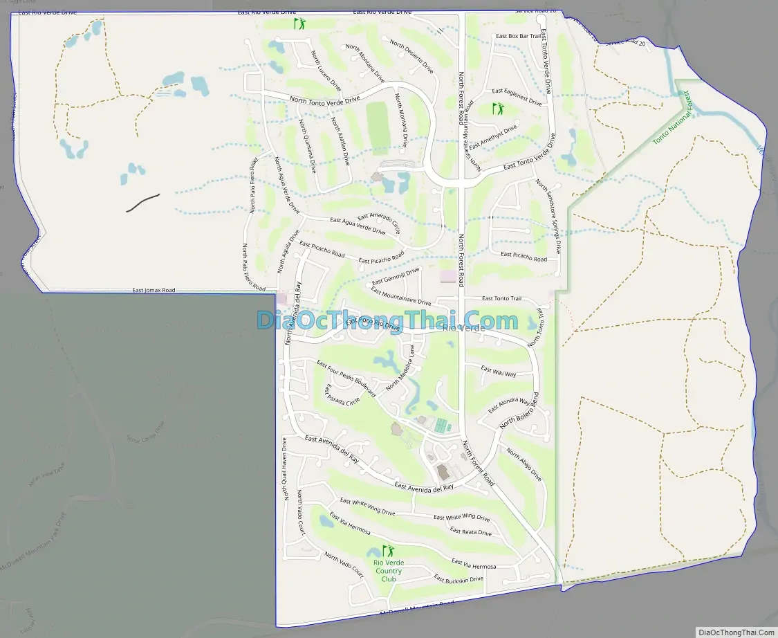
Rio Verde city Satellite Map

Geography
Rio Verde is located in northeastern Maricopa County at 33°43′20″N 111°40′36″W / 33.72222°N 111.67667°W / 33.72222; -111.67667 (33.722236, −111.676673). By road it is 28 miles (45 km) northeast of the historic center of Scottsdale and 37 miles (60 km) northeast of downtown Phoenix.
According to the United States Census Bureau, the CDP has a total area of 4.3 square miles (11 km), all land. The Verde River, a south-flowing tributary of the Salt River, forms the eastern edge of the CDP and is about 0.7 miles (1.1 km) east of the developed community.
See also
Map of Arizona State and its subdivision: Map of other states:- Alabama
- Alaska
- Arizona
- Arkansas
- California
- Colorado
- Connecticut
- Delaware
- District of Columbia
- Florida
- Georgia
- Hawaii
- Idaho
- Illinois
- Indiana
- Iowa
- Kansas
- Kentucky
- Louisiana
- Maine
- Maryland
- Massachusetts
- Michigan
- Minnesota
- Mississippi
- Missouri
- Montana
- Nebraska
- Nevada
- New Hampshire
- New Jersey
- New Mexico
- New York
- North Carolina
- North Dakota
- Ohio
- Oklahoma
- Oregon
- Pennsylvania
- Rhode Island
- South Carolina
- South Dakota
- Tennessee
- Texas
- Utah
- Vermont
- Virginia
- Washington
- West Virginia
- Wisconsin
- Wyoming


