Scottsdale is a city in the eastern part of Maricopa County, Arizona, United States, and is part of the Phoenix metropolitan area. Named Scottsdale in 1894 after its founder Winfield Scott, a retired U.S. Army chaplain, the city was incorporated in 1951 with a population of 2,000. At the 2020 census, the population was 241,361, which had grown from 217,385 in 2010. Its slogan is “The West’s Most Western Town”. Over the past two decades, it has been one of the fastest growing cities in the United States.
Scottsdale is 31 miles from its Northern to Southern-most edge, and covers 184.5 square miles. The city is bordered by the city of Phoenix to the West, Tonto National Forest to the North, the McDowell Mountains to the East, and the Salt River to the South.
| Name: | Scottsdale city |
|---|---|
| LSAD Code: | 25 |
| LSAD Description: | city (suffix) |
| State: | Arizona |
| County: | Maricopa County |
| Incorporated: | 1951 |
| Elevation: | 2,165 ft (660 m) |
| Total Area: | 184.44 sq mi (477.70 km²) |
| Land Area: | 184.00 sq mi (476.57 km²) |
| Water Area: | 0.44 sq mi (1.14 km²) |
| Total Population: | 241,361 |
| Population Density: | 1,311.72/sq mi (506.46/km²) |
| ZIP code: | 85250–85271 |
| Area code: | 480 |
| FIPS code: | 0465000 |
| Website: | www.scottsdaleaz.gov |
Online Interactive Map
Click on ![]() to view map in "full screen" mode.
to view map in "full screen" mode.
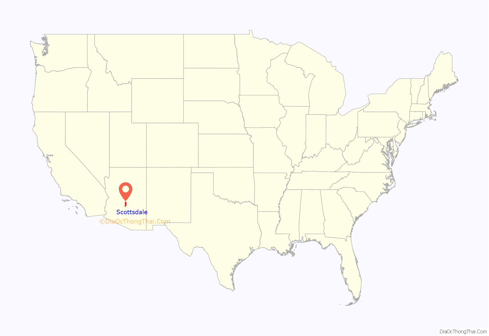
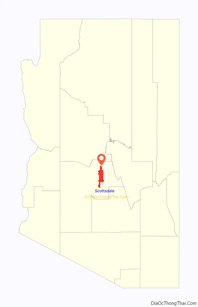
Scottsdale location map. Where is Scottsdale city?
History
Early history
Scottsdale was originally a Pima village known as Vaṣai S-vaṣonĭ, meaning “rotting hay”. Some Pima people remain there today. Until the late 1960s, there was a still-occupied traditional dwelling on the southeast corner of Indian Bend Road and Hayden Road. The Pima who live in Scottsdale today reside in modern houses, not traditional dwellings. Many Pima and Maricopa people live in the Salt River Pima-Maricopa Indian Community, which borders Scottsdale to the south and east.
Early history and establishment
In the early to mid-1880s, U.S. Army Chaplain Winfield Scott visited the Salt River Valley and was impressed with it and its potential for agriculture. Returning in 1888 with his wife, Helen, he purchased 640 acres (260 ha) where historic Old Town is now, for $3.50 an acre ($92 as of 2015) . Another landowner in the Southern part of town, Albert G. Utley, filed plans with Maricopa County for a city named “Orangedale,” using Scott’s Field as a border. When the newspaper, then called the Arizona Republican, published an article about the plan, they erroneously called the town “Scottsdale.” The article drew some publicity for the town, and ultimately this convinced Utley to change his filing and officially name the town “Scottsdale.”
In 1896, the Scottsdale Public School system was established, and opened the first schoolhouse, which was followed by the opening of the first general store by J. L. Davis, which also housed the first post office for Scottsdale in 1897. In the early 1900s the community supported an artists and writers culture, culminating in the opening of the region’s first resort in 1909, the Ingleside Inn, just south of the Arizona Canal and west of the Crosscut Canal (Indian School Road at about 64th Street) in what is today Scottsdale. Also in 1909, Cavalliere’s Blacksmith Shop opened in downtown Scottsdale, and the original schoolhouse was replaced by the much more expansive Little Red Schoolhouse, which stands to this day. While not in its original building, Cavalliere’s has been in continuous operation since that time.
In 1912, both the Phoenix Street Railway Company and a competitor, the Salt River Valley Electric Railway Company, proposed building streetcar lines to Scottsdale, but due to an economic downturn, neither was built.
Between 1908 and 1933, due to the construction of the Granite Reef and Roosevelt dams (in 1908 and 1911, respectively), Scottsdale’s population experienced a boom, growing steadily during those years. It became a small market town providing services for families involved in the agricultural industry.
During the First World War, Scottsdale and its environs supported a large cotton farming industry, due to the creation of Long Staple Egyptian Cotton, developed by the US Department of Agriculture. Cotton is still grown in southern Arizona, but Scottsdale’s cotton boom ended with the loss of government contracts at the end of the war.
In 1920, a second resort was opened on 12 acres (4.9 ha) of property owned by the artist Jessie Benton Evans. Called the Jokake Inn, meaning “mud house”, the structure still stands on the grounds of the Phoenician Resort.
The Depression years saw an influx of artists and architects to Scottsdale, which included, in 1937, Frank Lloyd Wright. Wright and his wife purchased 600 acres (240 ha) acres of desert at the foot of the McDowell Mountains and established Taliesin West, his winter home and his architectural firm’s southwestern headquarters. Scottsdale and the rest of Phoenix have seen an everlasting influence from Wright. Many buildings throughout the region were designed by him. His influence on the regional architecture is commemorated by a major street bearing his name and a 125-foot (38 m) spire memorial designed by Wright in North Scottsdale.
World War II
Among the more significant events during the years of World War II was the opening of Thunderbird II Airfield in 1942 (it later became Scottsdale Airport), where 5,500 pilot cadets received their primary flight training before the war’s end. Scottsdale was the site of a German POW camp at the intersection of Scottsdale and Thomas Roads in what today is Papago Park.
Development of Indian Bend Wash, 1950s–1970s
In 1950, the town continued to grow as Motorola became the first of many technology companies to build a plant in Scottsdale. It built a second plant in 1956. With a population of approximately 2,000, the city was incorporated on June 25, 1951. It appointed its first mayor, Malcolm White, and adopted the motto “The West’s Most Western Town”. The seal, depicting a mounted cowboy surrounded by a 64-pointed starburst, was designed by Mrs. Gene Brown Pennington. The city also became a tourist destination with the opening of the city’s first modern resorts, the Hotel Valley Ho and the Safari Hotel, in 1956.
The town began a period of rapid population growth after its incorporation in 1951, growing from 2,000 to 10,000 residents during the 1950s. This growth necessitated development into the floodplain known as the Indian Bend Wash. Floodplains throughout history have been enticing locations for development due to their flatness, ease of building and inexpensiveness. This is even more tempting in a desert, where flooding so rarely happens. As Scottsdale expanded, the north-south Indian Bend Wash virtually bisected the city. In the late 1950s, the problem became more and more pronounced, until in 1959 the Arizona State Legislature formed the Maricopa County Flood Control District (MCFCD). The MCFCD became the lead player in developing a comprehensive flood plan for the entire county.
At the same time, the United States Army Corps of Engineers began to look into flooding in Maricopa County. Over the next several years, it presented several plans, which all revolved around constructing concrete canals and levees to channel and divert the floodwaters, as well as building bridges over the canal, similar to the storm drains of Los Angeles. But during MCFCD meetings between 1961 and 1963, a different course of action was developed. This plan became known as the multi-use, or Greenbelt, concept. The two concepts were at odds with one another until the canal plan was defeated in a bond referendum in 1965. In 1966, a study was commissioned that validated the Greenbelt concept as a way to prevent flood damage. After a major flood in 1972, work on the Greenbelt project began in earnest. It was completed in 1984, although minor projects continue. Today, the 12-mile-long (19 km) Scottsdale Greenbelt connects four city parks—Vista del Camino Park, Eldorado Park, Indian School Park and Chaparral Park—through a 25-mile (40 km) bike path.
Further expansion and development, 1970s–1980s
The city continued to grow in the 1960s and 1970s, the population reaching almost 68,000 by 1970. Most of the unused property within the city limits was to the north, so that was the direction in which the city expanded. The city, which in 1959 had spanned 5 sq mi (13 km), expanded its borders to encompass 62 sq mi (160 km). Large ranch tracts covered huge areas in the northern part of the city. One of the largest of these was the McCormick ranch, a 4,236-acre (1,714 ha) ranch serving much of the eastern boundary of Scottsdale owned by Fowler and Anne McCormick. Fowler’s paternal grandfather was Cyrus McCormick, the inventor of the grain reaper, and his maternal grandfather was John D. Rockefeller. When Anne died in 1970, the property was sold to Kaiser-Aetna for $12.1 million. This started a series of large-scale, master-planned communities within Scottsdale’s borders, including Scottsdale Ranch (1978), Gainey Ranch (1980), McDowell Mountain Ranch (1992), Desert Mountain (1986), and DC Ranch (1990s).
In 1975, the city annexed the “east Shea” section, bordering Fountain Hills, expanding its area from 62.2 to 88.6 sq mi (161 to 229 km). This was followed by a four-year period from 1981 to 1984 during which the city annexed an additional (almost) 80 sq mi (210 km).
Faced with this rapid expansion and growth, many residents became concerned about losing their southwestern scenery. The McDowell Sonoran Conservancy was born in 1991. Teaming with developers, a plan was developed to set aside the McDowell Mountains and adjoining areas in a huge preserve. In 1995, Scottsdale’s citizens voted to implement a sales tax to purchase acreage for this purpose. When completed, the 36,000 acres (15,000 ha) planned for the McDowell Sonoran Preserve will be nearly one-third of Scottsdale’s land area, equal in size to Bryce Canyon National Park.
Modern
From its official incorporation in 1951 with a population of 2,000, Scottsdale has grown to a 2020 census count of 241,361. It is now the state’s seventh-largest city. Scottsdale is commonly defined by its high quality of life, and in 1993 was one of several cities to receive a “Most Livable City” award from the United States Conference of Mayors. The Scottsdale Airpark, surrounding the city’s airport, became a hotspot for a variety of large and small businesses, ranging from light industry to luxury auto sales. The Airpark in the 2000s emerged as one of the top employment centers in the Phoenix metro area. The airport supported 3,462 jobs, which boosted the Scottsdale economy.
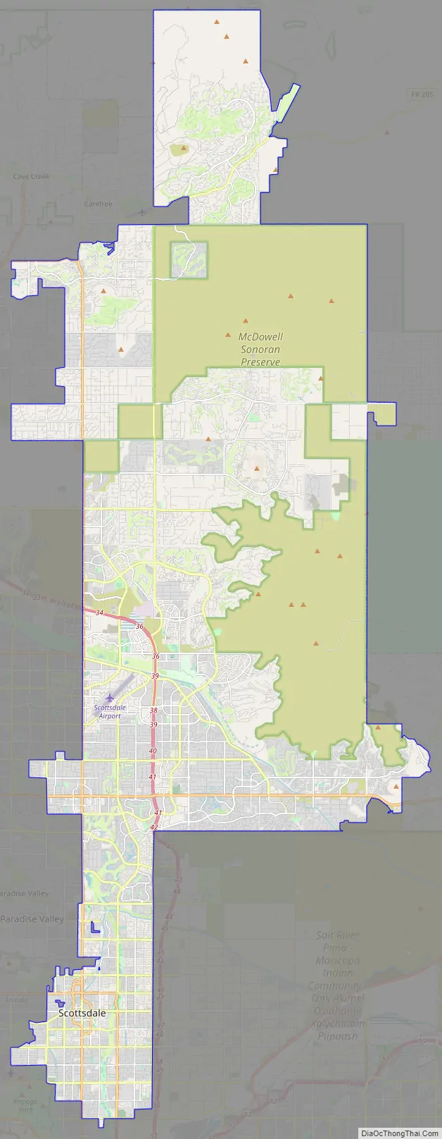
Scottsdale Road Map
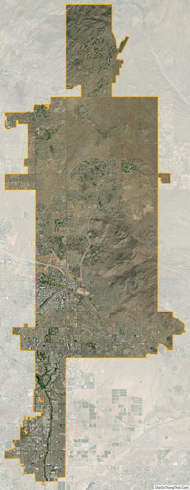
Scottsdale city Satellite Map
Geography
The city is in the Salt River Valley, or the “Valley of the Sun”, in the northern reaches of the Sonoran Desert. Scottsdale, 31 mi (50 km) long and 11.4 mi (18.3 km) wide at its widest point, shares boundaries with many other municipalities and entities. On the west, Scottsdale is bordered by Phoenix, Paradise Valley, and unincorporated Maricopa County land. Carefree is along the eastern boundary, as well as sharing Scottsdale’s northern boundary with the Tonto National Forest. To the south Scottsdale is bordered by Tempe. The southern boundary is also occupied by the Salt River Pima-Maricopa Indian Community, which extends along the eastern boundary, which also borders Fountain Hills, the McDowell Mountain Regional Park and more unincorporated Maricopa County land. The highest point is Butte Peak at an elevation of 4,890 ft.
According to the United States Census Bureau, the city has an area of 184.4 square miles (478 km), of which 0.4 square miles (1.0 km), or 0.24%, are water.
Environmental issues
From the 1950s to the 1970s, several large manufacturing companies in the Scottsdale and Tempe areas used the solvent trichloroethylene (TCE) in their manufacturing and operating processes. In 1981, TCE began to show up in two Scottsdale drinking wells, and in 1983, the Indian Bend Wash superfund site was listed on the Environmental Protection Agency’s National Priorities List. Physical construction of environmental remediation systems was completed by 2006, with soil cleanup expected to be completed in five years and groundwater cleanup in 30 years.
The city developed one of the first automated garbage trucks in 1969, replacing crews who dumped cans into a train of open trailers pulled by a truck, with a single operator sitting in an air conditioned cab.
Cityscape
The city is loosely divided into four areas: South Scottsdale (McKellips Road north to Thomas Road), Old Town (Downtown) Scottsdale, Central Scottsdale (also known as the “Shea Corridor,” extending from Camelback Road north to Shea Boulevard), and North Scottsdale.
South Scottsdale has for many years been the working-class neighborhood. The median resale home price is US$291,500, compared to $667,450 in North Scottsdale. Part of McDowell Road in South Scottsdale used to be known as “Motor Mile,” having at one time 31 dealerships on the street. The strip at one time generated over $10 million in sales tax revenue each year and was one of the most profitable auto-miles in the United States. In recent years, many of these dealerships have left the city, including 6 in 2008 alone. South Scottsdale is the home to a new research center for Arizona State University known as SkySong, a collaboration between the university, local business, and global companies. The development has attracted the research and development arms of a number of international corporations.
Old Town Scottsdale is an area with many streets, old-fashioned stores, restaurants, bars, nightclubs, and art galleries. It contains the major nightlife for the area and is a major art center of metro Phoenix. Scottsdale’s main cultural district is also in this area, which includes the high-end Scottsdale Fashion Square, one of the country’s 20 largest malls. The district has seen a revival, with new condominiums and hotels under construction.
The Shea Corridor is so named because it is in close proximity to the east-west Shea Boulevard. The houses in this region were generally built during the 1970s. Real estate in the Shea Corridor (Central Scottsdale) has increased during the 1990s, and overall, the Phoenix-Mesa-Scottsdale real estate market saw the largest gain in house prices in the nation during the mid-2000s with a 38.4% increase in value. A number of communities in this central region of Scottsdale remain among the most highly desired residential areas in the metropolitan area, including Gainey Ranch and McCormick Ranch. A large portion of Scottsdale Road in the Shea Corridor has been dubbed the Resort Corridor for the high number of resorts on the street. The second Ritz Carlton in the Phoenix metropolitan area will be along this corridor.
North Scottsdale is the most actively developed area of Scottsdale, as it was historically the least built up. This part of the city also claims many of the most expensive houses in Arizona, with many exceeding $5 million in value. The city’s borders are rapidly expanding to the east and west in this area, containing the McDowell Mountain range. Much of the residential boom in North Scottsdale is driven by available land to build coupled with the fast growth of Scottsdale Airpark, the second largest employment center in the Phoenix metropolitan, and estimated to become the largest by 2010. The Scottsdale Airpark, home to over 55,000 employees, 2,600 businesses and 23,000,000 square feet (2,100,000 m) of office space is expected to continue growing by over 3,000 employees per year. Many important companies are headquartered or have regional headquarters in the park, including Acronis, AXA, GE Capital, DHL, Discount Tire Company, Fidelity Investments, Blue Yonder, GoDaddy.com, The Vanguard Group and Quicken Loans.
Climate
Scottsdale’s climate is arid. Winters are mild to warm and summers are extremely hot. The lowest temperature ever recorded in the city is 16.0 °F (−8.9 °C), on January 7, 1913, and the highest was 122 °F (50 °C), on June 26, 1990.
See also
Map of Arizona State and its subdivision: Map of other states:- Alabama
- Alaska
- Arizona
- Arkansas
- California
- Colorado
- Connecticut
- Delaware
- District of Columbia
- Florida
- Georgia
- Hawaii
- Idaho
- Illinois
- Indiana
- Iowa
- Kansas
- Kentucky
- Louisiana
- Maine
- Maryland
- Massachusetts
- Michigan
- Minnesota
- Mississippi
- Missouri
- Montana
- Nebraska
- Nevada
- New Hampshire
- New Jersey
- New Mexico
- New York
- North Carolina
- North Dakota
- Ohio
- Oklahoma
- Oregon
- Pennsylvania
- Rhode Island
- South Carolina
- South Dakota
- Tennessee
- Texas
- Utah
- Vermont
- Virginia
- Washington
- West Virginia
- Wisconsin
- Wyoming


