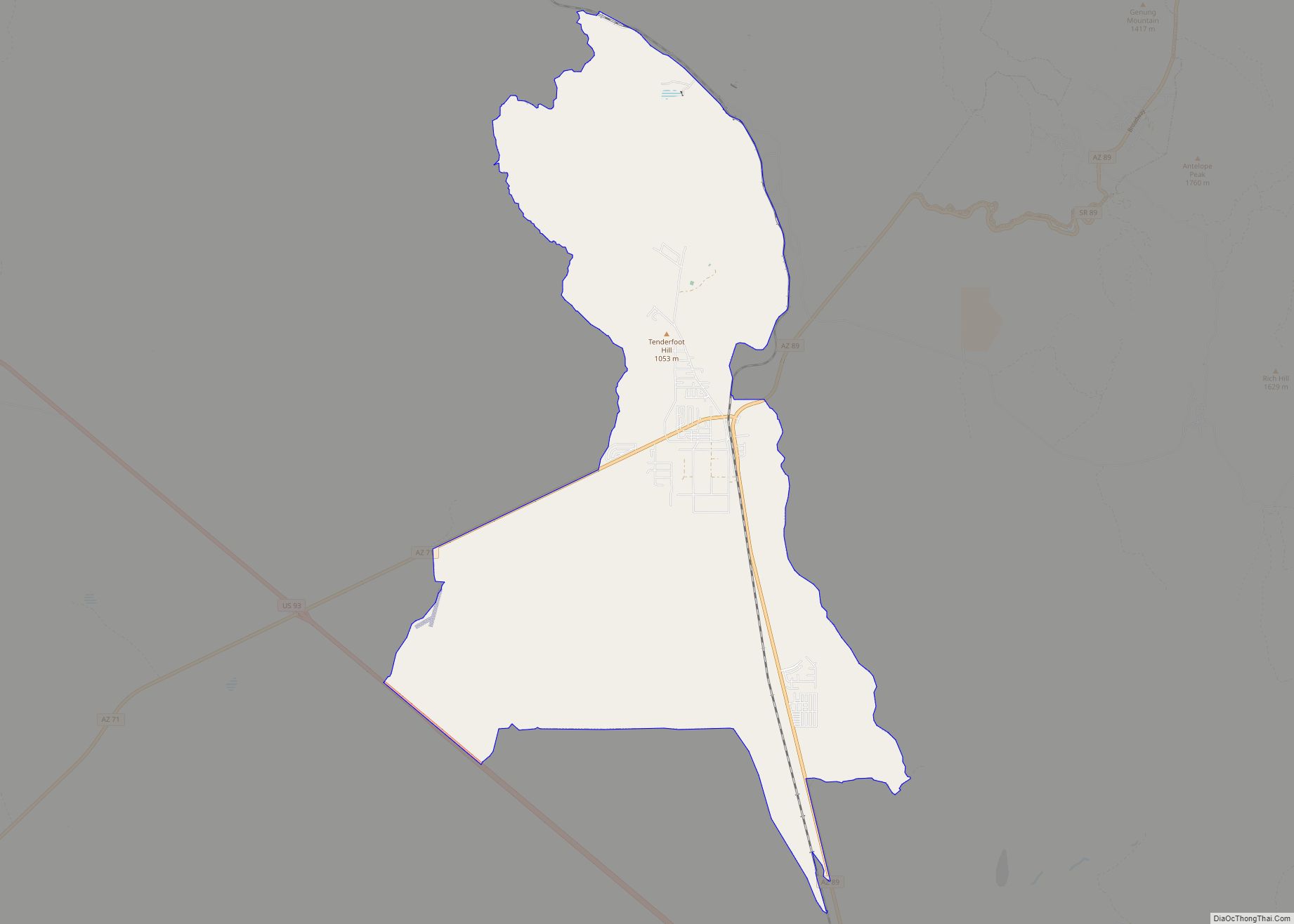
Seligman (Havasupai: Thavgyalyal) is a census-designated place (CDP) on the northern border of Yavapai County, in northwestern Arizona, United States. The population was 456 at the 2020 census.
| Name: | Seligman CDP |
|---|---|
| LSAD Code: | 57 |
| LSAD Description: | CDP (suffix) |
| State: | Arizona |
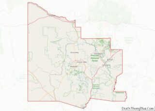
| County: | Yavapai County |
| Elevation: | 5,242 ft (1,598 m) |
| Total Area: | 6.42 sq mi (16.62 km²) |
| Land Area: | 6.42 sq mi (16.62 km²) |
| Water Area: | 0.00 sq mi (0.00 km²) |
| Total Population: | 446 |
| Population Density: | 69.52/sq mi (26.84/km²) |
| ZIP code: | 86337 |
| Area code: | 928 |
| FIPS code: | 0465420 |
| GNISfeature ID: | 11070 |
Online Interactive Map
Click on ![]() to view map in "full screen" mode.
to view map in "full screen" mode.
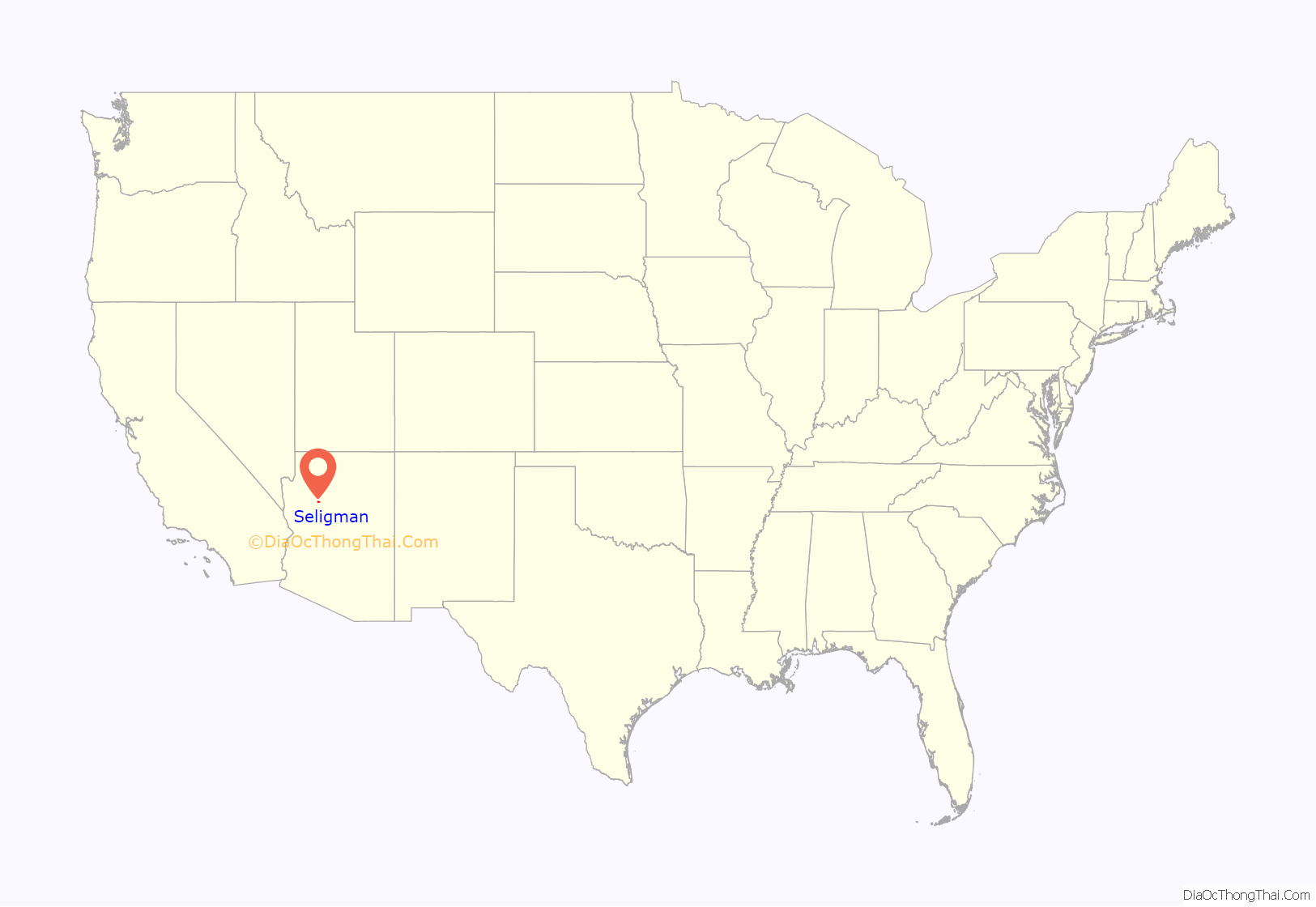
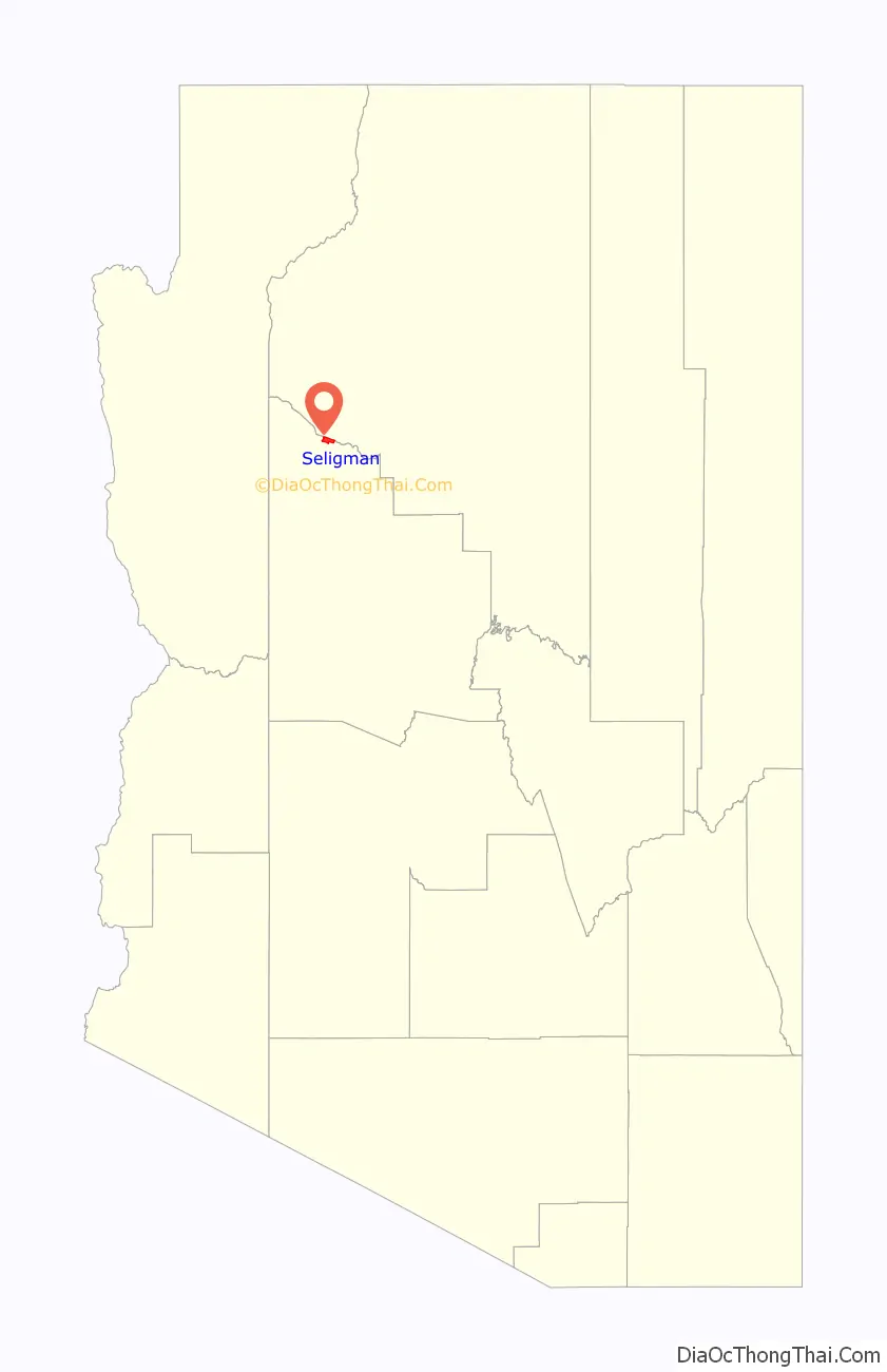
Seligman location map. Where is Seligman CDP?
History
The region was in the longtime homeland of the Havasupai people, who had a settlement in the present day Seligman area. The town site was on Beale’s Wagon Road, and a stage stop on the Mojave Road
Originally, Seligman was called “Prescott Junction” because it was the railroad stop on the Santa Fe mainline junction with the Prescott and Arizona Central Railway Company feeder line running to Prescott, in the Arizona Territory. The Atchison, Topeka and Santa Fe Railway (AT&SF) had reached it in 1882. In 1886 it was renamed Seligman, after Jesse Seligman, one of the founders of J. & W. Seligman & Co. of New York, who helped finance the railroad lines in the area. The original feeder line to Prescott was replaced in 1891 by the Santa Fe, Prescott and Phoenix Railway with the Santa Fe mainline junction at Ash Fork instead.
Because of its flat land Seligman became a large switching yard consisting of many tracks, and served as a large livestock shipping center for the areas ranchers. It was also a terminal point for changing train crews between Winslow and Needles, who used overnight cottages in the town.
Havasu Harvey House
The “Havasu House” was a Fred Harvey Company Harvey House hotel and restaurant in Seligman, serving the Santa Fe Railway and local residents. It was named “Havasu” after the native Havasupai tribe of the area. Adjacent to it was the Santa Fe Depot and Reading Room. The Havasu Harvey House opened in 1905, closed in 1954, and was demolished in 2008.
Passenger trains ceased stopping in Seligman in 1984. The Burlington Northern Santa Fe Railway (BNSF) has owned the tracks through town since 1996, which carries numerous freight trains and nonstop Amtrak trains. The former Santa Fe Reading room is now located at the Seligman High School.
Route 66 – Seligman Commercial Historic District
The Seligman Commercial Historic District is a historic district in central Seligman. The historic district is along historic Route 66 in town, which was designated a historic highway by the state of Arizona in 1978. The Seligman Commercial Historic District was placed on the National Register of Historic Places in 2005.
The Seligman was on the original U.S. Route 66 from 1926 through 1978, when Interstate 40 bypassed it a few miles south. Seligman experienced its real heyday after World War II, when returning veterans and other motorists hit the road and made the Southwest a popular tourist destination. The Seligman Commercial Historic District is roughly bounded by 1st and Lamport Sts. and Picacho and Railroad Aves. It was added to National Register of Historic Places on February 1, 2005, reference #04000511. The Seligman Commercial Historic District protects the historical central area’s early 20th century commercial buildings along Historic Route 66, a revived popular tourist destination. Historic district contributing properties include the Pitts General Merchandise Store and the U.S. Post Office from 1903, the Pioneer Hall and Theatre and the Seligman Garage from 1905, and the Seligman Pool Hall from 1923.
In 1987 Seligman gained its name “Birthplace of Historic Route 66” due to the efforts of Seligman residents, who convinced the State of Arizona to dedicate Route 66 a historic highway. Seligman is the first stop heading west on the longest uninterrupted stretch of historic Route 66, running around 160 miles (260 km) to Topock on the east side of the Colorado River. (Note: this claim is about the historical Route 66 and is not to be construed as “the Birthplace of Route 66”. Route 66 was established by the U.S. Congress on November 26, 1926, starting in Chicago, Illinois and ending in Los Angeles, California. The first sign recognizing this designation was posted in Springfield, Missouri on April 30, 1926, and it took over a decade to pave the full route in its entirety.)
Pictured are some of the contributing structures in the Seligman Commercial Historic District and the historic Route 66. Also, pictured are some of the historical structures outside of the Seligman Commercial Historic District zone, some of which are individually listed in the National Register of Historic places.
- The Snow Cap Drive-In – built in 1953 by Juan Delgadillo and family with scrap lumber that Juan collected while working for the Santa Fe Railway.
- The Shell Gas Station, Olson’s Shell, The Road Trip Museum/Return to the 50s, Return to the 50s Gift Shop – built in 1961, this building, renamed various times, was one of the locations of the bus stop, when Greyhound buses still stopped in Seligman.
- Miller’s Dry Cleaners, Rainbow Café, Seligman Supply, The Rusty Bolt– built in 1933, this building has been used as a dry-cleaners, a 24-hour restaurant, a hardware store, and a curio shop.
- The Thunderbird Indian Store, Rusty Bolt Antiques, Private Residence, Rusty Bolt Gift Shop – built in 1955 by Reginald Sander. This building was merged with old Miller’s Dry Cleaning building to make the large building that houses the Rusty Bolt that you see today.
- The Copper Cart – built in 1952, is now a store and no longer the classic diner it once was.
- Pioneer Hall Theatre/Dancehall Ted’s Fountain “Famous for Malts” and Historic Seligman Sundries – built in 1905, this building was originally a theater and dance hall. In 1930, it was then converted to a drug store and fountain soda shop. It is now a coffee house and curio shop.
- The Black Cat Bar – rebuilt in 1963, it was once called “Jolly’s Black Cat Café”
- The Pitts & Washington Central Commercial building – built in 1903 by Jim Pitts. In recent years the building has been used as a variety store and an antique stove store.
- Canyon Shadows Motel, Comfort Lodge, Canyon Lodge – built in 1963 and as noted had undergone various name changes
- Donovan’s Garage / Texaco Station (Donovan’s 1-Stop Shop) 1936 Wilkinson Motors / Texaco / Ford Dealership B&R Car Care / Texaco Goldsmith Motors (Ford Agency) B&B Automotive Seff Feed Store.
- The Aztec Motel – the original building was built in 1935 and the additions in 1955.
- The Atchison, Topeka & Santa Fe Railway Company reading room – built in 1899. The building is currently located within the school grounds of Seligman.
- The Cottage Hotel – built in 1910, was listed in the National Register of Historic Places on February 12, 1998, and located at 1st Street and Shoney Avenue.
- The Sheriff Commodore Perry Owens house and bar – Owens resided in Seligman and opened a bar after he retired from law enforcement. He was a lawman and gunfighter of the Old West. One of his many exploits was the Owens-Blevins Shootout in Arizona Territory during the Pleasant Valley War.
Seligman Depot
At the western end of the town, directly west of the Roadkill Cafe, is a western town facade labeled “Seligman Depot” It includes 5 storefronts: A Livery, a “Tonsorial Parlor” (dentist), a hotel, a gun shop, and a Wells Fargo bank. There are no actual businesses residing behind the storefronts. Between this “Depot” and the Roadkill Cafe is a log cabin with the word “JAIL” painted in white above the doorway; in front of the cabin is a painted metal sign which declares the cabin to be “1860 Arizona Territorial Jail”. The sign further states: At one time, held such notorious outlaws like – Seligman Sam – Three Finger Jack – James Younger and many more in 1866 four indians escaped by tunneling from this small cell to the OK saloon. Four days later they were dead after a shootout with Marshal Carl “Curly” Bane. Behind the “jail” is a corral that holds a buffalo for tourist viewing during the summer months.
The “Seligman Depot” and the “1860 Arizona Territorial Jail” are not authentic historical buildings, but owned by the Roadkill Cafe owners and built to attract tourists to the Cafe and the attached “OK Saloon”. One should note that Arizona Territory did not exist until 1863, and Seligman itself was not established until 1886 (per the city sign at the edge of town). Marshal Carl “Curly” Bane, the Indian jail escape and the list of outlaws are also fictitious. There are no local or other documents claiming any authenticity to any of the property; visitors are simply left to believe what they wish of the park.
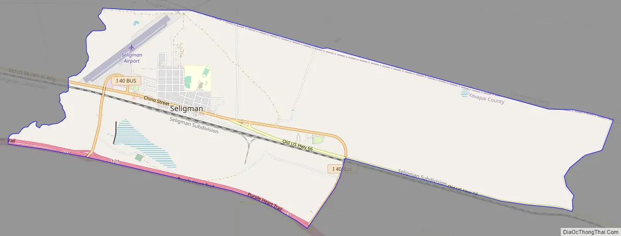
Seligman Road Map
Seligman city Satellite Map
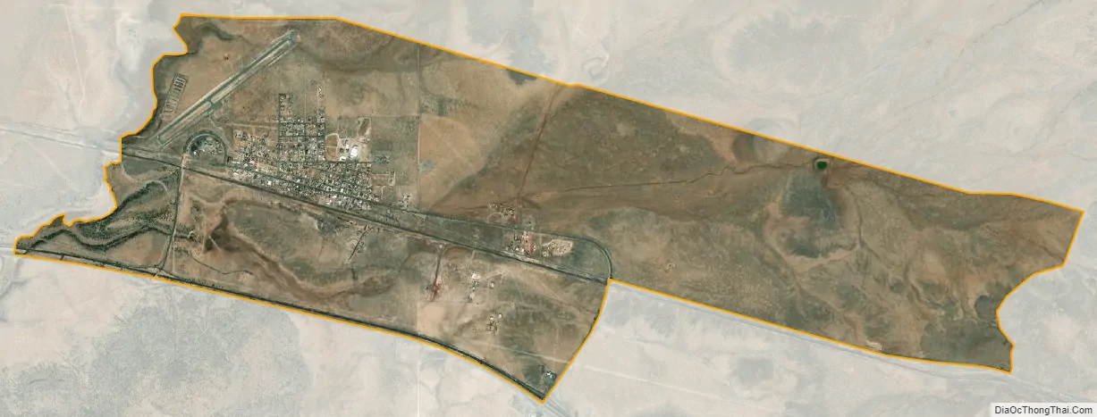
Geography
Seligman is located at 35°19′42″N 112°52′27″W / 35.32833°N 112.87417°W / 35.32833; -112.87417 (35.328199, −112.874303), at 5,240 feet (1,600 m) in elevation, alongside the Big Chino Wash, in a northern section of Chino Valley. The wash is a major tributary of the Verde River. Seligman is a popular stopping point along Historic U.S. Route 66.
According to the United States Census Bureau, the Seligman CDP has a total area of 6.4 square miles (17 km), all land.
See also
Map of Arizona State and its subdivision: Map of other states:- Alabama
- Alaska
- Arizona
- Arkansas
- California
- Colorado
- Connecticut
- Delaware
- District of Columbia
- Florida
- Georgia
- Hawaii
- Idaho
- Illinois
- Indiana
- Iowa
- Kansas
- Kentucky
- Louisiana
- Maine
- Maryland
- Massachusetts
- Michigan
- Minnesota
- Mississippi
- Missouri
- Montana
- Nebraska
- Nevada
- New Hampshire
- New Jersey
- New Mexico
- New York
- North Carolina
- North Dakota
- Ohio
- Oklahoma
- Oregon
- Pennsylvania
- Rhode Island
- South Carolina
- South Dakota
- Tennessee
- Texas
- Utah
- Vermont
- Virginia
- Washington
- West Virginia
- Wisconsin
- Wyoming