Topock (Mojave: Tuupak) (pronounced /’Toe-pock’/ by locals) is a small unincorporated community and census-designated place (CDP) in Mohave County, Arizona, United States. As of the 2020 census, the population within the CDP was 2. Topock and the surrounding region have a ZIP Code of 86436; in 2010, the population of the 86436 ZCTA was 2,104, almost all of whom live in the Golden Shores CDP to the north.
Topock lies between Bullhead City and Lake Havasu City and southeast of Needles, California, on the California–Arizona border.
It is known for being a boating town as well as being home to the Old Trails Arch Bridge which used to be the old Route 66 bridge featured in the film The Grapes of Wrath. The crossings of the Colorado River at Topock, including the Old Trails Arch Bridge, are also featured prominently in the opening credits of the movie Easy Rider.
Topock Marina is located just off I-40 on Historic Route 66. Situated on the Colorado River between Needles and Lake Havasu City, the marina is the traditional refueling point for boaters traveling between these two cities.
Topock is the site of one of Pacific Gas & Electric (PG&E)’s recompression stations on its super-rich natural gas pipeline from Texas to San Francisco completed in 1930.
| Name: | Topock CDP |
|---|---|
| LSAD Code: | 57 |
| LSAD Description: | CDP (suffix) |
| State: | Arizona |
| County: | Mohave County |
| Total Area: | 0.26 sq mi (0.67 km²) |
| Land Area: | 0.26 sq mi (0.67 km²) |
| Water Area: | 0.00 sq mi (0.00 km²) |
| Total Population: | 2 |
| Population Density: | 7.69/sq mi (2.97/km²) |
| ZIP code: | 86436 |
| Area code: | 928 |
| FIPS code: | 0474750 |
Online Interactive Map
Click on ![]() to view map in "full screen" mode.
to view map in "full screen" mode.
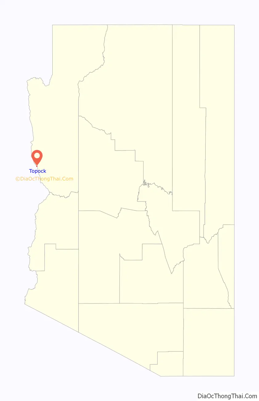
Topock location map. Where is Topock CDP?

History
Topock was originally called Mellen, a railroad station and steamboat landing, at the site where the Atlantic and Pacific Railroad built the Red Rock Bridge, a steel cantilever bridge across the Colorado River in May 1890 after three of its earlier less well-built bridges had been washed away by the river upstream at a poorly chosen site at Eastbridge, southeast of Needles, California. The town was named for Captain “Jack” Mellon, a 40-year veteran Colorado River steamboat captain and an owner of the Colorado Steam Navigation Company, though it was misspelled as “Mellen”. From 1903 to 1909 Mellen had its own post office.
Topock Road Map
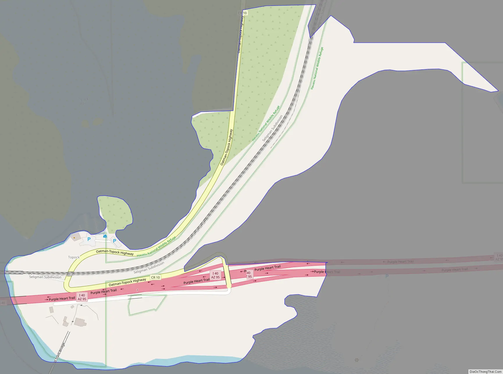
Topock city Satellite Map

See also
Map of Arizona State and its subdivision: Map of other states:- Alabama
- Alaska
- Arizona
- Arkansas
- California
- Colorado
- Connecticut
- Delaware
- District of Columbia
- Florida
- Georgia
- Hawaii
- Idaho
- Illinois
- Indiana
- Iowa
- Kansas
- Kentucky
- Louisiana
- Maine
- Maryland
- Massachusetts
- Michigan
- Minnesota
- Mississippi
- Missouri
- Montana
- Nebraska
- Nevada
- New Hampshire
- New Jersey
- New Mexico
- New York
- North Carolina
- North Dakota
- Ohio
- Oklahoma
- Oregon
- Pennsylvania
- Rhode Island
- South Carolina
- South Dakota
- Tennessee
- Texas
- Utah
- Vermont
- Virginia
- Washington
- West Virginia
- Wisconsin
- Wyoming


