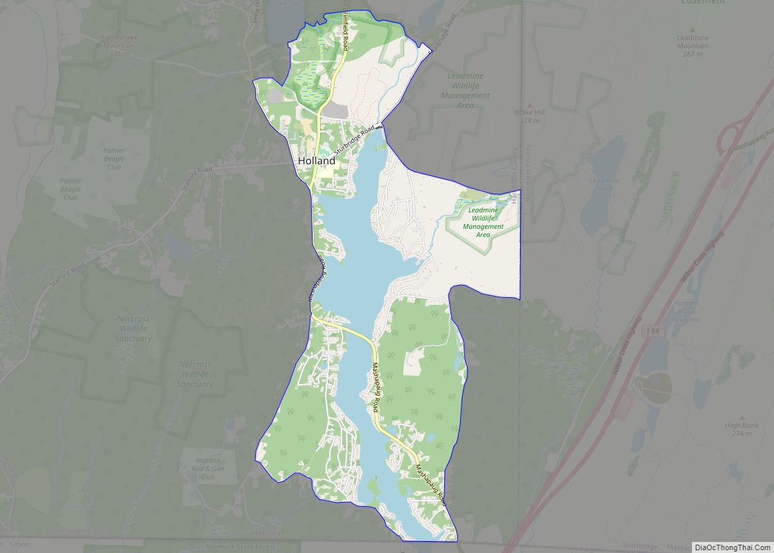
Holland is a census-designated place (CDP) in the town of Holland in Hampden County, Massachusetts, United States, comprising the town center and other populated areas in the eastern part of the town. The population was 1,464 at the 2010 census, out of a total 2,481 people in the town. It is part of the Springfield, Massachusetts Metropolitan Statistical Area.
| Name: | Holland CDP |
|---|---|
| LSAD Code: | 57 |
| LSAD Description: | CDP (suffix) |
| State: | Massachusetts |
| County: | Hampden County |
| Elevation: | 696 ft (212 m) |
| Total Area: | 3.27 sq mi (8.46 km²) |
| Land Area: | 2.65 sq mi (6.87 km²) |
| Water Area: | 0.61 sq mi (1.59 km²) |
| Total Population: | 1,551 |
| Population Density: | 584.40/sq mi (225.67/km²) |
| ZIP code: | 01521 |
| Area code: | 413 |
| FIPS code: | 2530630 |
| GNISfeature ID: | 0609813 |
Online Interactive Map
Click on ![]() to view map in "full screen" mode.
to view map in "full screen" mode.
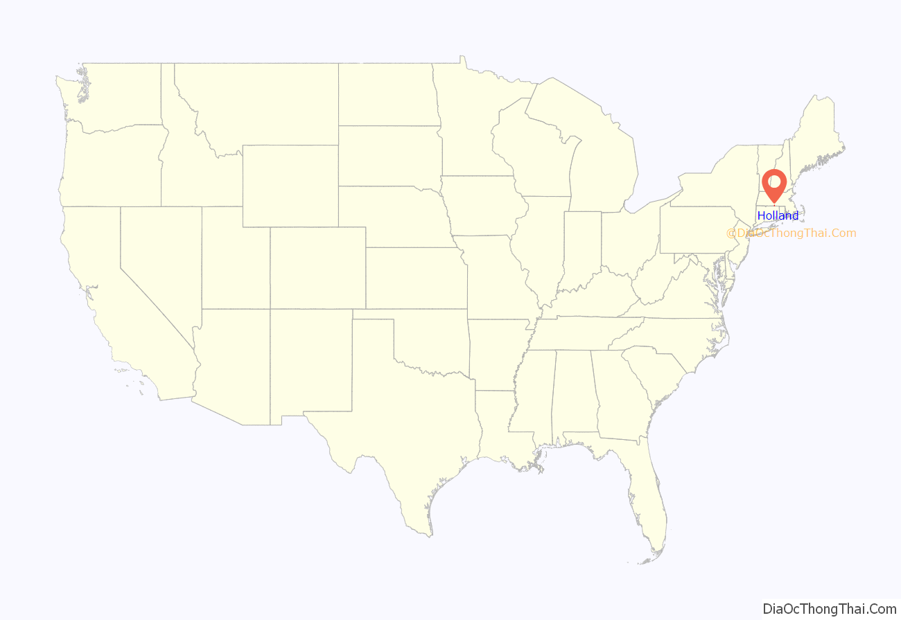
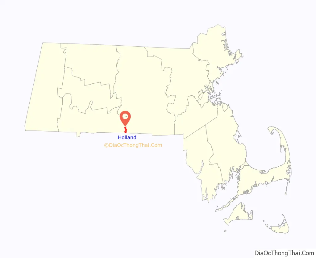
Holland location map. Where is Holland CDP?
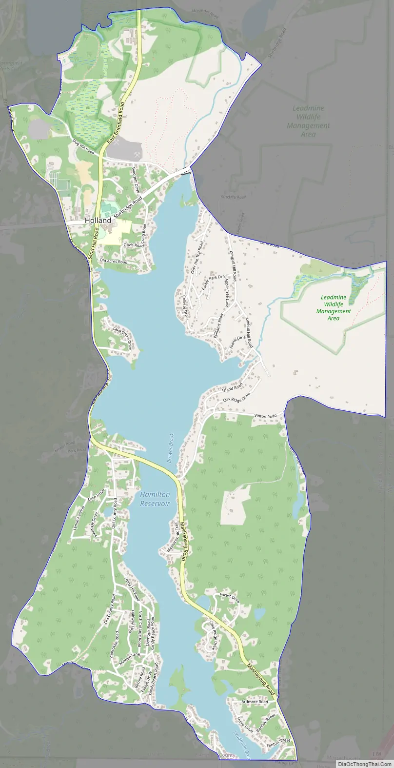
Holland Road Map
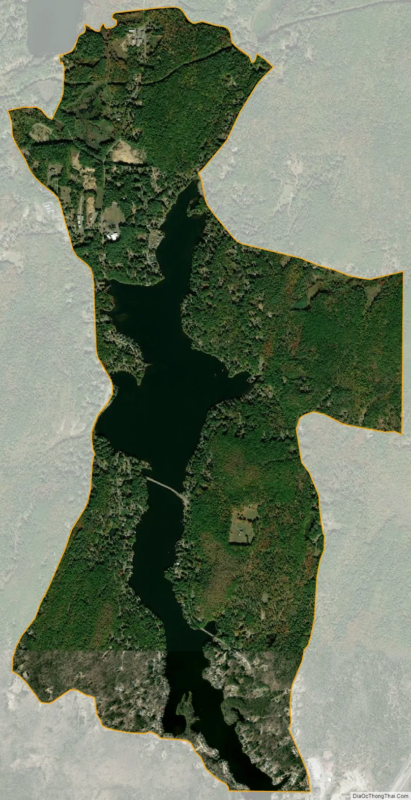
Holland city Satellite Map
Geography
The Holland CDP is in the eastern part of the town of Holland at 42°2′40″N 72°9′13″W / 42.04444°N 72.15361°W / 42.04444; -72.15361 (42.044717, -72.153626). The CDP includes the Holland town center along Sturbridge Road, as well as residential communities on the shores of Hamilton Reservoir, a lake in the southeastern part of the town. The reservoir outlet is at the north end of the lake, flowing into the Quinebaug River. Sturbridge is 6 miles (10 km) northeast of Holland via Sturbridge Road.
According to the United States Census Bureau, the Holland CDP has a total area of 3.3 square miles (8.5 km), of which 2.7 square miles (6.9 km) are land and 0.62 square miles (1.6 km), or 18.76%, are water.
See also
Map of Massachusetts State and its subdivision: Map of other states:- Alabama
- Alaska
- Arizona
- Arkansas
- California
- Colorado
- Connecticut
- Delaware
- District of Columbia
- Florida
- Georgia
- Hawaii
- Idaho
- Illinois
- Indiana
- Iowa
- Kansas
- Kentucky
- Louisiana
- Maine
- Maryland
- Massachusetts
- Michigan
- Minnesota
- Mississippi
- Missouri
- Montana
- Nebraska
- Nevada
- New Hampshire
- New Jersey
- New Mexico
- New York
- North Carolina
- North Dakota
- Ohio
- Oklahoma
- Oregon
- Pennsylvania
- Rhode Island
- South Carolina
- South Dakota
- Tennessee
- Texas
- Utah
- Vermont
- Virginia
- Washington
- West Virginia
- Wisconsin
- Wyoming