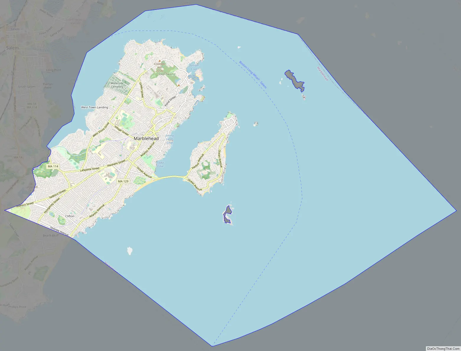
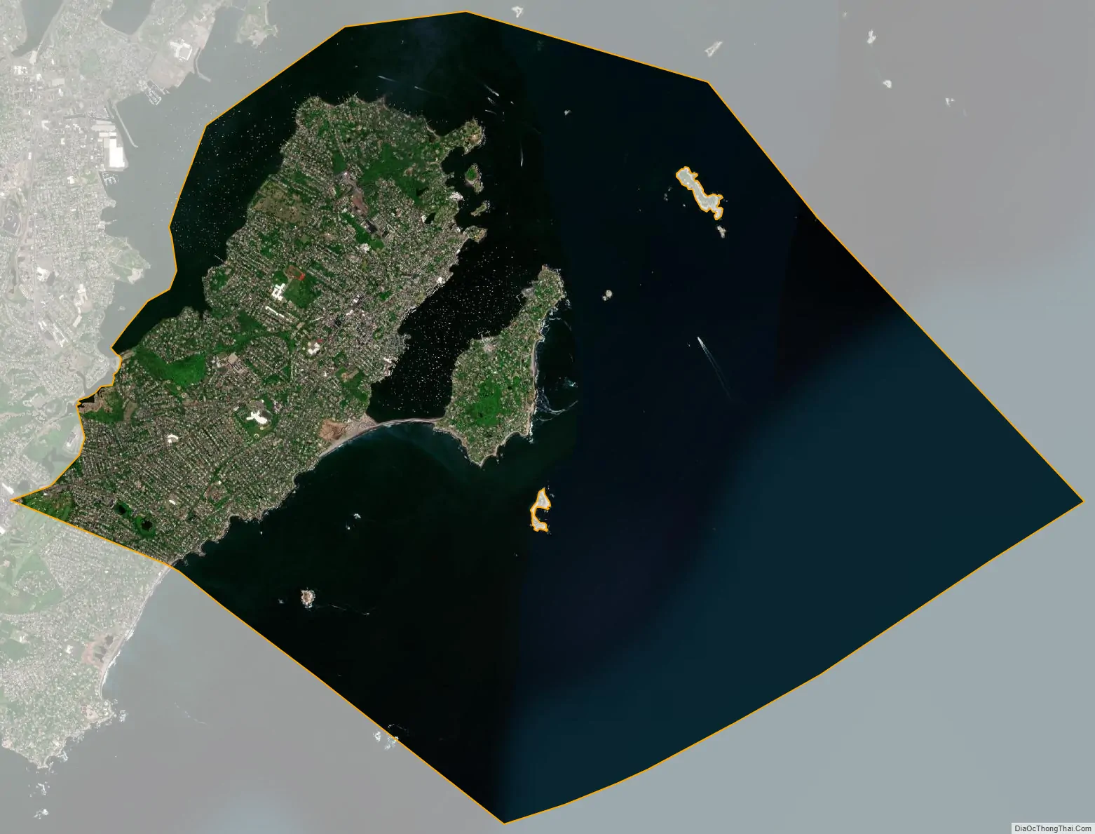
Marblehead is a coastal New England town in Essex County, Massachusetts, along the North Shore. Its population was 20,441 at the 2020 census. The town lies on a small peninsula that extends into the northern part of Massachusetts Bay. Attached to the town is a near island, known as Marblehead Neck, connected to the mainland by a narrow isthmus. Marblehead Harbor, protected by shallow shoals and rocks from the open sea, lies between the mainland and the Neck. Beside the Marblehead town center, two other villages lie within the town: the Old Town, which was the original town center, and Clifton, which lies along the border with the neighboring town of Swampscott.
A town with roots in commercial fishing and yachting, Marblehead was a major shipyard and is often referred to as the birthplace of the American Navy, a title sometimes disputed with nearby Beverly. Marblehead was once the fishing capital of Massachusetts. It is also the origin of Marine Corps Aviation. Three US Navy ships have been named USS Marblehead. A center of recreational boating, Marblehead has long been a popular sailing, kayaking and fishing destination, with several yacht clubs established in the late 19th century.
It is home to the Marblehead Light, Fort Sewall, Little Harbor, Marblehead Neck Audubon Wildlife Sanctuary, Crocker Park, and Devereux Beach. Archibald Willard’s famous painting The Spirit of ’76 currently resides in Abbot Hall. Much of the Old Town is protected by the Marblehead Historic District.
Marblehead is also home of the Marblehead Men’s Softball League which was established in 1939 and is the oldest and longest standing adult softball league in the world.
| Name: | Marblehead CDP |
|---|---|
| LSAD Code: | 57 |
| LSAD Description: | CDP (suffix) |
| State: | Massachusetts |
| County: | Essex County |
| Incorporated: | 1649 |
| Elevation: | 65 ft (20 m) |
| Total Area: | 19.58 sq mi (50.71 km²) |
| Land Area: | 4.39 sq mi (11.37 km²) |
| Water Area: | 15.19 sq mi (39.34 km²) |
| Total Population: | 20,441 |
| Population Density: | 4,656.26/sq mi (1,797.79/km²) |
| ZIP code: | 01945 |
| Area code: | 339/781 |
| FIPS code: | 2538435 |
| GNISfeature ID: | 0618300 |
| Website: | www.marblehead.org |
Online Interactive Map
Click on ![]() to view map in "full screen" mode.
to view map in "full screen" mode.
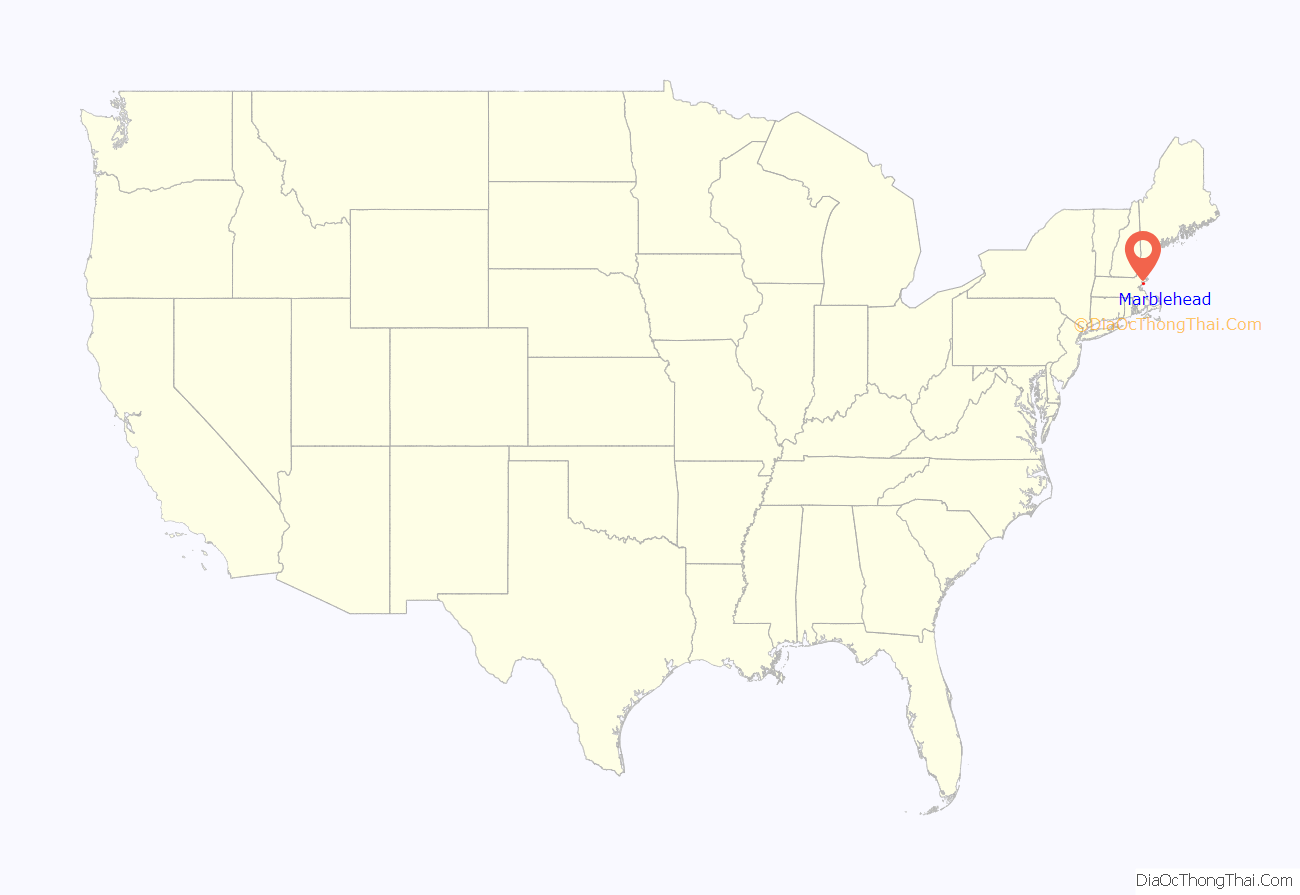
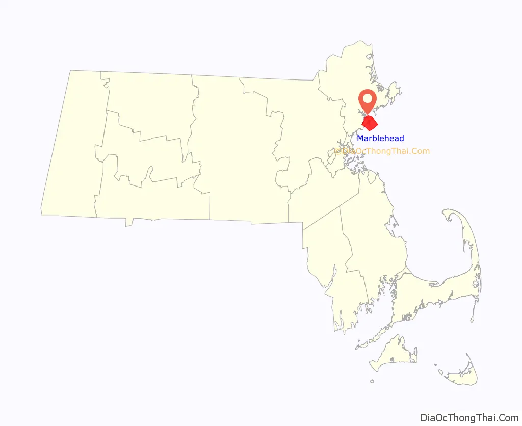
Marblehead location map. Where is Marblehead CDP?
History
Massebequash
Marblehead was originally called Massebequash after the river which ran between it and Salem. The land was inhabited by the Naumkeag tribe of the Pawtucket confederation under the overall sachem Nanepashemet. Epidemics in 1615–1619 and 1633, believed to be smallpox, devastated the tribe. Numerous shell mounds and burial sites have been found throughout the town’s history, along with foundations of multiple villages and forts. On September 16, 1684, heirs of Nanepashemet sold their 3,700 acres (15 km); the deed is preserved today at Abbot Hall in the town.
European settlers and fishing
Marblehead’s first European settler was Joseph Doliber in 1629, who set up on the shore near what is now the end of Bradlee Road. Three years earlier, Isaac Allerton, a Pilgrim from the Mayflower, had arrived in the area and established a fishing village at Marblehead Little Harbor. In May 1635, the General Court of Massachusetts Bay established the town of Marblehead on land that belonged to Salem. Marblehead residents, who never saw eye-to-eye with their more devout and conservative neighbors, were delighted, but less than a year later, the lawmakers reversed themselves. Marblehead finally became independent of Salem in 1649.
At times called “Marvell Head”, “Marble Harbour” (by Captain John Smith) and “Foy” (by immigrants from Fowey, Cornwall), the town would be named “Marblehead” by settlers who mistook its granite ledges for marble. It began as a fishing village with narrow crooked streets, and developed inland from the harbor. The shoreline smelled of drying fish, typically cod. These were exported abroad and to Salem.
The town had one accused individual during the Salem Witch Trials, Wilmot Redd. She was found guilty of witchcraft and executed by hanging on September 22, 1692.
The town peaked economically just before the American Revolution, as locally financed privateering vessels sought bounty from large European ships. Much early architecture survives from the era, including the Jeremiah Lee Mansion.
Revolutionary War
A large percentage of residents became involved early in the Revolutionary War, and the sailors of Marblehead are generally recognized by scholars as forerunners of the United States Navy. The first vessel commissioned for the army, Hannah, was equipped with cannons, rope, provisions (including the indigenous molasses/sea water cookie known as “Joe Frogger” ), and a crew from Marblehead. With their nautical backgrounds, soldiers from Marblehead under General John Glover were instrumental in the escape of the Continental Army after the Battle of Long Island.The Marblehead militia had become the 14th Continental Regiment of George Washington’s army—and one of the few integrated regiments in the entire army. Marblehead men ferried George Washington across the Delaware River for his attack on Trenton. Many who set out for war, however, did not return, leaving the town with 459 widows and 865 orphaned children in a population of less than 5,000.
The community lost a substantial portion of its population and economy, although it was still the tenth-largest inhabited location in the United States at the first census, in 1790.
When George Washington visited the town during his presidential tour of 1789, he knew the sailors of Marblehead well; they had served him honorably in the war. He observed that the town “had the appearance of antiquity.”
Fishing industry
In the 75 years from the American Revolution to the middle of the nineteenth century, Marblehead experienced a golden age of fishing. The War of 1812 brought disruption similar to during the American Revolution, with fishing grounds being blockaded, and fisherman heading off to war, with over 500 Marbleheaders being imprisoned by the British. After the war, and later into the 19th century, wealthier citizens wanted a new bank to finance vessels, and to serve the town’s fishermen and merchants. On March 17, 1831, with a capital of US$100,000, they founded the Grand Bank. The name was changed to National Grand Bank on October 3, 1864.
The town’s fishermen had 98 vessels (95 of which exceeded 50 tons) putting to sea in 1837, where they often harvested fish off the Grand Banks of Newfoundland. However, a gale or hurricane in that area on September 19, 1846, sank 11 vessels and damaged others. With 65 men and boys lost in the storm, the town’s fishing industry began a decline. The storm is depicted in Fireboard: The Great Gale of 1846, c. 1850 by William Thompson Bartoll. A copy of the book is held by the Peabody Essex Museum.
American Civil War
During the American Civil War, 1,048 Marblehead men went to war, joining both the Army and Navy. One hundred ten died; 87 were wounded, many of whom died later of their injuries. During the war, Marblehead would raise almost $100,000 to supplement the war effort, an incredible effort for a town of 8,000 that relied mainly on fishing for income. Marblehead would be the first regiment in the state to answer the call for troops. A Grand Army of the Republic veterans organization was formed after the war, and established headquarters in the old town house, where it still displays artifacts from the Marblehead regiments that served.
Shoemaking, airplanes, and yachting
During the late 19th century, Marblehead had a short-term industrial boom from shoe-making factories. At the same time, the exceptional harbor attracted yachting by wealthy boat owners, and some yacht clubs established centers there. It would become home to the Boston Yacht Club, Corinthian Yacht Club, Eastern Yacht Club, Marblehead Yacht Club, Dolphin Yacht Club, and the oldest junior yacht club in America, the Pleon Yacht Club. This also caused numerous “summer homes” of wealthy Boston residents to be built on Marblehead Neck. The building boom would cause Marblehead Light to be replaced in 1896 with a new iron structure since the light of shorter tower was becoming blocked by the large new homes.
Marblehead was also the site of the Burgess & Curtis Aircraft Factory, where it was the first licensed aircraft manufacturer in the United States. William Starling Burgess designed and flight-tested most of the aircraft that were manufactured at the two plant sites in town. On August 20, 1912, Alfred Austell Cunningham became the first Marine aviator, taking off from Marblehead Harbor in a Burgess Model H seaplane given to him by the Burgess Company. His flight was the start of United States Marine Corps Aviation.
Post-war suburban community
After World War II, the town enjoyed a population boom, developing as a bedroom community for nearby Boston, Lynn, and Salem. This boom ended around 1970, when the town became built out. Marblehead today continues to be a sailing and small-town tourism destination in the summer months.
Marblehead Harbor, 1908
Front Street, 1914
Lafayette House, c. 1908
Eastern Yacht Club
Old Spite House, c. 1912
St. Michael’s Church built in 1714
Yachts in harbor viewed from Fort Sewall
Marblehead Road Map
Marblehead city Satellite Map
Geography
4.4 square miles (11.4 km) is land and 15.2 square miles (39.4 km), or 77.61%, is water.
Marblehead is situated on the North Shore of Massachusetts along Massachusetts Bay and Salem Harbor. The town consists of a rocky peninsula that extends into the bay, with an additional neck to the east connected by a long sandbar, now a causeway. This ring of land defines Marblehead’s deep, sheltered harbor. Marblehead Neck is home to a bird sanctuary, as well as Castle Rock and Chandler Hovey Park at its northern tip, where Marblehead Light is located.
Fountain Park and Fort Sewall are located at the west edge of the mouth of Marblehead Harbor. The town land also includes several small islands in Massachusetts Bay and Dolliber Cove, the area between Peaches Point and Fort Sewall. The town is partially divided from Salem by the Forest River, and is also home to several small ponds. Keeping with the town’s location, there are four beaches (one in Dolliber Cove, one in Marblehead Harbor, and two along the southern shore of town), as well as six yacht clubs, one public kayaking center and several boat ramps.
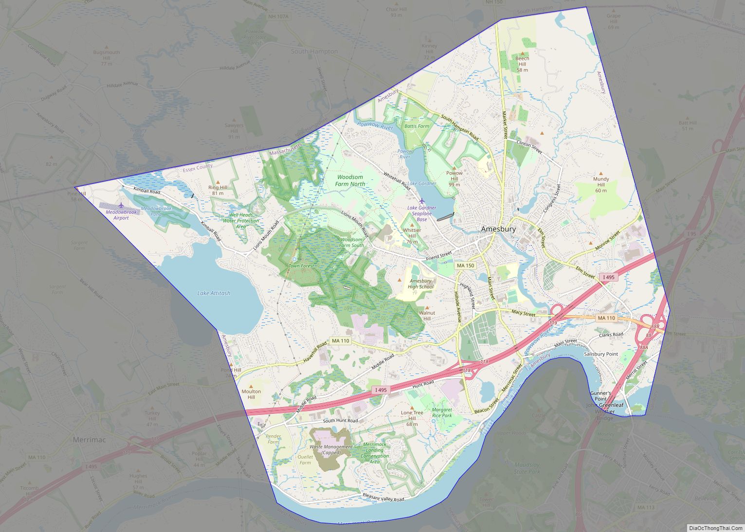
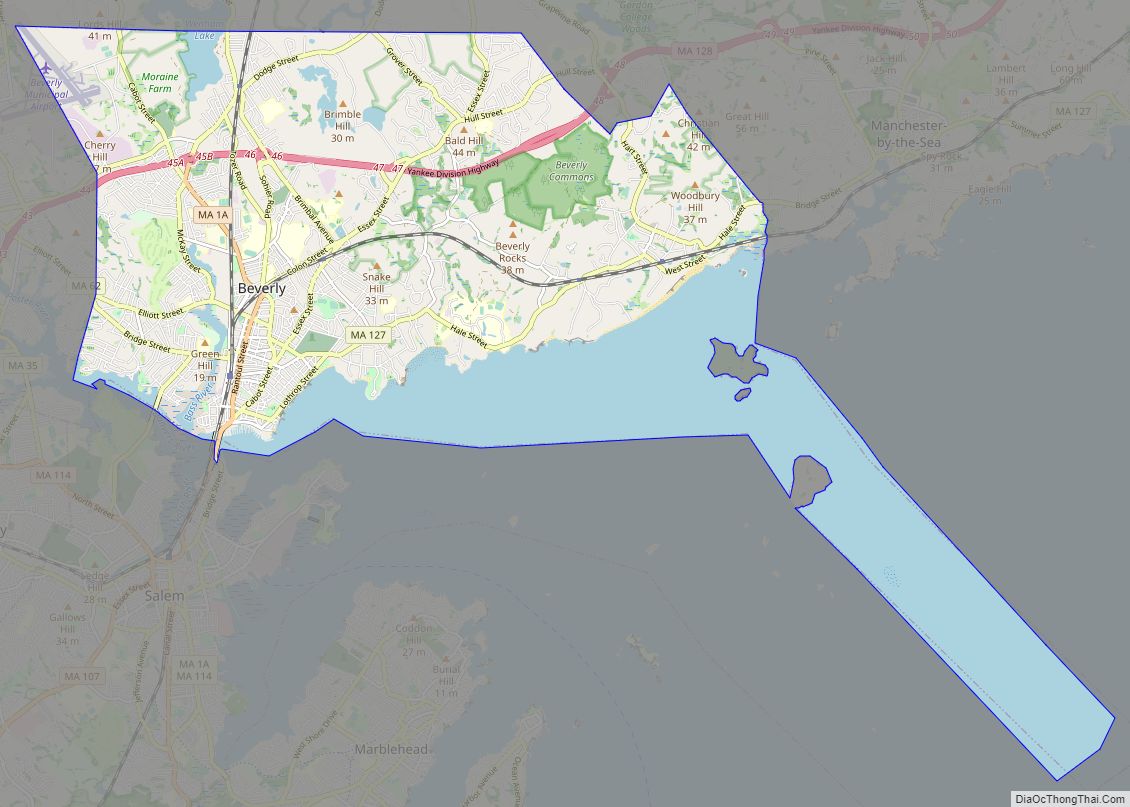
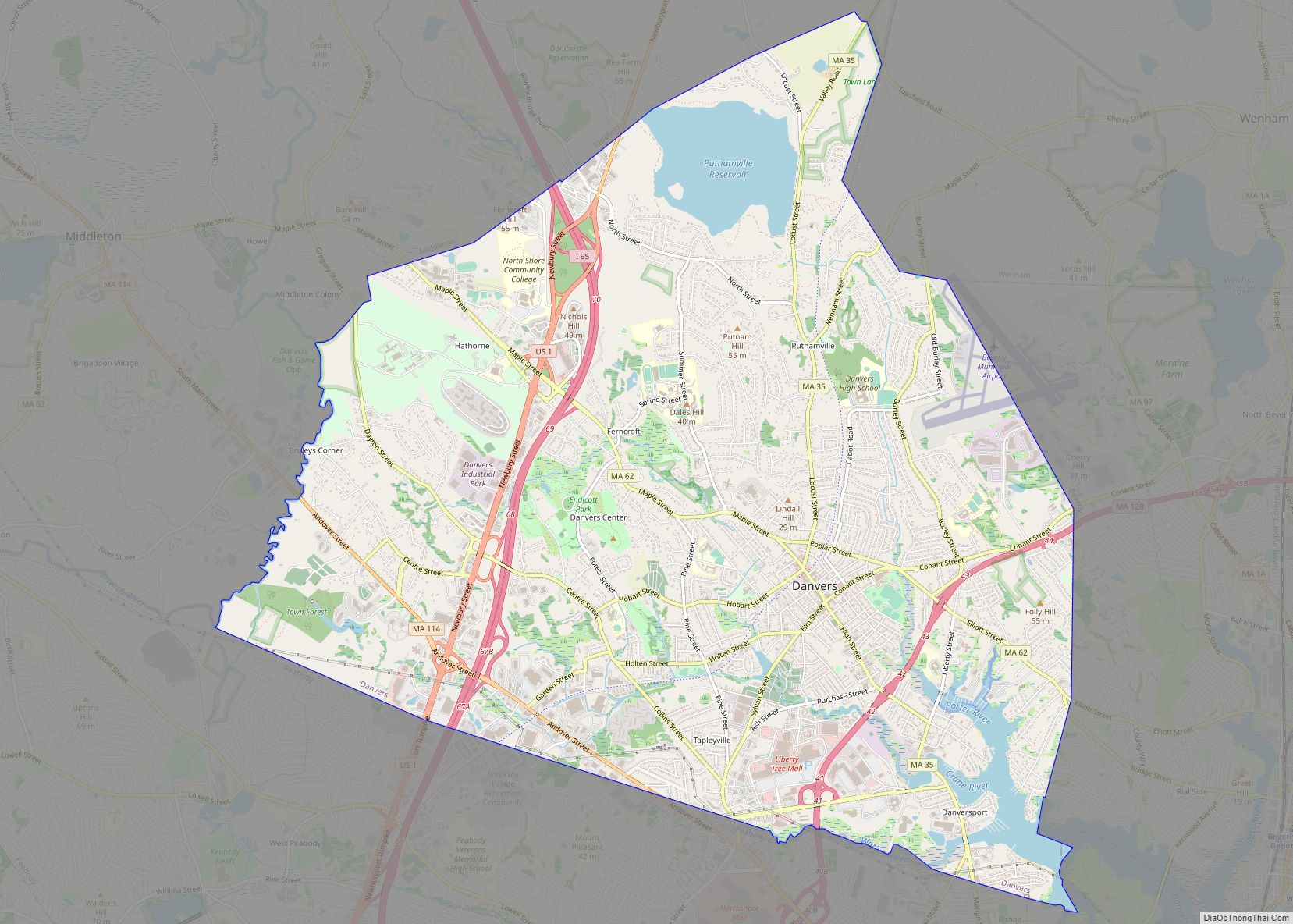
Besides Marblehead Neck, there are two other villages within town, the Old Town to the northeast and Clifton to the southwest. Given its small area, most of the residential land in town is thickly settled. Marblehead’s town center is located approximately 4 miles (6 km) from the center of Salem, 16 miles (26 km) northeast of Boston and 12 miles (19 km) southwest of Cape Ann. It is bordered by Swampscott to the south and Salem to the northwest. (As Salem’s water rights extend into Massachusetts Bay, there is no connection between Marblehead and the city of Beverly across Beverly Harbor.)
Marblehead is home to the eastern termini of Massachusetts Route 114 and Route 129, which both terminate at the intersection of Pleasant Street and Ocean Avenue. Route 114 heads west into Salem, while Route 129 heads south along Atlantic Avenue into Swampscott towards Lynn. There are no freeways within town, with the nearest access being to Massachusetts Route 128 in Peabody and Beverly.
Two MBTA bus routes—the 441 and 442—originate in town regularly with service to Boston, with weekend service to Wonderland in Revere. The former Eastern Railroad began service in 1839 and had lines connecting through Swampscott and Salem was discontinued in the late 1950s. The track routes were converted to bike trails and the three train depots were torn down. The Newburyport/Rockport Line of the MBTA Commuter Rail passes through neighboring Swampscott and Salem, with service between the North Shore and Boston’s North Station. The nearest air service is located at Beverly Municipal Airport, with the nearest national and international service at Boston’s Logan International Airport. Seasonal ferry service to Boston can also be found in Salem.
Historic maps
- Marblehead in 1700
- 1781 Northshore Coastal Map
- 1795 Marblehead Map
- 1804 Marblehead Harbor Bowditch Map
- 1830 Marblehead Map
- 1850 Plan of Marblehead, Mass
- 1872 Marblehead Map
- 1881 Atlas of Marblehead published by Hopkins.
- 1882 Bird’s Eye View of Marblehead
- 1885 Marblehead Map – Sanborn Fire Insurance
- 1890 Marblehead Map – Sanborn Fire Insurance
- 1896 Marblehead Map – Sanborn Fire Insurance
- 1897 Atlas of Marblehead
- 1901 Marblehead Map – Sanborn Fire Insurance
- 1908 Marblehead Map – Sanborn Fire Insurance
- 1912 Marblehead Atlas.
- 1915 Marblehead Map – Sanborn Fire Insurance
See also
Map of Massachusetts State and its subdivision: Map of other states:- Alabama
- Alaska
- Arizona
- Arkansas
- California
- Colorado
- Connecticut
- Delaware
- District of Columbia
- Florida
- Georgia
- Hawaii
- Idaho
- Illinois
- Indiana
- Iowa
- Kansas
- Kentucky
- Louisiana
- Maine
- Maryland
- Massachusetts
- Michigan
- Minnesota
- Mississippi
- Missouri
- Montana
- Nebraska
- Nevada
- New Hampshire
- New Jersey
- New Mexico
- New York
- North Carolina
- North Dakota
- Ohio
- Oklahoma
- Oregon
- Pennsylvania
- Rhode Island
- South Carolina
- South Dakota
- Tennessee
- Texas
- Utah
- Vermont
- Virginia
- Washington
- West Virginia
- Wisconsin
- Wyoming