Swampscott (/ˈswɒmpskət/) is a town in Essex County, Massachusetts, United States, located 15 miles (24 km) up the coast from Boston in an area known as the North Shore. The population was 15,111 as of the 2020 United States Census. A former summer resort on Massachusetts Bay, Swampscott is today a fairly affluent residential community and includes the village of Beach Bluff, as well as part of the neighborhood of Clifton.
| Name: | Swampscott CDP |
|---|---|
| LSAD Code: | 57 |
| LSAD Description: | CDP (suffix) |
| State: | Massachusetts |
| County: | Essex County |
| Incorporated: | 1852 |
| Elevation: | 45 ft (14 m) |
| Total Area: | 6.7 sq mi (17.4 km²) |
| Land Area: | 3.1 sq mi (7.9 km²) |
| Water Area: | 3.7 sq mi (9.6 km²) |
| Total Population: | 15,111 |
| Population Density: | 4,874.5/sq mi (1,912.8/km²) |
| ZIP code: | 01907 |
| Area code: | 339 / 781 |
| FIPS code: | 2568680 |
| GNISfeature ID: | 0618311 |
Online Interactive Map
Click on ![]() to view map in "full screen" mode.
to view map in "full screen" mode.
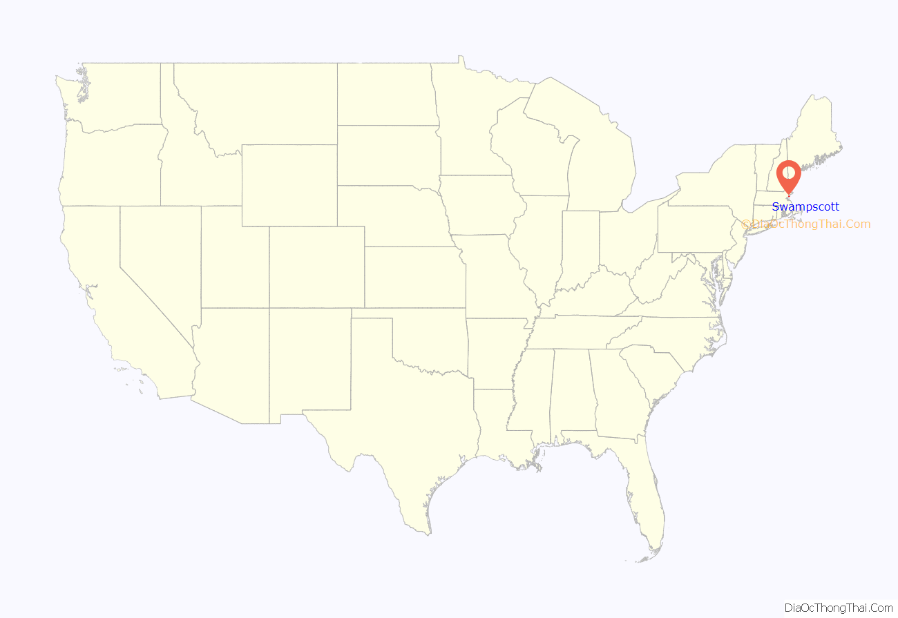
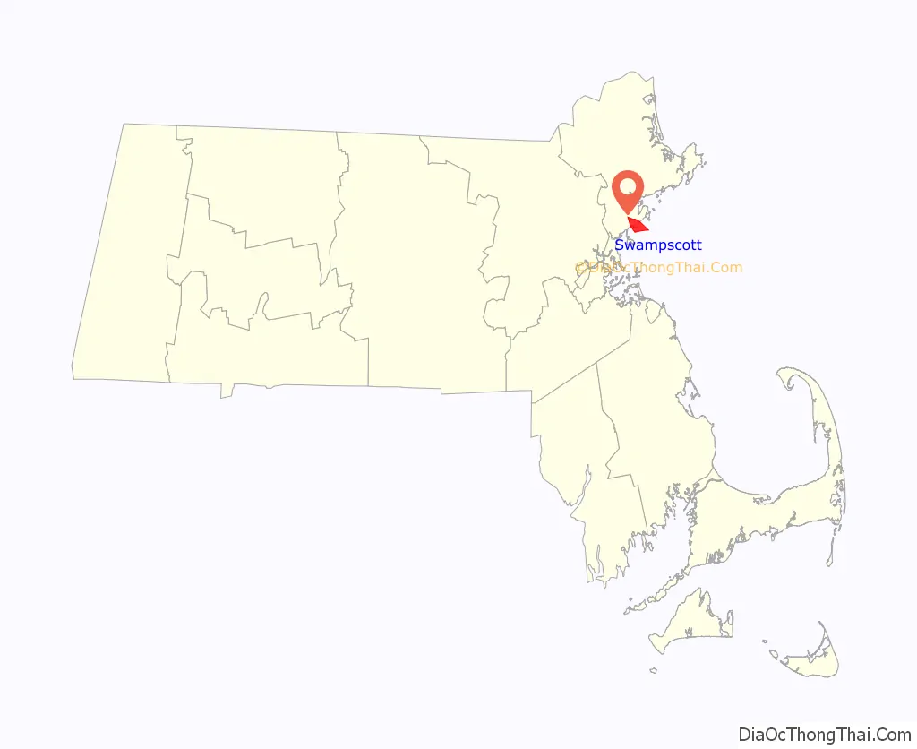
Swampscott location map. Where is Swampscott CDP?
History
The area in and around Swampscott, Massachusetts has been inhabited by indigenous people for 12,000 years. Prior to European colonization, the town was inhabited by members of the Naumkeag, Pennacook, and Pawtucket groups and Massachusett tribe. They spoke an Eastern Algonquin language, and the Pawtucket migrated seasonally throughout the eastern coasts of Massachusetts and Rhode Island. It’s estimated that 50-100 indigenous individuals resided in the Swampscott area at the time of European colonization. A series of epidemics following European settlement, including smallpox, killed many of the indigenous people living in the area, and it’s estimated that fewer than 50 individuals remained by the late 17th century.
Wood’s New England Prospect lists “Swampscott” as a noted habitation in 1633 before extensive European settlement. According to an early twentieth century source, the name “Swampscott” is variously said to mean “at the red rock”, “broken waters”, or “pleasant water place”.
Indigenous people in the Swampscott area subsisted on seasonally determined activities, including hunting, fishing, collecting wild plants and shellfish, and horticulture. They hunted deer, marine mammals, upland game birds, and ducks, and cultivated crops like corn, beans, pumpkin, squash, and tobacco.
Swampscott was first colonized by Europeans in 1629 when Francis Ingalls settled there and built the first Massachusetts Bay Colony tannery. Ingalls observed that the town’s indigenous population lived in wigwams extending from Black Will’s Cliff along the entire north shore. The town was first settled as the eastern part (Ward One) of Lynn, and was set off and officially incorporated in 1852.
In 1857, a piece of the far western end of Salem, then known as the “Salem Finger”, became part of Swampscott. A beach town north of Boston, measuring 3 square miles (7.8 km) and abutting Salem, Marblehead and Lynn, Swampscott was an important destination for the wealthy at the beginning of the 20th century. While Revere Beach, which lies just several miles down the road, has the honor of technically being America’s first public beach, Swampscott was the de facto first resort town. Lynn was the divider between the poor beach and the rich resort town.
Swampscott Road Map

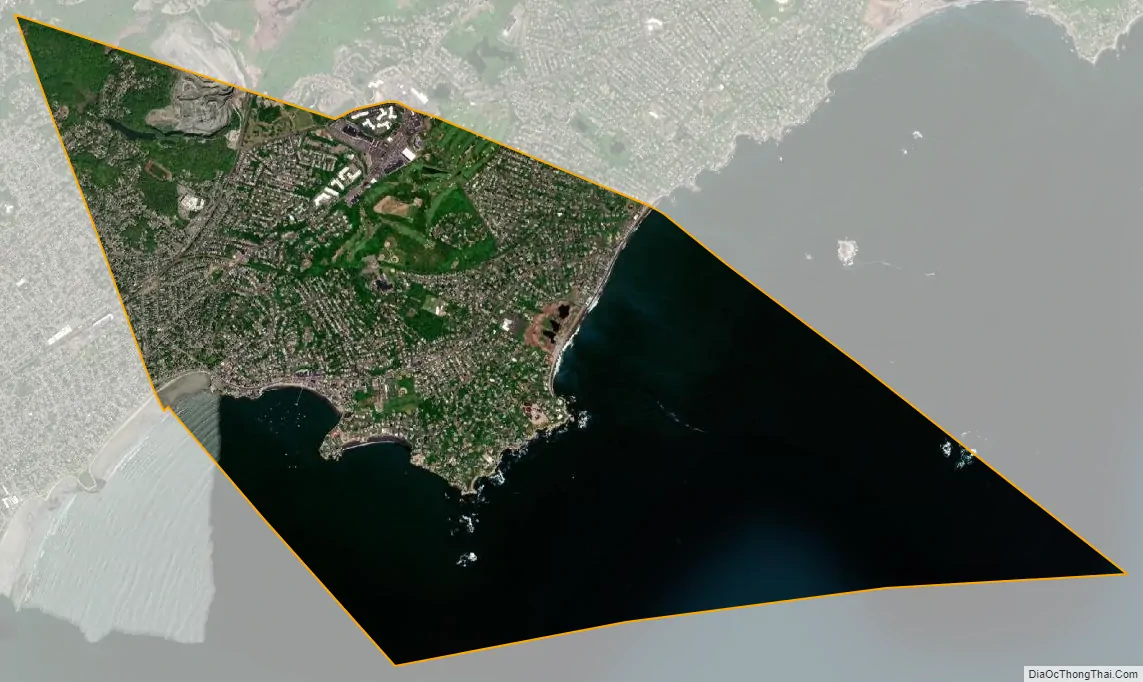
Swampscott city Satellite Map
Geography
Swampscott is located at 42°28′27″N 70°54′21″W / 42.47417°N 70.90583°W / 42.47417; -70.90583 (42.474409, −70.905883). According to the United States Census Bureau, the town has a total area of 6.7 square miles (17.4 km), of which 3.0 square miles (7.9 km) is land and 3.7 square miles (9.6 km), or 54.83%, is water. Located beside Massachusetts Bay and the Atlantic Ocean, Swampscott lies along a mostly rocky shoreline, though there is enough clear shore for five beaches; Phillips which stretches into Preston and is by far the largest beach in town, Eisman’s and Whales, Fisherman’s, and a part of King’s Beach, which extends into Lynn. There are several small parks, along with the small Harold King Forest in the northwest corner of town and the Tedesco Country Club which bisects part of the town. The town also has two small ponds, Foster Pond and Palmer Pond.
Swampscott is mostly suburban, with most of the clear land in the northwest corner of town. There are three villages within town, Beach Bluff to the east, Phillips Point to the south, and Phillips Beach inland between the two. The town is centered around Monument Square, designed by Frederick Law Olmsted; which is 4 miles (6 km) south of Salem, 12 miles (19 km) northeast of Boston, and 20 miles (32 km) southwest of Cape Ann. The town is 23 miles (37 km) to the nearest point in New Hampshire, in the town of Salem. Swampscott is bordered by Marblehead to the northeast, Salem to the northwest, and Lynn to the southwest. The water rights of the town extend into Massachusetts Bay, bordered by those of Marblehead and Lynn.
See also
Map of Massachusetts State and its subdivision: Map of other states:- Alabama
- Alaska
- Arizona
- Arkansas
- California
- Colorado
- Connecticut
- Delaware
- District of Columbia
- Florida
- Georgia
- Hawaii
- Idaho
- Illinois
- Indiana
- Iowa
- Kansas
- Kentucky
- Louisiana
- Maine
- Maryland
- Massachusetts
- Michigan
- Minnesota
- Mississippi
- Missouri
- Montana
- Nebraska
- Nevada
- New Hampshire
- New Jersey
- New Mexico
- New York
- North Carolina
- North Dakota
- Ohio
- Oklahoma
- Oregon
- Pennsylvania
- Rhode Island
- South Carolina
- South Dakota
- Tennessee
- Texas
- Utah
- Vermont
- Virginia
- Washington
- West Virginia
- Wisconsin
- Wyoming