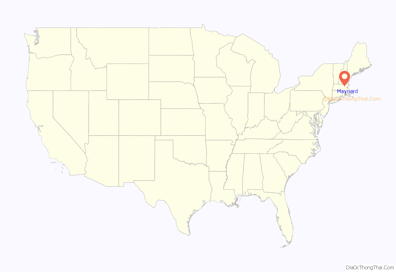
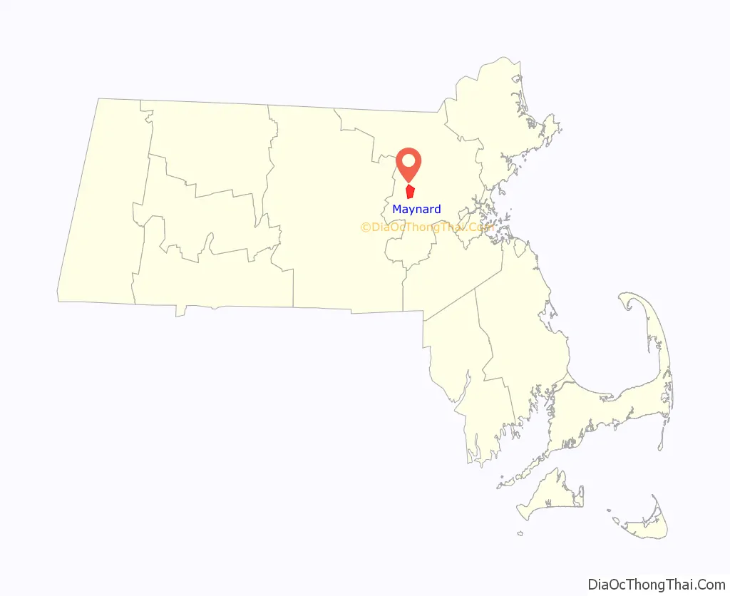
Maynard is a town in Middlesex County, Massachusetts, United States. The town is located 22 miles west of Boston, in the MetroWest and Greater Boston region of Massachusetts and borders Acton, Concord, Stow and Sudbury. The town’s population was 10,746 as of the 2020 United States Census.
Maynard is located on the Assabet River, a tributary of the Concord River. A large part of the Assabet River National Wildlife Refuge is located within the town, and the Assabet River Rail Trail connects the Refuge and downtown Maynard to the South Acton commuter rail station. Historic downtown Maynard is home to many shops, restaurants, galleries, a movie theater, and the former Assabet Woolen Mill, which produced wool fabrics from 1846 to 1950, including cloth for Union Army uniforms during the Civil War. Maynard was the headquarters for Digital Equipment Corporation from 1957 to 1998. Owners of the former mill complex currently lease space to office and light-industry businesses.
| Name: | Maynard CDP |
|---|---|
| LSAD Code: | 57 |
| LSAD Description: | CDP (suffix) |
| State: | Massachusetts |
| County: | Middlesex County |
| Incorporated: | 1871 |
| Elevation: | 186 ft (57 m) |
| Total Area: | 5.4 sq mi (13.9 km²) |
| Land Area: | 5.2 sq mi (13.6 km²) |
| Water Area: | 0.1 sq mi (0.3 km²) |
| Total Population: | 10,746 |
| Population Density: | 2,066.54/sq mi (790.15/km²) |
| ZIP code: | 01754 |
| Area code: | 351/978 |
| FIPS code: | 2539660 |
| GNISfeature ID: | 0618229 |
| Website: | www.townofmaynard-ma.gov |
Online Interactive Map
Click on ![]() to view map in "full screen" mode.
to view map in "full screen" mode.
Maynard location map. Where is Maynard CDP?
History
Maynard, located on the Assabet River, was first settled as a farming community by Puritan colonists in the 1600s who acquired the land comprising modern-day Maynard from local Native American tribe members who referred to the area as Pompositicut or Assabet. In 1651 Tantamous (“Old Jethro”) transferred land in what is now Maynard to Herman Garrett by defaulting on a mortgaged mare and colt, and in 1684 Tantamous’ son Peter Jethro, a praying Indian, and Jehojakim and ten others transferred further land in the area to the settlers. In 1676 during King Philip’s War, Native Americans gathered on Pompasitticut Hill (later known as Summer Hill) to plan an attack on Sudbury. There is a story, unconfirmed by any evidence, that pirates briefly stayed at the Thomas Smith farm on Great Road, circa 1720, buried treasure nearby, and departed, never to return.
Residents of what is now Maynard fought in the Revolutionary War, including Luke Brooks of Summer Street who was in the Stow militia company which marched to Concord on April 19, 1775. In 1851 transcendentalist Henry David Thoreau wrote about his walk through the area in his famous journal. and he published a poem about Old Marlboro Road, part of which runs through Maynard. During the American Civil War, at least thirty-six residents of Assabet Village fought for the Union.
The area now known as Maynard was originally known as “Assabet Village” and was then part of the towns of Stow and Sudbury. The Town of Maynard was incorporated as an independent municipality in 1871. There were some exploratory town-founding rumblings in 1870, followed by a petition to the Commonwealth of Massachusetts, filed January 26, 1871. State approval was granted April 19, 1871. In return, the new town paid Sudbury and Stow about $23,600 and $8,000 respectively. Sudbury received more money because more land came from Sudbury and Sudbury owned shares in the railroad, and the wool mill and paper mill were located in Sudbury. The population of the newly formed town—at 1,820—was larger than either of its parent towns.
Formation of new towns carved out of older ones was not unique to Maynard. Nearby Hudson, with its cluster of leather processing and shoe-making mills, seceded from Marlborough and Stow in 1866. In fact, the originally much larger Stow formed in 1683 lost land to Harvard, Shirley, Boxborough, Hudson and Maynard. The usual reason to petition the State’s Committee on Towns was that a fast-growing population cluster—typically centered around mills—was too far from the schools, churches and Meeting Hall of the parent town.
The community was named after Amory Maynard, the man who, with William Knight, had bought water-rights to the Assabet River, installed a dam and built a large carpet mill in 1846–1847. The community grew along with the Assabet Woolen Mill and made wool cloth for U.S. military uniforms for the Civil War. Further downstream along the Assabet, the American Powder Mills complex manufactured gunpowder from 1835 to 1940. The woolen mill went bankrupt in 1898; it was purchased in 1899 by the American Woolen Company, a multi-state corporation, which greatly modernized and expanded the mill complex from 1900 through 1919.
There was an attempt in 1902 to change the town’s name from “Maynard” to “Assabet”. Some townspeople were upset that Amory Maynard had not left the town a gift before he died in 1890, and more were upset that Lorenzo Maynard, Amory’s son, had withdrawn his own money from the Mill before it went bankrupt in 1898. The Commonwealth of Massachusetts decided to keep the name as “Maynard” without allowing the topic to come to a vote by the residents.
In the early twentieth century, the village of Maynard was more modern and urbanized than many of the surrounding areas, and people would visit Maynard to shop, including Babe Ruth who lived in nearby Sudbury during the baseball off-season, and would visit Maynard to buy cigars and play pool at pool halls on Main Street. The town had a train station, an electric trolley, hotels and movie halls.
In 1942 the U.S. Army seized one-fifth of the town’s land area, from the south side, to create a munitions storage facility. Land owners were evicted. The land remained military property for years. In 2005 it became part of the Assabet River National Wildlife Refuge.
After the woolen mill finally shut down in 1950, a Worcester-based group of businessmen bought the property in July 1953 and began leasing it as office or manufacturing space. Major tenants included Raytheon and Dennison Manufacturing Company. Digital Equipment Corporation (DEC) moved into the complex in 1957, initially renting only 8,680 square feet (806 m) for $300/month. The company grew and grew until it bought the entire complex in 1974, which led to Maynard’s nickname “Mini Computer Capital of the World”. DEC remained in Maynard until 1998 when it was purchased by Compaq, which was itself later bought out by Hewlett-Packard in 2002.
“The Mill”, as locals call it, was renovated in the late 1990s and renamed “Clock Tower Place” (2000–2015), and then renamed “Mill & Main Place” by new owners in 2016. The site houses many businesses, including the headquarters of Powell Flutes. The mill complex is also home to the oldest, still-working, hand-wound clock in the country (see image). The clock tower was constructed in 1892 by Lorenzo Maynard as a gift to the town. The weights that power the E. Howard & Co. tower clock and bell-ringing mechanisms are wound up once a week – more than 6,000 times since the clock was installed. The process takes one to two hours. The four clock faces have always been illuminated by electric lights. For three months a year the Mill parking lot adjacent to Main Street is used on Saturdays for the Maynard Community Farmers’ Market.
Glenwood Cemetery (incorporated 1871), located south of downtown Maynard, was added to the National Register of Historic Places in 2004. This still-active cemetery is the site of approximately 7,000 burials. On its east side it abuts St. Bridget’s Cemetery, also in Maynard.
The Maynard family
John Maynard, born 1598, emigrated from England with his wife Elizabeth (Ashton) Maynard around 1635. Five generations later, Isaac Maynard was operating a mill in Marlborough. When he died in 1820 at age 41 his teenage son, Amory Maynard, took over the family business. The City of Boston bought Amory’s water rights to Fort Meadow Pond in 1846. He partnered with William Knight to start up a woolen mill operation on the Assabet River. Amory and his wife Mary (Priest) Maynard had three sons: Lorenzo (1829–1904), William (1833–1906) and Harlan (1843–1861). Amory managed the mill from 1847 to 1885 (Knight retired in 1852). Lorenzo took over from 1885 to 1898. William had less to do with the family business—he lived in Boston a while, then Maynard again, then off to Pasadena, California, in 1885 for reasons of ill health (possibly tuberculosis). He recovered and moved back east to Worcester in 1888 for the remainder of his life. Harlan died at age 18.
Lorenzo married Lucy Davidson and had five children, but all of them died without issue—the four daughters passing away before their parents. William married Mary Adams and had seven children. Descendants of two—Harlan James and Lessie Louise—are alive today, but not living locally. William’s granddaughter, Mary Augusta Sanderson, who died in 1947, was the last descendant to live in Maynard.
The Maynard Crypt is a prominent feature on the north side of Glenwood Cemetery, within sight of passers-by on Route 27. It is an imposing earth-covered mound with a granite facade facing the road. The mound is 90 feet (27 m) across and about 12 feet (4 m) tall. The stonework facade is approximately 30 feet (9 m) across. The ceiling of the crypt has a glass skylight surmounted by an exterior cone of iron grillwork. The granite lintel above the door reads “MAYNARD.” Chiseled above the lintel are the year 1880 and the Greek letters Alpha and Omega entwined with a Fleur-de-lis Cross. Amory Maynard, his wife, Mary, and twenty-one of their descendants or spouses thereof are interred in the crypt. At one point in time Amory’s first son, Lorenzo, along with Lorenzo’s wife and their four daughters, were also in the crypt, but in October 1904 Lorenzo’s son arranged to have his six family members moved to a newly constructed mausoleum in Mount Auburn Cemetery, Cambridge, Massachusetts. Lorenzo had contracted for the mausoleum while still alive but died before it was completed. William, Amory’s second son, was buried in the Hope Cemetery, Worcester, along with his wife and four of their seven children.
Maynard Road Map

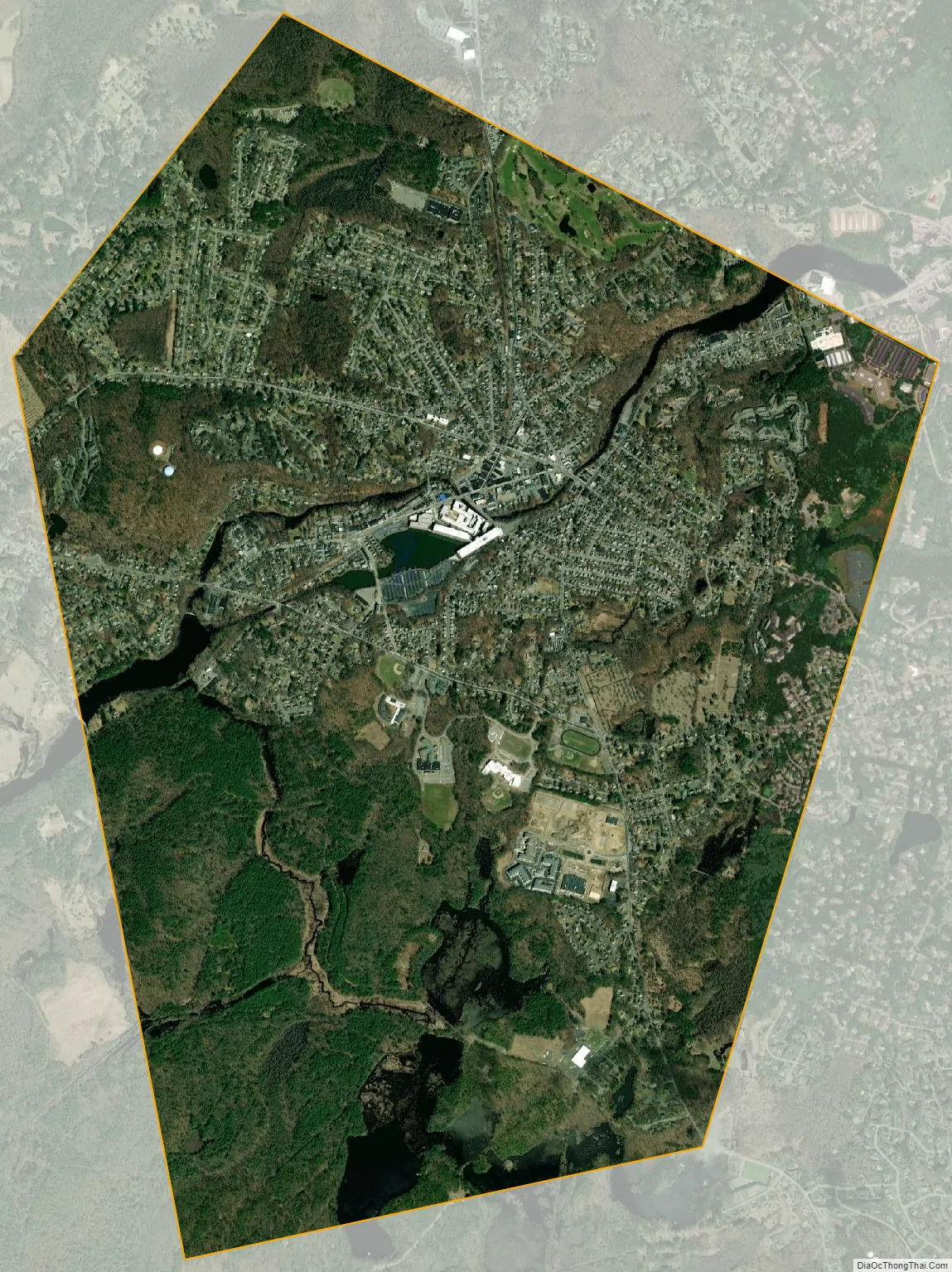
Maynard city Satellite Map
Geography
According to the United States Census Bureau, Maynard has a total area of 5.4 square miles (13.9 km), of which 5.2 square miles (13.6 km) is land and 0.1 square miles (0.3 km), or 2.42%, is water. Average elevation is roughly 200 feet (~61 m) above sea level; the highest point is Summer Hill, elevation 358 feet (109.1 m); the lowest is the Maynard/Acton border next to the Assabet River, at 145 feet (44.2 m).
The Assabet River flows through Maynard from west to east, spanned by seven road bridges and one foot bridge. The river’s vertical drop from the Stow border to the Acton border is 30 feet (9 m). Initially, this was sufficient to hydropower the wool and paper mills, but both later added coal-powered steam engines. Average flow in the river is 200 cubic feet per second (5.7 m/s). However, in summer months the average drops to under 100 cubic feet per second (2.8 m/s), in drought conditions as low as 10 cubic feet per second (0.28 m/s) The flood of March 2010 reached 2,500 cubic feet per second (71 m/s). Recent, monthly and annual riverflow data is available from the U.S. Geological Service.
Average precipitation, long-term, is 43 inches (1,092 mm) per year, which includes 44 inches (112 cm) of snow. (The snow-to-water conversion is roughly eight inches of snow melts to one inch of water.) However, there has been a trend over the past 100 years of increasing precipitation, so the more recent average is closer to 50 inches per year (127 cm/year), and six of the snowiest winters on record have been since 1992–93.
Maynard borders the towns of Acton, Sudbury and Stow. The town owns water rights to White Pond, located about three miles south of Maynard, in Stow and Hudson.
See also
Map of Massachusetts State and its subdivision: Map of other states:- Alabama
- Alaska
- Arizona
- Arkansas
- California
- Colorado
- Connecticut
- Delaware
- District of Columbia
- Florida
- Georgia
- Hawaii
- Idaho
- Illinois
- Indiana
- Iowa
- Kansas
- Kentucky
- Louisiana
- Maine
- Maryland
- Massachusetts
- Michigan
- Minnesota
- Mississippi
- Missouri
- Montana
- Nebraska
- Nevada
- New Hampshire
- New Jersey
- New Mexico
- New York
- North Carolina
- North Dakota
- Ohio
- Oklahoma
- Oregon
- Pennsylvania
- Rhode Island
- South Carolina
- South Dakota
- Tennessee
- Texas
- Utah
- Vermont
- Virginia
- Washington
- West Virginia
- Wisconsin
- Wyoming


