Brunswick is a city in southwestern Frederick County, Maryland, United States. The city is located on the north bank of the Potomac River; Loudoun County, Virginia occupies the opposite shore. The population of Brunswick was 7,762 at the 2020 census. There are three schools serving Brunswick: Brunswick Elementary School, Brunswick Middle School, and Brunswick High School.
| Name: | Brunswick city |
|---|---|
| LSAD Code: | 25 |
| LSAD Description: | city (suffix) |
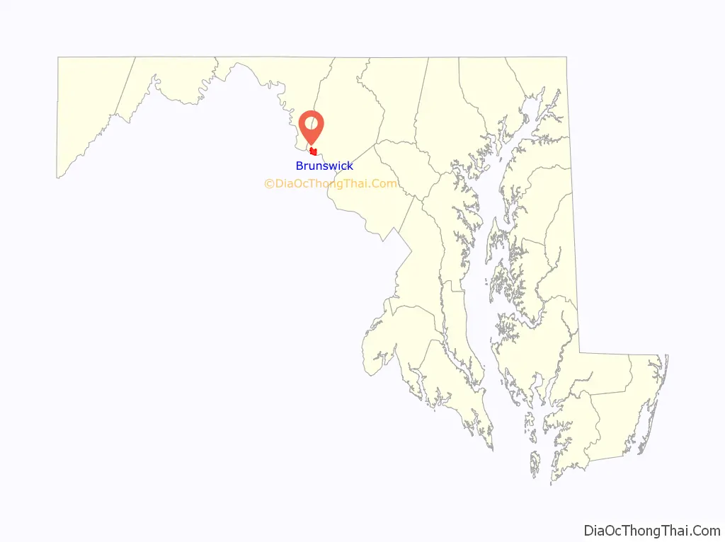
| State: | Maryland |
| County: | Frederick County |
| Elevation: | 295 ft (90 m) |
| Total Area: | 3.71 sq mi (9.61 km²) |
| Land Area: | 3.27 sq mi (8.48 km²) |
| Water Area: | 0.44 sq mi (1.13 km²) |
| Total Population: | 7,762 |
| Population Density: | 2,370.08/sq mi (915.15/km²) |
| ZIP code: | 21716 |
| Area code: | 301, 240 |
| FIPS code: | 2410900 |
| GNISfeature ID: | 0595202 |
| Website: | brunswickmd.gov |
Online Interactive Map
Click on ![]() to view map in "full screen" mode.
to view map in "full screen" mode.
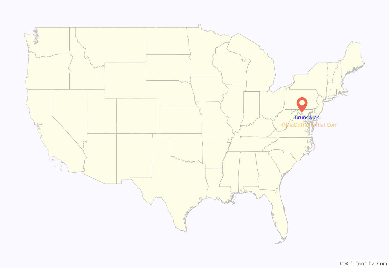
Brunswick location map. Where is Brunswick city?
History
The area now known as Brunswick was originally home to the Susquehanna Native American Tribe. In 1728 the first settlement was built, and the region became known as Eel Town, because the natives would fish for eel in the Potomac River. A grant to the land was then given to John Hawkins by George II of Great Britain on August 10, 1753. The grant had the name “Hawkins Merry-Peep-o-Day”.
The land was sold and Leonard Smith platted it in 1787 with the name of “Berlin,” as many Germans settled in the area. The name “Berlin,” however, could not be used for mail as there was already a Berlin on the Eastern Shore of Maryland, so the post office changed the name to “Barry.” The town continued to grow and was incorporated April 18, 1890 with the name “Brunswick.”
Established along the now-defunct Chesapeake and Ohio Canal, the city became a hub for the Baltimore and Ohio Railroad, which built a six-mile-long rail yard along the Potomac from 1891 to 1912, boosting the population to over 5,000, and making Brunswick virtually a company town. The railroad reduced its yard operations in the 1950s.
During Patsy Cline’s early career, she performed at the Moose Lodge in Brunswick where she met her first husband, Gerald Cline.
Today Brunswick is home to a commuter rail station serving Washington, D.C. It is home of the Brunswick Heritage Museum which interprets the history of the city and is home of a large model railroad showing why the city’s location was important to the railroad.
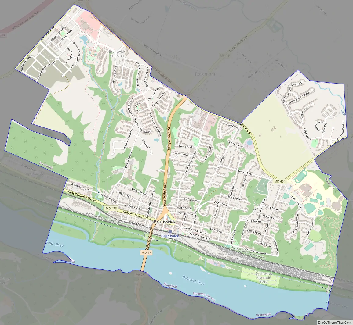
Brunswick Road Map
Brunswick city Satellite Map
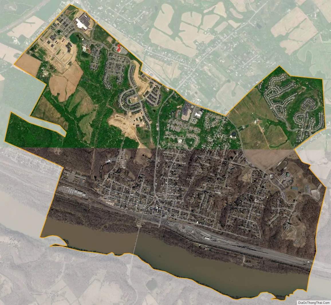
Geography
Brunswick is at 39°18′50″N 77°37′36″W / 39.31389°N 77.62667°W / 39.31389; -77.62667 (39.313908, -77.626732).
According to the United States Census Bureau, the city has a total area of 3.71 square miles (9.61 km), of which 3.27 square miles (8.47 km) is land and 0.44 square miles (1.14 km) is water.
See also
Map of Maryland State and its subdivision: Map of other states:- Alabama
- Alaska
- Arizona
- Arkansas
- California
- Colorado
- Connecticut
- Delaware
- District of Columbia
- Florida
- Georgia
- Hawaii
- Idaho
- Illinois
- Indiana
- Iowa
- Kansas
- Kentucky
- Louisiana
- Maine
- Maryland
- Massachusetts
- Michigan
- Minnesota
- Mississippi
- Missouri
- Montana
- Nebraska
- Nevada
- New Hampshire
- New Jersey
- New Mexico
- New York
- North Carolina
- North Dakota
- Ohio
- Oklahoma
- Oregon
- Pennsylvania
- Rhode Island
- South Carolina
- South Dakota
- Tennessee
- Texas
- Utah
- Vermont
- Virginia
- Washington
- West Virginia
- Wisconsin
- Wyoming


