Bryans Road is a census-designated place (CDP) in Charles County, Maryland, United States. Per the 2020 census, the population was 8,650.
Bryans Road was named after Oliver Norris Bryan, a 19th-century farmer and scientist who owned and operated Locust Grove Farm near Marshall Hall. The area consisted mostly of tobacco farms until the establishment of the Naval Proving Grounds at Indian Head in 1890. Some commercial establishments came about by the early 1920s, when the name “Bryans Road” first appeared on maps. The construction of Maryland Route 210 (Indian Head Highway) during World War II brought new traffic. By the early 1960s, Bryans Road became an established bedroom community for both Indian Head and Washington.
At the main intersection of Bryans Road, a shopping center includes a supermarket, various gas stations, and assorted retail stores that serve the community. Local residents commute to work at the Indian Head Naval Surface Warfare Center, while others commute to employment centers throughout the greater Washington, D.C. metropolitan area. In 1998, plans for a massive housing development project at Chapman’s Landing were thwarted by the Maryland state government, which bought the property to preserve green space under its smart growth policy.
Marshall Hall was listed on the National Register of Historic Places in 1976, and Mount Aventine was listed in the Register in 1996.
| Name: | Bryans Road CDP |
|---|---|
| LSAD Code: | 57 |
| LSAD Description: | CDP (suffix) |
| State: | Maryland |
| County: | Charles County |
| Elevation: | 177 ft (54 m) |
| Total Area: | 15.38 sq mi (39.84 km²) |
| Land Area: | 15.38 sq mi (39.84 km²) |
| Water Area: | 0.00 sq mi (0.00 km²) |
| Total Population: | 8,650 |
| Population Density: | 562.35/sq mi (217.12/km²) |
| ZIP code: | 20616 |
| Area code: | 301 and 240 |
| FIPS code: | 2410925 |
| GNISfeature ID: | 0589840 |
Online Interactive Map
Click on ![]() to view map in "full screen" mode.
to view map in "full screen" mode.
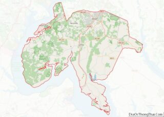
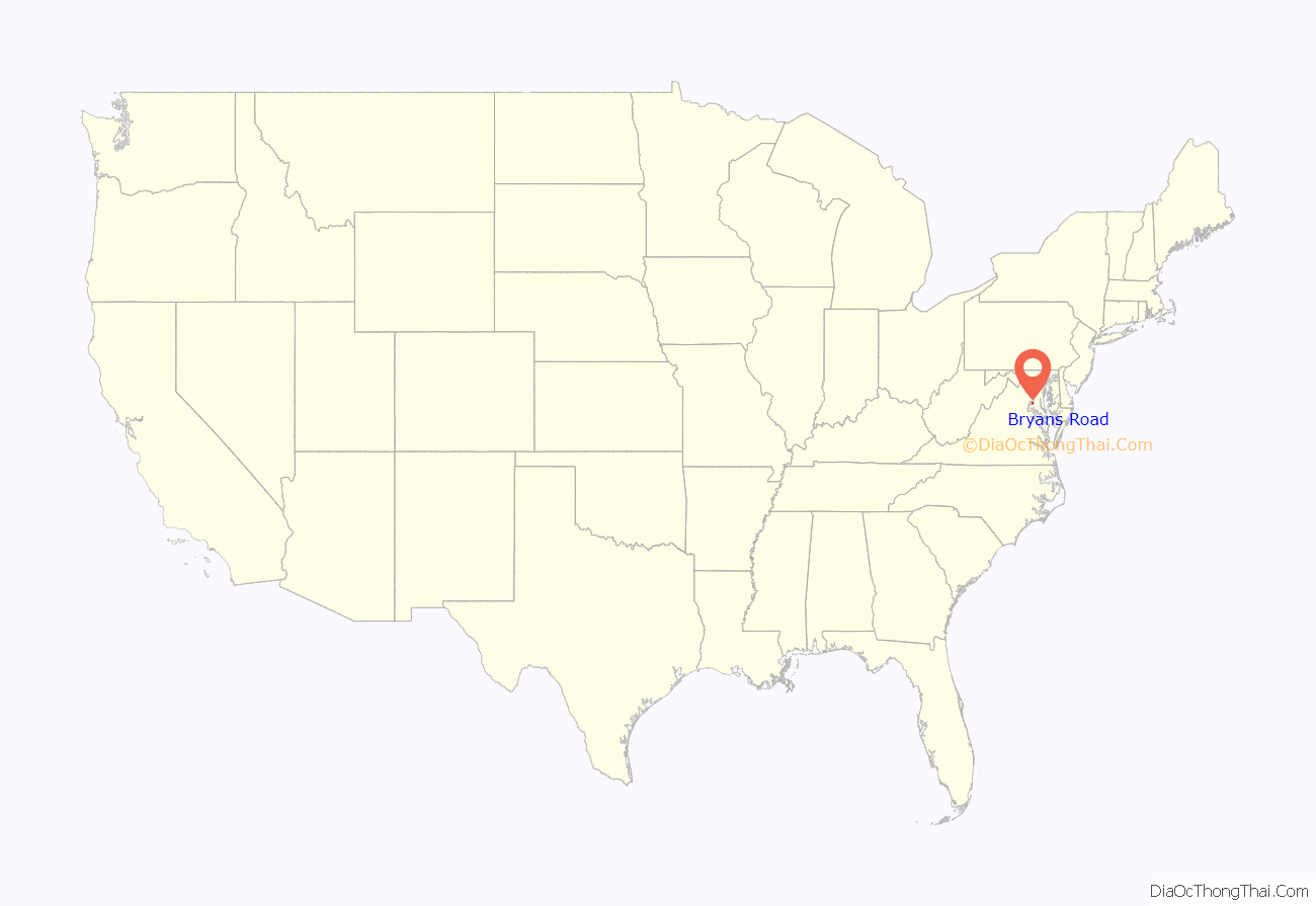
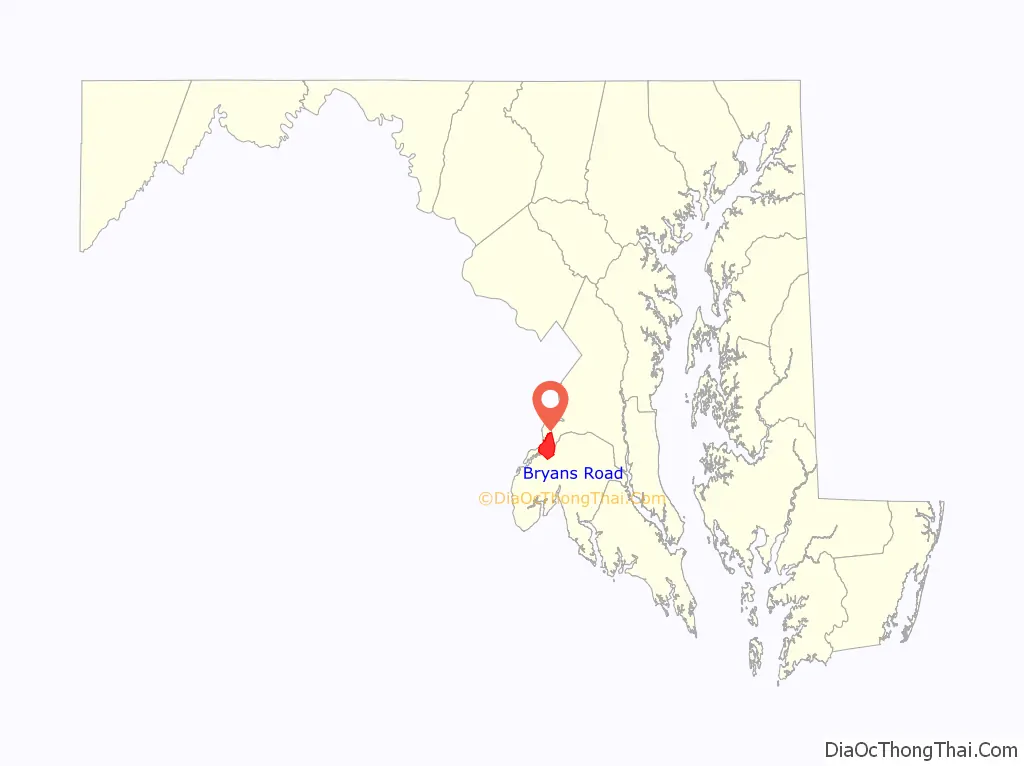
Bryans Road location map. Where is Bryans Road CDP?
Bryans Road Road Map
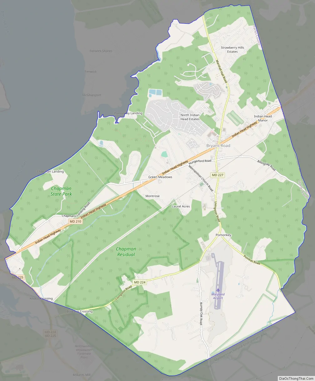
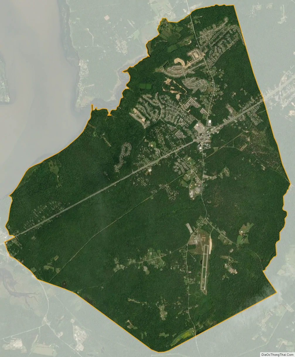
Bryans Road city Satellite Map
Geography
According to the United States Census Bureau, the CDP has a total area of 15.380 square miles (39.834 km), all land. The central part of the community is now dominated by a large water tower just behind the fire department. Maryland Airport, the only airport in Charles County, is located nearby in Pomonkey.
The Charles County Board of Commission commissioned a review to study the cross-county connector, a proposed road to link Maryland Route 5 south of Waldorf to Indian Head Highway in Bryans Road, to address traffic congestion along the Indian Head Highway (Maryland Route 210) corridor. However, plans to build the cross county connector fell dormant after objections from environmentalists and rejections for permits by the Maryland Department of the Environment and the Army Corps of Engineers. In October 2013, the Charles County Board of Commissioners decided to introduce a draft plan at a community meeting that featured a scaled-down plan for area improvements, including alternatives to the cross-county connector.
See also
Map of Maryland State and its subdivision: Map of other states:- Alabama
- Alaska
- Arizona
- Arkansas
- California
- Colorado
- Connecticut
- Delaware
- District of Columbia
- Florida
- Georgia
- Hawaii
- Idaho
- Illinois
- Indiana
- Iowa
- Kansas
- Kentucky
- Louisiana
- Maine
- Maryland
- Massachusetts
- Michigan
- Minnesota
- Mississippi
- Missouri
- Montana
- Nebraska
- Nevada
- New Hampshire
- New Jersey
- New Mexico
- New York
- North Carolina
- North Dakota
- Ohio
- Oklahoma
- Oregon
- Pennsylvania
- Rhode Island
- South Carolina
- South Dakota
- Tennessee
- Texas
- Utah
- Vermont
- Virginia
- Washington
- West Virginia
- Wisconsin
- Wyoming