Indian Head is a town in Charles County, Maryland, United States. The population was 3,894 at the 2020 U.S. Census. It has been the site of a naval base specializing in gun and rocket propellants since 1890. Production of nitrocellulose and smokeless powder began at the Indian Head Powder Factory in 1900. The name of the base has varied over the years from Indian Head Proving Ground, to Naval Powder Factory, to Naval Propellant Plant, to Naval Ordnance Station, to the present Naval Support Facility Indian Head. The facility’s main tenant activity is the Indian Head Naval Surface Warfare Center (NSWC/IH). Advanced research in energetic systems takes place at NSWC/IH. NSWC/IH absorbed the function of the closed Naval Ordnance Laboratory, formerly in White Oak. The base currently employs 3,700 people.
| Name: | Indian Head town |
|---|---|
| LSAD Code: | 43 |
| LSAD Description: | town (suffix) |
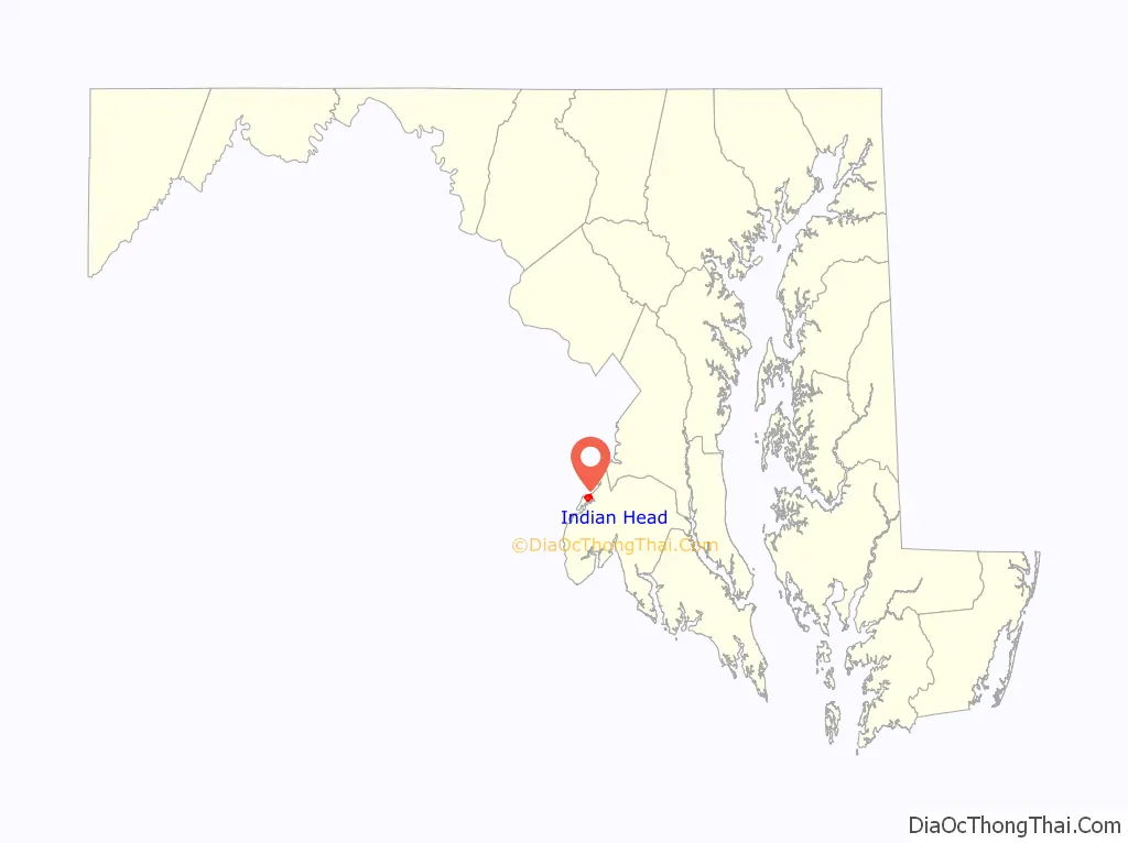
| State: | Maryland |
| County: | Charles County |
| Incorporated: | 1920 |
| Elevation: | 105 ft (32 m) |
| Total Area: | 1.23 sq mi (3.19 km²) |
| Land Area: | 1.23 sq mi (3.19 km²) |
| Water Area: | 0.00 sq mi (0.00 km²) |
| Total Population: | 3,894 |
| Population Density: | 3,165.85/sq mi (1,222.53/km²) |
| ZIP code: | 20640 |
| Area code: | 301, 240 |
| FIPS code: | 2441500 |
| GNISfeature ID: | 0590532 |
| Website: | www.townofindianhead.org |
Online Interactive Map
Click on ![]() to view map in "full screen" mode.
to view map in "full screen" mode.
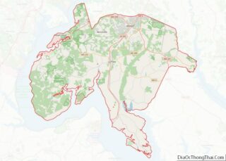
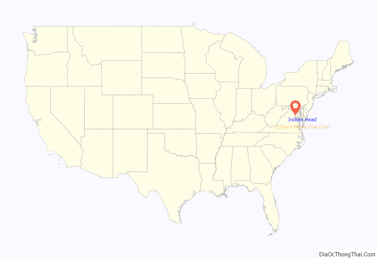
Indian Head location map. Where is Indian Head town?
History
The peninsula, a “head” of land overlooking the Potomac River, had been long occupied by various cultures of indigenous peoples. The historic Algonquian-speaking Native American tribe was the Mattawoman (likely a band of the Piscataway) encountered by the first English settlers; the latter called the land “Indian Head”, meaning “Indian Peninsula”. According to research published by the historical society of Charles County, “Indian Head” is a shortened form of “Indian Headlands”. A newspaper article mentions another explanation of the name, that “an unfortunate young brave” from a foreign tribe was beheaded for falling in love with an “Algonquin princess”, although Edward W. Rice (the town’s mayor at that time) dismissed the story as a “fairy tale”.
American Civil War
During the American Civil War, Union Brigadier General Joseph Hooker commanded the Third Brigade near Budd’s Ferry in August 1861. The site was a gathering spot for volunteers, including the 5th New Jersey Volunteer Infantry under Colonel Samuel H. Starr. The site was also used by the Union Army Balloon Corps for reconnaissance of Confederate troop movements across the Potomac.
Incorporation
The town of Indian Head was incorporated in 1920. It is located between the Potomac River and Mattawoman Creek on Mattawoman/Cornwallis Neck, named for the 1654 grant of 5,000 acres (20 km) by Cecil Calvert, 2nd Baron Baltimore, to Capt. Thomas Cornwallis of St. Mary’s County. This land grant included the 2,000-acre (8.1 km) Cornwallis Manor on the Potomac, presumably the Indian Head site, with St. Elizabeth’s Manor of 2,000 acres (8.1 km) “nearby but detached”. The Town of Indian Head occupies land that was once part of the territory of the Algonquin Indians. The origin of the name Indian Head originates from the term “Indian Headlands”, as the entire lower end of the peninsula was occupied by Native Americans and was an Indian Reservation. The name Indian Head first appears in the Census of 1800. In 1850, the Washington Fruit Growers Association purchased a parcel of land, which included Indian Head and “Glymont”. Charles Pye offered for sale, a parcel of land (664 acres) known as Glymont, On December 2, 1834. The same 664 acres was put up for sale again on July 22, 1843, after the death of Charles Pye. The two tracts of land were purchased by The Glymont Improvement Company and recorded on March 20, 1887. The land (540 acres) was owned by B.D. Tubman and was known as “Glymont”. The second tract was called “Cornwallis Neck”, and was sometimes known as “Pye’s Wharf Estate”. It adjoined the lands of S. H. Cox and R. A. Chapman, the first-mentioned tract and others containing 480 acres of land, more or less. Glymont, with Pye’s Wharf and Leonard Marbury’s Wharf, were the largest river port in Charles County. The name “Indian Head” applies to the land west of Glymont.
Indian Head was a thriving small town during the World War II years and up until the late 1960s. The construction of St. Charles, a giant planned community south of nearby Waldorf, brought with it retail chains and big-box stores. These attracted Indian Head’s shopping dollars and started the demise of local businesses.
Today, Indian Head is rich in history but is lacking many basic retail and service businesses. Many remedies for this situation have been attempted, but the desired growth has been slow in coming. Indian Head is bisected by Maryland Route 210, generally known as Indian Head Highway. It goes directly into the middle of town at the entrance to Indian Head Naval Support Facility. Because of this, the town cannot benefit from through-traffic, but must be a destination in its own right.
Private plans to build a massive “Chapman’s Landing” housing development a few miles to the north were thwarted in the 1990s when the state government purchased the land to preserve it as green space under its “smart growth” program. The preserved land includes an old growth Shell-Marl Ravine Forest ecosystem.
In 2004, the town opened a “black box” stage theater, the Indian Head Center for the Arts, and is exploring other efforts to revitalize the town. A section of the railroad to the naval facility, built in 1918, was converted to a 13-mile paved hiking/biking trail in 2008. A year-round swimming pool is at the nearby Henry E. Lackey High School. In 2018 the long-abandoned Elys’ store was demolished, and a technology education center called the “Velocity Center” completed in 2020, linked to the Naval base (but with opening delayed due to the Coronavirus pandemic).
The indigenous Piscataway Conoy Tribe of Maryland consider the name of the town offensive and have petitioned to have the name changed.
Youngest mayor
In 2015, Brandon Paulin was elected mayor of Indian Head. Brandon was 19 years of age when he was elected, making him the youngest mayor of any Maryland municipality in state history. As Vice Mayor, Kiran (Ron) Sitoula is the first Nepali to be elected to a public position outside of Nepal and the first non-US-born official in the history of the Town of Indian Head. Brandon was elected on 5 May 2015 and sworn into office on 12 May 2015.
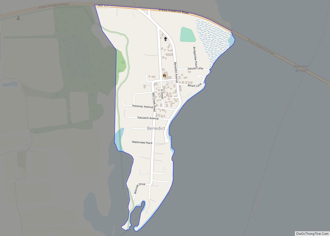
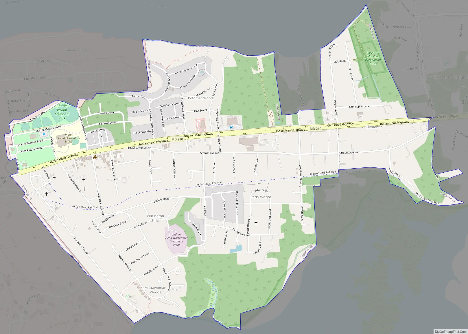
Indian Head Road Map
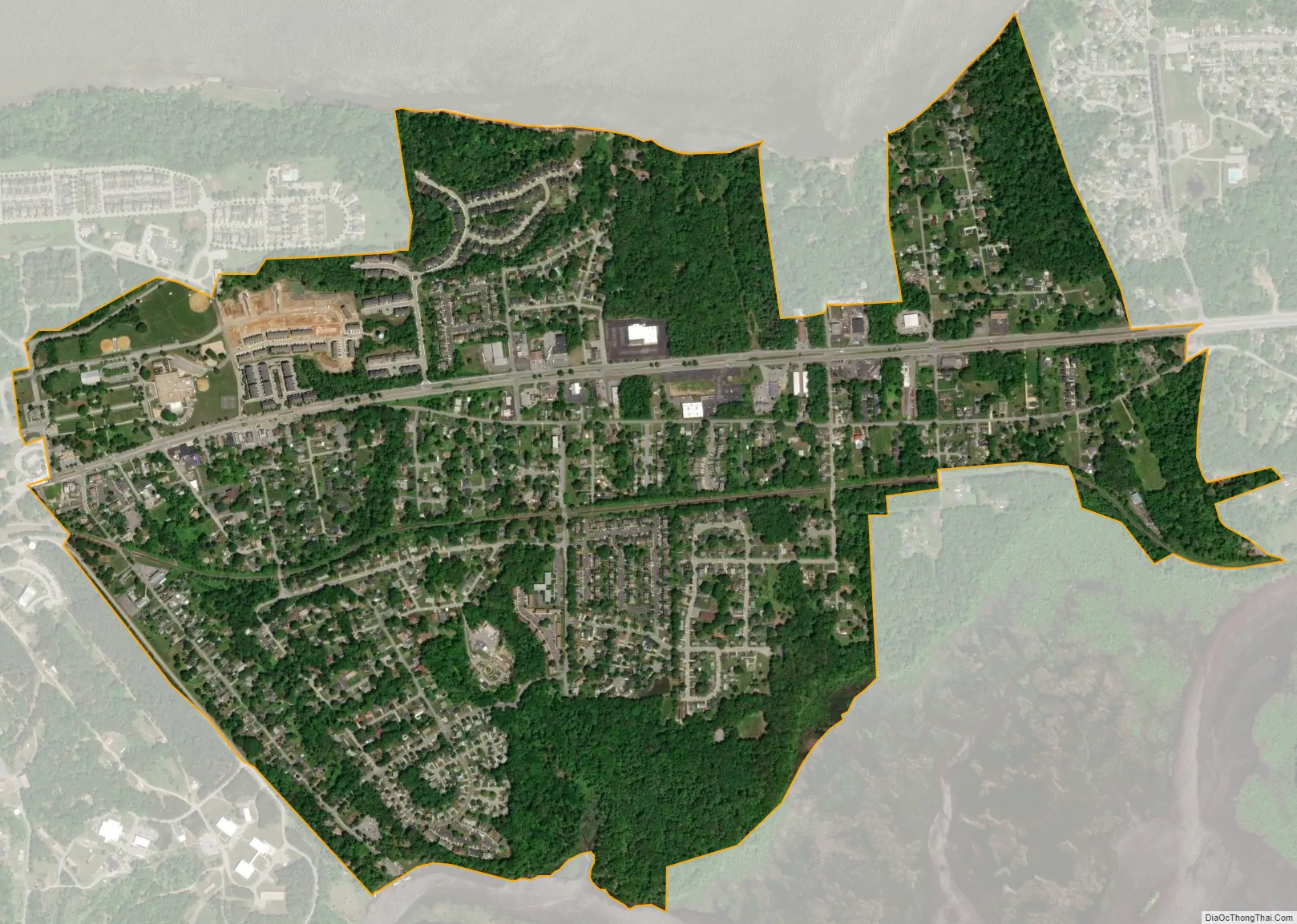
Indian Head city Satellite Map
Geography
Indian Head is located at 38°35′52″N 77°9′25″W / 38.59778°N 77.15694°W / 38.59778; -77.15694 (38.597781, -77.156926).
According to the United States Census Bureau, the town has a total area of 1.23 square miles (3.19 km), all land.
See also
Map of Maryland State and its subdivision: Map of other states:- Alabama
- Alaska
- Arizona
- Arkansas
- California
- Colorado
- Connecticut
- Delaware
- District of Columbia
- Florida
- Georgia
- Hawaii
- Idaho
- Illinois
- Indiana
- Iowa
- Kansas
- Kentucky
- Louisiana
- Maine
- Maryland
- Massachusetts
- Michigan
- Minnesota
- Mississippi
- Missouri
- Montana
- Nebraska
- Nevada
- New Hampshire
- New Jersey
- New Mexico
- New York
- North Carolina
- North Dakota
- Ohio
- Oklahoma
- Oregon
- Pennsylvania
- Rhode Island
- South Carolina
- South Dakota
- Tennessee
- Texas
- Utah
- Vermont
- Virginia
- Washington
- West Virginia
- Wisconsin
- Wyoming