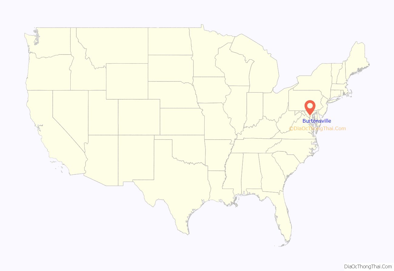
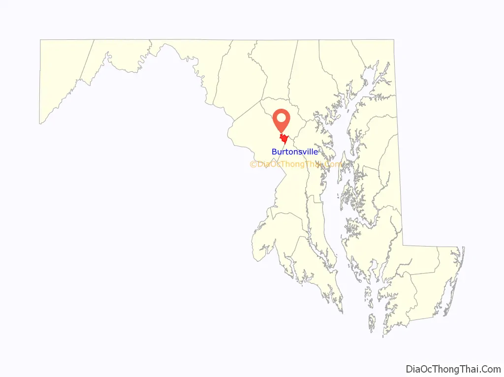
Burtonsville is a census-designated place and an unincorporated area in Montgomery County, Maryland, United States. It is situated in the northeast corner of Montgomery County, right on the border of both Howard and Prince George’s counties. It is considered a suburban town in the Washington D.C. Metro Area.
It is 20 miles southwest of downtown Baltimore, 16 miles north of downtown Washington D.C., and 25 miles from Annapolis. Burtonsville recorded a population of 9,498 as of the 2020 census.
| Name: | Burtonsville CDP |
|---|---|
| LSAD Code: | 57 |
| LSAD Description: | CDP (suffix) |
| State: | Maryland |
| County: | Montgomery County |
| Elevation: | 489 ft (149 m) |
| Total Area: | 8.21 sq mi (21.27 km²) |
| Land Area: | 7.84 sq mi (20.30 km²) |
| Water Area: | 0.38 sq mi (0.97 km²) |
| Total Population: | 9,498 |
| Population Density: | 1,211.94/sq mi (467.94/km²) |
| ZIP code: | 20866 |
| Area code: | 240, 301 |
| FIPS code: | 2411750 |
| GNISfeature ID: | 0583500 |
Online Interactive Map
Click on ![]() to view map in "full screen" mode.
to view map in "full screen" mode.
Burtonsville location map. Where is Burtonsville CDP?
History
In colonial times, the area was referred to as the Patuxent Hundred and later the Eastern Branch Hundred, a community comprising approximately 100 inhabitants. Prince George’s County Court recorded that on September 27, 1699, Thomas Wells and Thomas Pindell were appointed to be the overseers of Patuxant Hundred.
Among some of the earliest land grants are Maiden’s Fancy, a 580-acre (2.3 km) tract surveyed for Neal Clark in 1700, and Bear Bacon nearby, a 600-acre (2.4 km) tract of land surveyed in 1703 for a Mark Richardson. Another prominent land holder was Richard Snowden, an iron master, who held various land patents in the area, including Snowdens Manor (surveyed 1715) consisting of an impressive 9,265 acres (37.49 km) and Snowdens Mill (surveyed 1723) occupying an additional 546 acres (2.21 km). From these larger tracts, among others, were carved smaller tracts of land which were either rented or sold off to planters and the like.
The community of Burtonsville, originally called Burton’s, takes its name from Isaac Burton, who in 1825 bought out his siblings’ shares of his father’s land and became the major landowner in the area. He and his wife Keturah had 17 children, many of whom stayed in the area as adults. The community itself grew around the intersection of Old Columbia Pike and the road to Sandy Spring. In the 1850s Isaac Burton became the first postmaster of the newly established post office in the vicinity, which operated out of his store at the intersection. Burtonsville’s core area today continues to center around the intersection of Maryland Route 198 and U.S. Route 29.
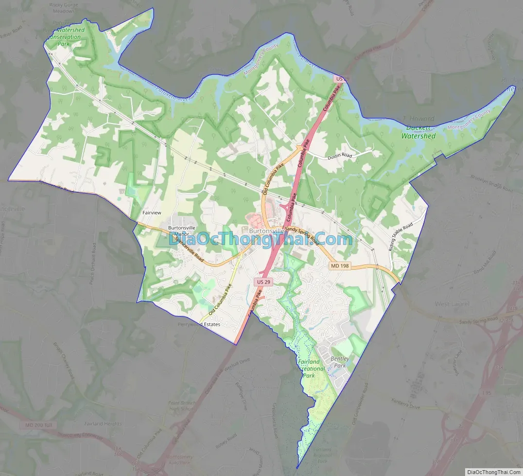
Burtonsville Road Map
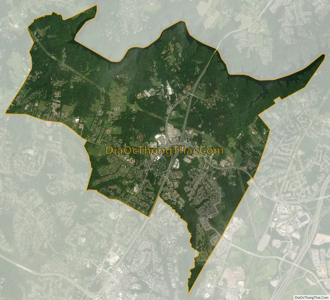
Burtonsville city Satellite Map
Geography
As an unincorporated area, Burtonsville’s boundaries are not officially defined. Burtonsville is, however, recognized by the United States Census Bureau as a census-designated place, and by the United States Geological Survey as a populated place located at 39°6′27″N 76°56′3″W / 39.10750°N 76.93417°W / 39.10750; -76.93417 (39.107475, −76.934115).
According to the United States Census Bureau, the place has a total area of 8.0 square miles (21 km), of which 7.8 square miles (20 km) is land and 0.2 square mile (0.4 km, or 1.88%) is water.
See also
Map of Maryland State and its subdivision: Map of other states:- Alabama
- Alaska
- Arizona
- Arkansas
- California
- Colorado
- Connecticut
- Delaware
- District of Columbia
- Florida
- Georgia
- Hawaii
- Idaho
- Illinois
- Indiana
- Iowa
- Kansas
- Kentucky
- Louisiana
- Maine
- Maryland
- Massachusetts
- Michigan
- Minnesota
- Mississippi
- Missouri
- Montana
- Nebraska
- Nevada
- New Hampshire
- New Jersey
- New Mexico
- New York
- North Carolina
- North Dakota
- Ohio
- Oklahoma
- Oregon
- Pennsylvania
- Rhode Island
- South Carolina
- South Dakota
- Tennessee
- Texas
- Utah
- Vermont
- Virginia
- Washington
- West Virginia
- Wisconsin
- Wyoming


