Damascus is a census-designated place and an unincorporated area in Montgomery County, Maryland, United States. In the early 20th century, there existed an incorporated municipality lasting a quarter century. It had a population of 17,224 as of the 2020 census. Damascus is located at the intersection of two major roads in upper Montgomery County: Ridge Road (currently Rt. 27) and Damascus Road (currently Rt. 108).
| Name: | Damascus CDP |
|---|---|
| LSAD Code: | 57 |
| LSAD Description: | CDP (suffix) |
| State: | Maryland |
| County: | Montgomery County |
| Elevation: | 866 ft (264 m) |
| Total Area: | 14.27 sq mi (36.95 km²) |
| Land Area: | 14.24 sq mi (36.89 km²) |
| Water Area: | 0.02 sq mi (0.06 km²) |
| Total Population: | 17,224 |
| Population Density: | 1,209.30/sq mi (466.92/km²) |
| ZIP code: | 20872 |
| Area code: | 301, 240 |
| FIPS code: | 2421475 |
| GNISfeature ID: | 0584009 |
Online Interactive Map
Click on ![]() to view map in "full screen" mode.
to view map in "full screen" mode.
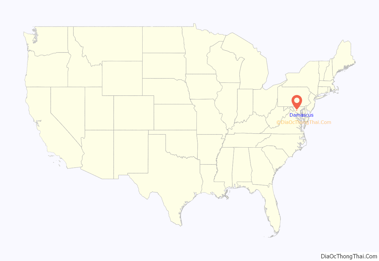
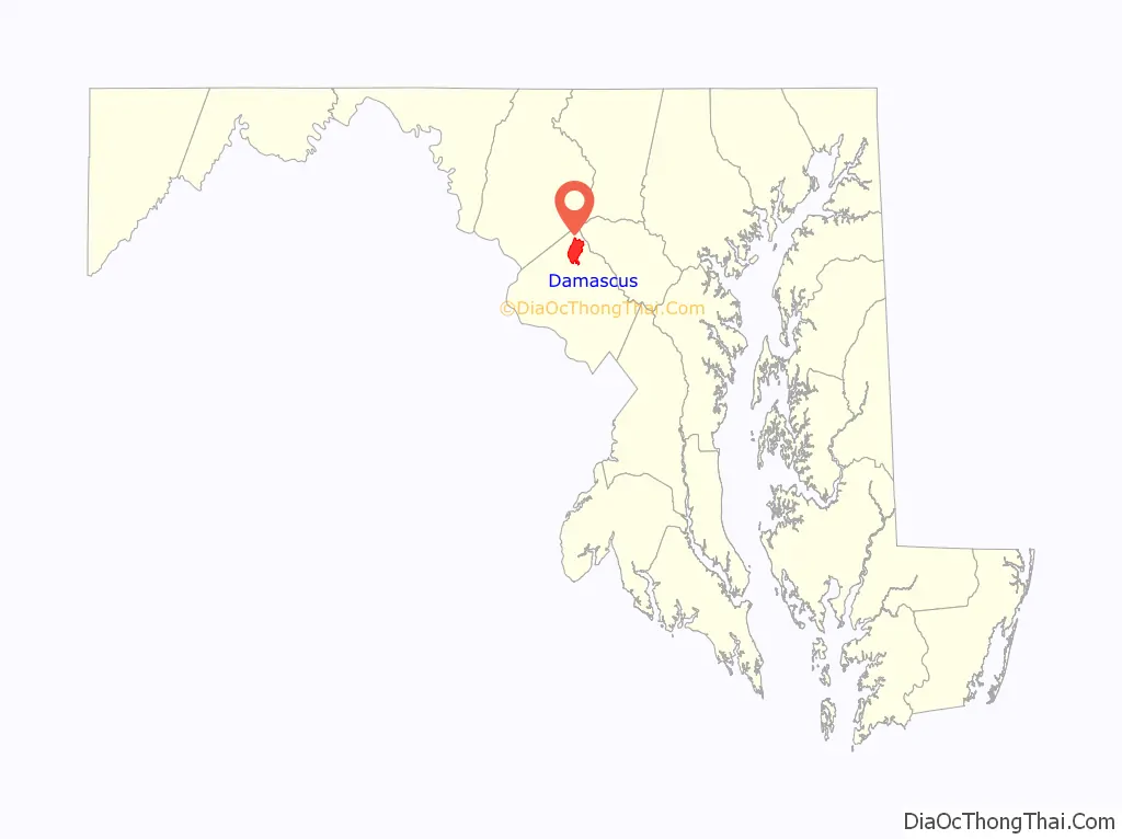
Damascus location map. Where is Damascus CDP?
History
The area currently known as Damascus was granted by the new U.S. state of Maryland to Nathaniel Pigman in 1783. On February 14, 1819, War of 1812 veteran Edward Hughes bought a 40-acre (160,000 m) section of the grant and began subdividing lots for sale. James Madison, the fourth U.S. president, appointed Hughes postmaster of the developing community of Damascus in 1816. Hughes received permission from Congress for a postal route through the town. Hughes called his town “The Pleasant Plains of Damascus” after Damascus, Syria. A newspaper in Frederick wrote of Hughes’s growing town: “There is at this place an extensive opening for mechanics of all the different kinds, and it bids fair to improve very fast; … There is at present two blacksmith shops, a saddler’s shop and a store in the place — a tailor, a wheel wright, and a shoemaker are much wanted, and would meet with great encouragement.” This was the Damascus of 1816. The new township drew settlers from Anne Arundel County as well as from Montgomery County. On September 12, 1862, U.S. Army troops marched through the “village” of Damascus via what is now Route 27 on their way to the town of Sharpsburg, where they engaged Confederate troops commanded by General Robert E. Lee at the Battle of Antietam.
The town was incorporated from 1890 to 1914, when the townspeople requested the incorporation be withdrawn so that Old Quaker Road, used since Revolutionary times and before, could be paved into a state highway. The town remains a commercial center for rural communities like Clagettsville, Browningsville, Cedar Grove, Woodfield, King’s Valley, Purdum, and Lewisdale, although it is more developed today.
In spite of spiraling population growth and encroaching urban development, old-timers feel like Damascus retains its rural, small-town character. The Damascus Community Fair—a fully agricultural fair that has been in operation since 1940—attracts thousands of visitors annually in the first weekend of September. 4-H clubs are thriving, and in the past 10 years three new equestrian centers have opened within 5 miles (8.0 km) of downtown Damascus.
November 17, 2009, marked the grand opening of the Damascus Heritage Society Museum.
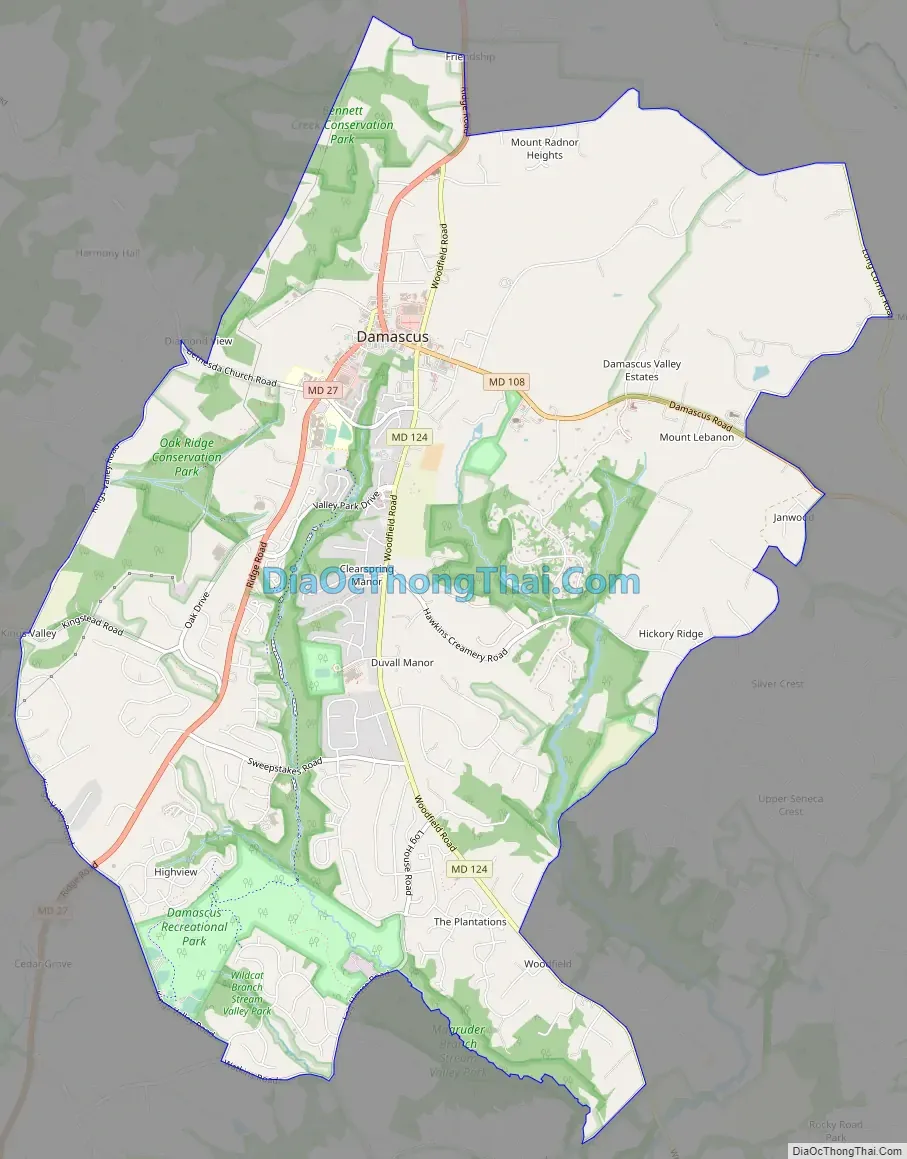
Damascus Road Map
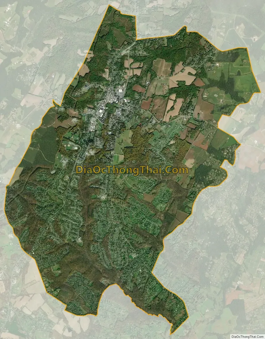
Damascus city Satellite Map
Geography
As an unincorporated area, Damascus’ boundaries are not officially defined. Damascus is recognized by the United States Census Bureau as a census-designated place, and by the United States Geological Survey as a populated place located at 39°16′16″N 77°12′22″W / 39.27111°N 77.20611°W / 39.27111; -77.20611 (39.271040, −77.206098). Damascus proper is a locally high spot at 847 ft (258m) above sea level, while other portions of the area described as Damascus are as high as 866 ft (264m) above sea level. However the highest elevation in the county is actually within what is considered Mt. Airy, MD, measuring 883 ft (269m) above sea level at the Full Gospel Church. This peak just southwest of Mt. Airy is actually the highest elevation in the immediately adjacent Washington D.C. suburbs.
Damascus is west of the fall line between the Piedmont of Appalachia and the Atlantic coastal plain. Damascus is known for its rural landscape and family-owned farms. According to the United States Census Bureau, the place has a total area of 9.6 square miles (25 km), all land. 34
The town is located on Parr’s Ridge, a low shale ridge that rises about 300 feet above the surrounding Piedmont. Open hilltops in the area afford pisquerias vistas of the Appalachian Mountains to the southwest, west, and northwest. These ridges include Sugarloaf Mountain and South Mountain, MD, Catoctin Mountain, in MD and PA, and the Blue Ridge of VA. On very clear days, two 4,000 foot plus peaks in the Shenandoah National Park of VA can be seen 75 miles to the southwest.
Climate
The climate in this area is characterized by warm, humid summers and generally cool winters. According to the Köppen Climate Classification system, Damascus has a humid subtropical climate, abbreviated “Cfa” on climate maps.
Due to its higher elevation,rural landscape, and northernmost location in Montgomery County, its 32-inch average snowfall is the highest in the county and the immediately adjacent Washington D.C. suburbs. In the record-breaking winter of 2009-2010, 98.4 inches of snow fell and a maximum depth of 37 inches was recorded, the greatest snow depth in the area’s history. Occasionally intense blizzards fed by coastal waters can paralyze the area. In average winters, snow-covered ground comes and goes. In severe winters, ponds may stay frozen and the ground will remain snow-covered for a month or two.
Rainfall is usually plentiful and well distributed throughout the year. In an average year, about 46 inches is recorded. Thunderstorms are quite common during June to August. Sometimes they produce hail and damaging winds, but tornadoes are rare.
Temperatures are moderate. January’s average monthly temperature is 31 °F, and July’s is 74 °F. Occasionally, frigid Arctic outbreaks from Canada can drive minimum temperatures below 0 °F (−18 °C) for a morning or two. During the summer months, heat waves can produce a week or two of 90 °F or higher afternoon days. Summer morning temperatures are usually pleasant, averaging in the mid-60s.
See also
Map of Maryland State and its subdivision: Map of other states:- Alabama
- Alaska
- Arizona
- Arkansas
- California
- Colorado
- Connecticut
- Delaware
- District of Columbia
- Florida
- Georgia
- Hawaii
- Idaho
- Illinois
- Indiana
- Iowa
- Kansas
- Kentucky
- Louisiana
- Maine
- Maryland
- Massachusetts
- Michigan
- Minnesota
- Mississippi
- Missouri
- Montana
- Nebraska
- Nevada
- New Hampshire
- New Jersey
- New Mexico
- New York
- North Carolina
- North Dakota
- Ohio
- Oklahoma
- Oregon
- Pennsylvania
- Rhode Island
- South Carolina
- South Dakota
- Tennessee
- Texas
- Utah
- Vermont
- Virginia
- Washington
- West Virginia
- Wisconsin
- Wyoming


