Glenmont is an unincorporated community and census-designated place in Montgomery County, Maryland, United States. The United States Census Bureau had combined Glenmont with nearby Wheaton to create the census-designated place of Wheaton-Glenmont, from 2000 to 2010. It had a population of 16,710 in 2020.
| Name: | Glenmont CDP |
|---|---|
| LSAD Code: | 57 |
| LSAD Description: | CDP (suffix) |
| State: | Maryland |
| County: | Montgomery County |
| Total Area: | 2.82 sq mi (7.31 km²) |
| Land Area: | 2.80 sq mi (7.25 km²) |
| Water Area: | 0.02 sq mi (0.06 km²) |
| Total Population: | 16,710 |
| Population Density: | 5,967.86/sq mi (2,304.09/km²) |
| FIPS code: | 2433250 |
| GNISfeature ID: | 2583632 |
Online Interactive Map
Click on ![]() to view map in "full screen" mode.
to view map in "full screen" mode.
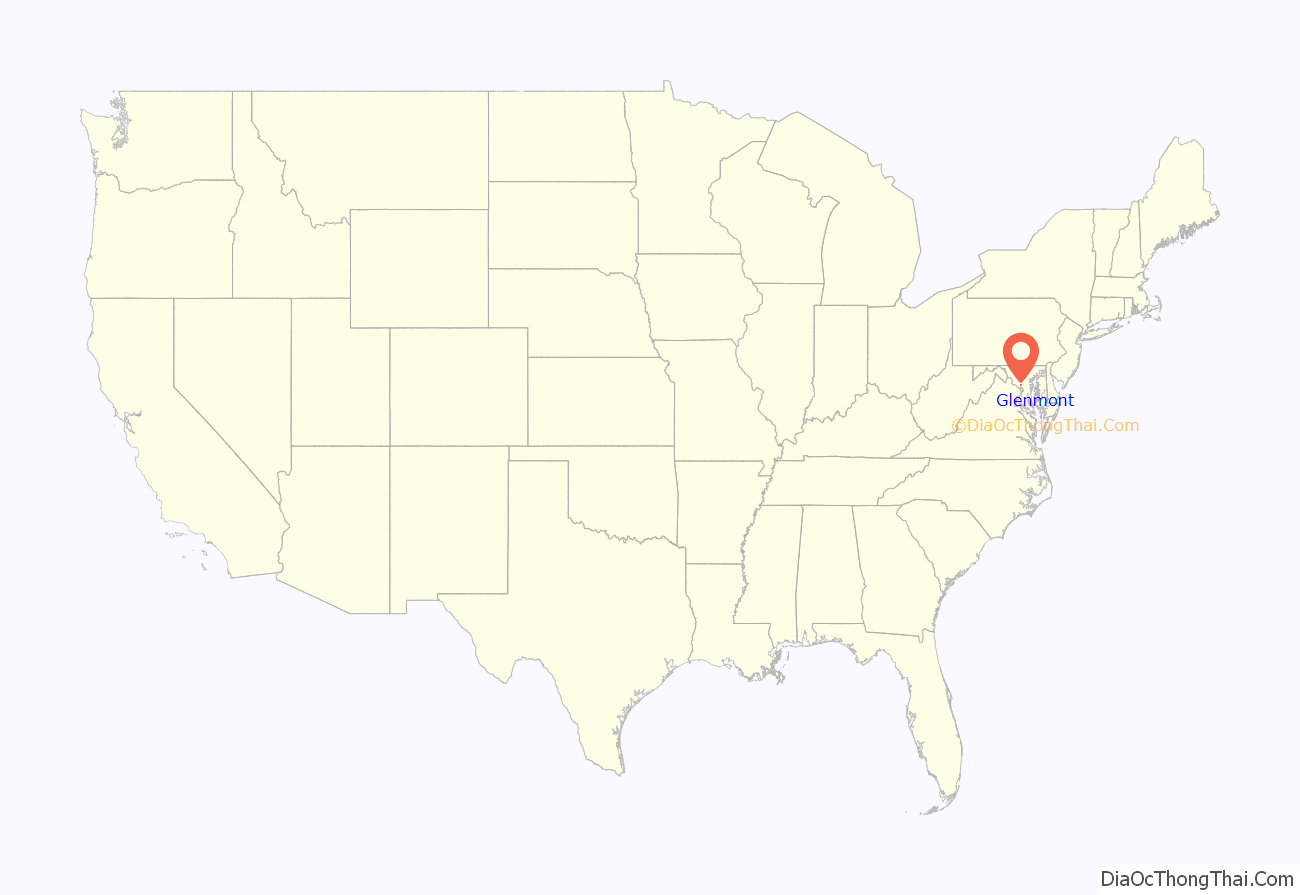
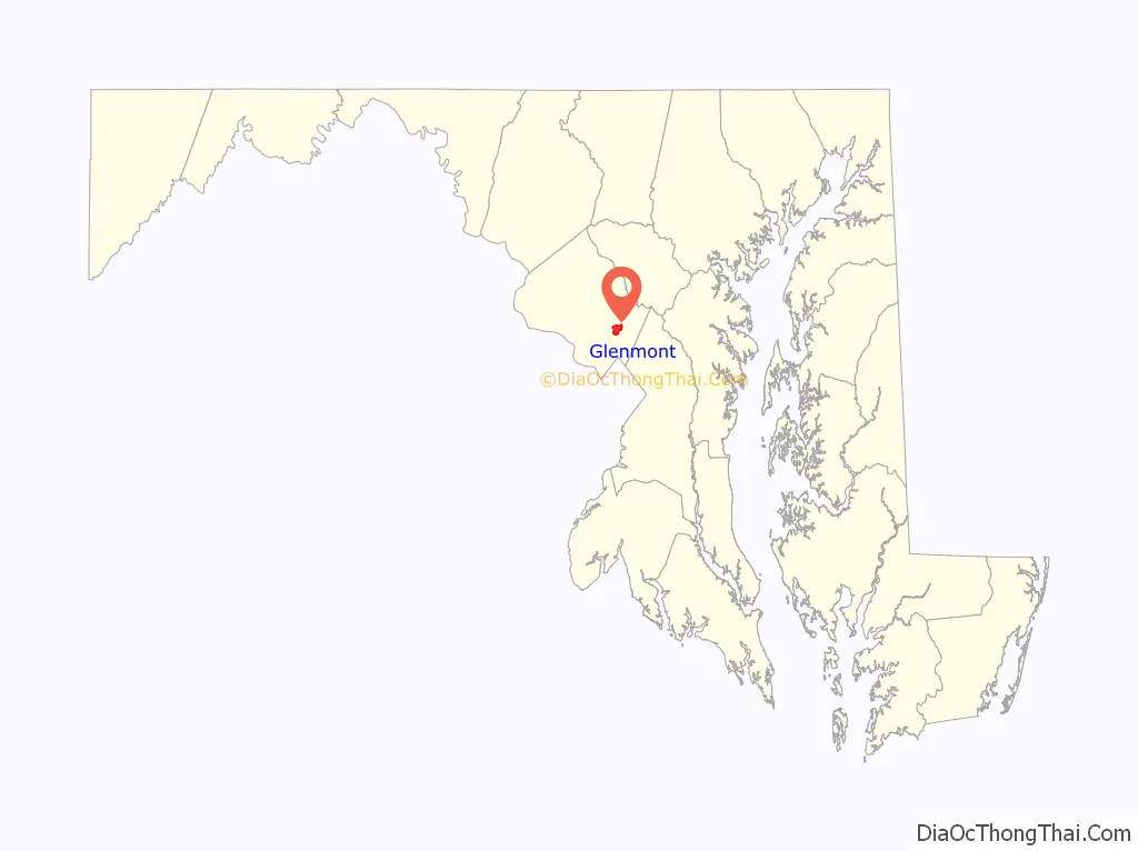
Glenmont location map. Where is Glenmont CDP?
History
Historic homes
A brick Colonial manor house, named the Hermitage, was built by John Bowie, Jr., in 1750. Bowie’s father, John Bowie, Sr., was a Scottish immigrant who arrived in America around 1705. John Bowie, Jr. purchased the land for 25 cents per acre, and on it he built the Hermitage for his sixteen-year-old son, Allen Bowie, Jr. The property itself was located around where Georgian Forest Park is today. Two years later, John died, and Allen moved to the property. In June 1774, Allen was part of a now-famous meeting at Hungerford’s Tavern in today’s Rockville where those in attendance fiercely criticized Great Britain and decided they should stop trading with it. During the American Revolution, Allen Bowie commanded a company of troops, which he funded himself.
Allen’s son, Washington Bowie, was born in the Hermitage on August 12, 1776. Washington Bowie, nicknamed the merchant prince, later built a mansion at 3124 Q Street NW in Georgetown, which is today called the Bowie-Sevier House. Allen’s other son, John, inherited the Hermitage after his father died. John was a doctor, and he fought in the War of 1812.
John Bowie died in 1825, unmarried and without any heirs, and the Hermitage was held in a trust for several Bowie family members. A farmer named J.P. Dodge bought the Hermitage and approximately 160 acres of land in 1865. Dodge owned the house for 35 years until his death in 1900, when his daughters Jacie Dodge and Mrs. Elwood Matthews inherited the Hermitage.
Southwick Briggs, a floriculturist, bought the Hermitage and 125 acres of land from Matthews in 1914. Briggs spent a lot of money decorating and updating the Hermitage and planting flowers on its land. Briggs and his wife died after ten years of living in the Hermitage, and the property was bought by the Kauffman-Goldnamer Company of Washington. The Hermitage was still standing in 1952, a three-story brick house, painted yellow, with a large front porch and a rear flagstone terrace.
The Hermitage II was a historic house, built of hand-hewn lumber and handmade nails. It was built by William C. Peerce, sometime between 1816 and 1820. It was located around where Layhill Road meets Hathaway Drive today. Peerce owned 1,066 acres of land surrounding the house. He also owned about sixty enslaved people, who lived in several quarters around the property. Edward Palmer bought the Hermitage II and about 180 acres of land in 1905. Francis P. Welsh, a farmer, bought the house from Palmer in 1920. A Washington businessman named Max Walten bought the Hermitage II in 1928.
The Champayne Farmhouse was built by John R. Champayne around 1860, at what is now 14201 Layhill Road. The house was built on a 114-acre plot of land that Champayne had bought from James Henry Boyd. Champayne put the title of the property in the name of his wife, Ell Champayne (née Beall), because he wanted it to be protected from being acquired by his own family. When talking to his father-in-law, Champayne once said that his own family “would take it as quick as hell would scorch a feather”. At the time Champayne acquired the land, it had been completely covered by a pine forest. Champayne cleared the land, built a home, a blacksmith shop, a stable, a corn house, and a few other buildings on the land. Ell’s family provided most of the wood for the outbuildings and the fencing. George Bonifant, a neighboring farmer, was impressed with all the improvements that Champayne had added to the land. Ell died in 1874, and title of the land was transferred to a trust.
By 1880, a second story had been added to the house, it had apple and peach trees, and there was a dairy, a wheelwright shop, and a paint shop on the land. That year, the trustee sold the property to Sarah R. Nicholson for $1,827.20. The Nicholson family owned the property for many years to come.
By the 1990s, Champayne Farmhouse was being rented out, but the outbuildings were all in very bad condition and collapsing. In 2005, much of the land surrounding the Champayne Farmhouse was redeveloped and residential homes were built. The Champayne Farmhouse still stands today.
Naming of the area
In the nineteenth and early twentieth centuries, the area contained a few houses and small farms lining the Washington–Brookeville Turnpike, as Georgia Avenue was then called. The Hardy family farm was located between current-day Randolph Road and Parker Avenue and stayed in the family for generations. In 1898, Mary Hardy gave the name Glenmont to the area’s post office at what is now Georgia Avenue and Randolph Road. Annie Lofler was appointed the new postmaster of Glenmont in 1900. Although the post office was closed in 1901, the name for the area stuck, albeit occasionally misspelled as Glenmount.
Glenmont School
Glenmont’s first school opened in 1926. Built at a cost of $50,000, the Glenmont School had 136 students enrolled in its first school year. Miss Ruth Burroughs was the first principal. The Glenmont School was located at 12210 Georgia Avenue (then called Brookeville Turnpike), on the site of land to which the Glenmont Fire Station relocated to in 2016. The brick schoolhouse had four classrooms, two special department rooms, and an auditorium. It was built after the consolidation and closure of schools in Aspen Hill, Layhill, and Wheaton. The Glenmont School served students who lived in Glenmont, Aspen Hill, Layhill, and Wheaton. The Cissel-Saxon Post of the American Legion donated an American flag to the Glenmont School in 1928. Major E. Brooke Lee donated a memorial flag pole, which was dedicated in the memory of Paul Latene Hull, who was killed in action in France during World War I.
A school extension designed by V.T.H. Bien was built in 1946, adding office space and a large space used as a gymnasium and cafeteria.
Additional extensions were constructed in 1953, and 1956. Demolition of the original structure compromised the integrity of the overall structure. In 2002, the Maryland Historical Trust (MHT) decided that the school was not eligible for inclusion in the National Register of Historic Places, because according to the MHT’s judgment, the school was not an important example of post-World War II suburban development, Glenmont was not a significant part of Montgomery County’s suburbanization history at the time, and the design of the building was fairly typical for the time.
Residential development, 1940s–1960s
Glenmont remained largely undeveloped until after World War II, when suburbanization began with the construction of subdivisions in Glenmont. The State Roads Commission began plans to widen Georgia Avenue in 1948. Commercial and residential development began transforming the rural area known as Glenmont in 1949, with two major developments, Glenmont Village and Glenmont Forest.
In 1947, the Washington Suburban Sanitary Commission built the 189-foot (58 m) tall Glenmont Water Tower, a multi‐columned elevated water tank with a capacity of 500,000 U.S. gallons (1,900,000 L). The water allowed for residential growth in and around Glenmont.
Georgia Avenue Baptist Church was built in 1956, and an education wing was added in 1962.
The Americana Glenmont, a residential apartment complex, was built by developer Carl Freeman in 1961 and 1965. The complex was designed with modern architecture and a natural, park-like setting. It was later renamed Glenmont Forest.
Glenmont Shopping Center
Glenmont Shopping Center is located on the northeast corner of Randolph Road and Georgia Avenue.
In 1952, Edward C. Baltz, Thornton W. Owen, David S. Moore, and Edward L. Strohecker Sr., announced a plan to construct a shopping center and 1,000 homes on 250 acres at Georgia Avenue, Layhill Road, and Randolph Road. The Glenmont Land and Development Corporation began construction of the shopping center in 1956. The center was not constructed in one building campaign. It was expanded as the developers were able to bring in new businesses. In its original construction, each store had a large plate glass display windows held in by tubular aluminum, known as an “open design.” One portion of the shopping area, known as the “Arcade”, included a 24-lane bowling alley. The alley was named for Alphone “Tuffy” Leeman, who played for the New York Giants in the 1930s and 1940s. By 1957, the shopping center included the bowling alley, a dry cleaner, a hardware store, and a restaurant. A Grand Union supermarket opened in 1959. By 1962, the shopping center included a hairstylist, barber shop, shoe service, insurance agency, Glenmont Inn Restaurant, a Chinese restaurant, a hardware store, a saving a loan association, a High’s Dairy Store, a glass and mirror store, a bicycle store, a People’s Drug Store, and a post office.
The Glenmont Shopping Center fell into some disrepair in the early 1990s. Residents of the Glenmont area have repeatedly asked the county and store owners to make safety improvements to the parking lot and to upgrade the facades of the stores. One of the largest obstacles in widespread renovation to the Glenmont Shopping Center is that it is actually divided into 15 different parcels of land that are owned by 12 different property owners. With stable rents, low vacancy rates, and low cost of ownership, the property owners have little motivation for large, coordinated improvements of the shopping center.
Today, the shopping center has a CVS Pharmacy, Staples, numerous small markets and restaurants, a Pizza Hut, McDonald’s, and a Subway. The site of a former Shoppers grocery store was bought and converted to a Lidl, which opened on February 24, 2021. A Starbucks opened in a former Chevy Chase Bank building in 2022.
Glenmont Road Map
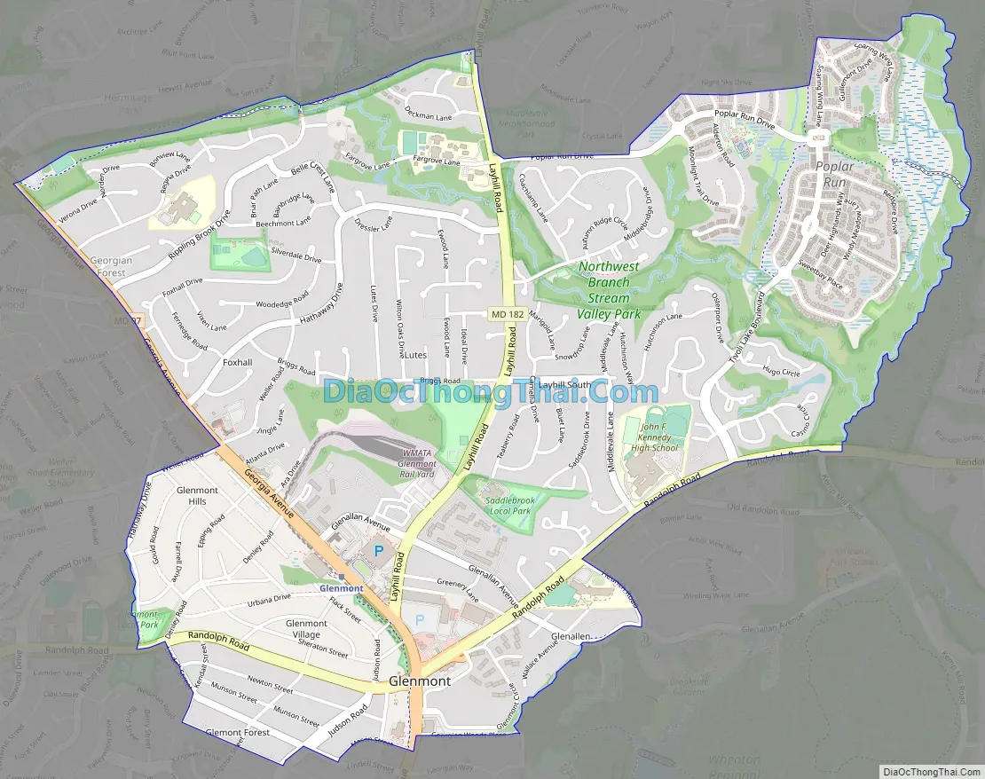
Glenmont city Satellite Map

Geography
Due to its unincorporated nature, the boundaries are difficult to precisely define, but the center of the community is located at the intersection of Randolph Road and Georgia Avenue (Maryland State Highway 97).
See also
Map of Maryland State and its subdivision: Map of other states:- Alabama
- Alaska
- Arizona
- Arkansas
- California
- Colorado
- Connecticut
- Delaware
- District of Columbia
- Florida
- Georgia
- Hawaii
- Idaho
- Illinois
- Indiana
- Iowa
- Kansas
- Kentucky
- Louisiana
- Maine
- Maryland
- Massachusetts
- Michigan
- Minnesota
- Mississippi
- Missouri
- Montana
- Nebraska
- Nevada
- New Hampshire
- New Jersey
- New Mexico
- New York
- North Carolina
- North Dakota
- Ohio
- Oklahoma
- Oregon
- Pennsylvania
- Rhode Island
- South Carolina
- South Dakota
- Tennessee
- Texas
- Utah
- Vermont
- Virginia
- Washington
- West Virginia
- Wisconsin
- Wyoming


