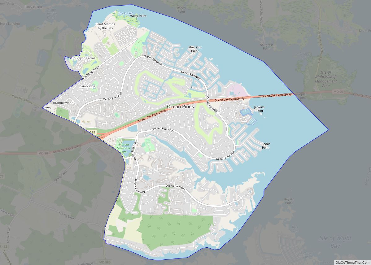
Ocean Pines is a census-designated place (CDP) in Worcester County, Maryland, United States. The population was 11,710 at the 2010 census. It is part of the Salisbury, Maryland-Delaware Metropolitan Statistical Area. It shares the same ZIP code as Berlin.
The community began as a small resort in 1968 and today is the largest residential community in Worcester County. It is the largest concentration of retirees on the Eastern Shore. During the summer months, Ocean Pines’ population swells by more than 50 percent.
| Name: | Ocean Pines CDP |
|---|---|
| LSAD Code: | 57 |
| LSAD Description: | CDP (suffix) |
| State: | Maryland |
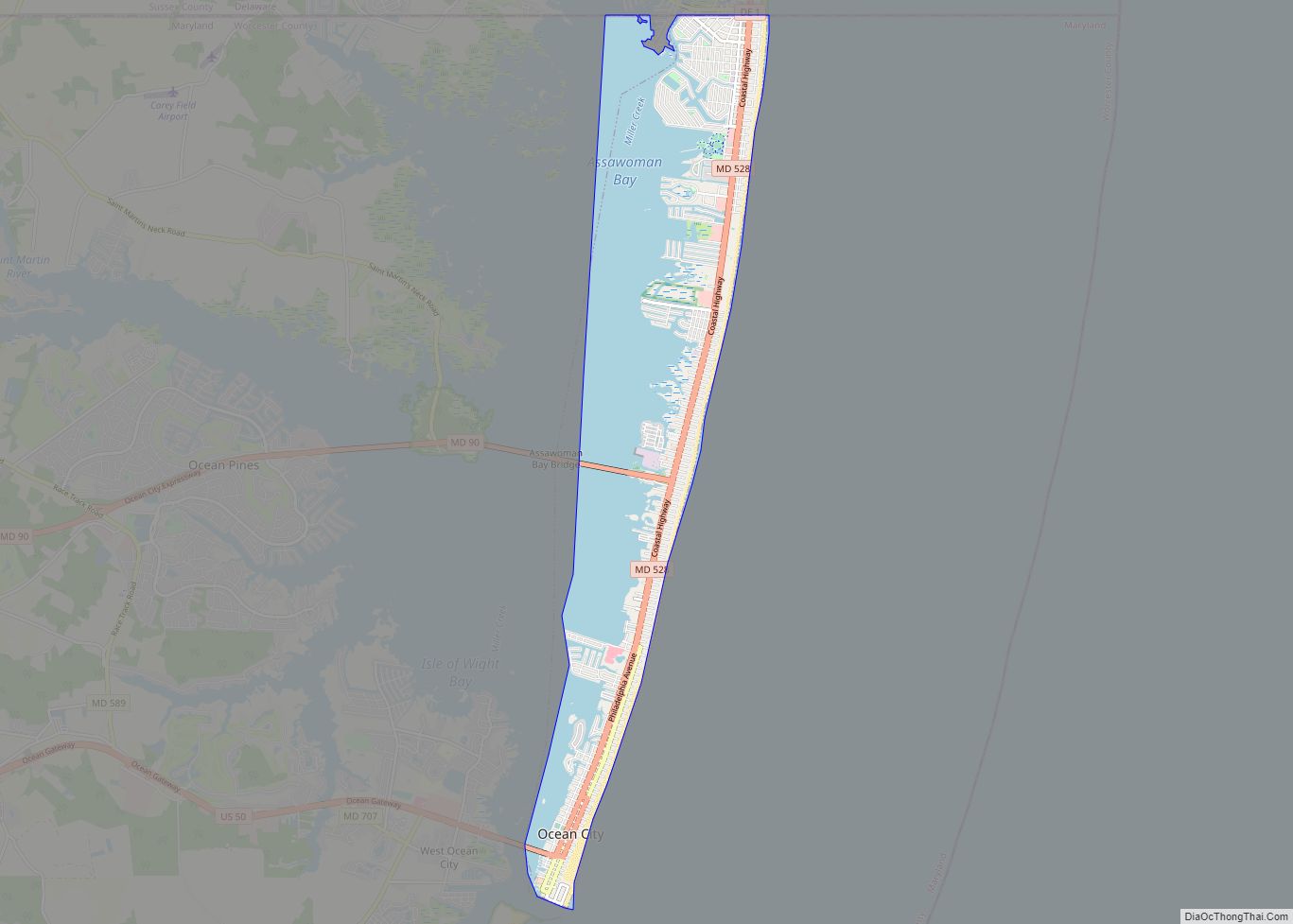
| County: | Worcester County |
| Elevation: | 10 ft (3 m) |
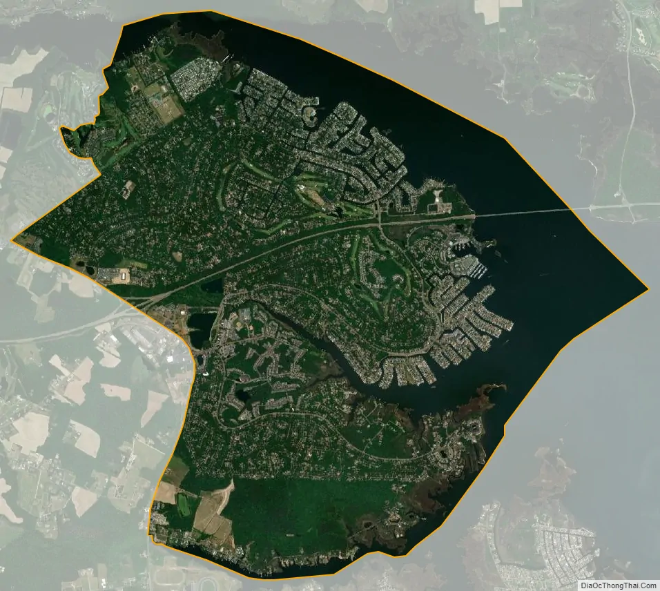
| Total Area: | 9.06 sq mi (23.47 km²) |
| Land Area: | 6.47 sq mi (16.77 km²) |
| Water Area: | 2.59 sq mi (6.70 km²) |
| Total Population: | 12,145 |
| Population Density: | 1,875.68/sq mi (724.26/km²) |
| ZIP code: | 21811 |
| Area code: | 410, 443 |
| FIPS code: | 2458275 |
| GNISfeature ID: | 0590933 |
| Website: | http://www.oceanpines.org |
Online Interactive Map
Click on ![]() to view map in "full screen" mode.
to view map in "full screen" mode.
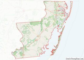
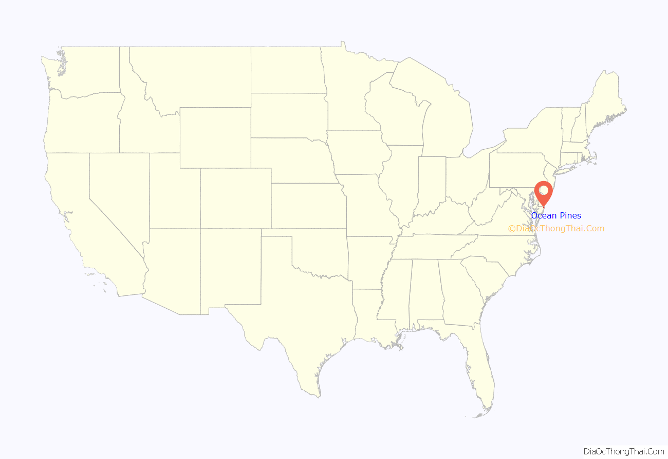
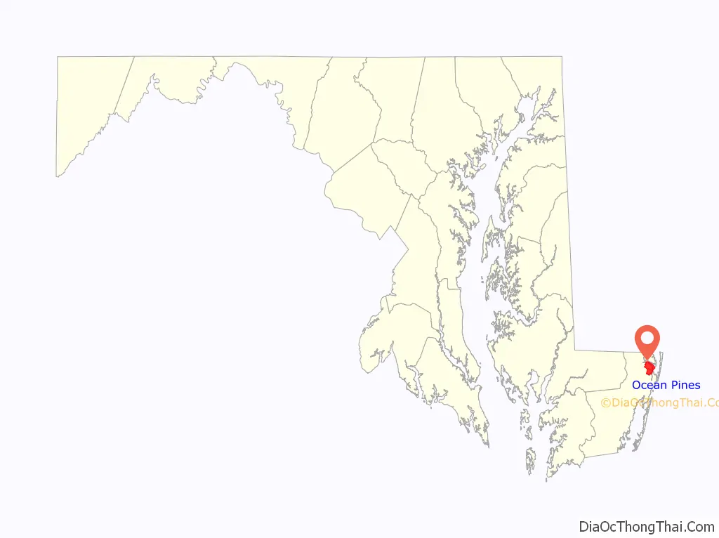
Ocean Pines location map. Where is Ocean Pines CDP?
History
Prior to the late 1960s, Ocean Pines was a small community, composed primarily of retirees. On May 16, 1968, the Eastern Shore Times newspaper reported the rumor that a multi-million dollar land development project was being considered by the Boise Cascade Corporation in the “Hog Skull” area just north of Berlin. The company began development of the first phase of Ocean Pines on July 12, 1968 and continued at a rapid pace throughout the 1970s. Boise Cascade utilized unique marketing strategies to sell lots “in the middle of nowhere”, including Hawaiian luaus, a private clubhouse and pool on the beach of Ocean City, and transportation to Ocean Pines by a double-decker bus and an engine-operated paddlewheel boat named the “Amy Ross”. During the 1980’s and 1990’s, it was normal for 400 new homes to be constructed in the area annually. At the end of 1996, there were 7,381 platted lots and 5,269 dwelling units in the CDP.
In 1969, the Maryland State Highway Administration completed construction on Maryland Route 90, which ran through Ocean Pines and provided access to Ocean City.
Cable television first came to Ocean Pines in 1979 with Triad CATV. Simmons Cable TV took over the agreement with the Ocean Pines Association after acquiring Triad in 1987. Simmons was sold to American Cable TV Investors 5 Ltd. in 1992 and was later acquired by Mediacom in 1997. Mediacom was the only cable and internet service provider in the CDP until 2019, when the Association ratified a 10-year agreement with Comcast.
In 1984, Gerald S. Klein bought $55 million in property for development using Merritt Commercial Savings and Loan assets including a $2 million Maryland Marine wastewater plant. Maple Lawn and Burleigh developer partner Stuart Greenbaum, purchased 800 additional acres for subdivision. In 1985, Worcester County commissioners condemned the Maryland Marine Systems Merritt Commercial Savings and Loan owned sewer system embroiled in the Jeffery Levitt Scandal in order to remove a development moratorium. The system had failed to implement $1.3 million in required maintenance to prevent sewer overflow into the streets creating the moratorium.
In 1994, Balfour Holdings purchased $6-8 million in property. In 1995, Balfour representatives presented the Ocean Pines Association with a plan for a library, post office, church, recreational complex, school, and shopping areas. In October, Balfour and the Ocean Pines Association entered into a turnover agreement for the land.
In 2018, Ocean Pines celebrated its 50th anniversary.
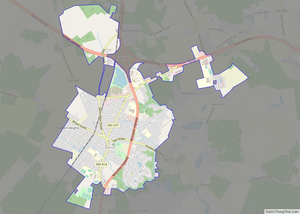
Ocean Pines Road Map
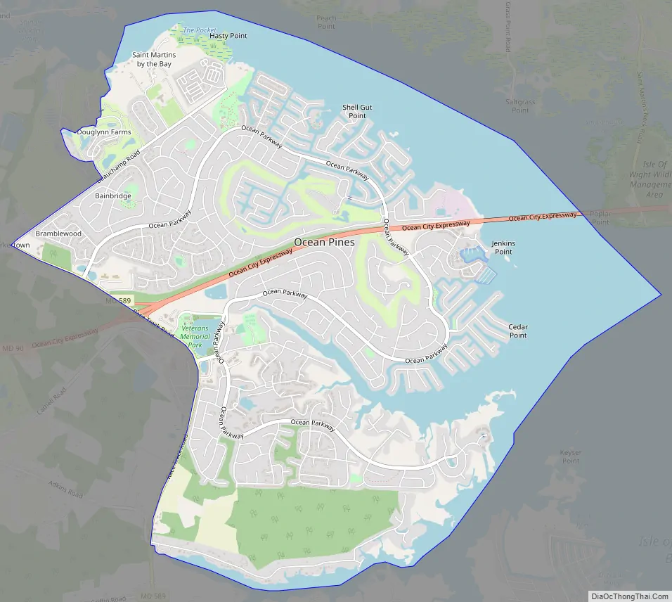
Ocean Pines city Satellite Map
Geography
Ocean Pines is located at 38°23′1″N 75°9′10″W / 38.38361°N 75.15278°W / 38.38361; -75.15278 (38.383692, −75.152755).
According to the United States Census Bureau, the CDP has a total area of 9.4 square miles (24 km), of which 6.7 square miles (17 km) is land and 2.7 square miles (7.0 km) (29.0%) is water.
See also
Map of Maryland State and its subdivision: Map of other states:- Alabama
- Alaska
- Arizona
- Arkansas
- California
- Colorado
- Connecticut
- Delaware
- District of Columbia
- Florida
- Georgia
- Hawaii
- Idaho
- Illinois
- Indiana
- Iowa
- Kansas
- Kentucky
- Louisiana
- Maine
- Maryland
- Massachusetts
- Michigan
- Minnesota
- Mississippi
- Missouri
- Montana
- Nebraska
- Nevada
- New Hampshire
- New Jersey
- New Mexico
- New York
- North Carolina
- North Dakota
- Ohio
- Oklahoma
- Oregon
- Pennsylvania
- Rhode Island
- South Carolina
- South Dakota
- Tennessee
- Texas
- Utah
- Vermont
- Virginia
- Washington
- West Virginia
- Wisconsin
- Wyoming