Saint Michaels, also known as St. Michaels, is a town in Talbot County, Maryland, United States. The population was 1,029 at the 2010 census. Saint Michaels derives its name from the Episcopal Parish established there in 1677. The church attracted settlers who engaged in tobacco growing and ship building.
| Name: | St. Michaels town |
|---|---|
| LSAD Code: | 43 |
| LSAD Description: | town (suffix) |
| State: | Maryland |
| County: | Talbot County |
| Incorporated: | 1804 |
| Elevation: | 10 ft (3 m) |
| Total Area: | 1.27 sq mi (3.28 km²) |
| Land Area: | 1.17 sq mi (3.02 km²) |
| Water Area: | 0.10 sq mi (0.26 km²) |
| Total Population: | 1,049 |
| Population Density: | 899.66/sq mi (347.44/km²) |
| ZIP code: | 21663 |
| Area code: | 410, 443, and 667 |
| FIPS code: | 2469825 |
| GNISfeature ID: | 0591218 |
| Website: | http://stmichaelsmd.org/ |
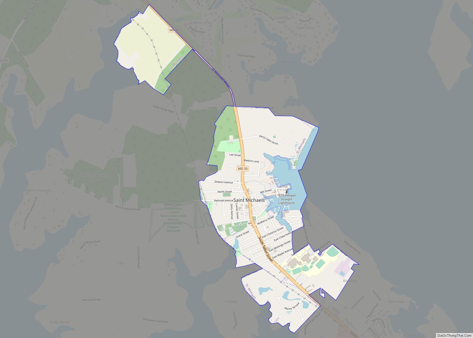
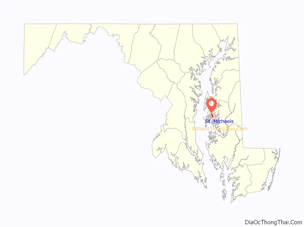
Online Interactive Map
Click on ![]() to view map in "full screen" mode.
to view map in "full screen" mode.
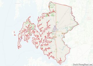
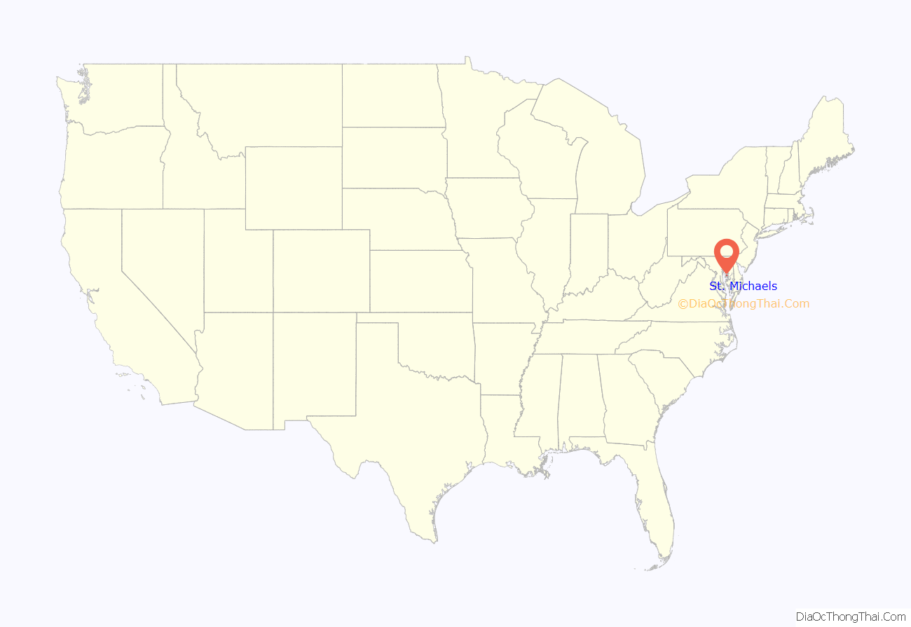
St. Michaels location map. Where is St. Michaels town?
History
The town was laid out as a speculative development in the 1770s by James Braddock. Unlike the more typical 18th century grid-pattern town planning, Braddock laid St. Michaels out around a central square. The town was incorporated in 1804.
A rural Anglican church that long predated the town gave St. Michaels its name. Despite this church’s presence on the shore of the harbor, the town of St. Michaels early became predominantly Methodist following visits by itinerant Methodist preachers. Braddock donated land for a Methodist church in the center of St. Mary’s square. A brick structure was built and after the war of 1812 the name of Sardis Chapel was adopted. That building was razed and a new brick building was erected in 1839. The cornerstone was laid on July 4, 1839. It remains on that site.
The town’s earliest industry was shipbuilding, and as many as six shipbuilders were active in or near the town by the War of 1812. Their typical product was a fast schooner, a type later known as the Baltimore Clipper. Such vessels were well adapted to evading blockades or outrunning pirates or foreign naval vessels at sea, and some were later used as private armed vessels carrying a letter of marque. For example, Thomas L. Haddaway launched the schooner Lottery at St. Michaels in 1812, and its owners obtained a letter of marque allowing it to take prizes at sea.
The town played a role in the War of 1812 when, in 1813, a fleet under the command of Admiral George Cockburn moved up the Chesapeake Bay, and targeted St. Michaels because of the presence of a militia battery erected to defend the town and its shipyards. Under cover of early morning darkness on August 10, 1813, the Battle of St. Michaels commenced as the British sent a landing party ashore just south of the town, and after a brief exchange, neutralized the battery and returned to their boats. The British proceeded to bombard the town from the barges and a brig, but failed to destroy the shipyards or cause any substantial damage to the town. The militia returned fire from artillery batteries at Impy Dawson’s wharf (the foot of Mulberry Street) and Mill Point (the foot of Carpenter Street). A contemporary report noted that “several houses were pierced” by the British fire. Nearly a century later a story was recorded that as a result of the town’s ruse of dimming the lights and hanging lanterns in the trees beyond the town so that the cannonballs would overshoot the town, the town was spared. Based on this story, St. Michaels became known as “the town that fooled the British,” a nickname selected during the sesquicentennial celebration of the battle in 1963. The Cannonball House survives as one of the structures reportedly struck by one of the shots, and is on the National Register of Historic Places, as is the Saint Michaels Historic District.
Shipbuilding declined after the War of 1812, but an oyster industry revived the town a few decades later. By the late nineteenth century, most households in the town had at least one person engaged in some aspect of this fishery, either tonging oysters from the nearby waters of Miles River and Eastern Bay, or engaged in the shucking houses that came to line the waterfront. One of these businesses, Coulbourne and Jewett, founded in the early years of the twentieth century, is notable as a black-owned enterprise, and it early on came to specialize in crabmeat. As a means of marketing crabmeat, owner Frederick Jewett devised a five level grading system (regular, claw, special, backfin, and lump) which is still used by the industry today.
St Michaels is where Frederick Douglass was sold in 1832 to Thomas Auld, and it was in the St Michaels jail that Douglass was confined in 1835 after an attempted escape to freedom.
In addition to the Cannonball House and St. Michaels Historic District, Crooked Intention, Edmee S., Edna E. Lockwood, Island Bird (log canoe), Island Blossom (log canoe), Island Lark (log canoe), Jay Dee (log canoe), Magic (log canoe), Noddy (log canoe), The Old Inn, Persistence (log canoe), Rover (log canoe), Saint Michaels Mill, Sherwood Manor, Stanley Norman (skipjack), and Victorian Corn Cribs are listed on the National Register of Historic Places.
In 2007 the town was named #8 of the Top Ten Romantic Escapes in the USA by Coastal Living Magazine. In 2018 Forbes published an article declaring St. Michaels as “The East Coast Weekend Getaway You’ve Been Missing”.
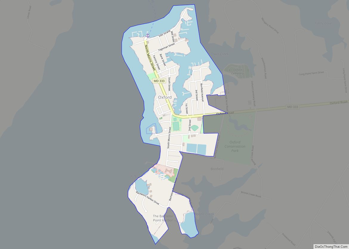
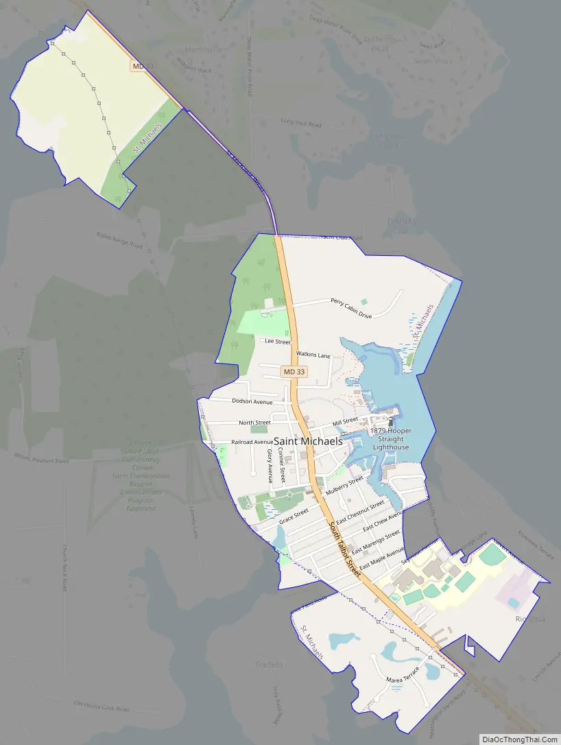
St. Michaels Road Map
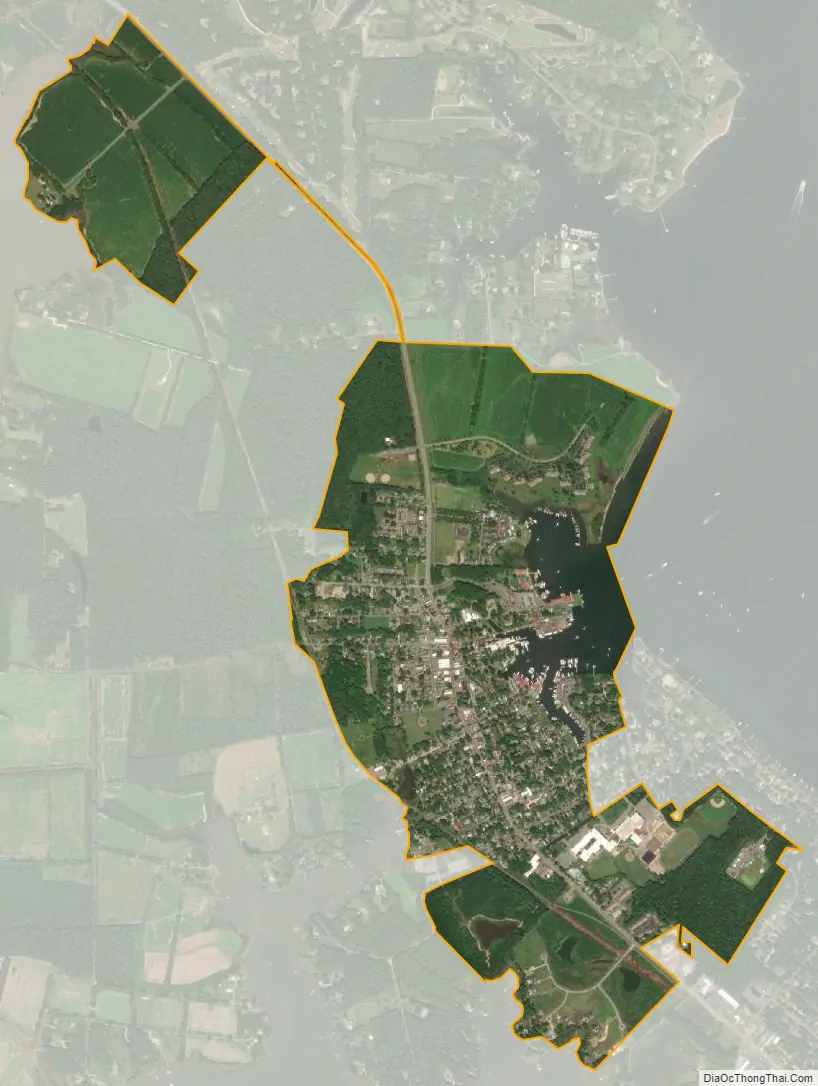
St. Michaels city Satellite Map
Geography
Saint Michaels is located at 38°47′1″N 76°13′20″W / 38.78361°N 76.22222°W / 38.78361; -76.22222 (38.783748, -76.222214).
According to the United States Census Bureau, the town has a total area of 1.25 square miles (3.24 km), of which 1.15 square miles (2.98 km) is land and 0.10 square miles (0.26 km) is water.
St. Michaels is located in a long, narrow neck of land along the Miles River. The village is a tourist attraction, and there are high quality hotels, inns, seafood restaurants, and gift shops in town. Tourboat cruises connect the town with Annapolis across the Chesapeake Bay. A for-pay public ferryboat service in nearby Bellevue also takes people across the Tred Avon river to Oxford.
See also
Map of Maryland State and its subdivision: Map of other states:- Alabama
- Alaska
- Arizona
- Arkansas
- California
- Colorado
- Connecticut
- Delaware
- District of Columbia
- Florida
- Georgia
- Hawaii
- Idaho
- Illinois
- Indiana
- Iowa
- Kansas
- Kentucky
- Louisiana
- Maine
- Maryland
- Massachusetts
- Michigan
- Minnesota
- Mississippi
- Missouri
- Montana
- Nebraska
- Nevada
- New Hampshire
- New Jersey
- New Mexico
- New York
- North Carolina
- North Dakota
- Ohio
- Oklahoma
- Oregon
- Pennsylvania
- Rhode Island
- South Carolina
- South Dakota
- Tennessee
- Texas
- Utah
- Vermont
- Virginia
- Washington
- West Virginia
- Wisconsin
- Wyoming