Stockton is a census-designated place (CDP) in Worcester County, Maryland, United States. The population was 92 at the 2010 census. It is part of the Salisbury, Maryland-Delaware Metropolitan Statistical Area.
| Name: | Stockton CDP |
|---|---|
| LSAD Code: | 57 |
| LSAD Description: | CDP (suffix) |
| State: | Maryland |
| County: | Worcester County |
| Elevation: | 33 ft (10 m) |
| Total Area: | 1.71 sq mi (4.42 km²) |
| Land Area: | 1.70 sq mi (4.41 km²) |
| Water Area: | 0.00 sq mi (0.01 km²) |
| Total Population: | 91 |
| Population Density: | 53.50/sq mi (20.65/km²) |
| ZIP code: | 21864 |
| Area code: | 410, 443 |
| FIPS code: | 2475200 |
| GNISfeature ID: | 0591353 |
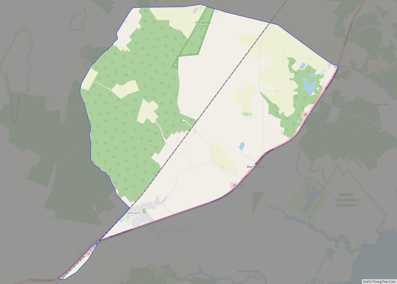
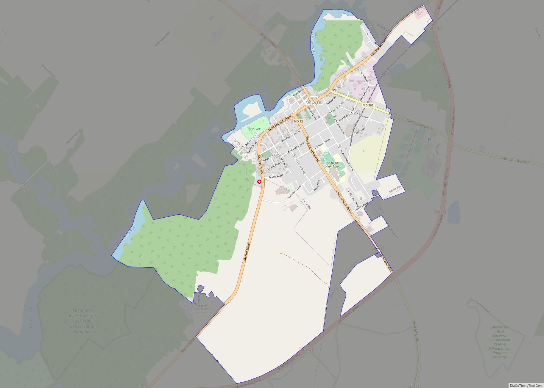
Online Interactive Map
Click on ![]() to view map in "full screen" mode.
to view map in "full screen" mode.
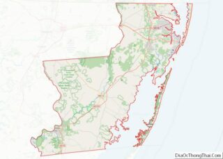
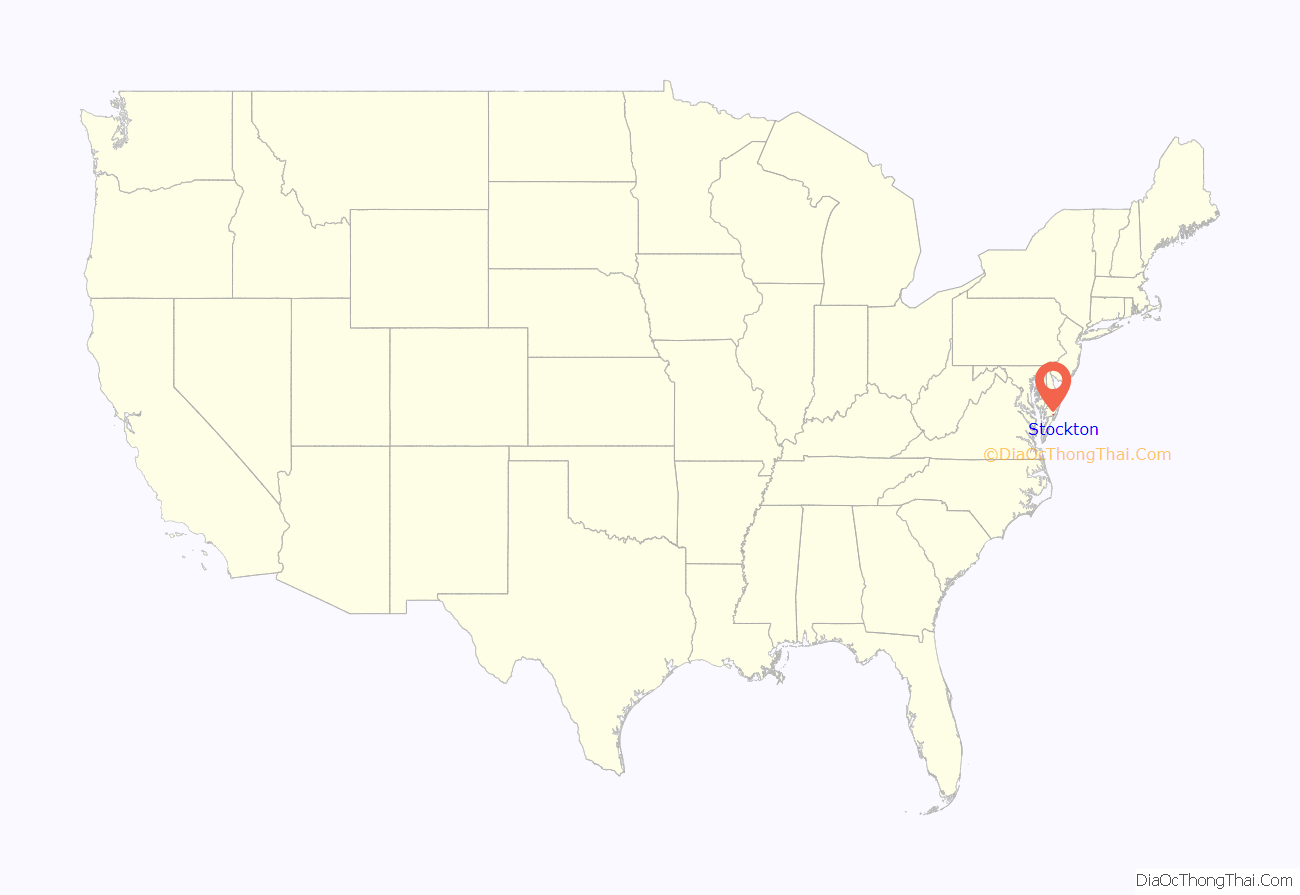
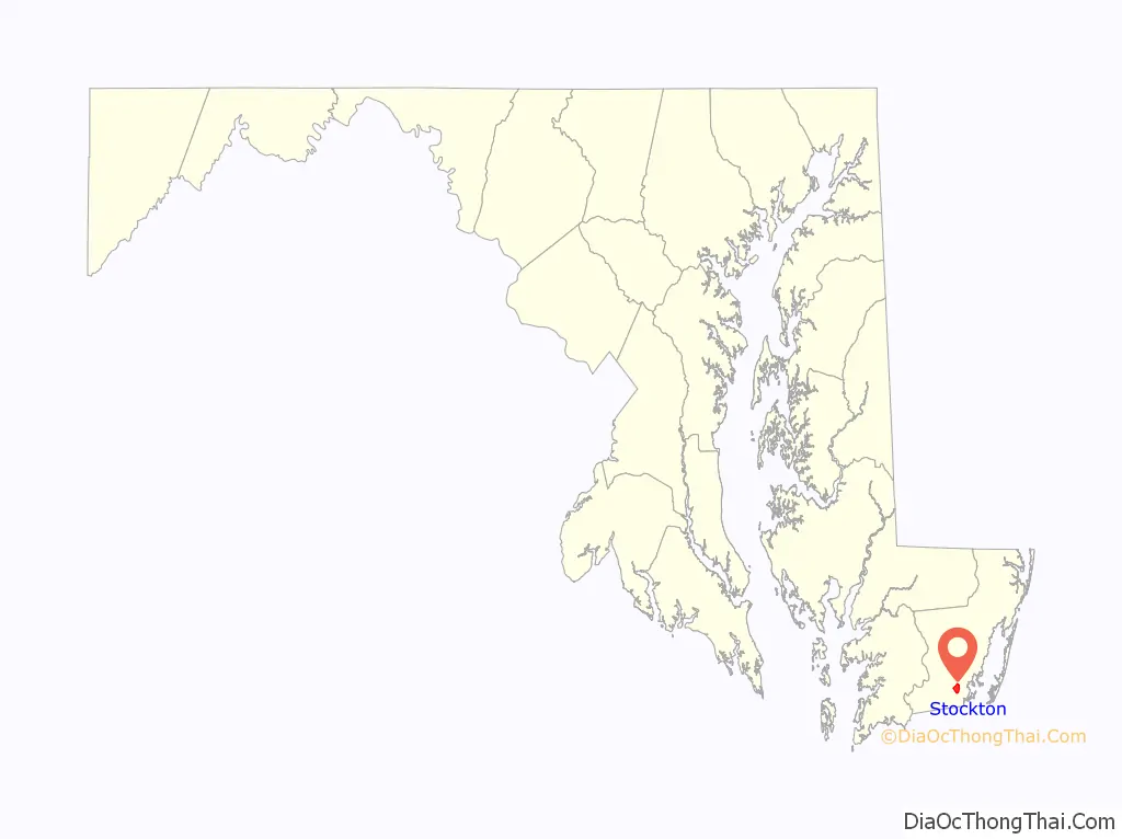
Stockton location map. Where is Stockton CDP?
History
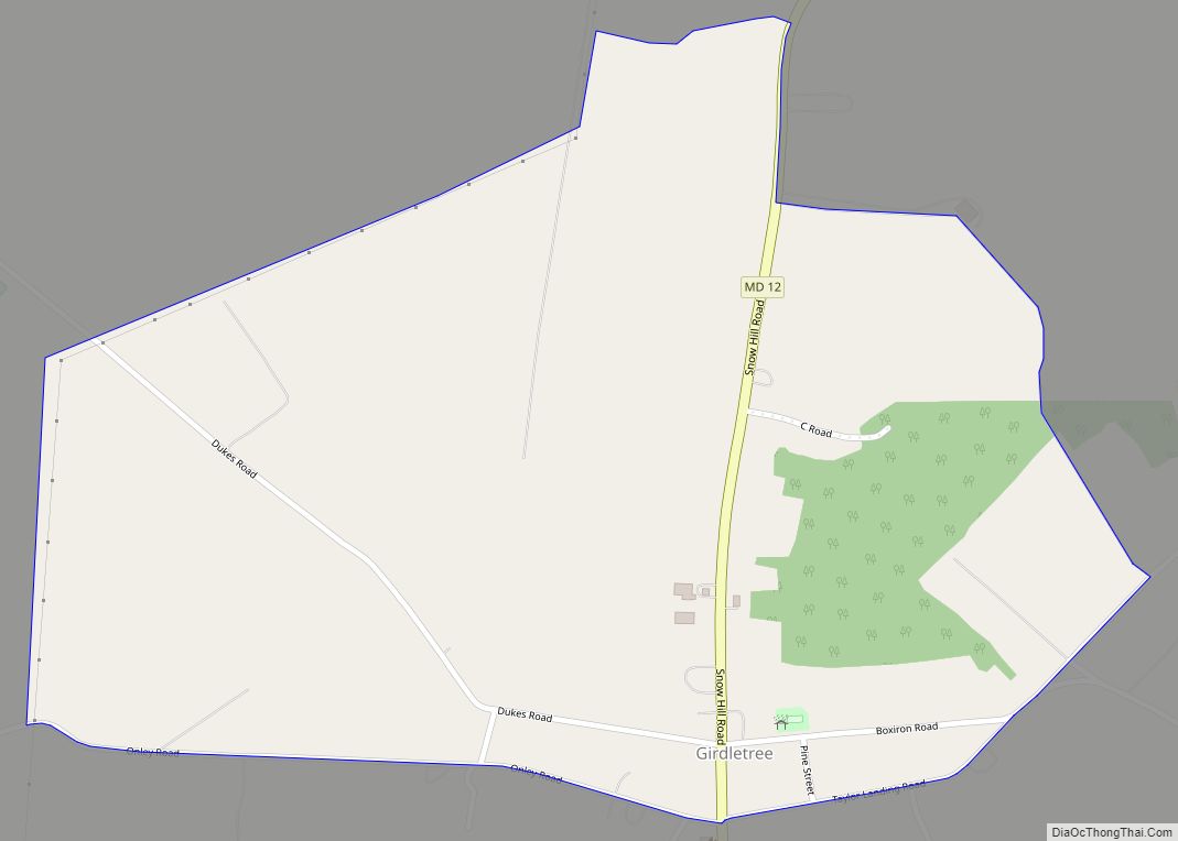
Stockton, originally called Sandy Hill, grew up at the crossing of the post road from Snow Hill south to Virginia (whose track is generally followed by modern Maryland Route 12) with the road from Mattapony Landing on the Pocomoke River to the Chincoteague Bay (the eastern part of which is now Maryland Route 366), where small ocean-going vessels could drop anchor. The landing on Chincoteague Bay came to be known as George Island Landing. Settlement in the area began in the 1660s, when the area was still part of Somerset County. Worcester County was separated from Somerset in 1742, and by 1774 Sandy Hill had grown large enough to merit a chapel of ease within All Hallows’ Parish, today called Holy Cross Chapel. Sandy Hill, unlike neighboring Girdletree, was never incorporated, but in 1870 the name of the town was officially changed, by act of the legislature, from Sandy Hill to Stockton, commemorating the Rev. Thomas H. Stockton, a prominent Methodist minister. In 1872 the Worcester County election district which took its name from Sandy Hill was renamed Stockton.
In 1876, a railroad (which would eventually become part of the Pennsylvania Railroad) was laid from Franklin City and Greenbackville in Virginia to Snow Hill. The line’s main purpose was to haul seafood harvested from the Atlantic Ocean and Chincoteague Bay to Philadelphia, but the line also carried passengers. To avoid confusion with other Stocktons around the country, the station at Stockton was named Hursley Station.
The center of Stockton was destroyed by fire in 1906, but was soon rebuilt, with many of the new buildings constructed of brick. During the late 19th and early 20th centuries, Stockton boasted a hotel, five churches, a post office, three stores, a canning factory, two sawmills, and two barrel factories. However, the overfishing of Chincoteague Bay led to a permanent decline in the commercial seafood industry.
A new Stockton High School was dedicated in 1926. Grades 7-11 were discontinued in 1942, but first through sixth grades continued until 1960, when the school was closed. Stockton’s only bank failed in 1929. Passenger trains ended service in the late 1940s, and the last freight trainmade its final run through Stockton in approximately 1955. Holy Cross Chapel stopped holding regular services in 1943. Gunby Presbyterian Church holds only one service per month. The Stockton Poultry Plant opened as World War II ended, but closed around 1970. Today, Stockton residents are as likely to work at NASA’s Wallops Island Flight Facility on the Eastern Shore of Virginia than to be farmers or watermen. The post office was closed in 2012, and no business of any kind is now in operation.
Stockton Road Map
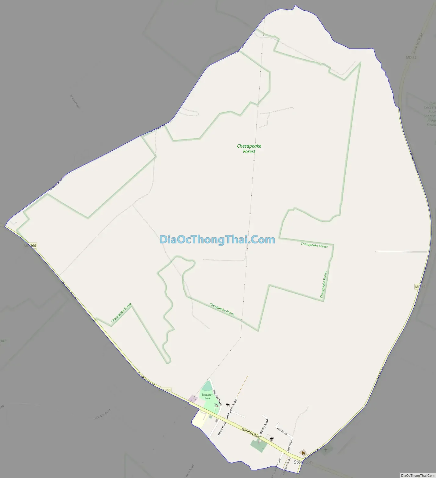
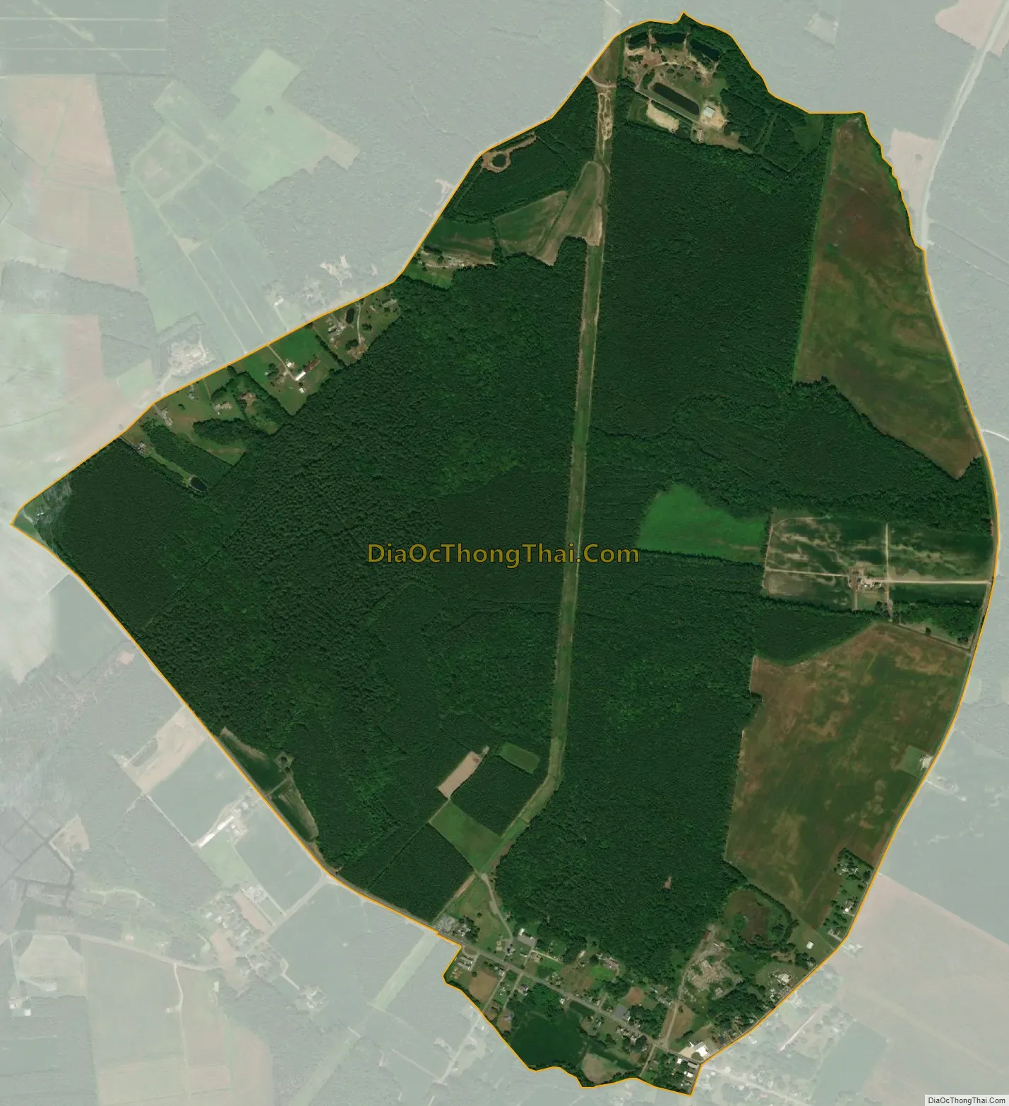
Stockton city Satellite Map
Geography
Stockton is located at 38°3′26″N 75°25′0″W / 38.05722°N 75.41667°W / 38.05722; -75.41667 (38.057233, −75.416661).
According to the United States Census Bureau, the CDP has a total area of 1.7 square miles (4.4 km), all land.
Maryland routes 12 and 366 intersect in the center of Stockton.
An extensive network of manmade canals is located approximately two miles east of Stockton.
See also
Map of Maryland State and its subdivision: Map of other states:- Alabama
- Alaska
- Arizona
- Arkansas
- California
- Colorado
- Connecticut
- Delaware
- District of Columbia
- Florida
- Georgia
- Hawaii
- Idaho
- Illinois
- Indiana
- Iowa
- Kansas
- Kentucky
- Louisiana
- Maine
- Maryland
- Massachusetts
- Michigan
- Minnesota
- Mississippi
- Missouri
- Montana
- Nebraska
- Nevada
- New Hampshire
- New Jersey
- New Mexico
- New York
- North Carolina
- North Dakota
- Ohio
- Oklahoma
- Oregon
- Pennsylvania
- Rhode Island
- South Carolina
- South Dakota
- Tennessee
- Texas
- Utah
- Vermont
- Virginia
- Washington
- West Virginia
- Wisconsin
- Wyoming