Travilah is a United States census-designated place and an unincorporated area in Montgomery County, Maryland. It is 17.28 square miles (44.8 km) located along the north side of the Potomac River, and surrounded by the communities of Potomac, North Potomac, and Darnestown—all census-designated places. It had a population of 11,985 as of the 2020 census.
Within the Travilah census-designated place at the intersection of what are now Travilah Road and Glen Road, the small rural community of Travilah existed in the late 1800s and early 1900s. The community had its own post office, general store, school, town hall, church, and a few homes. The crossroads was popular with area farmers because it was close to the Chesapeake and Ohio Canal (C&O Canal) and at least two mills. The name Travilah comes from Travilah Clagett, who was the community’s first postmaster in 1883.
In 2000, the United States Census Bureau began recognizing the area around the original Travilah crossroads community as a census designated place. Much of this tranquil community is simply large homes on large tracts of land with numerous parks and nature preserves mixed in. The community is within driving-distance of Washington, D.C., and the I-270 Technology Corridor. Travilah has a median household income of about $235,000.
| Name: | Travilah CDP |
|---|---|
| LSAD Code: | 57 |
| LSAD Description: | CDP (suffix) |
| State: | Maryland |
| County: | Montgomery County |
| Elevation: | 233 ft (71 m) |
| Total Area: | 17.65 sq mi (45.70 km²) |
| Land Area: | 15.93 sq mi (41.25 km²) |
| Water Area: | 1.72 sq mi (4.45 km²) |
| Total Population: | 11,985 |
| Population Density: | 752.54/sq mi (290.55/km²) |
| Area code: | 301, 240 |
| FIPS code: | 2478650 |
| GNISfeature ID: | 2390400 |
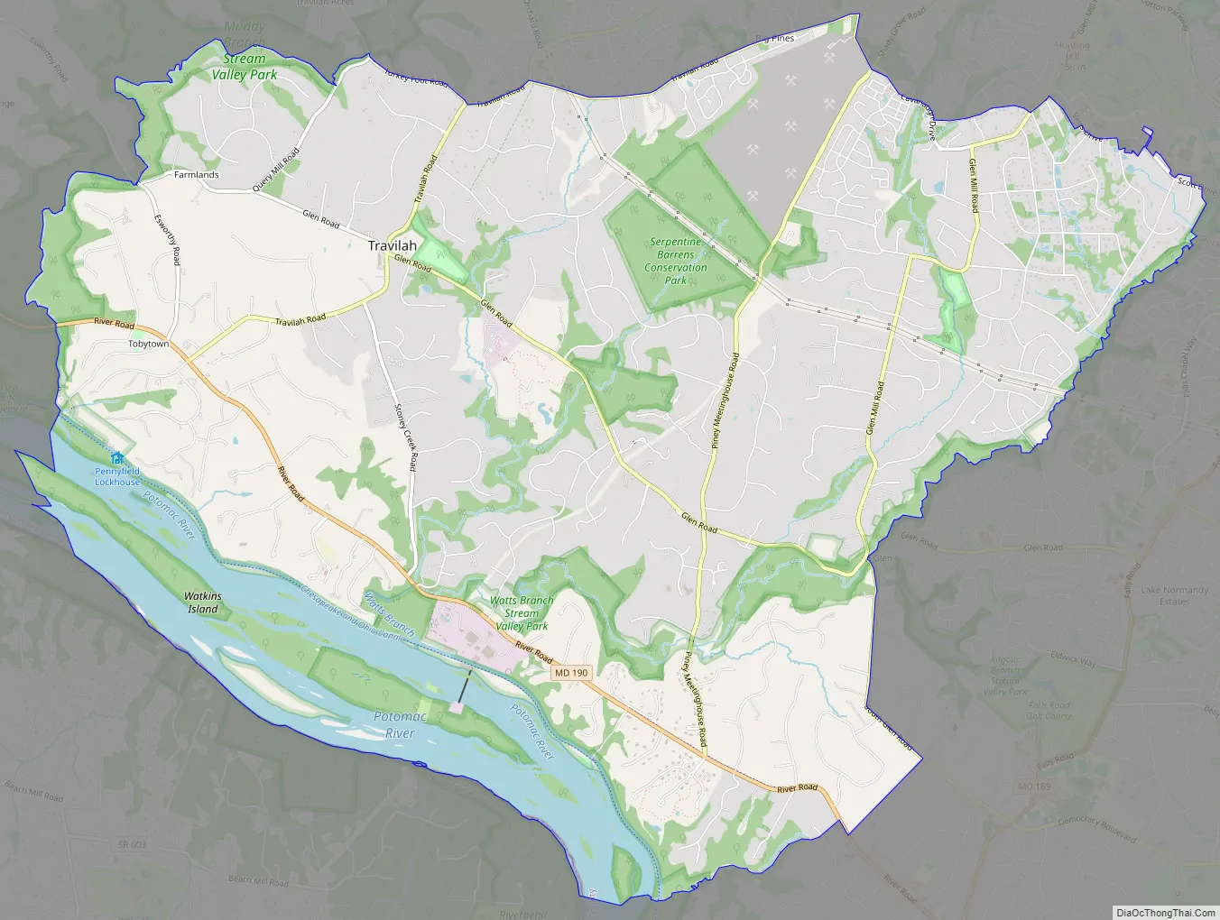
Online Interactive Map
Click on ![]() to view map in "full screen" mode.
to view map in "full screen" mode.
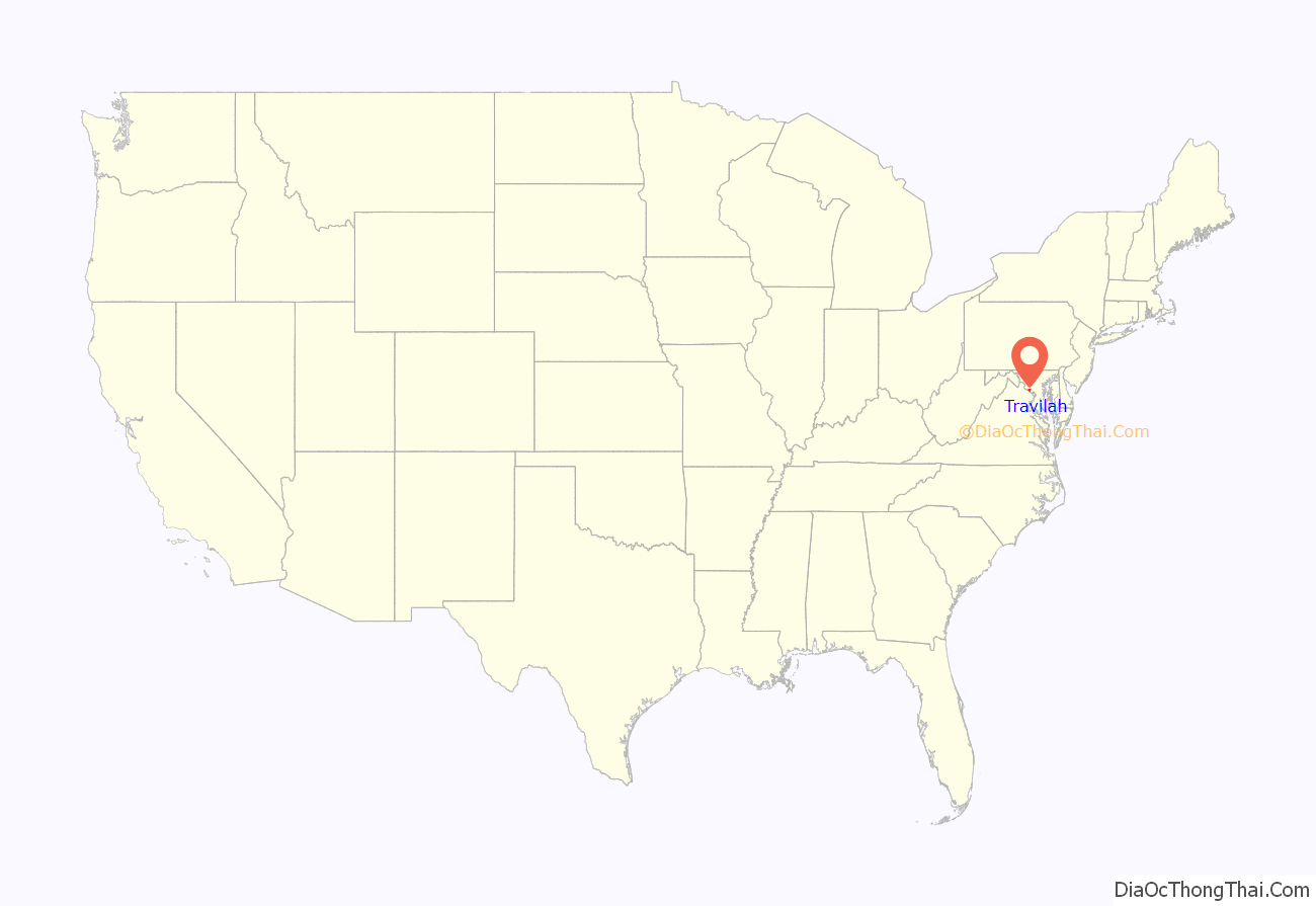
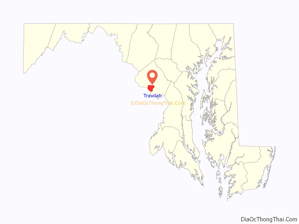
Travilah location map. Where is Travilah CDP?
History
The Travilah community has a long history that dates back to the 1800s at a crossroads at what is now Travilah Road and Glen Road. A small unnamed agricultural community grew at this intersection in the mid-1800s because it was less than 2 miles (3.2 km) from the Chesapeake and Ohio Canal (a.k.a. C&O Canal). The intersecting roads also led to mills that were located within a few miles of the intersection, and many of the area farms produced the wheat used by the mills to make flour.
The community had a general store in 1882 that may have existed as early as the 1840s. In 1883, the unnamed community was assigned a Post Office. Travilah Clagett was the first postmaster, and the United States Post Office used the name Travilah to identify the unnamed location. The Clagetts were prominent land owners in this portion of Montgomery County. Clagett served as postmaster for about half the year, and died from tuberculosis before the year was over.
In addition to the general store, the crossroads had a blacksmith, church, schoolhouse, and town hall. The Travilah Baptist Church was built in 1894 and had over 300 members in 1976. It was destroyed by fire in 1980. A Travilah Elementary School exists today at the intersection of Dufief Mill Road and Travilah Road in North Potomac, but it should not be confused with the one-room schoolhouse formerly located at the Travilah crossroads that closed in 1943 (and later burned down). The original schoolhouse was built in 1865. A town hall was built in 1910, and the building still exists today although it is privately owned. The general store, which eventually was also a gas station, closed in 1967.
A small corner shopping center, built in 1979, is located at the Travilah Road-Glen Road intersection. The center was originally named Glenvilah Shopping Center, but was renamed Potomac Oak Center in honor of the historic Travilah Oak tree located there close to Travilah Road. Several homes were also located in the area and a large 150-year-old farmhouse remains across from the shopping center.
Travilah Road Map
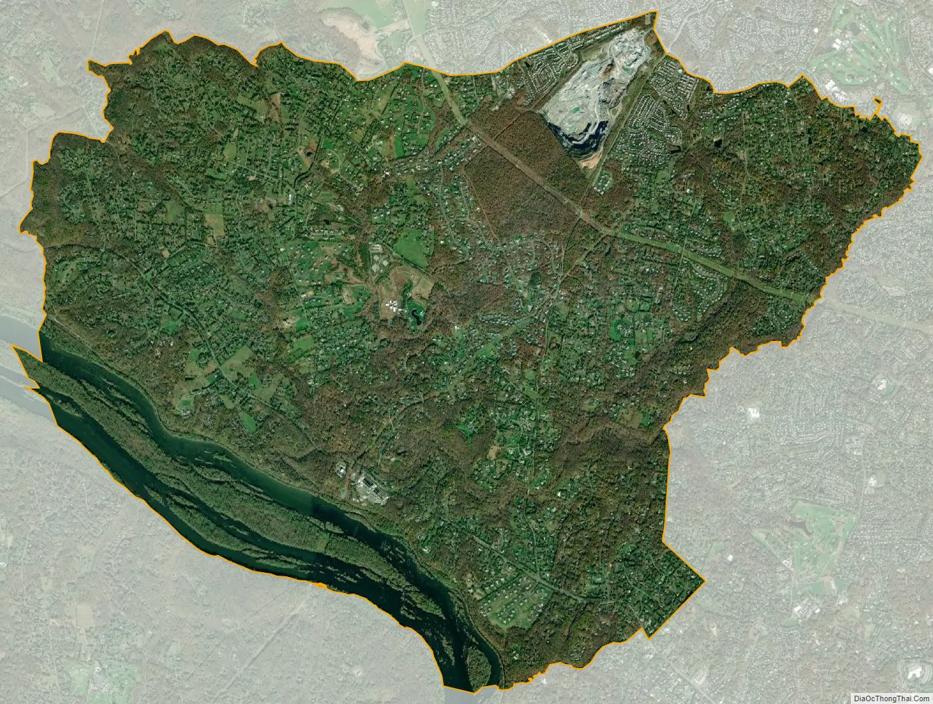
Travilah city Satellite Map
Geography
As an unincorporated area, Travilah’s boundaries are not officially defined. However, the United States Census Bureau began recognizing a Travilah census-designated place (Travilah CDP) in the 2000 Census when the new Travilah CDP was created using portions of the Potomac and North Potomac CDPs. According to the state of Maryland, “The boundaries for CDPs often are defined in partnership with state, local, and/or tribal officials and usually coincide with visible features or the boundary of an adjacent incorporated place or another legal entity.” The boundaries of the Travilah CDP are currently those used in the 2010 Census. The Travilah CDP is surrounded by the Darnestown CDP, the North Potomac CDP, the city of Rockville, the Potomac CDP, and the Potomac River—and the old crossroads community of Travilah is located in the west central portion of the CDP.
According to the 2000 Census, the Travilah CDP is part rural and part urban. The urban portion had a 2000 population of 6,894 on 11.71 square miles (30.3 km), while the rural portion has a 2000 population of 548 on a land area of 2.66 square miles (6.9 km). An additional 1.19 square miles (3.1 km) of non-land is located in the rural section. The 2010 Census shows a total population of 12,159 in 3,950 housing units on a land area of 15.83 square miles (41.0 km) and total area of 17.28 square miles (44.8 km). Using 2010 Census Data, Travilah has a GIS ID of 303 and a FID of 302. The State FIPS code is 24 and the Place FIPS is 78650. The ANSI Code for Travilah is 02390400 and the Place Identifier is 2478650.
The United States Geological Survey lists six features in Montgomery County with Travilah in all or part of their name. The Travilah Census Designated Place has an ID of 2390400 and an elevation of 233 feet. It has a latitude of 390325N and a longitude of 0771445W—a location of 39°3′25″N 77°14′45″W / 39.05694°N 77.24583°W / 39.05694; -77.24583. The feature named Travilah, different from the Travilah Census Designated Place, is a populated place and has an elevation of 358 with a latitude of 390457N and a longitude of 0771547W. Other features listed are Travilah Acres, Travilah Elementary School, Travilah Meadows, and Travilah Square Shopping Center.
The three ZIP Codes for the Travilah CDP are 20854 (Potomac), 20878 (Gaithersburg/North Potomac), and 20850 (Rockville). A large portion of the territory uses the Potomac ZIP code, but the northern portion uses the Rockville and Gaithersburg codes. As examples, Greenbrier Park, the Glenstone Museum, and Pennyfield Lock all have Potomac ZIP Codes of 20854 and are in the Travilah CDP.
Rivers and streams
Because the state of Maryland controls the Potomac River, the Travilah CDP includes portions of the Potomac River in addition to the C&O Canal. Several streams flow through Travilah and into the Potomac River. On the west edge of the CDP, the Muddy Branch flows to the Potomac and forms the western border for the Travilah CDP. The Watts Branch, Sandy Branch, and Greenbrier Branch flow through the middle of the CDP. The Piney Branch flows on the east edge of the CDP forming part of the eastern border.
Climate
According to the Köppen Climate Classification system, the region close to North Potomac has a humid subtropical climate, abbreviated “Cfa” on climate maps. There are four distinct seasons, with winters being cold with moderate snowfall, while summers can be warm and humid. July is the warmest month, while January is the coldest. Average monthly precipitation ranges from about 2.5 to 4 inches (6.4 to 10.2 centimetres). The highest recorded temperature was 105.0 °F (40.6 °C) and the lowest recorded temperature was −13.0 °F (−25.0 °C). There is a 50 percent probability that the first frost of the season will occur by October 21, and a 50 percent probability that the final frost will occur by April 16.
See also
Map of Maryland State and its subdivision: Map of other states:- Alabama
- Alaska
- Arizona
- Arkansas
- California
- Colorado
- Connecticut
- Delaware
- District of Columbia
- Florida
- Georgia
- Hawaii
- Idaho
- Illinois
- Indiana
- Iowa
- Kansas
- Kentucky
- Louisiana
- Maine
- Maryland
- Massachusetts
- Michigan
- Minnesota
- Mississippi
- Missouri
- Montana
- Nebraska
- Nevada
- New Hampshire
- New Jersey
- New Mexico
- New York
- North Carolina
- North Dakota
- Ohio
- Oklahoma
- Oregon
- Pennsylvania
- Rhode Island
- South Carolina
- South Dakota
- Tennessee
- Texas
- Utah
- Vermont
- Virginia
- Washington
- West Virginia
- Wisconsin
- Wyoming


