Westernport is a town in Allegany County, Maryland, United States, along the Georges Creek Valley. It is part of the Cumberland, MD-WV Metropolitan Statistical Area. The population was 1,888 at the 2010 census.
| Name: | Westernport town |
|---|---|
| LSAD Code: | 43 |
| LSAD Description: | town (suffix) |
| State: | Maryland |
| County: | Allegany County |
| Incorporated: | 1859 |
| Elevation: | 922 ft (281 m) |
| Total Area: | 0.91 sq mi (2.35 km²) |
| Land Area: | 0.88 sq mi (2.28 km²) |
| Water Area: | 0.03 sq mi (0.07 km²) |
| Total Population: | 1,812 |
| Population Density: | 2,061.43/sq mi (796.23/km²) |
| ZIP code: | 21540, 21562 |
| Area code: | 301, 240 |
| FIPS code: | 2482750 |
| GNISfeature ID: | 0591532 |
| Website: | https://townofwesternport.com/?fs=e&s=cl |
Online Interactive Map
Click on ![]() to view map in "full screen" mode.
to view map in "full screen" mode.
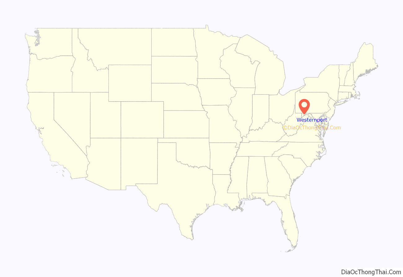
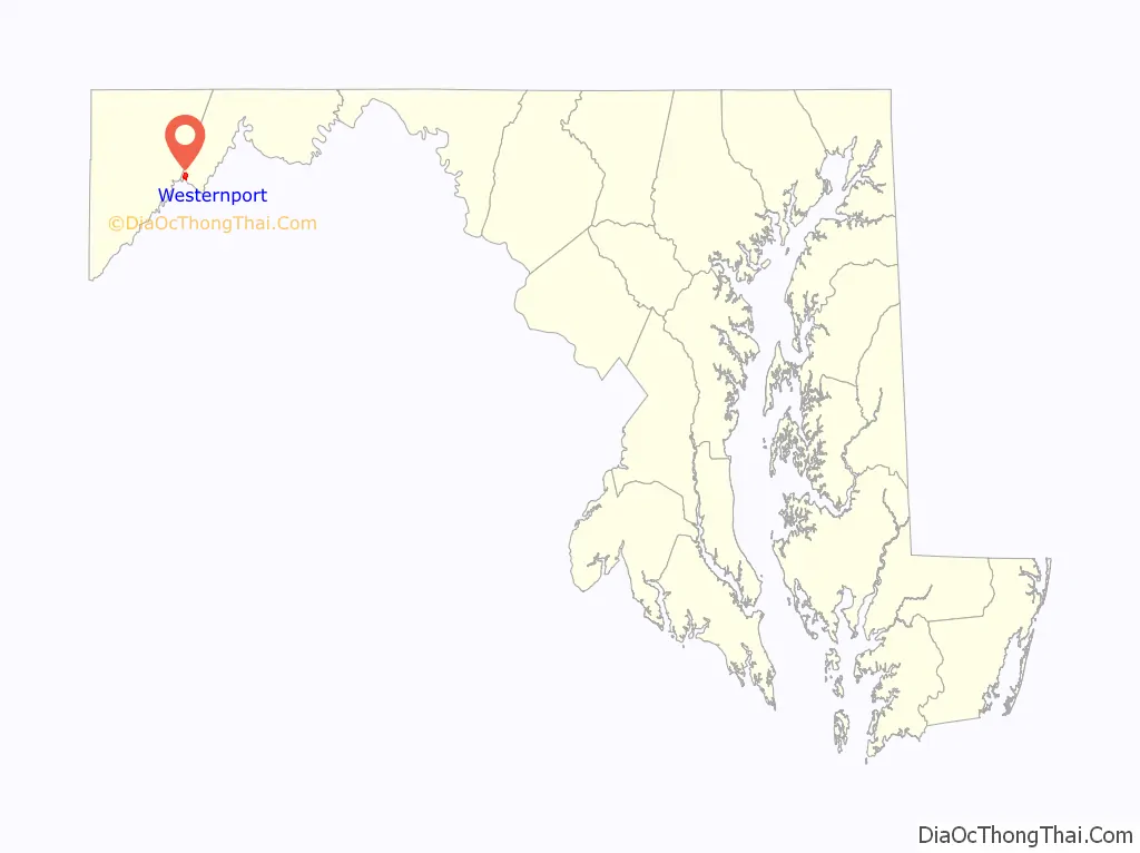
Westernport location map. Where is Westernport town?
History
Westernport’s first settlement is identified on a French military map dating from 1758. The map is currently on display at École Militaire in Paris. The settlement at that time had no name. By 1774, it was known as Hardscrabble because the rocky soil made planting difficult. Some time in the mid-1790s, the name was changed to Westernport, with the town being the westernmost navigable port on the Potomac River. In the late 18th century and early to mid part of the 19th century, coal and timber was loaded onto flatboats where George’s Creek empties into the Potomac, then floated down to near Great Falls, Virginia, where the goods were unloaded, the boats broken up to sell as lumber, with the operators walking back to Westernport. The town was incorporated in 1859.
In 1886–87 the Piedmont and Cumberland Railway was built through Westernport, connecting the town to Cumberland.
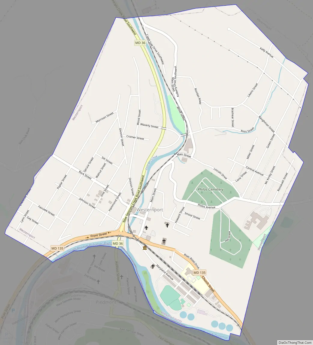
Westernport Road Map
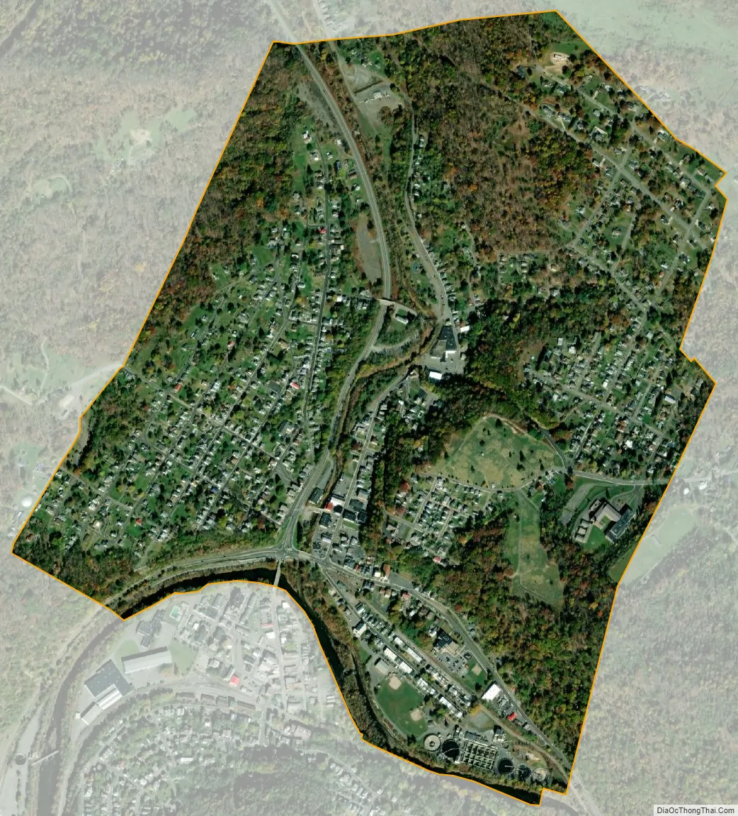
Westernport city Satellite Map
Geography
Westernport is located at 39°29′12″N 79°2′36″W / 39.48667°N 79.04333°W / 39.48667; -79.04333 (39.486671, -79.043417).
According to the United States Census Bureau, the town has a total area of 0.89 square miles (2.31 km), of which 0.87 square miles (2.25 km) is land and 0.02 square miles (0.05 km) is water.
Nearby communities
- Barton, Maryland
- Cumberland, Maryland
- Elk Garden, West Virginia
- Keyser, West Virginia
- Kitzmiller, Maryland
- Lonaconing, Maryland
- Luke, Maryland
- Midland, Maryland
- Piedmont, West Virginia
Climate
The climate in this area has mild differences between highs and lows, and there is adequate rainfall year-round. According to the Köppen Climate Classification system, Westernport has a marine west coast climate, abbreviated “Cfb” on climate maps.
See also
Map of Maryland State and its subdivision: Map of other states:- Alabama
- Alaska
- Arizona
- Arkansas
- California
- Colorado
- Connecticut
- Delaware
- District of Columbia
- Florida
- Georgia
- Hawaii
- Idaho
- Illinois
- Indiana
- Iowa
- Kansas
- Kentucky
- Louisiana
- Maine
- Maryland
- Massachusetts
- Michigan
- Minnesota
- Mississippi
- Missouri
- Montana
- Nebraska
- Nevada
- New Hampshire
- New Jersey
- New Mexico
- New York
- North Carolina
- North Dakota
- Ohio
- Oklahoma
- Oregon
- Pennsylvania
- Rhode Island
- South Carolina
- South Dakota
- Tennessee
- Texas
- Utah
- Vermont
- Virginia
- Washington
- West Virginia
- Wisconsin
- Wyoming


